

Up and down the Kennebec Valley: Sidney ponds
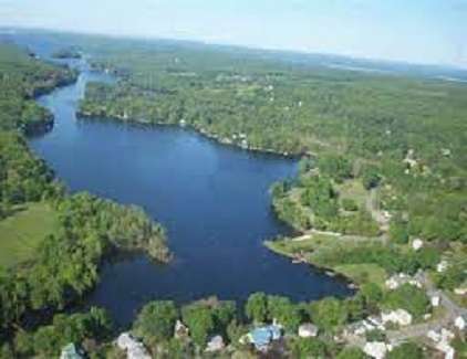
Messalonskee Lake
by Mary Grow
Here is the last article (for a while) on central Kennebec Valley ponds and people for whom they might have been named. This week’s topic is ponds in the Town of Sidney (which was until Jan. 30, 1792, part of Vassalboro, despite being on the other – west – side of the Kennebec River).
A map of Sidney shows a large lake, Messalonskee Lake (aka Snow Pond), along much of its western border with Belgrade. If the map is detailed enough, it will show smaller ponds scattered through town.
They include Lily (Henry Kingsbury spelled it Lilly in his Kennebec County history) Pond, in northeastern Sidney between Interstate 95 and the Kennebec River. In the southwestern corner of town are nine small ponds, some shared with Belgrade on the west and Manchester on the south.
Lily Pond appears as an oval running approximately southwest to northeast. Its outlet, from the northeast corner, drains east into the Kennebec River.
According to the Maine Department of Inland Fisheries and Wildlife’s (IF&W) summary report dated 1997, Lily Pond had an area of 44 acres and a maximum depth of 30 feet. The report called it “a shallow warmwater pond with many areas of aquatic vegetation that provides excellent habitat for pickerel and largemouth bass.”
The Lakes of Maine website agrees on the maximum depth but gives the area as only 26 acres. Aerial photos on two websites show large areas of brown surrounding the pond, as though the water level had dropped significantly and the exposed areas had not grown vegetation.
* * * * * *
The northernmost of Sidney’s southern ponds, Ward Pond, is northeast of Route 27, a main road that runs diagonally through the southwest corner of town. Ward Pond lies between two north-south roads, Pond Road on the west and Quaker Road on the east.
Ward Pond was probably named after one of Sidney’s Ward families, though your writer has been unable to determine which one(s).
The 1856 map of Sidney shows a Ward house on the west side of Quaker Road, a short distance south of the pond. The 1879 map reproduced in Alice Hammond’s Sidney history shows what might be the same house, with a blacksmith shop beside it, and another Ward dwelling on the east side of Quaker Road north of the pond.
John Ward owned land in Sidney by 1794. When the first 10 school districts were laid out that year, some of the boundaries Hammond quoted referenced his land, which was evidently several miles from the Kennebec.
Kingsbury listed among early settlers in western Sidney “Deacon William Ward and his father.”
In 1843, Kingsbury and Hammond (apparently copying; she included Kingsbury in her list of sources) wrote that “Asa, William and David T. Ward” were among organizers of what became the West Sidney Baptist Church the next year.
William was probably the Rev. William Ward, who married into the large Tillson (Hammond) or Tilson (Kingsbury) family. According to the Tillson genealogy that Hammond included, Holmes Tillson (born July 4, 1776) moved to Sidney from Massachusetts in 1805; he and his wife Olive (Packard) had 10 children, the five youngest born in Sidney.
Holmes Tillson expanded his land-holdings on both sides of the southern end of Pond Road. Hammond said his son Jason donated the land for the West Sidney Baptist Church building in October, 1845. Her 1992 book has a photo of the church building at 51 Pond Road, not far north of Route 27 and south of Ward Pond.
Holmes Tillson “and one of his sons” ran Tillson Tavern (Hammond gave no dates), in a building she wrote was still standing in 1992, at the Route 27/Pond Road intersection. Kingsbury said Holmes’ sons, Jason (1806-1865) and Anson (born in 1808), succeeded him as tavern-keepers; he too omitted dates.
Anson Tillson was the first postmaster when the West Sidney post office opened in December 1831.
Holmes Tillson’s second daughter, Mary (born in 1800), married William Ward. Their son, Anson T. Ward, served in the Civil War.
After the war, Anson married Mary (Robbins) Tillson, from Rome, Maine, widow of his uncle, Jason. Anson and Mary moved to Arlington, Virginia, after 1881.
Kingsbury’s list of town officials – selectmen, town clerks and treasurers – from 1792 to 1892 includes no Til(l)sons and only one Ward. Loren B. Ward was elected a selectman in 1865 and served five terms.
* * * * * *
The other eight southern ponds are south of Route 27.
Northeasternmost is Joe Pond, an irregular rectangle. Southeast of Joe Pond is tiny round Lily Bay Pond; southwest of Joe Pond, mostly in Belgrade, is Penny or Penney Pond, shaped vaguely like a bird with half its long, rounded tail in Sidney and its body and head in Belgrade.
North-south Gould Pond, south of the east end of Penny, is entirely in Sidney, as are the two ponds parallel to its east shore. The northern of these another source names Bean Pond. The southern one the detailed Sidney map calls Doctors Pond, probably erroneously; other sources name it Emery or Mud Pond. The real Doctors Pond is probably the one east of this grouping and even smaller than Lily Bay Pond, unnamed on the Sidney map.
South of Emery Pond, partly across Sidney’s south line in Manchester, is Silver Lake.
The IF&W web page says Joe Pond has an area of 40 acres, a maximum depth of 20 feet and very acidic water. It is described as “a typical bog pond with dense shoreline vegetation and sphagnum moss growing to the waters [sic] edge.”
Lakes of Maine, as usual, agrees on the maximum depth but lists the size as only 28 acres. An undated aerial view shows Route 27 not far east of the pond and “Jepsen Woods Ln” running west off the road across the north end of the pond. There is also a suggestion of an access – a break in the vegetation – on the east shore.
Lily Bay Pond is described by Lakes of Maine as covering only three acres; no depths are given. The Lakes of Maine aerial photo shows a wooded shoreline. IF&W has no website for Lily Bay Pond.
Penny Pond, according to the IF&W website, covers 44 acres, with a maximum depth of 38 feet. IF&W calls it “a small kettle pond of glacial origin.”
(A kettle pond or kettlehole is a reminder of the glaciers that once covered Maine. It is formed when a block of ice, left buried in the ground after a glacier retreats, melts and leaves a hole that fills with water. Windsor’s Donnell Pond, described by Henry Kingsbury [and cited in the Feb. 15 article in this series] as apparently having no bottom, is quite likely a kettlehole.)
Lakes of Maine says Penny Pond covers 39 acres and agrees on the 38-foot maximum depth. Its aerial photo shows “Jepsen Woods Ln” reaching – or almost reaching – Penny Pond’s east shore, in Belgrade, over the north end of Joe Pond. Penny and Joe ponds are less than half a mile apart, according to Lakes of Maine.
The IF&W website links Gould Pond with smaller Wellman Pond, northwest and almost entirely in Belgrade. Gould Pond, the website (citing a 2000 update) says, covers 19 acres and has a maximum depth of 34 foot; Wellman is only nine acres in area, but is 66 feet deep. These are two more kettleholes, IF&W says.
The Lakes of Maine aerial photo clearly shows the stream linking Gould and Wellman ponds. Lakes of Maine says Gould Pond is 23 acres, with a 34-foot maximum depth. (For Wellman Pond, Lakes of Maine’s dimensions agree with IF&W’s.)
The Sidney map with which your writer started this investigation shows Doctors Pond as the larger and southern of two ponds parallel to the east shore of Gould Pond. It is an irregular square with a “tail” extending south and turning southwest.
Lakes of Maine has a website for a two-acre Doctor Pond in southern Sidney, with an aerial photo showing a rectangular pond with no “tail.” This pond is said to be east of Gould and Lily Bay ponds; the Sidney map shows a small unnamed pond that fits that information. IF&W does not have a Doctor(s) Pond website.
After comparing sundry maps and descriptions, your writer decided that the two ponds within half a mile of Gould Pond’s east shore are Bean Pond (northern) and Emery or Mud Pond – not Doctors Pond — (southern). A stream connects the two.
Bean Pond covers four (IF&W) or five (Lakes of Maine) acres, with a maximum depth of 30 feet (both sources).
Hammond’s history mentions several people whose last name was Bean, including the James H. Bean for whom Sidney’s school is named. Most lived in the 20th century.
One exception was David Bean, who in 1843 sold land on Belgrade Road (now Route 27), reserving a piece for his use to bury the dead. Hammond said a West Sidney Cemetery Association was organized; some of its trust funds remained in town hands in 1992.
The photos and sketches of Emery Pond match the Sidney map’s Doctors Pond. Lakes of Maine says the area is eight acres; IF&W says nine acres; both give the maximum depth as 42 feet.
The Knowles or Summerhaven Road loops around the southern ends of Emery and Gould ponds, separating them from Silver Lake, which is shared between Sidney and southern neighbor Manchester.
Silver Lake is also called Figure Eight Pond; one website calls it a “two-lobed” pond, another refers to Upper Silver Lake. Lakes of Maine’s aerial photo shows how two peninsulas almost meet to divide the lake into larger northern and smaller southern sections.
Lakes of Maine gives the size as 34 acres (IF&W says 29 acres, as of 2000) and the maximum depth as 62 feet (IF&W agrees). There are roads and buildings around much of the lake, and IF&W says there is a small boat launch on the southwest, off Summerhaven Road, near the Sidney/Manchester town line.
Knowles Road, your writer guesses, was the early name for Summerhaven Road, and it might recognize an early Sidney family. According to Hammond, Holmes Tillson’s oldest daughter, Rhoda (born in 1799), married “Deacon Joseph Knowles, of Readfield, who was associated with the Rockwood Meeting House in Belgrade.”
Their homestead was “in back of Summerhaven on the Knowles Road,” Hammond said. Knowles paid property taxes in Belgrade, Manchester and Sidney.
Hammond called Summerhaven a part of Sidney with “natural resources which furnished recreational areas.” The ponds provided opportunities for boating, swimming, fishing and ice-skating, she wrote.
On line, Summerhaven is variously identified as a neighborhood and a recreational area. It is partly in Sidney, partly farther southeast in Augusta.
Several websites refer to motorcycle trails; one says they are closed and the site remains up only for historic reasons and to prevent people making wasted trips to the former site. Other websites mention a shooting range.
Main sources
Hammond, Alice, History of Sidney Maine 1792-1992 (1992).
Kingsbury, Henry D., ed., Illustrated History of Kennebec County Maine 1625-1892 (1892).
Websites, miscellaneous.
