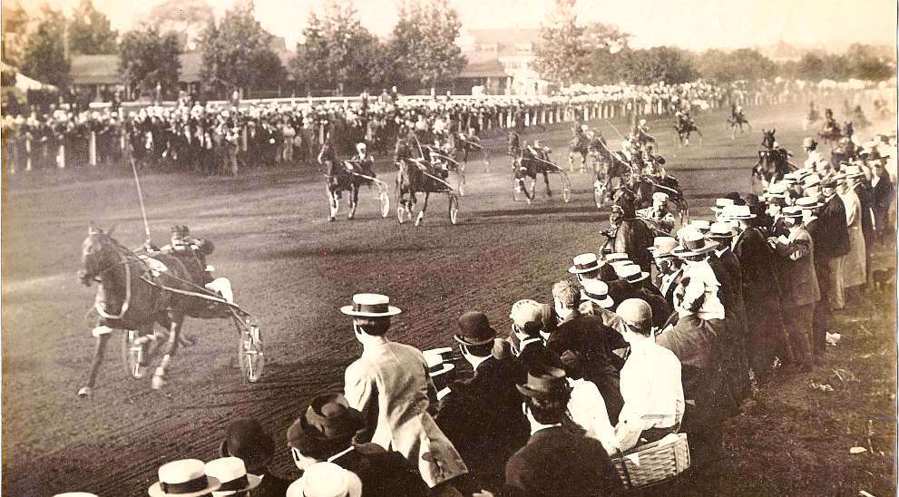
LIFE ON THE PLAINS: Pictorial walk down Water St., and buildings that are no longer there

by Roland D. Hallee

Over the next few weeks, we will go down Water St., from north to south, and take a look at some of the buildings that played a major role in the self-contained community of The Plains, that have long since been demolished.

(Read part 2 here.)

All photos courtesy of E. Roger Hallee

The old barn that stood across the street from the Lockwood-Duchess Textile Mill, and out buildings. The former KFC building now occupies the site.

Rodrigue’s Market, and below, Ma Roy’s Tavern. In the approximate area of where Sunrise Bagel now stands.

Ma Roy’s tavern

Pete’s Market, three doors down from where Ma Roy’s Tavern was located.


The story behind the creation of M*A*S*H

by Mary Grow

An article in the latest issue of The Saturday Evening Post says the television show M*A*S*H pioneered Sept. 17, 1972, 50 years ago this month.

The show was based on the movie of the same name, which came out in 1970; and the movie was based on the novel MASH, written by Richard Hooker and published in 1968 by William Morrow & Company.

Richard Hornberger Jr.

“Richard Hooker” was the pen name of Waterville surgeon H. Richard Hornberger, Jr. (Feb. 1, 1924 – Nov. 4, 1997). The H. stands for Hiester.

A United Press International obituary dated Nov. 5, 1997, says Hornberger chose the pen name as “a reference to his golf swing.”

Hornberger was a New Jersey native who graduated from Bowdoin College and Cornell University Medical School. Drafted for service in the Korean War, he served in a Mobile Army Surgical Hospital, or MASH unit, whose doctors worked close to the front lines, usually in tents, to treat – often to save – wounded soldiers.

The UPI obituary said Hornberger’s family had summered in Maine and had roots here that went “back several generations.” After the war, Hornberger moved to Bremen.

His post-war career included a stint with the Veterans’ Administration at Togus and surgical practice in Waterville, from which he retired in 1988. He began writing drafts of his first novel in the late 1950s; it was followed by M*A*S*H Goes to Maine and M*A*S*H Mania, neither as successful as the original.

His Nov. 7, 1997, obituary in the New York Times said survivors included his widow, Priscilla Storer Hornberger, two sons, two daughters and three grandchildren.

Dr. Hornberger’s circle included two other Waterville doctors, both with national reputations. Fairfield resident Loring Withee Pratt was an otolaryngologist (a specialist in ear, nose and throat problems); Skowhegan’s George E. Young was a radiologist and surgeon.

A long obituary of Dr. Pratt (May 26, 1918 – March 13, 2012), published in the Waterville Morning Sentinel on March 16, 2012, said he was born in Farmington, graduated from Middlebury College in Vermont in 1940 and studied medicine at Johns Hopkins School of Medicine in Baltimore.

The obituary says Pratt spent two years in Air Force flight surgeon training in Texas. After his June 1948 discharge, he and his wife Jennie (Jeanette Burque) came to central Maine, where he ran a Waterville ear, nose and throat medical practice until he retired in 1985.

Additional responsibilities included “assistant director of the F.T. Hill Seminar at Colby College in Waterville; chief of staff at Thayer Hospital in Waterville 1979-1981; and chief of department of otolaryngology — head and neck surgery 1977-1979 at Thayer Hospital.” He worked with tuber­culosis pa­tients at Fairfield’s Central Maine Sanato­rium and was “on the consulting staff of Waterville Osteopathic Hospital; Kennebec Valley Medical Center, Augusta; Franklin Memorial Hospital, Farmington; PenBay Medical Center, Rockland; Redington Fairview General Hospital, Skowhegan; Veterans Administration Hospital (Togus), Augusta; and the Charles Dean Memorial Hospital, Greenville.”

After he retired, the obituary says he continued his connections with the Mayo Clinic in Scottsdale, Arizona, and at Johns Hopkins.

The writer of the obituary said of Pratt, “For a doctor from a small Maine city, he had accomplishments on a national level in the field of medicine.”

Pratt was a fellow of numerous American medical associations; the writer listed as three “of his most prized” the American Medical Association (since 1948), the American College of Surgeons (since 1952) and the Triological Society (aka The American Laryngological, Rhinological and Otological Society, Inc.) (since 1954).

Other contributions the writer mentioned were “publishing papers in medical journals and presenting at professional conferences. One of his specialties was chainsaw injuries to the head and neck. He was recognized nationally for this work.”

In his spare time, Pratt was active in community organizations, including the Masons and the Fairfield Historical Society, and pursued interests in plant and animal life, gardening, geology and photography.

Pratt was survived by his wife, their nine children and numerous grandchildren and great-grandchildren. The large Pratt house on Lawrence Avenue in Fairfield remains a private residence.

Dr. Hornberger’s other nationally known colleague, about whom little information is available from on-line sources, was Dr. George E. Young (Nov. 15, 1888 – Aug. 7, 1960), an early radiologist and a surgeon. He and his wife Clara (1894 – 1978) lived in a large house on Madison Avenue in Skowhegan; like Dr. Pratt, Young worked extensively with tuberculosis patients at Central Maine Sanatorium.

George and Clara Young are buried in Skowhegan’s Southside Cemetery.

The newest building at the former Central Maine Sanatorium, which closed June 30, 1970, is the Young Surgical Building at 50 Mountain Avenue, on the east side of the campus. Built in 1955 and named in honor of George E. Young, it was added to the National Register of Historic Places on June 28, 2021.

The application for National Register status was prepared in March 2021 by Preservation Consultant Christine Beard, of Essex Preservation Consulting, in Amesbury, Massachusetts.

The application says the building has historic value “for its association with the treatment of tuberculosis in Maine” between 1955 and 1970. Maine’s most seriously ill tuberculosis patients were sent to Central Maine Sanatorium because it was there that “surgery could be performed if necessary.”

The explanation continues: “The [Young] Surgical Building is the only building constructed by the state solely for use as a surgical center for tuberculosis patients. At the time it was constructed, the Surgical Building was considered state-of-the-art and greatly expanded the ability to treat advanced cases of tuberculosis.”

The physical description of the building calls it “a three-story brick Modern style institutional building with masonry bearing walls and steel framing. The building has a T-shaped plan, with a rectangular three-story main block and a two-story rectangular rear ell.”

The building’s architect was Stanley S. Merrill, of Auburn, the application says.

Also on the lot, and part of the historic listing, is a 1935 brick boiler house just north of the main building. It is described as one and a half stories high with a single-story wooden addition built around 1950.

At its height, Central Maine Sanatorium consisted of 12 buildings, the application says; five remained when the application was prepared, standing on separate lots since a 1984 division of the property. The demolition of most of the buildings and changes to the surviving ones “preclude the formation of a cohesive historic district.”

The Young Surgical Building was a nursing home for some years. It is currently undergoing major renovations, with the goal of making it Mountain View apartments.

Maine’s other two tuberculosis sanatoria were Northern Maine in Presque Isle, built in the 1920s and improved in 1938 and 1939 with federal funds, and Western Maine in Hebron, started in 1904 as a private hospital and taken over by the state in 1915. Both closed in 1959; 18 of Hebron’s 30 patients came to Fairfield, and the other dozen were discharged.

The Fairfield hospital also began as a private venture about 1909, in Waterville, run by the Central Maine Association for the Relief and Control of Tuberculosis. The temporary housing –- patients spent the day at the facility and went home at night, according to the historic district application – was moved to Fairfield in 1910.

After Frank Chase’s widow, Valora Chase, donated money for the first building, the institution became Chase Memorial Sanatorium in 1914. It too became a state institution in 1915. The additional buildings were built between 1938 and 1955. In 1933 and 1934, Mountain Avenue was rebuilt with federal money.

Up and down the Kennebec Valley: Waterville historic district – Part 3

Original Hathaway Shirt Factory, on Hathaway, St., in Waterville.

by Mary Grow

After two weeksdigressions, your writer returns to Waterville history, beginning with the C. F. Hathaway Shirt Company, described in Roger Reed and Christie Mitchell’s Lockwood Mill Historic District application as “an internationally known firm that originated in Waterville.” The application adds that Mill Number 2 “is the only intact industrial facility in Waterville associated with the important shirt maker.”

The company was founded by Charles Foster Hathaway, born July 2, 1816, in Plymouth, Massachusetts. In May 1840 he married Temperance Blackwell, of Waterville, in Waterville. Temperance died Jan. 19, 1888; Charles died Dec. 15, 1893. Both are buried in Waterville’s Pine Grove Cemetery.

Wikipedia says Hathaway quit school when he was 11 to work in a nail factory. When he was 15 he switched to printing, and later to his uncle Benjamin’s shirt factory in Plymouth.

The Hathaways moved to Waterville in 1843 or 1844, and Hathaway worked for different printers. In 1847 he bought out one of them for $571.47 and in April started publishing the Waterville Mail, described as “a weekly paper of four pages filled with sermons, religious homilies, and moral stories.” On July 19, 1847, he sold the business, for $475.

Ernest Marriner, who devoted a chapter in his Remembered Maine to Hathaway, explained that Waterville readers were not interested in “the religious homilies and the stern puritanical advice with which Hathaway filled his paper.”

By 1850, perhaps earlier, Hathaway was back in Massachusetts, opening the Hathaway and (Josiah) Tillson shirt factory, in Watertown. He sold out on March 31, 1853, and on April 1, according to his diary quoted on Wikipedia, agreed to start C. F. Hathaway and Company, in Waterville, in partnership with his brother George.

The first Hathaway Shirt Factory site was a one-acre lot on Appleton Street, bought for $900; the ground-breaking was June 1, 1853. Over the summer, Hathaway and two others made shirts in Hathaway’s house. By the end of October, Marriner wrote, quoting Hathaway, the factory was operating: “the working hours were 7 A.M. to 6 P.M., six days a week, with an hour off at noon” – a sixty-hour work week.

Cyr/Professional Building, corner of Appleton and Main streets, in Waterville.

Appleton Street runs from Elm Street across Main Street to Water Street, the intersection north of Temple Street. Your writer has been unable to locate the Hathaway factory on the street (Editor’s note: It is now an apartment building on Hathaway St.). She believes the building was wooden, because Marriner described Hathaway’s 1856 negotiations over lumber for an addition.

The Hathaway Company manufactured only men’s shirts until 1874, when a line of ladies’ underwear was added. Henry Kingsbury, writing in 1892, said that since 1853, the business “has grown with the steadiness of an oak tree.” By 1902, Reuben Dunn wrote in Edwin Whittemore’s Waterville history, Clarence A. Leighton, “associated with” Charles Hathaway since 1879, was sole proprietor. (Dunn disagreed with other sources on the dates of the company’s founding and of Hathaway’s death.)

Marriner wrote that the Appleton Street factory ran for more than a century, information that matches Reed and Mitchell’s saying that Mill Number 2 in the Lockwood complex “served as the principal manufacturing plant” for Hathaway shirts from 1957 to 2002, when the business closed.

Kingsbury called Hathaway “a man of strong, original character” who valued “thorough, honest work,” held “unusually earnest religious convictions” and had “friendly and honorable” relations with his employees.

Whittemore showed Hathaway the patriot. When the first two Waterville companies mustered for Civil War service in May 1861, the 183 men and their officers marched to the Hathaway factory, “where each man was presented with a pair of French flannel shirts by Mr. Hathaway.”

Marriner called Hathaway “Poor tortured soul!” He described a man overdriven by his religious belief, seeking to be a saint but constantly bemoaning his own “depravity and deceit” and the “wickedness of…[his] natural heart.”

Hathaway wanted to convert his employees; Marriner said he required prayer at the start of each work day – “Charles Hathaway’s special brand of prayer” – until rebellion and ridicule made him lift the requirement. He felt a duty to preach to everyone he met, including those who found his “starvation wages and other business practices” not very Christian.

He was hard to do business with, being frequently sure he was cheated. Marriner described his feud with Waterville Baptist Church pastor Henry S. Burrage; and joined Whittemore’s contributors and Kingsbury in praising Hathaway’s role in establishing the Second Baptist Church in the South End.

Marriner expressed sympathy for Temperance, writing that in 1840, she could not have foreseen “the ostracism, the loneliness, the ridicule she must encounter as the wife of this man.”

* * * * * *

Before the interjection of the Lockwood Mill Complex and Hathaway’s shirts, readers had followed Matthew Corbett and Scott Hanson’s 2012 application for Historic Preservation listing southward on the east side of Waterville’s Main Street. Crossing to the south end of the west side of the street, Corbett and Hanson listed three buildings south of the intersection where Silver Street joins Main Street from the west. Ticonic Row was at 8-22 Main Street, separated by an alley from the newer Parent Block at 26 Main Street; next was the Milliken Block, bordered on the north by Silver Street.

Ticonic Row is described as showing Greek Revival architectural elements. Brick, four stories high, flat-roofed, it is divided into four sections with name plates from periods of separate ownership: from south to north, Gabrielli Pomerleau, Abraham Joseph, Tozier-Dow and Sarah Levine. Built in 1836, it is the district’s oldest building. Originally three stories with a gable roof, the fourth floor was added, the uppermost windows lengthened and the roof flattened in 1924.

The Parent Block, a four-story brick building with decorative brick trim, dates from 1909. The style is described as “early 20th century commercial.” Corbett and Hanson found a mid-20th-century photograph of “the original storefront with a deeply recessed central entrance between tall display windows on low wood bulkheads…. The floor of the recess was one step up from the sidewalk and appears to be a granite slab.”

The building on the south corner of Silver and Main streets, which now has Silver Street Tavern on the street floor, was in 2012 the Milliken Block, dating from 1877.

An on-line Maine Preservation website gives more history than Corbett and Hanson had space for. The site says in 1866, Waterville National Bank directors hired architect Moses C. Foster (see box) to design a bank building on the site of an earlier wooden building.

Foster’s three-story brick Italianate style building went up in 1877. Waterville National Bank failed two years later, and the building was renamed to honor banker Dennis L. Milliken.

An undated photograph on the website shows a small carriage drawn by a white horse standing on Silver Street and eight men loitering on Main Street, two leaning on hitching posts and one holding a dog on a leash. The photo shows business signs above three street doors on Main Street; the legible ones read “Mitchell Clocks & Jewelry” and “Waterville National Bank.” Smaller signs mark second-floor businesses, and on the building’s northeast corner is a large third-floor shield identifying the Odd-Fellows Hall.

This photo shows the elegant brick and stone trim and the elaborate ornaments on the protruding cornice that Corbett and Hanson described. The Milliken Block is flanked by story-and-a-half wooden buildings south on Main Steet and west on Silver Street.

Early in the 20th century, the Maine Preservation site continues, O. J. Giguere bought the building. He combined three street-level stores into one, Giguere’s Clothing Store, and “installed the “G” lead glass windows.” He also put “a name plaque on the Maine [sic] Street elevation, a common trend in Waterville as Franco-Americans started purchasing commercial blocks on the south end of Maine [sic] Street.”

The plate on the building in the photograph described above is between the second and third floors. It appears to have a name and a date.

Moses Coburn Foster

Moses Coburn Foster was born in Newry, Maine, July 29, 1827. He married Francina Smith (born in 1830), of Bethel, in 1849; they had five daughters and one son.

According to the chapter on businessmen in Whittemore’s Waterville history, Foster was educated at Rumford High School and Gould and Bethel academies. He began his career as a builder and contractor in 1846; during the Civil War he was a master builder in the Union Army’s quartermaster’s department.

The family moved to Waterville in 1874, and in 1880 he incorporated M. C. Foster and Son with his son Herbert (born in 1860, died Aug. 31, 1899).

Foster is credited with many public buildings in New England and adjacent Canadian provinces, including post offices, churches, hotels and the Maine Central Railroad Station, in Brunswick.

Francina Foster died in 1890; Moses died Sept. 21, 1906. They are buried in Pine Grove Cemetery.

Their daughter, Carrie Mae (July 18, 1862 – Dec. 24, 1953), married businessman Frank Redington in 1890. From about 1892 until Moses Foster died, the couple lived with him in the Queen Anne style house that he built, described in a 2014 Central Maine newspaper article as “the first example of this architectural style in Waterville.” The two-story wooden house is an elaborate multi-gabled structure, with a square turret and a small front porch, its fancy shingles and decorative moldings painted contrasting colors. Wikipedia says parts of the interior are original, including “the entrance hallway with formal fireplace and ‘mahogany woodwork’ and stairs.”

The Redingtons remodeled in the early 1900s, probably adding the “tin ceilings, chandeliers, and fluted Doric columns in the opening between the parlor and library.” After Frank Redington’s death in February 1923, Carrie continued to live in the house until her death.

The Foster-Redington House was listed on the National Register of Historic Places on April 11, 2014. Located in a secluded area near downtown Waterville, it is privately owned; anyone visiting is urged to respect the owner’s rights.

Main sources

Corbett, Matthew, and Scott Hanson, National Register of Historic Places Registration Form, Waterville Main Street Historic District, Aug. 28, 2012, supplied by the Maine Historic Preservation Commission.
Kingsbury, Henry D., ed., Illustrated History of Kennebec County Maine 1625-1892 (1892).
Marriner, Ernest, Remembered Maine (1957).
Reed, Roger G., and Christi A. Mitchell, National Register of Historic Places Registration Form, Lockwood Mill Historic District, Jan. 11, 2007.
Whittemore, Rev. Edwin Carey, Centennial History of Waterville 1802-1902 (1902).

Websites, miscellaneous

Up and down the Kennebec Valley: Trotting parks

Trotting park.

by Mary Grow

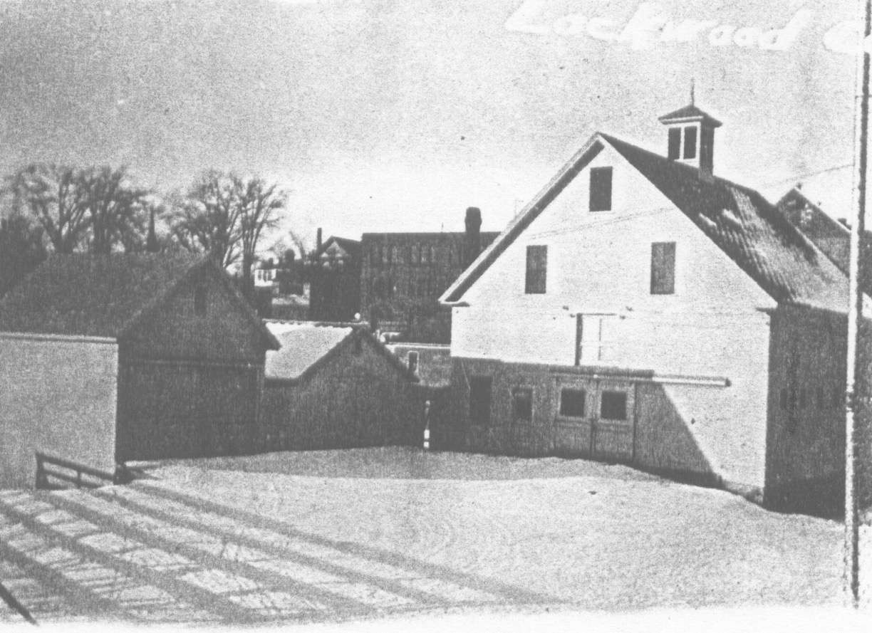
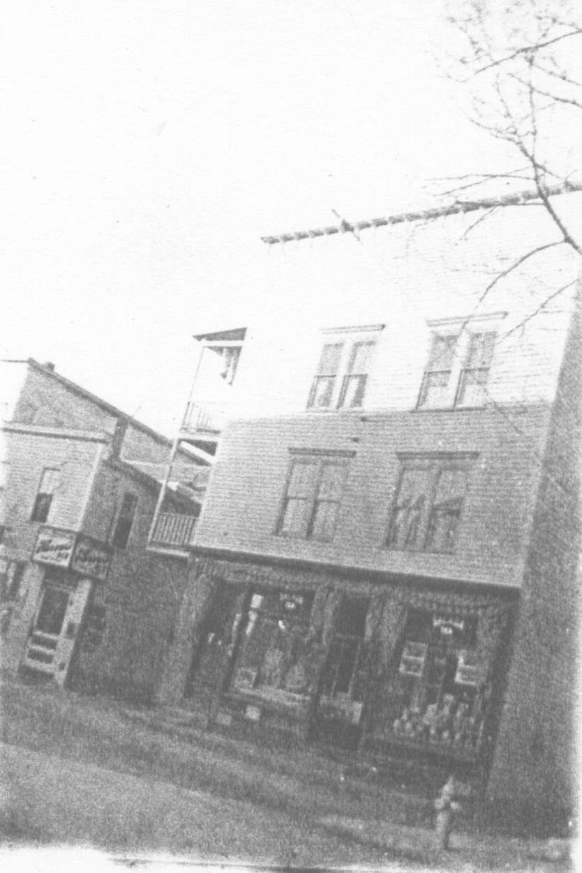
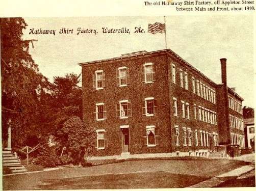
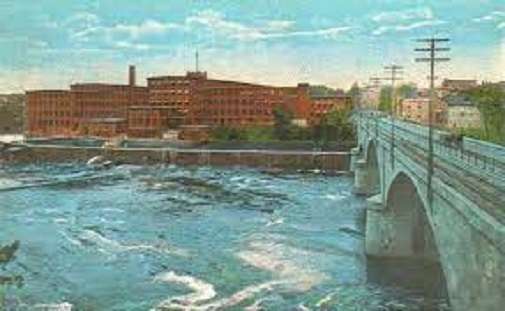
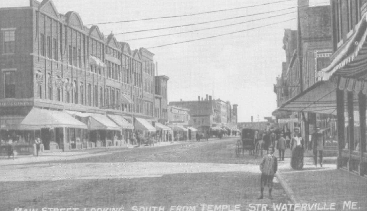
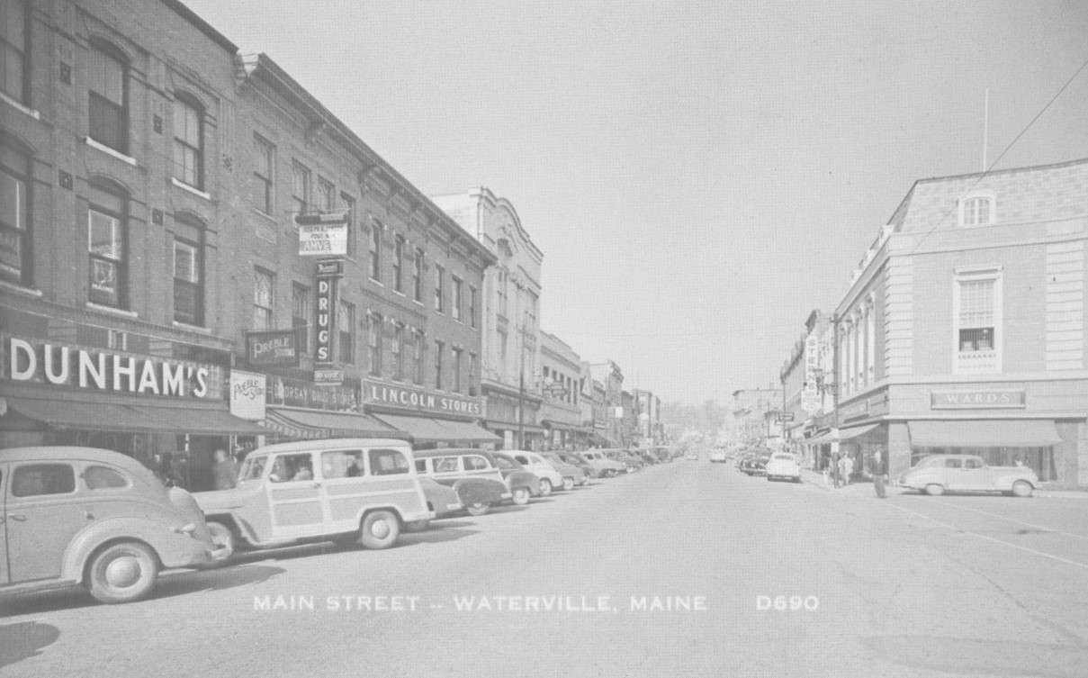
Your writer intended to deliver the promised article on Charles Hathaway and his shirt company, and more information on Waterville’s historic Main Street buildings, this week. But a reader reacted to last week’s digression on agricultural fairs with a question: what is a trotting park?

Hence another digression, which led your writer to a delightfully illustrated, highly recommended website: The Lost Trotting Parks Heritage Center (see box). This page will share some of the information from this and other sources.

Disclaimer: your writer is not a horse expert. Readers who are, please be kind.

A trotting park, also called a harness racing track, is an oval dirt racetrack, usually a mile long but sometimes shorter. Historically, a trotting park could be public, owned and maintained by an agricultural society of other organization, or privately owned.

On these tracks trotting or pacing horses race, each pulling a sulky with a single human occupant.

Wikipedia says most horses have four “natural” gaits, or “patterns of leg movements.” In order from slowest to fastest, they are called walk, trot, canter and gallop.

The Wikipedia writers describe the gaits in terms of two, three or four “beats.” The trot is a two-beat gait; the horse lifts left front and right rear hoofs simultaneously, then right front and left rear. Average speed is a bit over eight miles an hour.

Wikipedia’s illustrations include a photo of Thomas Eakins’ painting from 1879 or 1880 titled The Fairman Rogers Four-in-hand, or A May Morning in the Park. It shows a group of people in a coach drawn by four brown horses, the two lead horses clearly trotting.

The trot is a comfortable gait that a horse can maintain for hours, Wikipedia says. It is less comfortable for a human rider, who is bounced up and down; riders therefore learn to “post,” to raise themselves up and down in the stirrups in time with the horse’s motion.

The pace, called on another site an artificial gait, is also a two-beat gait, but the two legs on the same side of the horse’s body move together, so that the horse rocks from side to side – even less comfortable for a rider than trotting.

Harness racing could be for either trotters or pacers, Wikipedia says. In the United States, harness-racing horses must be Standardbred. Wikipedia says Standardbreds have shorter legs, longer bodies and “more placid dispositions” than Thoroughbreds.

A sulky, also called a bike, a gig or a spider, is a light-weight, single-seat horse-drawn vehicle with two large wheels.

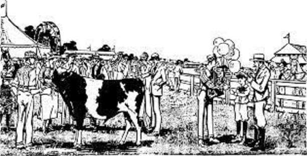
On-line sites indicate that harness racing is common worldwide. In the United States, there are races for both pacers and trotters. A pacer or trotter who comes in top in each of three sets of races in the same year becomes a Triple Crown winner.

This year’s Windsor Fair program included harness racing. The Windsor Historical Society, headquartered on the fairgrounds, has information and photographs about past horses and races.

* * * * * *

Last week’s story mentioned trotting parks in China, Waterville and Windsor. Henry Kingsbury wrote in his Kennebec County history that China’s, Windsor’s and one of Waterville’s were public. China’s was built in 1868 and abandoned before 1892.

Kingsbury listed six nineteenth-century private parks in the county. Four were still operating in 1892, one in Farmingdale, one in West Gardiner, and two in Waterville, C. H. Nelson’s and Appleton Webb’s.

Palermo native and Civil War veteran Charles Horace “Hod” Nelson (1843 – 1915), of Sunnyside Farm, in Waterville, was an internationally recognized horse breeder; his champion trotter, Nelson (1882 – Dec. 4, 1909) set multiple records and in 1994 was named an Immortal in the Harness Racing Hall of Fame.

Your writer failed to find information on an Appleton Webb she is sure was a trotting park owner. Waterville lawyer and politician Edmund Webb’s son Appleton (Aug. 12, 1861 – Aug. 23, 1911) would have been about the right age; one website says he was admitted to the bar, and none links him with horses.

Other trotting parks in the central Kennebec Valley included one in Albion, three in Augusta (two private) and one in Fairfield (apparently private).

* * * * * *

Albion’s trotting park, according to Ruby Crosby Wiggin’s history, was in Puddle Dock, a locality in the southern part of town on Fifteen Mile Stream. The South Freedom Road crosses the stream there; near the bridge, a dam provided water power for various small industries for years, and Wiggin found the South Albion post office was nearby from 1857 (or maybe earlier) to about 1890.

The 1857 postmaster, she wrote, was D. B. Fuller, who lived “in Puddle Dock just opposite Maple Grove Cemetery and on the same side of the road as the trotting park.”

Maple Grove Cemetery is on the southwest side of South Freedom Road, just north of its eastward turn to cross Fifteen Mile Stream; so the trotting park would have been on the northeast side, between the road and the stream.

Wiggin continued her history of fairs in Albion, summarized last week, by saying that after the records she found ended in 1891, the fairs probably wound down, becoming “mostly horse pulling and a horse trot…held at the Trotting Park at Puddle Dock, just opposite Maple Grove Cemetery.”

To many 1960s Albion residents, she wrote, the park was “the place where they learned to drive their first car.” Not long before her history was published in 1964, the park was converted to a large plowed field (visible in an on-line aerial view).

* * * * * *

Augusta’s principal trotting park appears on old maps on the west bank of the Kennebec River, just south of Capitol Park. Newer maps show the area housing the Augusta police department and the YMCA building and grounds.

An on-line site shows a postcard with the typical oval track. Accompanying text says the trotting park was on a 22-acre lot.

Both James North, in his 1870 history of Augusta, and Kingsbury said the park opened in 1858. That year, North wrote, the State Agricultural Society chose Augusta as the site for its fourth fair. City officials and workers spent the summer getting ready.

North wrote, “A trotting park was graded and fenced at considerable expense, on the ‘Bowman lot,’ adjoining the State grounds, where the fair was opened Tuesday, September 21st.”

The 1858 fair was the Society’s most successful thus far, North said, with more and better livestock than ever before shown in Maine and a fine display of industrial and agricultural products in a 50-by-84-foot wooden addition to the State House. During “the ladies’ equestrian exhibition,” attendance was estimated at up to 15,000 people.

On Thursday evening, North wrote, the fair hosted a guest speaker on agriculture, United States Senator Jefferson Davis from Mississippi. Some auditors praised his agricultural knowledge; others detected a political message. North wrote that the Kennebec Journal called the speech “a bid for the presidency, with an agricultural collar and wristbands.”

Kingsbury wrote that up to 1892, the Augusta trotting park operated “with but few intermissions” under successive owners; in 1892, it was run by the Capital Driving Park Association. At some point, the postcard caption said, grandstands with space for 2,000 spectators were built.

In addition to racing and fairs, the park hosted circuses; and in 1911, the on-line site says, it was the landing place for the first airplane to visit Augusta, described as “St. Croix Johnstone’s Moisant monoplane.”

(Your writer could not resist exploring these names on line. She found that John Bevins Moisant [April 25, 1868 – Dec. 31, 1910] was an American aviator from Illinois who designed the Moisant biplane, which crashed on its first flight in February 1910, and the Moisant monoplane, which Wikipedia says “had difficulty staying upright on the ground and was never flown.” A different article says St. Croix Johnstone [another Illinoisan, born Jan, 2, 1887, and died Aug. 15, 1911] “flew a Moisant monoplane,” described as a United States version of the 1909 French Bleriot XI. Both aviators died in flying accidents.)

The Lost Trotting Parks Heritage Center website says Augusta’s two private trotting parks were on the east side of the Kennebec. George M. Robinson’s, built in 1872, was on South Belfast Avenue (Route 105). Alan (in other sources, Allen) Lambard’s, dating from 1873, was off Route 17. Kingsbury said both were “abandoned” by 1892.

North provided a short biography of Allen Lambard (July 22, 1796 – Sept. 5, 1877). He was by 1870 “in the evening of his days,” but still vigorous and interested in agriculture. His business ventures in Augusta and in Sacramento, California, had made him “the largest individual tax-payer in Augusta.” In October 1870, North wrote, he donated the house at the intersection of Winthrop and Pleasant streets as St. Mark’s Home for Aged and Indigent Women. The institution closed in October 1914.

The on-line Find a Grave site says Allen Lambard is buried in Augusta’s Forest Grove Cemetery. Other sources say Lambard was a grandson of Hallowell midwife Martha Ballard, made famous by Laurel Thatcher Ulrich’s publication of her diary.

George M. Robinson might be the man found on line who was born in 1823, died in 1888, and is buried in Augusta’s Mount Pleasant Cemetery; and might also be the man who made the March 25, 1876, Portland Daily Press after a gale blew down two of his barns.

* * * * * *

The Fairfield trotting park was located on the west side of town, west of West Street and south of the present Lawrence High School athletic fields. The Fairfield bicentennial history leaves its dates uncertain – it might have existed before 1872, while Fairfield was still called Kendall’s Mills, and it was very popular in the 1890s.

The local historians relied on two sources. One was a 1939 article by G. H. Hatch, who believed Edward Jones Lawrence (Jan. 1, 1833 – November 1918) and Amos Gerald (Sept. 12, 1841 – 1913) built the track “which was active in racing circles for years.”

Lawrence and Gerald owned and bred horses, according to Hatch. The first “really famous” Fairfield horseman, he said, was J. H. Gilbreth, whose horse named Gilbreth Knox was “a famous trotter of his day.” Gilbreth Knox is listed on line as a sire in the 1870s.

Lawrence acquired “the beautiful Knox stallion, Dr. Franklin,” listed as a sire in the 1880s.

The other mention of the trotting park in the Fairfield history tells readers that on Wednesday, Aug. 21, 1895, there was a “big event” at the trotting park that brought horses and people from miles around. The owners of the lumber mills in the downtown complex on the Kennebec River gave their employees the afternoon off to attend.

That day, for the third time, a fire started in a mill (earlier fires were in 1853 and 1882) and spread through the others. After the destruction, only one mill was partly rebuilt, and it didn’t last long. “Thus,” wrote the Fairfield historians, “the lumber industry in the Kendall’s Mills area of Fairfield, after a century of progress, came essentially to a close.”

The Lost Trotting Parks Heritage Center

The Lost Trotting Parks Heritage Center is a nonprofit organization in Hallowell, founded and run by Stephen Thompson. Its website describes its mission:

“to preserve the stories and images of the 19th century to present day that illustrate the history of Maine’s harness racing, lost trotting parks, fairs, agricultural societies, Granges, and the significance of the horse in society.”

A Kennebec Journal article from October 2021 says Thompson was looking for a space to turn his on-line venture into a physical museum.

Tax-deductible contributions are welcome. The website is losttrottingparks.com; the postal service address is Lost Trotting Parks Heritage Center, P.O. Box 263, Hallowell, ME 04347; and Thompson’s email is listed as lifework50@gmail.com.

Main sources

Fairfield Historical Society, Fairfield, Maine 1788-1988 (1988).
Kingsbury, Henry D., ed., Illustrated History of Kennebec County Maine 1625-1892 (1892).
North, James W., The History of Augusta (1870).
Wiggin, Ruby Crosby, Albion on the Narrow Gauge (1964).

Websites, miscellaneous.

Reviving the China Historical Society

The interior of the China History Museum.

by Bob Bennett

As we all know, it is inevitable that things change over time. Those of us who recall and cherish the past are the ones who can help restore and keep those memories alive. It is with that purpose that I have composed this short article.

For a number of years, the China Historical Society boasted many active members and leaders. For example, as a lifelong railroad fan, I was amazed by the late Mark Johnson’s contributions, as the head of the society in the late 1990s, to the authors of the six volume history of the Wiscasset Waterville And Farmington “two footer,” Narrow Gauge In The Sheepscot Valley. However, in the last few years, numbers have dwindled and we are now down to just a few interested people. Thus, as a follow-up to the excellent turnout that we had at our China Community Days open house, and to hopefully stir up even more interest in the society, we will be having another “meet and greet” on Saturday, September 10, beginning at 1 p.m. There are several reasons for this meeting.

First, the town’s history and relevant artifacts need to be protected as much as possible and as a retired history teacher, I certainly understand the need for this preservation. Lost history can never be recovered. However, the conditions that exist in the present historical museum are not conducive to quality storage. There is no climate control, save for Mother Nature, and pests and rodents are frequent visitors. Electricity is present but basic at best. While the town does deal with the pests, these issues may become even greater down the road. Possibly, some human visitors might have resources or suggestions that could help alleviate this situation.

In addition, to continue to be a viable entity, The China Historical Society needs people and these folks are welcome from all age groups. Older individuals are often more interested in history and its physical aspects. This is largely because they’ve lived and witnessed more of the past and/or have ties to it. But, to keep that interest alive and growing, we also need to inspire younger humans to get interested and involved in learning about the past and keeping it alive. Thus, I am hoping that our get-together on September 10 will attract China residents, and seasonal visitors, of all ages.

As I stated earlier, we’ll shoot for a start time of 1 p.m., in the afternoon. Hopefully, that will allow folks to take care of their weekend chores. I would suggest thinking about bringing folding or lawn-type chairs since in-building seating is not very available or comfortable; the town will likely provide some as well. Several of we members will be there and the OPEN flag will be flying in the newly-installed holder on the ramp railing. I look forward to seeing you!

Up and down the Kennebec Valley: Agricultural Fairs

by Mary Grow

Your writer is pleased that she didn’t promise a story about Hathaway shirts this week, because, considering the season, she decided to detour to write about the country fairs our ancestors enjoyed. Some of the historians cited previously in this series mentioned them; your writer will share bits of their information.

Samuel L. Boardman, in his chapter on agriculture in Henry Kingsbury’s Kennebec County history, and Linwood Lowden, in his history of Windsor, summarized development of central Maine agricultural organizations, often sponsors of agricultural fairs.

Lowden’s list:

  • The short-lived Kennebec Agricultural Society, “organized in 1787 and incorporated in 1807,” was the first in New England and the second in the United States. (On-line sources say the first in the country was the 1785 Philadelphia Society for Promoting Agriculture, still active.)
  • The short-lived Maine Agricultural Society, incorporated Feb. 21, 1818, “held cattle shows in Hallowell in 1820 and 1821.” The 1820 show was Maine’s first, Boardman wrote.
  • The Winthrop Agricultural Society, incorporated Feb. 28, 1829, and reorganized in 1832 as the Kennebec County Agricultural Society, leased fairgrounds in Readfield beginning in 1856. By 1892, Boardman wrote, it had several buildings, a track and a grandstand; organizers continued “the old custom” of having a prominent Maine man deliver an annual address.
  • The North Kennebec Agricultural Society, headquartered in Waterville, began July 31, 1847. E. P. Mayo (in the agricultural chapter in Edwin Whittemore’s Waterville history) wrote that its first exhibition was in October 1847. Another early action, Mayo wrote with approval, “was to raise $75 for the purchase of standard agricultural works for a library.”
    • This organization bought land in southern Waterville and built a half-mile horse track in 1854. Its annual exhibitions continued into the 1880s, Mayo wrote, until competition from outlying towns cut too deeply into attendance. Its real estate was sold to expand Pine Grove Cemetery.
  • The South Kennebec Agricultural Society, which included Windsor, was incorporated in 1853 and in April 1857 bought three lots in Gardiner for a fairground.
  • The Kennebec Union Agricultural and Horticultural Society was incorporated on March 17, 1860, and took over “all assets” of the South Kennebec Society. Its “active career” ended in 1877, according to Boardman.
  • The Eastern Kennebec Agricultural Society, organized April 4, 1868, “built a half mile race track, and held its fairs on a sixteen acre site at China,” the China Fairgrounds or China Trotting Park, west off Dirigo Road. In 1869, Boardman said, the Society added a 40-by-60-foot exhibition hall. The last fair was in the fall of 1874; Boardman wrote that bad weather on fair days kept income below expenses, and the society gave up in December 1877 and sold its property.
  • A second South Kennebec Agricultural Society was organized March 24, 1888, in South Windsor, and incorporated by the Maine legislature a year later. This Society leased a lot with a trotting park, the earliest part of the current Windsor Fairgrounds. Lowden wrote that in 1973 the Society’s legal name became Windsor Fair.

* * * * * *

Albion historian Ruby Crosby Wiggin was delighted to find secretaries’ records of the Farmer’s and Mechanic’s Club of Albion (the apostrophes are as she placed them), organized Oct. 5, 1863, and sponsor of an annual October fair from Oct. 13, 1863, through at least 1891, when the records end.

The secretaries’ books answered a question that had plagued her research: local residents told her three different locations for the fairs. The records showed everyone was right.

The 1863 fair was in the Temperance Hall, on Bangor Road, with outdoor exhibits near the former Marden’s – later Drake’s – store. After what was first the Public Hall and later the Grange Hall was built in 1873, the fair moved there and used land behind Keay’s store, on Main Street. And after the town house was built in 1888, it hosted indoor displays, with outdoor events in the field behind the Besse building.

Wiggin’s list of animals at the first fair in 1863 totals more than 100 horses, oxen, cows, sheep and swine. Indoor displays featured farm produce, including locally-raised tobacco; cheeses; and buttons, “carpets, quilts, rugs, cloth, yarn” and other handicrafts.

Exhibits became more varied over the years, Wiggin wrote. She listed some she considered unusual: a “collection of stuffed birds”; a 100-year-old chair; an English table cover more than 100 years old; woolen stockings and a patchwork quilt made by women in their 90s; and a “worsted lamp mat” made by a six-year-old boy.

She found no description of baby shows, but, she said, in 1865 the “largest, fattest and best fed baby” won a prize, and in 1879 a committee named the “longest and leanest and poorest fed man.”

Old-time residents told Wiggin the Albion fair sometimes included a merry-go-round “run by two fellows turning it by a crank in the middle.” It was reportedly owned by Stevens Brothers, from Unity, and was a feature of annual Unity fairs.

* * * * * *

Palermo historian Milton E. Dowe, in his 1996 book of memories, included a short description of the annual Branch Mills Grange fair, where, he wrote, “A wonderful time was had by all.” His undated description refers to a time after 1909, when the Grange Hall, in Branch Mills Village, was built after the 1908 fire.

Behind the building, Dowe wrote, was a hitching rail where people left their horses for the day. On the grounds were cattle exhibits and the horse pulling competitions that were “the highlight of the Fair day.”

Inside, Dowe wrote, people admired “displays of handiwork, arts, crafts, vegetables, etc.” There was an afternoon baby show. The noon dinner included “baked beans, brown bread, biscuits, casseroles, pickles,…various kinds of pies…[and] always plenty of coffee.”

* * * * * *

Alice Hammond’s history of Sidney credits the Sidney Grange with starting the Sidney Agricultural Fair in 1885; it continued well into the 20th century. Kingsbury said its specialties were fruit –Sidney had many apple orchards – and “working cattle.” One year, he wrote, 75 yokes (pairs) of cattle paraded in a line.

Hammond included a report that the fair’s treasurer, Martin L. Reynolds, put in the 1890 town report “[o]wing to the inquiry of some of the townsmen” about the use of town funds.

From 1887 through 1890, taxpayers gave the fair $25 annually. In 1887, fair organizers spent $24.62. The largest expenditure was $9 to E. A. Field for “lumber and hauling same.” The two smallest were 30 cents each for two dozen hooks from O. Williamson and “Swifel Eye to machine” from J. S. Grant (Hammond wondered what a swifel eye was; your writer suggests a misspelling for swivel eye).

In 1888, A. E. Bessey chipped in $1 (he was probably, despite the spelling difference, Dr. Alden Edward Besse [Jan. 1, 1838 – June 15, 1903], born in Hebron, living in Sidney in 1880, died in Waterville, buried in Pine Grove Cemetery). Lumber was again the most costly item; total expenditures were $23.65.

The 1889 expenditure totaled $12.10. Joseph Field earned $2 for “care of lumber” – Hammond noted that the wooden animal pens were dismantled after each fair, stored and rebuilt the next year – and Badger and Manley charged $3.50 for posters (up from $2.50 in 1887).

In 1890 three individuals added $21.94 to the $25 appropriation. The account was nonetheless overdrawn for the first time, mostly because the Oakland Band, making its first appearance, cost $20. Because of earlier frugality, however, treasurer Reynolds reported a balance in the fair treasury of $12.91 at the end of four years.

The year 1890 was also the first year that fair organizers bought a police badge, for 75 cents. Hammond wondered if the crowd was getting rougher, or if the organizers were merely being extra careful.

* * * * * *

Alma Pierce Robbins focused her Vassalboro history on agricultural organizations, mentioning fairs only incidentally. The Vassalborough Agricultural Society was organized in 1820, she wrote. The town had three Granges, Oak Grove (1875, moved to Getchell’s Corner in 1883), Cushnoc at Riverside (1876) and East Vassalboro, organized in 1895 and still flourishing.

The Agricultural Society must have sponsored fairs, because Robbins wrote of spring “preparations to exhibit at the Fall fairs.” She also wrote about “premiums” for “wheat, corn, hemp, flax and silk,” and “prizes” for “cattle, sheep and swine,” and mentioned oxen-pulling and later horse-pulling.

Robbins specifically referred to Cushnoc Grange fairs “with fine exhibits of hand work, farm produce and stock.” She added memories of “the oyster stew suppers on cold snowy nights, the baked bean and brown bread dinners with great jars of home made pickles and dozens of apple pies,” where all the neighbors gathered.

* * * * * *

Windsor’s extensive fairgrounds are at 82 Ridge Road (Route 32), not far north of the intersection where Route 32 joins Route 17. The site includes a dozen historic buildings restored and maintained by the Windsor Historical Society, multiple exhibition halls for everything from livestock to jams and jellies, an oval racetrack and large parking areas.

Lowden wrote that the first Windsor Fair was held Oct. 3 and 4, 1888, before the South Kennebec Agricultural Society was organized and legislatively incorporated in the spring of 1889. There is some confusion about whether a formal racetrack was used that year; Lowden said “a firmly held local tradition” is that horses ran on the road that is now Route 32, across a bridge that “stood high above” Gully Brook. But he found an Oct. 5, 1888, newspaper report saying there was a race track by 1888, so he inferred the in-the-road races must have been earlier.

Lowden wrote that the horse races have always been the most popular attraction and “the financial backbone” of the fair. Other features he described included displays of and competitions among other farm animals. In 1888, the exhibition of horses and colts drew a local reporter’s praise; the reporter was even more enthusiastic about the displays of fruit, vegetables and “artistic needle and fancy work.”

The fair introduced inventions and new practices for farmers and their families, like a new parlor stove and a new kitchen stove in 1893; an automobile in 1900; a hot air balloon in 1902; and an airplane in 1917. The midday featured varied entertainers, simple games, food vendors; the first merry-go-round appeared in 1916.

Main sources

Dowe, Milton E., Palermo, Maine Things That I Remember in 1996 (1997).
Hammond, Alice, History of Sidney Maine 1792-1992 (1992).
Kingsbury, Henry D., ed., Illustrated History of Kennebec County Maine 1625-1892 (1892).
Lowden, Linwood H., good Land & fine Contrey but Poor roads a history of Windsor, Maine (1993).
Robbins, Alma Pierce, History of Vassalborough Maine 1771 1971 n.d. (1971).
Whittemore, Rev. Edwin Carey, Centennial History of Waterville 1802-1902 (1902).
Wiggin, Ruby Crosby, Albion on the Narrow Gauge (1964).

Websites, miscellaneous.

Upcoming fairs

Although Maine’s 2022 fall fair season is winding down, there is still time to take in some that aren’t too far from the central Kennebec Valley.

  • Windsor Fair began Aug. 28, and runs through Monday, Sept. 5. See the website windsorfair.com for daily programs.
  • The Clinton Lions Agricultural Fair, on the fairgrounds at 1450 Bangor Road (Route 100) opens at 3 p.m., Thursday, Sept. 8, and runs through 5 p.m., Sept. 11. Details are on Clintonlionsagfair207.com.
  • Litchfield Fair, at the 44 Plains Road fairground, opens Friday, Sept. 9, and runs through Sept. 11, with free admission for seniors on opening day. See litchfieldfair.com.
  • Farmington Fair runs from 10 a.m., Sunday, Sept. 18, through Saturday afternoon, Sept. 24. The fairground is at the intersection of Maple Avenue and High Street, on the northwest (right) side of Routes 2 and 27 coming from New Sharon. See farmingtonfairmaine.com.
  • The annual Common Ground Country Fair runs from Friday, Sept. 23, through Sunday, Sept. 25, in Unity, at the Maine Organic Farmers and Gardeners Association (MOFGA) education center, 294 Crosby Brook Road (off Route 139 in southeastern Unity). See mofga.org.

CORRECTION: The building in the photo in last week’s issue is the Clukey Building, located on the corner of Main and Silver streets, location of the Paragon Shop today. It was an editing error.


LIFE ON THE PLAINS: The formative years at St. Joseph School

The only photo that could be found of the St. Joseph School was taken in 1944. Maybe you have some relatives in the photo. These were the Cadets (grades 5-8). Front row, left to right, Arthur Belanger, (?), Donald Bouchard, Edwin Daigle, Norman Pilotte, Louis Champagne, Norman Giroux, Gid Talbot, Armand Giguere, Alex Cormier, Robert Bourget, Roger Corbin and Arnold Trahan. Second row, Donald Carpentier, Denis Labonte, Arthur Routhier, Lionel Cabana, Bob “Satch” Maheu, Bertrand Lacroix, Jerome Hallee, Donald Pelletier, Gene Gagne, Reginald Porter, Francis Poirier, Robert Champagne, Thomas Michaud, Richard Duperry, Robert Trahan, Raymond Carpentier and Edmond Martin. Rear, going up the steps, Brandon Rancourt, Roger Ouellette, (?) Champagne, Reg Pelletier, Robert Lessard, Reginald Roy, Francis Poirier, Kenneth Rancourt, Francis Hallee, Richard Carrier, Donald Vachon, Gerald Mathieu, Jerome Poirier, Wilfred Viens, Fernand Michaud, Reginald Trahan, Bernard Bolduc, David Bolduc, Roger Hallee, Marcel Jalbert and Donald Maheu. (photo courtesy of E. Roger Hallee, published in Paper Talks, 1984.)

by Roland D. Hallee

Like any other phase of life, growing up on The Plains also meant school days.

Although the first five years of my school days were spent at St. Francis de Sales Parochial School, there came a time when I had to go to a different school.

St. Francis only accommodated boys until the fifth grade. Girls could stay until the eighth grade. At the time I was there, the “brothers” school across the parking lot had been shuttered. The only occupants were from the Lebanese community, who were using the building as a temporary school while awaiting the completion of their own building, St. Joseph Maronite School, on Appleton St. For some reason I don’t recall, we were mostly segregated from them, and didn’t get to meet them until high school, some of whom became good friends.

So, the boys had to go to St. Joseph Catholic School, on Silver Street, to continue their parochial education, or enroll in a public school. My parents chose to enroll me at St. Joseph’s.

St. Joseph School was located between Preston and Kimball streets, the present site of Notre Dame Catholic Church. It was a one-story, white, clapboard-sided building that sat way back from the street. It resembled your standard-looking school building. It also included a field across Preston St. where we had formulated a crude softball field. The site of the school actually had three softball fields. The other two being in front of the school, one on the south side of the yard, and the other on the north side.

Every day, I would walk up Summer St., actually passing the site of my dad’s old market, and down Kimball St. I only attended that school two years (1960-1962), going on to junior high school my eighth grade year. That is a whole different story.

The teachers at the school at the time was Brother Eugene, Mr. Roberge and Mrs. Pelletier. I only had the two former as teachers, in sixth and seventh grades, respectively. My cousin, E. Roger Hallee, began teaching their my eighth grade year, but I never had him because I had moved on to junior high.

My first experience was strange, because so far my entire school life had been spent with the same kids, most of whom lived in my neighborhood, so we were very well acquainted. Now, I was thrust into an environment where I met other boys, mostly from Notre Dame Parochial School, that was located between King and Water streets, at the time, where the KVCAP main building is now.

There was nothing exceptional that stands out in recollecting those years, except the highly-competitive softball games during recess and lunch hour in fall and spring. The South End was home to some of Waterville’s best athletes, and competing against them, or with them, was an excellent learning experience.

Of course, most of the school year took place during winter months, and nothing much went on outside, except an occasional chance to go to the nearby South End Arena to play some hockey.

I could name some of the guys I went to school with there, but it wouldn’t be fair to those I don’t remember. But I do remember one, who shall remain nameless, who was a left-handed hitter, that could hit the ball all the way to Silver St. – on the fly – something no one else could do. Sometimes in the fall, we would organize touch football games. We also played some soccer.

For those of us growing up in the area of The Plains, those years at St. Joseph School were formative years that prepared us for the next phase in our lives – high school.

Read more of this series here.

Up and down the Kennebec Valley: Waterville historic district – Part 2

The Clukey Building, located on the corner of Main and Silver streets, location of the Paragon Shop today.

by Mary Grow

This week’s description of Waterville’s Main Street Historic District begins where last week’s left off, with the Common Street buildings on the south side of Castonguay Square, and continues down the east side of Main Street. It adds a summary of the separate Lockwood Mill Historic District, across the intersection of Spring and Bridge streets at the north end of Water Street (see also the May 7, 2020, issue of The Town Line.)

* * * * * *

Continuing with Matthew Corbett and Scott Hanson’s 2012 application for the Waterville downtown historic district, on the south side of Common Street, the building at the east end (closest to Water Street) is the brick Haines Building at 6-12 Common Street. Built four stories tall in 1897, after a 1942 fire destroyed the top three stories only one was rebuilt.

Next west is the 1890 “Romanesque Revival style Masonic Block,” a four-story brick and granite building. Adjoining it is the three-story Gallert Block, which the application says was built in 1912 to replace wooden stores that had burned in 1911. Corbett and Hanson describe it as blonde brick with granite and brick trim and an example of Commercial Style architecture.

The building on the corner of Common and Main streets is the Krutzky Block (57-59 Main Street), also built a year or so after the 1911 fire. The building “combines elements of the Arts and Crafts and the Spanish Colonial Revival styles.” The façade has two bays that face Common Street; four bays that “begin to turn toward Main Street”; a single narrow bay with the main entrance facing “the corner of Common and Main Streets”; and two bays on Main Street.

Materials in this building include stucco, stone, metals and brick. The brick is “laid in Flemish bond which provides a subtle pattern to the brickwork.”

The next two properties south, the GHM Insurance Company building and the pocket park, are post-1968, too new to count as historic.

Next south of the park, the 1936 three-story Federal Trust Company Bank building at 25-33 Main Street was designed by architects Bunker & Savage, of Augusta, in Art Deco style, the only Art Deco building in the district that was designated in 2012. The original part on the north end “is of limestone construction with later expansions in stone or ceramic tiles and stucco with varied marble and brick storefronts,” Corbett and Hanson wrote.

The bank later absorbed two buildings south, a 19th-century brick one and an undated section, also brick, taken over from the Levine Building. The application says the southern building dated from the early 19th century and “appears to have been a two story brick block with granite piers and lintels at the storefront level and a side gable roof.” By 1875, it was three stories high.

The Levine’s Clothing building dated from 1880. Four stories, brick, it was remodeled in 1905 and again in 1910 before being demolished recently to make room for Colby College’s Lockwood Hotel.

Crescent Hotel

Corbett and Hanson name the hotel on the Levine building’s upper floors the (earlier) Lockwood Hotel. Frank Redington’s chapter on businesses in Whittemore’s history calls the southernmost “pretentious building” on the east side of the street the R. B. Dunn Block, with the Bay View Hotel above the street-level store. The Town Line editor Roland Hallee wrote that the Levine building “expanded in the 1960s to the site of the former Crescent Hotel,” on the then-existing traffic circle at the foot of Main Street. (See the June 9, 2022, issue of The Town Line for Hallee’s memories of Levine’s in the 20th century.)

The historic district application describes the building at 9-11 Main Street as separate from, but by 2012 part of, Levine’s. Built before 1875 as “a two-bay, two-story Italianate style brick commercial building,” it acquired a “third story and new cornice” between 1889 and 1894, “apparently as part of change of use from a grocery store to small restaurant and saloon.”

Your writer and Hallee both remember the Silver Dollar tavern, which Hallee locates overlooking the Kennebec River on the east side of the traffic circle. Whether the Silver Dollar is the “saloon” Corbett and Hanson mentioned is not clear. Hallee wrote that the tavern building was demolished when the rotary was eliminated.

* * * * * *

Lockwood-Dutchess Textile Mill complex looking from Winslow

The Lockwood Mill Historic District was added to the National Register of Historic Places on May 8, 2007. The application was completed in January 2007 by Roger G. Reed, an architectural historian with the Portland architectural firm of Barba and Wheelock, and Christi A. Mitchell, of the Maine Historic Preservation Commission.

The district at “6, 6B, 8, 10 and 10B Water Street” includes three large mill buildings numbered 1, 2 and 3; a 1918 power house and the “Canal Headworks/Forebay Canal”; and a power house too new to count as contributing to the historic value.

Reed and Mitchell’s summary calls it a “complex of brick textile factory buildings and associated water-retaining and hydro-electric generating structures”; and “the only major nineteenth century textile complex constructed in Waterville.”

The three main buildings “represent all the surviving buildings associated with the textile factory except for the Lockwood gasometer building on the west side of Water Street,” too much changed to be included.

The northern building, Number 1, has a long extension northward (once called the Picker Building) paralleling the canal and the Kennebec River and a wheelhouse on its east end. Since 1883, Number 1 has been connected to the central building, Number 3. Number 2 stands alone parallel to the other two.

Prominent Rhode Island industrial designer Amos DeForest Lockwood (Oct. 30, 1811 – Jan. 16, 1884) designed the buildings and machinery, and, since local financiers had no expertise in the textile industry, provided essential financial advice as well.

Reed and Mitchell wrote that Mill Number 1 was started in 1873 – the Hallowell granite cornerstone was laid Oct. 17 — and finished in 1875; the wheelhouse gained a second floor in the first decade of the 20th century, and there were alterations in 1958. Mill Number 2 dates from 1881-82, with alterations in 1957. The middle of Mill Number 3 was built in 1883; the structure was extended westward in 1889 and eastward in 1894 and extensively modified in 1957 and 1958.

Described as brick buildings on granite foundations with granite trim, their architectural style is listed as Late Victorian/Italianate. Reed and Mitchell found that the brick was made in a brickyard in Winslow; the granite came from the famous Hallowell quarries.

The builders provided granite windowsills, and inset the windows and spandrels one brick deep, “creating the appearance of pilasters running the full height of the buildings.” The reason, the application explains, was that Lockwood wanted large windows for maximum natural light, but needed thick walls to withstand the stress caused by the vibrating machinery.

(Spandrels are the near-triangular corners between the tops of arches and the surrounding frame. Pilasters are vertical ornamental columns on walls that look like supports, but are only decorations.)

The application quotes the local newspaper writing in 1874 that Waterville’s large French-Canadian population (21 percent in 1880, 44 percent in 1900, Reed and Mitchell found) provided a good labor supply.

“The construction of a new city hall and opera house in 1901 and a Carnegie library in 1902 were symbolic of the prosperity initiated in large part by the Lockwood Mill,” Reed and Mitchell wrote.

Henry D. Kingsbury, describing mill operations in 1892, wrote that by then $1.8 million had been invested. In the first half of the year, he wrote, the Lockwood Company produced “8,752,682 yards of cotton cloth, weighing 2,978.000 pounds.” Twelve hundred and fifty people worked 10 hours each weekday at the looms and spindles; 50 to 75 “skilled mechanics” were “constantly employed, capable of reconstructing any machinery in use.”

Mill Number 1 is about 70 feet wide and four stories tall, with a five-story tower in the middle of the south side. The tower did not mark the main entrance, Reed and Mitchel found; it was called the “back tower” on early plans, and the mill office, which they imply was the main entrance, was “on the north side facing Water Street.”

The tower housed the freight elevator and bathrooms.

Three curving wooden staircases in the main building were surviving in 2007. They were enclosed between the outside walls and interior walls that also housed sprinkler pipes.

Here is Reed and Mitchell’s description of the interior of the main part of Mill Number 1: “the basement sections (separated by brick fire walls) were allocated for weaving, the storage of mill supplies, and carpentry and machine shop. The first floor was allocated for weaving, the second floor for spinning, the third floor for carding and warping, and the fourth floor for sizing, spooling and spinning.”

The building remained a textile mill until around 1979.

Mill Number 2, the southernmost building, is the largest, about 100 feet wide and in its main section five stories high. It had on the east a “four story wheel house and harness shop” and on the west a four-story wing with a one-story addition on the south. There were “two brick entrance vestibules on the north side.”

Reed and Mitchell wrote that the single-story wing was much changed, both outside (windows and entrance) and inside, in 1957, when it became the C. F. Hathaway Shirt Company. The new entrance and its surroundings were Colonial Revival style. Inside, the building acquired elevators and part of the open space was partitioned to make offices, a third-floor cafeteria and other rooms.

Mill Number 3, dating from 1883, was between and parallel to the other two buildings, and in its early life connected to each at the second-floor level. Of the same original style and materials, it was the most extensively changed in the 1950s.

Reed and Mitchell wrote that the original use was “packing, boiling, rolling and folding on the first floor, and weaving on the second floor.” The extensions in 1889 and 1894 provided more room for weaving.

After Central Maine Power Company moved into the building in 1958, the “brick shell” remained, with replacement doors and windows and “major interior alterations.”

Reed and Mitchell’s application includes descriptions of the canal, replacing earlier wooden cribbing “to channel the water and power the mill,” and the associated Lockwood Powerhouse. The concrete powerhouse, through which water runs “through turbines to power the generators,” is in two sections. The larger north side is open from top to bottom; the south side has “a mezzanine with two floors of rooms.”

* * * * * *

The Hathaway Shirt Company deserves a section of its own, but, as usual, your writer has run out of space. As Vassalboro School Superintendent Alan Pfeiffer often says, “Stay tuned.”

Main sources

Corbett, Matthew, and Scott Hanson, National Register of Historic Places Registration Form, Waterville Main Street Historic District, Aug. 28, 2012, supplied by the Maine Historic Preservation Commission
Kingsbury, Henry D., ed., Illustrated History of Kennebec County Maine 1625-1892, (1892).
Reed, Roger G., and Christi A. Mitchell, National Register of Historic Places Registration Form, Lockwood Mill Historic District Jan. 11, 2007.
Whittemore, Rev. Edwin Carey, Centennial History of Waterville 1802-1902 (1902).

Websites, miscellaneous.

Up and down the Kennebec Valley: Waterville historic district – Part 1

Waterville City Hall

by Mary Grow

As sources cited in this and the following articles say, Waterville’s downtown business district was in the 19th and 20th centuries (and still is in the 21st century) an important regional commercial center. Buildings from the 1830s still stand; the majority of the commercial buildings lining Main Street date from the last quarter of the 19th century. Hence the interest in recognizing and protecting the area’s historic value by listing it on the National Register of Historic Places.

Waterville’s original downtown historic district, according to the initial application for historic listing in 2012, includes 22 historic buildings and three others too new to count as historic; two “objects” (in Castonguay Square) one “structure” (the information kiosk in the square, too modern to count) and two public parks, Castonguay Square and the Pocket Park on the north side of the Federal Trust Bank building.

The district runs from the intersection of Temple and Main streets south to the connector to Water Street at the south end of Main Street, covering both sides of Main Street. It includes both sides of Common Street, encompassing the Opera House and City Hall building that had been on the National Register of Historic Places since 1976.

In 2016, the district was extended northward on the east side of Main Street for another block, from Temple Street to Appleton Street. This additional section of the historic district will be described in a later article.

The 2012 application for historic register listing was prepared by Matthew Corbett and Scott Hanson, of Sutherland Conservation and Consulting, in Augusta. The document lists Main Street buildings from north to south on the east (river) side of the street, with a detour down Common Street, and from south to north on the west side. The names of some of the businesses will be familiar to those who knew Waterville 11 years ago and earlier.

Almost all the buildings share common walls to form a solid façade. Most extend directly to the sidewalk, creating what the application describes as a “canyon effect” that was destroyed north of Temple Street by the demolition of west-side buildings in a 1960s urban renewal project.

Because so many of the street-level entrances have been modernized over the years, the more historically interesting parts of the building facades are from the second floor upward. Corbett and Hanson listed details of windows, trim and other features for each building.

Arnold-Boutelle-Elden Block

On the east side of Main Street, the northernmost building in the original district, on the south corner of Main and Temple streets, is the Arnold-Boutelle-Elden Blocks (103-115 Main Street, according to the application). It consists of six store fronts with common walls, the first four built in 1886 and 1887 and the last two in 1893. The application describes the three-story buildings as Queen Anne style and describes in detail the decorative elements in granite and brick. Names and dates are carved in granite plaques “in the pediments of the second, third, and fifth blocks.”

Next south was what was in 1912 the Hanson, Webber & Dunham Hardware store, built in 1894. Four stories high, brick with granite sills and brick arches, topped by a “decorative cornice flanked by two small corbelled brick piers,” the application says it was once owned by Central Maine Power Company.

In 1902, according to Frank Redington’s chapter on businesses in Edwin Carey Whittemore’s Waterville history, the blocks from Arnold to Hanson, Webber & Dunham, inclusive, had been remodeled to form “an unbroken front.” From there to Castonguay Square there were only wooden buildings in 1902.

The wooden buildings were succeeded by the three-story brick Montgomery Ward Department Store building at the corner of Main Street and Castonguay Square, originally built in 1938 and expanded northward in 1967 (when it took over what the application calls the Stearns commercial block and your writer remembers as Sterns department store). The building is Georgian Revival style; Corbett and Hanson’s application says Montgomery Ward used it from 1933 to 1948.

Montgomery-Ward

Corbett and Hanson wrote that what is now Castonguay Square was part of a parcel deeded in 1796 from Winslow (which until 1802 included Waterville) “to be used for church/meetinghouse and school house.” Both buildings were put up, and the meeting house later became the town hall, with an adjoining area of open space with trees, “at one point, bounded by a wooden fence.”

Redington wrote that local boys used to call the square “the hay scales.” He did not explain.

In the early 20th century the town hall became City Hall and the park became City Hall Park. It became Castonguay Square in 1921 to honor First Sergeant Arthur L. Castonguay, killed in World War I.

Stephen Plocher wrote in his on-line Waterville history that more than 500 men from Waterville served in World War I, and Castonguay was the first to die. Another on-line source suggested that he was among National Guard members who became part of the 103rd infantry, a unit that fought in major battles in France.

The two historic objects in the square are unrelated. An inscription on a round boulder, a 1917 gift from Silence Howard Hayden Chapter of the Daughters of the American Revolution, commemorates Benedict Arnold’s 1775 march to Québec. A “German 15 cm heavy field howitzer model 1893” is probably one of the captured weapons distributed nation-wide by the United States Department of Defense in the 1920s.

* * * * * *

On the north side of the square stands the combined Opera House and City Hall, with an address of 1 Common Street. This building has been on the National Register of Historic Places since the beginning of 1976; the application for listing was prepared in October 1975 by Earle G. Shettleworth, Jr., and Frank Beard of the Maine Historic Preservation Commission.

The application calls the building “a good representative example of the multi-purpose civic buildings erected in Maine at the turn of the century.” The idea came from a May 1896 citizens’ petition to the Waterville mayor and board of aldermen.

City officials chose George G. Adams, of Lawrence, Massachusetts, as architect, and in February 1897 signed a building contract with another Massachusetts firm, Kelly Brothers, of Haverhill.

The building was supposed to be finished by July 1, 1898, but it was delayed until early 1902, “partially due to litigation with the architect over fees,” Shettleworth and Beard wrote.

Apparently the builder changed, because in William Abbott Smith’s chapter in Whittemore’s history the builder is Horace Purinton and Company and its spokesman referred to construction contracts signed July 12, 1901. The June 13, 1890, issue of the Waterville Mail, found on line, has a front-page ad for Horace Purinton & Co., contractors and builders specializing in brickwork and stonework, with headquarters in Waterville and brickyards in Waterville, Winslow and Augusta.

The 1975 application for historic recognition calls the building’s architectural style Colonial Revival. The basement and lower floor are stone, the two upper stories “brick with wood and stone trim.” The front features arched doorways and windows, Doric columns and decorative brick features and is topped by “an elaborate wooden cornice composed of a dentil molding, a series of modillions and an ornamental crest at the center bearing the inscription ‘City Hall.'”

Smith quoted from Horace Purinton’s remarks at the June 23, 1902, dedication of the new city hall. Purinton told his audience that material for the building came from as far away as Michigan and Indiana, with two exceptions. Some of the wood was logged and milled in Maine; and “The material for the brick was in its natural state in the clay banks within our borders.” (From the context, Purinton probably meant the borders of Maine, not of Waterville.)

The building’s interior is in two sections, Shettleworth and Beard wrote. City offices occupy the first two floors, with a main entrance on the south (Castonguay Square) side and another entrance on the east (Front Street) side. The upper part of the building is the large auditorium, originally called the “Assembly Rooms.”

The applicants described the auditorium in 1975 as still looking much as it did in 1902. They wrote that “The balcony and proscenium arch are ornamented with elaborate Baroque style plasterwork,” and the “original painted curtain bearing a large scenic landscape” was still there.

The first event in the Opera House was a dairymen’s exhibition, Shettleworth and Beard found – they gave no date. Later it hosted amateur shows and touring acting companies. Well-known artists who performed there included Australian actress Judith Anderson, American contralto Marion Anderson, singer and actor Rudy Vallee and cowboy actor Tom Mix, whose horse was “hauled up the outside of the building” to join him on stage.

After World War II, movies displaced live shows and the auditorium served as a movie theater. Beginning in 1960, Shettleworth and Beard found the venue resumed live productions – “plays, musicals, and recitals.”

“This kind of activity carried on in a 1900 theatre in a relatively small city is extremely unusual in this day and age,” they commented.

* * * * * *

Alas, your writer has, as so often happens, run out of space before she ran out of information. She hopes readers will find this description of a small part of Waterville’s history interesting enough to look for continuations in following weeks.

Main sources

Corbett, Matthew, and Scott Hanson, National Register of Historic Places Registration Form, Waterville Main Street Historic District, Aug. 28, 2012, supplied by the Maine Historic Preservation Commission.
Plocher, Stephen, Colby College Class of 2007, A Short History of Waterville, Maine, Found on the web at Waterville-maine.gov.
Shettleworth, Earle G., Jr., and Frank A Beard, National Register of Historic Places inventory – Nomination Form, Waterville Opera House and City Hall, October 1975.
Whittemore, Rev. Edwin Carey, Centennial History of Waterville 1802-1902 (1902).

Websites, miscellaneous.

LIFE ON THE PLAINS: A pictorial look at The Plains

Water St. looking north. Notice the row of tenement buildings on the right. Those were built on the river bank, and were supported by stilts. They were removed in the 1960s and 1970s. (photo courtesy of E. Roger Hallee)

by Roland D. Hallee

Water St. looking south. Beginning with Poissonnier’s Market in right foreground. The Maine Theater marquis can be seen in the middle of the photo. On the left is a home that is still there today. (photo courtesy of E. Roger Hallee)

The Hose 3 substation of the Waterville Fire Department was located across the street from the Second Baptist Church. The building remains, but is now a residence. (photo courtesy of E. Roger Hallee)

The Grove St. playground in the 1950s. The tenement building in the background, burned several years ago and is no longer there. (photo courtesy of E. Roger Hallee)

Read more from this series here.