When this historical series started in the spring of 2020 as a way to distract writer and readers from the Covid-19 pandemic, part of the plan was a survey of historic local disease outbreaks and other disasters. The latter have come to include weather, floods, fires and other destructive events, man-made or a combination.
January in Maine seems like a good time to talk about weather, including floods. Some local historians collected a lot of information on the topic; others paid it little attention. Here is your writer’s proposal to share some past events.
Of great importance along the Kennebec River were – and still are – the frequent floods, often called “freshets.” Kennebec River freshets, interrelated with human attempts to control the water and sometimes including tributary streams, will be the first topic.
(Wikipedia: “The term freshet is most commonly used to describe a spring thaw resulting from snow and ice melt in rivers located in upper North America.”)
Then there is the famous “Year without a summer,” 1816, for a second topic.
Other weather-related events that have distressed central Kennebec Valley residents over the years, were recorded and have not been covered under the prior two topics will be a third topic.
* * * * * *
To the Kennebec Valley’s Native American inhabitants, the Kennebec River was a main source of transportation and communication up-river and down; a barrier, though one that could be overcome in various ways; a source of food; and a recreational resource. Early European inhabitants further counted the river as a natural dividing line, for example when Waterville was set off from Winslow and Sidney from Vassalboro; and a source of power for industry. To everyone, it was sometimes a threat.
Your writer found two books especially good sources of information on the river’s interactions with the Europeans who settled along its banks. The older is James North’s history of Augusta, published in 1870; the newer is Ernest Marriner’s 1954 Kennebec Yesterdays.
North mentioned the Kennebec in the first sentence of his book, when French explorer Sieur de Monts visited the mouth of the river in 1604. Marriner’s first chapter is titled Our Lady Kennebec; he described the river as a “gracious lady” who intermittently loses her temper and wreaks havoc.
After Europeans discovered the mouth of the river, exploration extended upstream. A series of land grants from the British monarchy authorized settlements, starting with the Plymouth Colony in Massachusetts. (Your writer has avoided trying to untangle the history of early land titles in the Kennebec Valley.)
The Plymouth settlers started trading with Kennebec Valley Native Americans, especially for furs. Their first three trading posts, established around 1628, were at the mouth of the river; in the Richmond/Swan Island area; and at Cushnoc, on the east bank of the river in what is now Augusta.
Trade was broken off in the 1650s. The valley was mostly devoid of Europeans, mainly because of opposition from the Native Americans and their French supporters in Canada, until Fort Halifax and Fort Western were built in 1754.
By the Feb. 19, 1763, Treaty of Paris, the French abandoned their claim to northern North America (they kept Louisiana until President Thomas Jefferson bought it in 1803). Without French backing, Kennebec Valley Native Americans moved north to join other tribes.
British settlers quickly replaced them. North listed about 100 families around Fort Western by 1762. On April 26, 1771, the Massachusetts legislature incorporated the towns of Hallowell, Vassalboro, Winslow and Winthrop.
(Later boundary changes took Augusta, Chelsea and most of Farmingdale and Manchester out of Hallowell; divided Sidney from Vassalboro, and Waterville from Winslow, separated by the river; and took Readfield from Winthrop.)
Hallowell residents built their log houses and laid out early roads on both banks of the Kennebec, which they apparently crossed at will. North wrote that the 1773 annual town meeting began on March 15 in a house on the west shore; after the first decisions, voters adjourned until March 16, when they reassembled in a house on the east shore.
Henry Kingsbury’s Kennebec County history has the earliest mention of a freshet, not on the Kennebec’s main stem but on Bog – later Hastings – Brook, which flows in from the west in what was then Vassalboro (now Sidney). (This brook was in the southern part of town; it might have been the one now called Goff Brook.)
An early settler named John Marsh built a sawmill and a grist mill on Bog Brook, between the road (the present West River Road, also Route 104, approximately follows this road) and the river. Both mills “were carried away by a freshet and an ice jam in 1774.”
Kingsbury wrote that another early settler, Thomas Clark, had two bags of meal in the grist mill. He rescued one; saying his family needed the second bag, he went back into the mill “just as the resistless torrent bore it and him to destruction.”
North’s first mention of a Kennebec flood was in April 1789, after an April 7 rainstorm. Apparently a minor flood, it nonetheless set a destructive precedent: a six-month-old bridge over Bond Brook (formerly Ballard’s Brook), which enters the Kennebec from the west at the north end of Water Street, was washed out, and Ephraim Ballard’s house and dam were damaged.
On Feb. 3, 1791, North wrote, Hallowell residents experienced “the greatest freshet…since the settlement of the country.” After bare ground and an ice-free river at the end of 1790, the river froze and a foot of snow fell by Jan. 4. There was more snow at the beginning of February; it changed to rain as the wind blew from the southeast.
Again the area around the mouth of Bond Brook was hard-hit. A store was flooded, and the house where Martha and Ephraim Ballard’s son was living was knocked off its foundation by four feet of water carrying cakes of ice.
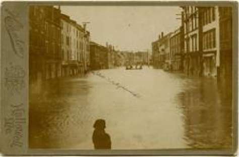
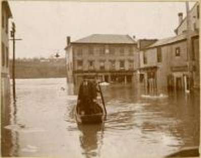
Hallowell flood of 1896.
During the winter of 1794 – no specific date – and on Feb. 5, 1795, North wrote that ice jams in the river led to brief flooding. In February 1806, a combination of rain and ice-jams raised water levels, in Bond Brook early in the month and in the Kennebec in mid-month.
The week of March 21, 1826, began with thunderstorms and ended with “torrents of rain” falling on almost two feet of ice on the Kennebec. Saturday morning, March 26, North wrote, the ice broke up, floated down to Hallowell and jammed against Brown’s Island, creating a barricade that brought the river 20 feet above normal high water in Augusta by Sunday (while downstream in Gardiner the level was below normal).
This flood took out parts of bridges in Norridgewock and Waterville. In Augusta it damaged a mill on Bond Brook, floated away stockpiled lumber and flooded cellars. Buildings on Hallowell’s Main Street had first floors as well as cellars water-filled, and much merchandise was ruined. “Capt. Wyman’s sloop was driven into Mr. Elias Bond’s garden”; other ships were carried downriver to join the jam at Brown’s Island.
Late Sunday afternoon, March 27, the jam let go. A “compact mass” of ice, trees, logs, lumber and five schooners” tore past Gardiner and hung up again a mile or two south, raising the river “to an unprecedented height” at Gardiner.
The next year, 1827, Augusta was chosen as the capital of Maine, which had become a separate state from Massachusetts in 1820. The Maine legislature began its first session in the new state house on Wednesday, Jan. 4, 1832. In May 1832 occurred what North, Edwin Carey Whittemore in his centennial history of Waterville and Marriner agreed was the worst flooding Europeans had seen on the Kennebec to that date.
North wrote that central Maine got a lot of snow in the winter of 1831-32, and spring was late – the ground was still frozen early in May. A sudden warming beginning May 8 started melting the snow. After rain, at first moderate and then “in torrents” from Thursday night, May 17, through Tuesday morning, May 22, “the Kennebec was swollen to an unexampled height.”
North listed damage as including destruction of two bridges in Waterville (part of one came downstream past Augusta); all but one of that town’s sawmills knocked off their foundations; on Bond Brook, a “valuable fulling-mill” and – again – the bridge swept away.
He wrote: “The Redington saw mill [from Waterville] came floating along, upright and high out of the water, being buoyed up by lumber piled in it. The formidable looking mass as it rapidly approached was expected to seriously damage if not remove the [Augusta] bridge. It struck, stopped for a moment, the gable of the building was crushed, and it sunk down into the water and passed under” without harming the bridge.”
However, the water damaged the east end of the bridge enough so that it was unsafe for carriages for two weeks.
Whittemore dated the Redington mill and the dam on which it stood to 1792. The bridge that sailed downriver was the Ticonic bridge, a privately-constructed wooden toll bridge dating from the early 1820s. It had been damaged in the “great freshet” in March 1826 and promptly repaired.
To Whittemore, the 1832 “great freshet” had not been equaled when he finished editing his history in 1902.
Kingsbury wrote that the bridge across the Sebasticook in Winslow was also taken out. A private company replaced it with a toll bridge in 1834; in 1866, the town bought it for $2,500 and abolished the tolls.
Marriner described his Lady Kennebec in May 1832 (and again in 1936) as a “demon of wrath” who did millions of dollars in damage. Much of his description of the flood is based on an 1891 report by a Winslow-born engineer named Timothy Otis Paine, employed in the interest of the Hollingsworth and Whitney Company to date high-water marks.
Paine, born in a house uphill from the Sebasticook River and Fort Halifax and eight years old in 1832, remembered watching the Kennebec cover Lithgow Street and continue rising. He knew other people who measured subsequent floods by how close the water came to 1832 levels, as recorded on riverside trees and other features.
Why, Paine asked, did the river rise so dramatically in 1832? He discounted two theories: the rumor that a dam holding back Moosehead Lake had breached, because there was no dam at the foot of the lake in 1832; and an elderly resident’s theory that the persistent northeast wind had blown water out of the lake to supplement the rainfall.
Marriner wrote that Paine decided the flood was so bad because large logs being floated to sawmills got jammed in Fairfield, against the foundations of “the three bridges between Fairfield and Benton” and around Bunker Island. When the jam broke and moved forcefully downriver, pent-up water followed in a series of waves, each higher than the one before.
This information does not match the Fairfield Historical Society’s bicentennial history. That book contains a single reference to the 1832 flood, a quotation from the Dec. 17, 1901, Fairfield Journal saying the Dec. 16, 1901, flood was “the worst freshet since 1832.”
The Fairfield history dates the first dam across the west channel of the Kennebec, between downtown Fairfield (then Kendall’s Mills) and Mill Island, to the late 1780s, but there is no reference to a dam in Marriner’s account of the flood. The Fairfield history also says the bridges linking Fairfield and Benton were built in 1848, so they could not have held back logs in 1832.
Marriner retold an odd story from Paine. He wrote that a flock of sheep pastured on the east bank of the Kennebec “just above the Pond Hole,” with “an old flat boat turned bottom up” as their shelter, lived through the flood.
In the course of trying to find out how they survived, Paine decided the “Pond Hole” was neither a pond nor a hole, merely a piece of very rough ground. Why that interpretation saved the sheep, Marriner did not explain.
Main sources
Fairfield Historical Society, Fairfield, Maine 1788-1988 (1988).
Kingsbury, Henry D., ed., Illustrated History of Kennebec County Maine 1625-1892 (1892).
Marriner, Ernest, Kennebec Yesterdays (1954).
North, James W., The History of Augusta (1870). Whittemore, Rev. Edwin Carey, Centennial History of Waterville 1802-1902 (1902).
Websites, miscellaneous.
Responsible journalism is hard work!
It is also expensive!
If you enjoy reading The Town Line and the good news we bring you each week, would you consider a donation to help us continue the work we’re doing?
The Town Line is a 501(c)(3) nonprofit private foundation, and all donations are tax deductible under the Internal Revenue Service code.
To help, please visit our online donation page or mail a check payable to The Town Line, PO Box 89, South China, ME 04358. Your contribution is appreciated!
https://townline.org/wp-content/uploads/2016/06/TownLineBanner.jpg00Mary Growhttps://townline.org/wp-content/uploads/2016/06/TownLineBanner.jpgMary Grow2023-01-11 15:51:252023-01-11 15:52:52Up and down the Kennebec Valley: Kennebec River floods – Part 1
0replies
Leave a Reply
Want to join the discussion? Feel free to contribute!


Leave a Reply
Want to join the discussion?Feel free to contribute!