Up and Down the Kennebec Valley: Early surveyors
 by Mary Grow
As promised, the next articles in this series will introduce some of the important surveyors in the central Kennebec Valley as Massachusetts proprietors sold lots – mostly pieces of land they had never seen – to settlers, and other people began lumbering, trapping and farming without the formality of buying a lot.
Readers should remember that Kennebec Company, Kennebec Proprietors, Plymouth Company and Plymouth Proprietors all mean the same organization of Massachusetts businessmen who owned most of the Kennebec Valley. Different local historians preferred different names.
* * * * * *
European settlers had moved into the lower Kennebec Valley in the first half of the 18th century. Once the threat from the Natives and their French supporters ended in the 1760s, interest in upriver lands increased. The Kennebec Proprietors hired Nathan Winslow to survey both sides of the river from Chelsea, south of Augusta, to the north line of present-day Vassalboro, dividing the land for three miles inland into lots.
Multiple historians wrote that Winslow was hired in 1761 and dated his completed survey June 17, 1761. Your writer found in the on-line Maine Memory Network a statement that Winslow covered Pittston, Hallowell, Vassalboro (then including Sidney) and “Some in Winslow town and finished his Survey and made his plan and dated it the 17th of June 1761.”
This statement continued: “all those Surveys was made for the Kennebeck proprietors hath been made from may 1750 & Continually one after another: in Succession as of oft as they Could be.” If this information is accurate, the implication is that Winslow’s work took 11 seasons (but see below for his contradictory birthdate).
In their town histories, Alice Hammond and James North each reproduced the parts of the survey that became Sidney and Augusta, respectively. Winslow laid out three tiers or ranges of lots, each a mile deep, with an eight-rod (132-foot) space for roads between the each tier.
(Winslow’s range roads or rangeways were laid out as straight lines, but might in practice vary with the terrain. Some Kennebec Valley deeds still refer to them; and Waterville has streets named First Rangeway, roughly parallel to the Kennebec, and Second Rangeway, farther west.)
The 100-acre lots with river frontage were 50 rods (825 feet) wide. (At least one source says each lot was 125 acres; the math disagrees.) The maps show Range 2 lots as three times the width (150 rods, or 2,475 feet); and Range 3 lots 75 rods (1,237.5 feet) wide.
Along the river, one of every three lots was reserved for the Proprietors and marked with a P on the plans. Settlers’ lots were marked S. All of the big Range 2 lots were for Proprietors and all of Range 3 for settlers.
Winslow numbered the lots from south to north: in Augusta, on the east side of the river the lots run from 1 to 50, but on the west side, where the survey starts farther upriver, the northernmost lot is 34.
Vassalboro historian Alma Pierce Robbins’ account of Winslow’s survey on the east bank of the river was less detailed, but comparable. She, too, wrote of three tiers of lots, adding that Vassalboro included riverside lots 51 to 102 on the east bank and 35 to 82 on the west (later Sidney) bank. Most of Seven Mile Pond (now Webber Pond in Vassalboro) was in the third tier.
Rev. Edwin Carey Whittemore, in his history of Waterville, said that a March 12, 1766, grant from the Plymouth Company gave six named men 18,600 acres “covering the present Winslow,” with conditions.
Within four years, the new landowners were to have 50 settlers, at least 25 of them with their families, and 50 houses “not less than twenty feet square and seven feet studd [high?] each.” Each settler was to have cleared and ready for mowing at least five acres adjoining his house.
Robbins said the Proprietors gave settlers three years to clear five acres and build a 20-by-20-foot house, and required the settler or his heirs to occupy the house for another seven years. In addition, for 10 years each settler was to work two days a year on town roads and another two days for the church or the minister’s house.
These requirements were common for Kennebec Valley land grants. Their effects seem to have varied.
Whittemore claimed that the plan for (future) Winslow “was the only one to succeed of many similar propositions.” However, the 1761 plan in North’s Augusta history has owners’ names, rather than numbers, on most lots; and the China bicentennial history says that “between 1762 and 1766 most of these riverside lots [none in China, which is inland from the river] were taken up.”
For the April 2011 issue of the Sidney Historical Society’s newsletter, Polly Furber wrote an article on some of the early deeds in the town, based on Nathan Winslow’s 1761 survey. Having done that research, she decided to find out more about the surveyor, commenting that “I have never seen his name mentioned in any local history.”
Furber found that Winslow was the son of Nathan and Charity (Hall) Winslow, born April 1, 1743, in Falmouth – therefore, she pointed out, only 18 in 1761. He lived all or most of his life in Falmouth; Furber found a Quaker document recording the births of his five sons and five daughters there, between 1765 and 1785.
He married in 1764, probably to Jane Crane (according to multiple sites, including the list of his children in Quaker records; Furber called her Judith). FamilySearch says she died in 1805. In 1807, Furber found, he married again, a woman name Mary Vinal from Dresden.
FamilySearch adds that Winslow “registered for military service in 1778.” He was still actively surveying into the 1800s. FamilySearch dates his death Nov. 7, 1820, aged 77.
An on-line genealogy of a remotely-related family named Nagel says Winslow died Nov 7, 1826 (not 1820), in Falmouth. This source says his wife, Jane Crane, was born Nov. 12, 1742, in Sagadahoc (in the lower Kennebec Valley) and died March 30, 1805, in Windham.
* * * * * *
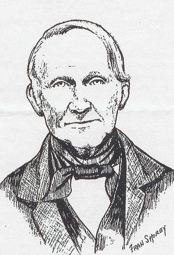
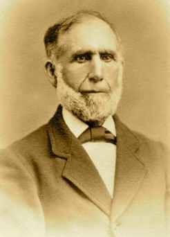
Surveyor Ephraim Ballard is mentioned in several early accounts. He was born May 6 or May 17, 1725, in Oxford, Massachusetts (or in Billerica and moved with his parents to Oxford in 1726). On Dec. 19, 1754, in Oxford, he married Martha Moore (born Feb. 9, 1735), author of the well-known diary of life as a midwife in the central Kennebec Valley from 1785 to 1812.
In 1775, Ephraim (and presumably his family) came to Fort Halifax. James North wrote in his 1870 Augusta history that on Oct. 15, 1777 (another source says 1776), Ballard moved into surveyor John Jones’ former house in Augusta (then Hallowell) and took over Jones’ mills, which Jones had abandoned because of his Loyalist sympathies.
Most sources wonder if Ballard, too, was a Loyalist. North thought not, citing 200 British pounds given him from the town “for his contribution to the revolutionary cause” in 1780, as well as his election to town offices.
He was a Hallowell selectman from 1784 through 1787. Later, he was the town’s tax collector, imprisoned in 1804 for failing to collect all the taxes he should have. Maine An Encyclopedia calls him a “prominent local resident” and says he is “frequently mentioned in the town’s records.”
This source calls Ballard one of the Proprietors’ “principal surveyors” and says, “His name appears on hundreds of maps in the area, and of such far-flung locations as Canaan, Lincoln Plantation, Bangor, Magalloway Plantation, Eustis, and Dover-Foxcroft.”
One such map, found on line, is dated 1794 and shows “the few county roads and three church parishes of early Hallowell,” before the two northern parishes became a separate town – eventually the City of Augusta — in 1797. A recent comment on the map says, “Mr. Ballard drew this map on the same kind of paper that Martha Ballard cut and folded to make her diary.”
Ballard is named as the surveyor of part of Albion, an area Kingsbury said the Kennebec Proprietors had given to Nathan Winslow. North wrote that while Ballard was surveying in Balltown (the area that later became Jefferson and Whitefield), armed men (perhaps settlers without deeds?) stole his surveying instruments and papers and drove him away.
One survey North described was in 1796, for the Plymouth Company, tracing a stream that flows into the Kennebec in Gardiner. In June, Ballard reported he had “ascertained the general course of the Kennebec from ‘Cobbossee stream’ down to the ‘chops'”; had found “the utmost limits of Cobbosseecontee towards the western ocean”; and had run a line from that point east-southeast to the Kennebec.
The “utmost limits” of the stream Ballard defined as the most southern point at which water was running into it. North said he was paid seven pounds, 10 shillings for this job.
Also in 1796, North wrote, the Commonwealth of Massachusetts hired Ballard to survey potential settlements on the Penobscot, in what became Hampden and Bangor.
One of Ballard’s surveys created the Ballard Line. As Millard Howard explained in his 2015 Palermo history, in the area that became Palermo the Kennebec Proprietors’ claim overlapped with a separate land grant called the Waldo Patent, owned in 1795 by General Henry Knox.
In June 1795, Knox and the Proprietors agreed on a division and hired Ballard to implement it on the ground. The Ballard Line is close to the eastern border of Palermo, Howard wrote, “leaving most of the town to the Kennebec Proprietors.”
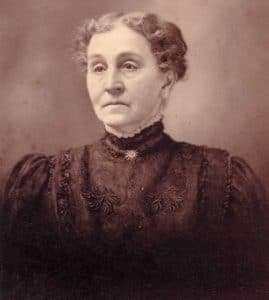
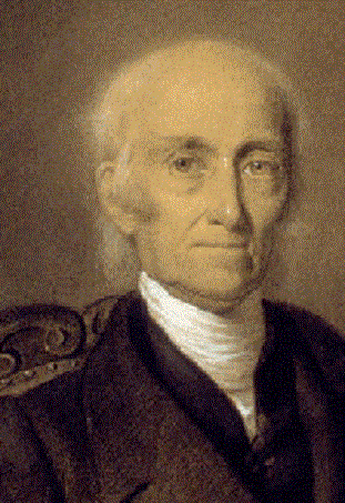
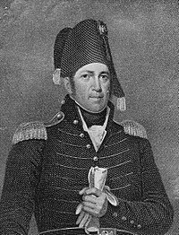
Martha Ballard
Martha Ballard’s diary recorded some of her husband’s work. (Excerpts were included in a Feb. 16, 2023, article in this series in The Town Line.)
On Aug. 23, 1796, she said, a committee (unspecified) hired him to go to Dresden “to lay out a road to the point.” After preparations that included bringing “two birch cannoes [her spelling] to our shore,” he left at 10 a.m. Sept. 5; he came home Oct. 13.
Martha’s diary shows him actively surveying in following years, for the Proprietors, for individual settlers and sometimes laying out new roads for a town.
In mid-April, 1801, she recorded that he was dividing 2,000 acres somewhere between the Kennebec and the Penobscot. In late June that year he had a job in Bowdoinham. In September, he was working in Readfield, and in November, in Fairfield. December 22 he spent running the Sidney-Augusta town line.
In 1803, Martha wrote that he “sett [her spelling] out to go to Davis Town” on July 26; he returned on Sept. 27. (The length of time he was away suggests he could have been working in Maine’s current Davis Town, in Franklin County north of Rangeley and Mooselookmeguntick lakes, almost 100 miles from Augusta.)
Besides being a surveyor, Ballard ran the Jones mills he took over during the Revolution, North says until the fall of 1791. Other sources mention his working as a builder and a farmer.
The Ballards had three sons and two, three or four daughters (sources disagree), born between 1756 and 1779. At least one daughter, maybe two or three, died in childhood in a June 1769 diphtheria epidemic in Oxford.
On Nov. 1, 1799, North said, Ephraim and Martha moved to their son Jonathan’s riverside farm about a mile north of Augusta’s center.
Most sources say Martha Ballard died in May 1812, but North quoted an Aug. 7 1812, diary entry and wrote that she died within the next three weeks. Ephraim died January 7, 1821. Find a Grave says they “were buried in Augusta in a small family burial ground on…[their] son Jonathan’s property. The cemetery was later plowed up to plant crops.”
Main sources
Hammond, Alice, History of Sidney Maine 1792-1992 (1992).
Howard, Millard, An Introduction to the Early History of Palermo, Maine (second edition, December 2015).
North, James W., The History of Augusta (1870).
Robbins, Alma Pierce, History of Vassalborough Maine 1771 1971 n.d. (1971).
Ulrich, Laurel Thatcher, A Midwife’s Tale The Life of Martha Ballard, Based on Her Diary, 1785-1812 (1990).
Websites, miscellaneous.