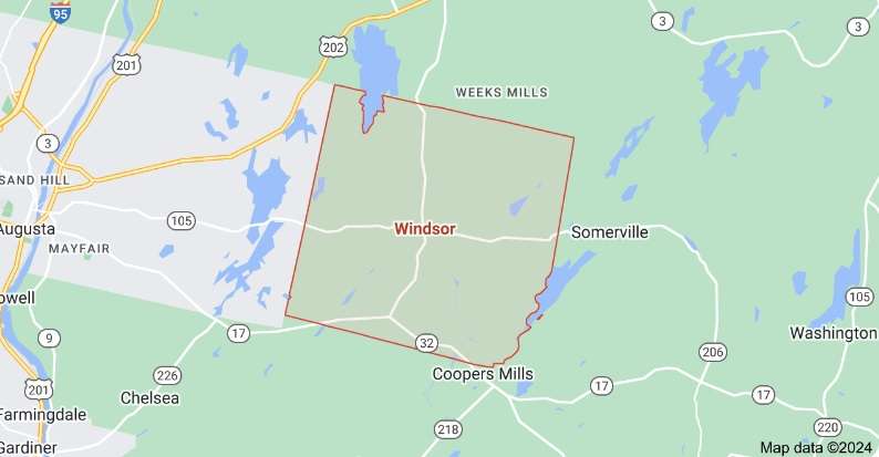
A suggestion to readers: this story will be easier to follow if you have a map of Windsor, Maine. Do not believe everything you see, however; your writer noted discrepancies between on-line maps and official tax maps of Windsor and its neighboring towns. Two Kennebec County atlases, published in 1856 and 1879, offer other variations.
Windsor is the southeasternmost of the dozen municipalities this series has included in the central Kennebec Valley. Henry Kingsbury called its shape unique in Kennebec County, with “four equal sides and four right angles.”
Windsor covers 36 square miles, Kingsbury wrote. Starting as New Waterford Plantation, it was incorporated as Malta in 1809, became Gerry in 1820 and Windsor in 1822.
It is bordered by Vassalboro and China on the north, Augusta on the west, Somerville on the east and Whitefield on the south. Only Vassalboro and Augusta have frontage on the Kennebec River.
Kingsbury counted “seven distinct bodies of water” partly or wholly in Windsor. Windsor’s tax maps show five named ponds (plus others that are nameless, and numerous wetland/swamp areas) entirely within town boundaries. Four more ponds – Wellman and Given in the south, Threemile (or Three-mile, to Kingsbury) in the northwest, Long in the northeast – are shared with neighbors.
Some of these ponds derived their names from early settlers, according to Kingsbury and Windsor historian Linwood Lowden.
* * * * * *
map of Windsor, Maine
WELLMAN POND
Starting, arbitrarily, in the southwestern corner of Windsor, on the border with the City of Augusta, the Windsor tax map shows that Windsor includes a small part of the east shore of Wellman Pond. (An on-line map shows this pond entirely in Augusta.) This pond might well have been named after a Wellman family, but your writer was unable to find evidence.
The Windsor tax map shows the State of Maine owning the land around the Windsor end of the pond, and a large surrounding area that includes Baker Bog a short distance northeast.
East of Wellman Pond and a short distance south of Route 17, Windsor tax maps show the northern tip of Given (or Given’s; formerly, as on the 1856 and 1879 maps, Longfellow) Pond inside the Windsor town line. Three-fourths of the pond is in Whitefield, Kingsbury said.
The Maine Inland Fisheries and Wildlife (IF&W) website says this pond covers 20 acres; Lakes of Maine says 23 acres. Both give its maximum depth as 20 feet.
Kingsbury wrote that Longfellow Pond “probably” took that name “from an early settler,” and was definitely renamed Given’s Pond to honor “another family living on contiguous land.”
Lowden said David Given, born in Newcastle Sept. 4, 1779, and married to Mary Marson there on Dec. 1, 1803, came to Windsor in or after the spring of 1808. He “settled to the east of Given Pond.”
In Kingsbury’s version, David Given arrived in 1810 with his son James (1792-1881). The 1856 and 1879 maps both show J. Given living northeast of Given Pond.
James and his wife, Elizabeth “Betsey” (Johnson) Given (Feb. 27, 1797-March 6, 1888), had three sons (one named David, who was, in 1892, living on what had been his grandfather’s farm, Kingsbury said).
They also had a daughter named Annie (1821-September 1822), who was the first or one of the first people to be buried in the Oak Hill (or Colburn or Coburn) cemetery. The Find a Grave website shows a gravestone Annie shares with Elizabeth J. Given, born in 1830 and died June 17, 1888, at the age of 58.
Family members listed on the Given monument, also pictured on Find a Grave, include an earlier David, born in 1745 and died Jan. 8, 1825, and his wife, Ann, born in 1749 and died Oct. 5, 1832; James’ widow, Betsey (whose birth year is listed as 1795); and David (probably James and Betsey’s son), born in 1837, married Sylvia Le Ballister (1848-1930), and died in 1921.
The youngest David was a teacher as well as a farmer, and served the town as a selectman for eight years and supervisor of schools for three years, Kingsbury said.
* * * * * *
East and north of Wellman and Given ponds, close enough to Wellman so the State of Maine owns its western shore, is long, narrow Moody Pond, the southernmost widening of Dearborn Brook.
According to Kingsbury, Moody’s Pond, near Given’s Pond, “received its designation in a similar manner” to Given’s. Lowden found that Windsor attracted several families named Moody, one (or more) of whom might have lived close to Moody’s Pond.
Deacon Clement Moody, Lowden wrote, was born in Nobleboro c. 1746; an on-line source corrects the date to 1776, which fits better with his history. He died May 5, 1863.
Lowden said Clement and Mary (Moody) filed marriage intentions April 4, 1796, in Nobleboro; presumably they married soon afterward. Mary Moody Moody was born Dec. 10, 1772. She died Dec. 10, 1856, according to an on-line genealogy, or Dec. 10, 1865, according to Lowden.
Lowden wrote that the Moodys came to Windsor in the summer of 1801. Clement served as deacon of the Whitefield Baptist Church, and in 1820 helped organize the North Windsor Baptist Church.
Clement’s land was on the Windsor-Whitefield line in southern Windsor. Lowden wrote that he sold his property to his nephew, Clement Moody II, Richard’s son.
Your writer worked hard to unscramble the Moody genealogy. She concluded that Richard Moody, another early settler Kingsbury named, was Deacon Clement’s brother.
An on-line source says Richard was born in Nobleboro in 1762 and died in Windsor in 1839. This source lists only one (the oldest?) son in each succeeding generation.
Richard, if your writer interpreted different incomplete sources correctly, had (at least) three sons.
John was born Dec. 4, 1789. Lowden’s list of early Windsor residents says he owned land on Windsor Neck in the northern part of town.
Richard II was born in 1793 in Nobleboro and died in 1876 in Windsor. The on-line source lists the younger Richard’s son as Clement F., born in 1823 in Windsor and died there in 1888; and Clement F.’s son as John H. (1868-1952).
Richard I’s son Clement was born in 1800 and died in 1858. Clement’s son Miles was living when Kingsbury finished his history; Kingsbury said he had moved in 1888 from “the old homestead where his father died” to South Windsor to take care of his in-laws.
Lowden’s list of Windsor men who served briefly in the War of 1812 (they spent less than three weeks in Belfast after the British had occupied it, he wrote) includes Sergeant Clement Moody and private John Moody (uncle, in his mid-30s, and nephew, aged 22, if your writer’s genealogical conclusions are correct).
The 1866 Windsor school committee report included in Lowden’s history lists Miles Moody as District 2 school agent and yet another Clement Moody as District 7 agent.
* * * * * *
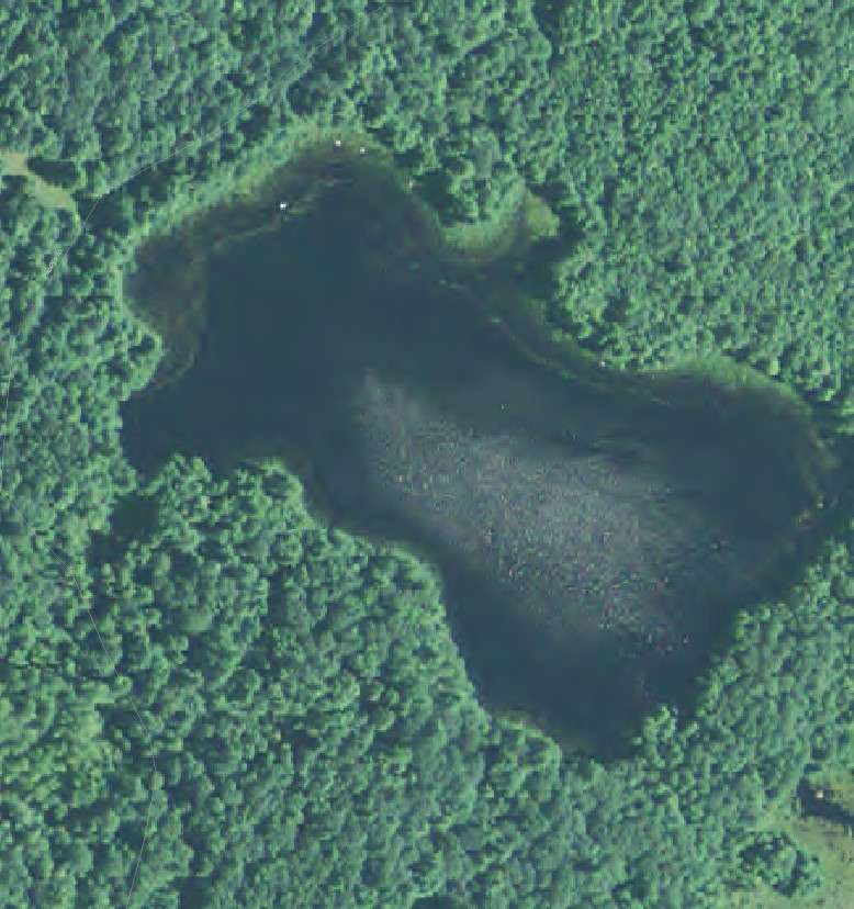
Less than a mile south of Windsor’s four corners (the intersection of Route 32 and Route 105), on the east side of Route 32, is a small round pond ignored by IF&W and Lakes of Maine, but mentioned by Lowden and Kingsbury. It is nameless on contemporary tax maps; the historians said its names have included Dorr’s Pond, Donnell Pond (on the 1856 and 1879 maps) and Grant Pond (to Kingsbury in 1892).
This “aqueous lilliputian” covers a little more of an acre, but is worth notice because, Kingsbury wrote, “it has no perceptible outlet, and, as near as can be ascertained by soundings, no bottom.”
Your writer found no relevant Dorrs or Grants. The name Donnell Pond recognizes Methodist preacher, Rev. Moses Donnell, Jr.
Donnell was born in Wiscasset Aug. 25, 1789, and came to Windsor in March, 1818. He kept detailed records, from which Lowden took information about his strenuous life and how much – or little – money he earned. Lowden listed different houses Donnell probably owned at different times and wrote that he preached in Windsor in 1822 and again from 1832 until his death.
After 1838, he was appointed to different circuits, preaching in multiple towns and traveling thousands of miles. His home base was Windsor; Lowden said he moved back for good on Dec. 3, 1839, taking over the “circuit house” that stood between Donnell Pond and the road that is now Route 32.
The Find a Grave website says in 1817, Donnell married Martha Cunningham, born in 1793. The couple named their children Mary (1819-1876), Jeremiah (1821-1906), John Wesley (1826-1869) and Moses (1833-1904).
Rev. Donnell died on October 2, 1861, and Martha sometime in 1868. Find a Grave has a photo of the family monument in Windsor’s Resthaven Cemetery, which is on Route 32 a short distance south of his former house.
* * * * * *
MUD POND
Other ponds in or partly in Windsor are not named for people.
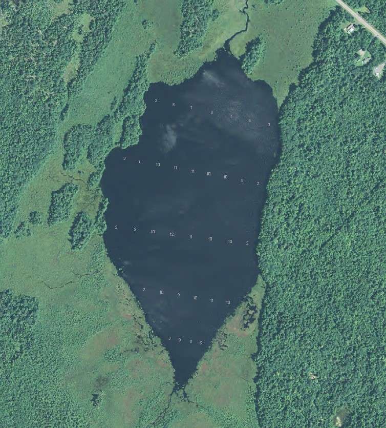
Going back west to the Augusta line, north of Route 105, is Mud Pond (and on the tax map another unnamed pond north of it). It covers either 52 acres (IF&W) or 65 acres (Lakes of Maine) and has a maximum depth of 12 feet. Located below Porcupine Hill, Mud Pond is accessible by “an old woods road and trail,” the state says.
Barton Brook connects Mud Pond with the south end of Threemile Pond, which is mostly in Windsor’s northern neighbors, China and Vassalboro.
THREE MILE POND
Threemile Pond is the largest of the named lakes – 1,162 acres, according to IF&W, or 1,174 acres according to Lakes of Maine. Its maximum depth is 37 feet; it has shore frontage in Vassalboro on the northwest and China on the northeast. Public access is via the state-owned boat landing on Route 3, in Vassalboro.
The on-line Google map shows town lines following the shoreline to leave the pond entirely in China & Vassalboro. All three towns’ tax maps show straight lines, putting the triangular southern end of the pond, and one of its four small islands, in Windsor.
To Kingsbury, this pond’s name “requires no elucidation.” Wikipedia relates the name to its size, saying that “Despite the name,” the pond is 2.71 miles long.
Jumping to northeastern Windsor, near the Somerville town line, on-line maps show four more ponds; the tax map shows two and some swampland. The smaller northeastern pond is named Fox Pond. The tax map shows a brook – one-eighth of a mile long, Kingsbury wrote — connecting it with larger Savade Pond.
Savade Pond’s outlet flows a short distance west into the intersection of Bull Brook and Choate Brook. Choate Brook flows into the west branch of the Sheepscot River. The State of Maine has a Savade Pond boat landing on a 14.1-acre parcel on Greeley Road.
Kingsbury said Fox Pond was “a favorite resort” of wild foxes. Savade he equated with “surveyed.”
South of Route 105 on Windsor’s eastern boundary, Long Pond is a wide place in the west branch of the Sheepscot River, on the Somerville town line. This pond covers 523 acres (IF&W) or 504 acres (Lakes of Maine), and is only 16 feet deep at its deepest.
Main sources
Kingsbury Henry D., ed., Illustrated History of Kennebec County Maine 1625-1892 (1892).
Lowden Lowden, Linwood H., good Land & fine Contrey but Poor roads a history of Windsor, Maine (1993).
Websites, miscellaneous.
Responsible journalism is hard work!
It is also expensive!
If you enjoy reading The Town Line and the good news we bring you each week, would you consider a donation to help us continue the work we’re doing?
The Town Line is a 501(c)(3) nonprofit private foundation, and all donations are tax deductible under the Internal Revenue Service code.
To help, please visit our online donation page or mail a check payable to The Town Line, PO Box 89, South China, ME 04358. Your contribution is appreciated!
https://townline.org/wp-content/uploads/2016/06/TownLineBanner.jpg00Mary Growhttps://townline.org/wp-content/uploads/2016/06/TownLineBanner.jpgMary Grow2024-02-14 16:42:172024-02-14 16:43:29Up and down the Kennebec Valley: People for whom ponds are named, part 4
0replies
Leave a Reply
Want to join the discussion? Feel free to contribute!


Leave a Reply
Want to join the discussion?Feel free to contribute!