Windsor select board deals with multiple agenda items
 by The Town Line staff
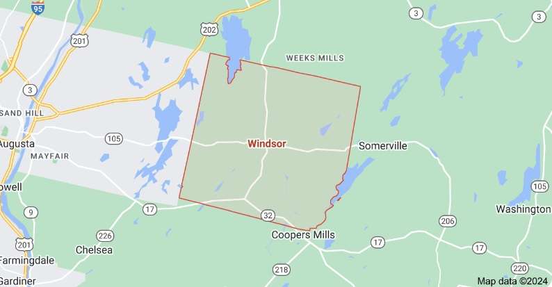
At the May 21, 2024 meeting of the Windsor Select Board, Road supervisor Keith Hall reported on several repairs being done to town equipment. Also select board member Tom McNaughton asked Keith for an update on the Amish signs. Keith said he had gotten prices on the signs and that is as far as he had gone with the project. Keith said he had not gotten the final answer to order signs. Moira Teekema added she had conversations with the Amish, they were happy with the selected locations discussed for placement for the signs. After some discussion, Thomas McNaughton made a motion to purchase five Amish signs and Chevron signs for the corner on Coopers Mills Road by Piper Road, seconded by Chester D. Barnes and approved 5-0-0.
From the transfer station, Keith reported the following:
a.) Freon units have been picked up from the Transfer Station.
b.) Maine Scale LLC will be coming to calibrate the scales at the Transfer Station on 5/30/24.
c.) Transfer Station employees Hunter, Allison, Dan, and Amelia, who covers for the transfer station, completed Core 1 training virtually. Core 1 training helps employees gain a better understanding of department regulations and concerns, learn methods of operation that achieve compliance and improve efficiency.
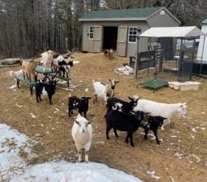
On behalf of animal control office Ryan Carver, town manager Theresa Haskell reported there is an issue on Rte. 105 of cows getting out. Ryan has been to the residences four times in 15 days. One time the cows made it all the way to Wingood Road. There were reports of the cows going head on with cars on Rte. 105. The owner says the deer keeps knocking his fence over. The town ordinance is a fine up to $500 payable to the town per call. Carver would like to know the select boards suggestion to enforce this. The select board will ask Carver to be available at a future meeting for more discussion.
In other business, Haskell reported the following.
– Theresa has a Certificate of Appointment for Greg Feltis for the position of E-911 Alternate Addressing Officer, to be effective until a new Alternate Addressing Officer is appointed. Chester D. Barnes Jr. made a motion to sign the Certificate of Appointment for Greg Feltis appointed as E-911 Alternate Addressing Officer effective until a new Alternate Addressing officer is appointed, seconded by Thomas McNaughton and approved 5-0-0.
– Ray Bates reviewed the Town Hall’s water results received by Water Quality & Compliance Inc. The water test results were normal.
– Theresa read aloud a letter from Lake Stewards of Maine requesting $500 in funds from the town to support water testing. Theresa will send back a response to the request.
– The Safety Grant Press Release will be posted on the website for the town to view.
– Friday June 28, 2024, is the last day of FY 2024. The town office will be closing at noon to get all reports and books closed for FY 2024. Andrew Ballantyne made a motion to close the town office at noon on June 28, 2024, for office staff to get all reporting and books closed by the end of day for FY year 2024.
– A handout was given to the Select Board regarding the Ridge Road property. There will be discussion at a later date when the select board has time to look over what the town’s attorney has drafted. There is currently no other information to give on the property.
– The Kennebec County budget began at 44.1 percent and after several meetings and discussion about the final budget it is now down to 28.9 percent.
– The select board was handed a copy of the Public Works monthly 4-day work week schedule. It was noted that public works will swap their day off if their day off falls on a holiday so they can still get paid for that holiday.
Tim had questions about signing the smoking policy. He asked for clarification before he signed anything. He would like to see it amended. The select board assured Tim that there was zero finger pointing intended when the memo and the smoking policy were sent to be signed by all employees.
The memo was initiated from a letter that was left anonymously by a resident. The select board thought at the time it was an opportunity to remind all employees of the smoking policy. Allison Wynot wanted to comment that confidentiality should not be broken. With no details, she said she believes that confidentiality has been broken to her in public.
Chester D. Barnes Sr. would like to arrange a Conservation Committee meeting sooner than later. Haskell and Chester looked at the calendar and a date of June 17, 2024, at 6 p.m. was set. They will reach out to other committee members with the date and time.
Haskell received a resignation letter from Moria Teekema, resigning from both the transfer station committee as secretary and resigning from the Conservation Committee. Chester D. Barnes Jr. made a motion to accept Moria Teekema’s resignation from both the transfer station committee as secretary and from the Conservation Committee, seconded by Andrew Ballantyne and accepted 5-0-0.
Tom Reed noted the walls upstairs at the town hall looked a mess. Discussion about town hall use and the cost it would take to keep fixing and painting the walls because residents put holes and peel the paint, also the cost of tables and chairs that get broken and need to be replaced. More discussion will follow at a future meeting about the town hall use policy and if that should be updated.
Tom McNaughton updated he has not seen a new contract come through from Delta Ambulance Service. He has also not heard any response regarding being on the board for Delta.
Andrew Ballantyne gave a brief update about the power line restarting their engine on Renewable Wind Energy. The best advice that is being passed around to towns is to be sure your ordinances are in place, and you have a strong comprehensive plan. William Appel Jr. said we will need to devote time to the comprehensive plan.


