Up and Down the Kennebec Valley: Women doctors in central Kennebec Valley

Gertrude Emma Heath’s home, in Farmingdale, circa 1850.

by Mary Grow

In the course of collecting information on the doctors included in last week’s article about the central Kennebec Valley (and other places), your writer reviewed lists in Henry Kingsbury’s Kennebec County history and Rev. Edwin Carey Whittemore’s Waterville history.

Each book has a chapter on the medical profession in the 19th century. Kingsbury’s includes a list of 200 or more doctors, Whittemore’s almost 50 (with duplicates, of course). All the Waterville doctors named were men.

Kingsbury listed four women (in alphabetical order; your writer has used the same arrangement). Two were from Gardiner, one was from China and one was from Randolph, across the Kennebec from Gardiner. He did not include Martha Ballard, so he was not talking about midwives, though he identified two of his subjects as both midwives and doctors.

Your writer was intrigued enough to seek more information on these women. She succeeded, at least partly, with three of the four, thanks to the resources of the internet, and now shares her findings.

Only Gertrude Heath was identified as a doctor by any source other than Kingsbury. As with last week’s topics, these stories wander outside the central Kennebec Valley. Again, homeopathic medicine is mentioned.

* * * * * *

Gertrude Emma Heath’s information comes from multiple on-line sources, including a genealogy, dated 1909, and a website called buildings of New England, which has an undated photograph of her 1850 Gothic Revival house in Farmingdale.

The writer of the latter site commented: “It is amazing learning stories about such strong women, when at the time, women medical practitioners were almost unheard of and women were decades away from earning the right to vote.”

The genealogy says Heath was the granddaughter of a doctor named Asa Heath. Her father, Alvan M. C. Heath (born in 1828), was “a printer by trade and newspaper editor by principal occupation.”

In the Civil War, Alvan Heath was a corporal in the 16th Maine Infantry. He was killed December 16, 1862, during the battle of Fredericksburg, “leaving his widow Sarah to run the family affairs.” Sarah was the former Sarah H. Philbrook (July 23, 1831 – Aug. 7, 1915).

Alvan and Sarah had three sons and one daughter: Herbert M., born Aug. 27, 1853, a prominent Augusta lawyer and politician; Willis K., born Feb. 12, 1855; Dr. Frederick C., born in 1857 and in 1909 practicing medicine in Indianapolis, Indiana; and Dr. Gertrude E., born Jan. 20, 1859, in Gardiner (or, according to Find a Grave, in Windsor).

Gertrude Heath attended local schools, where she reportedly did well, and, the New England buildings site says, went to Hahnemann Medical College – not in Philadelphia, where so many of the Pulsifers discussed last week were trained in homeopathic medicine, but in Chicago.

(There was indeed another Hahnemann Medical College, in Chicago. It was chartered in 1855, opened in 1860, and began admitting women in 1871. Its website says in 1872, six of 76 students were women; by 1889, 51 women were among 312 students. The college closed around 1921.)

Heath took “special courses” at Hahnemann and got her M. D. degree in 1883 (Kingsbury specified in March) or 1884 (Find a Grave). She started practice in Chicago in 1884, returned to Gardiner the same year, and not long afterwards “accepted a position at the Maine State Hospital, at Augusta, where she specialized in eye and ear conditions.”

(The Maine State Hospital was one of several successive names for the insane asylum on the east bank of the Kennebec River.)

Find a Grave calls Heath the State Hospital’s second assistant physician for seven years. This site says she was also a staff doctor at the Gardiner hospital and for four years Gardiner’s school physician.

Several sources say she continued her private practice while doing her public jobs. In 1892, Kingsbury wrote, she was in practice in Gardiner, with a partner named Huldah Potter (of whom more later).

Another website says Heath headed the local Red Cross branch in the 1910s (“during World War I,” according to Find a Grave). This writer described her as a “respected senior doctor,” who was listed in a 1928 book on important Maine people as widely honored and beloved.

Find a Grave calls her “an active member of the Maine Homeopathic Society.”

Heath’s other career was as a poet, primarily a writer of children’s poems. The Maine State Library held an exhibit of her poetry in the 1920s, “describing her work ‘of special value to Maine people.'”

Titles of Heath’s poetry collections include Rhymes and Jingles for a Good Child (1897) and Sing, Little Birdie and When All the Birds Begin to Sing (both published in 1928). In 1918, Forgotten Books republished her book titled The Madonna and the Christ-Child: Legends and Lyrics, a “collection of poetry and songs” first published in the “late nineteenth century.”

She also edited and arranged what appears to be an autobiography by her older brother, Herbert, titled A Son of Maine: Herbert Milton Heath, published in Augusta in 1916. Herbert died Aug. 18, 1912.

Gertrude Heath died in Gardiner on Nov. 23, 1935, aged 76. She is buried in Gardiner’s Oak Grove cemetery. The eight other Heaths there include her father, her mother and her brother, Willis, who died Oct. 10, 1927, in Farmingdale.

* * * * * *

Dr. Huldah M. Potter, Dr. Heath’s partner for several years, has much less information on line. Find a Grave offers the most your writer found. It does not identify her as a doctor, and, oddly, it lacks information on where she is buried.

Find a Grave says she was born Huldah McArthur in March 1838, in Parsonsfield, in York County. Her parents were John and Huldah (Dalton) McArthur. Educational records are in Augusta, then at Congregational Academy (wherever that was) and Gorham Academy.

The McArthur family might have been in Augusta by 1850. In 1868, Find a Grave says, Huldah McArthur married Charles F. Potter; he left her a widow in less than a year.

A brief genealogical entry in James North’s Augusta history says Charles Fox Potter was born Jan. 29, 1821 (Find a Grave says Jan. 25, 1821). North wrote that he was an Augusta druggist and for some years a “Pension Agent.”

(A pension agent was probably a local representative of the federal Bureau of Pensions, created in 1832, first as part of the War Department and after 1849 as part of the Department of the Interior. Its responsibilities were to determine veterans’ eligibility for pensions and to distribute them.

(Wikipedia says, “In 1896, pensions accounted for 40% of all federal spending as the Bureau of Pensions provided monthly funds that averaged $12 to 750,000 veterans, and 222,000 dependents, especially widows.” As Civil War veterans died in the 20th century, the bureau became smaller. In 1930, President Herbert Hoover integrated it into the Veterans Administration.)

Charles E. Nash, in his chapters on Augusta in Kingsbury’s history, named Charles F. Potter as the fifth proprietor of the Craig drug store, founded in January 1828, on Augusta’s Market Square. In May 1865, Nash said, a former clerk bought part of Potter’s interest; “shortly before the fire of 1865,” he bought the rest.

(The fire, on Sept. 17, 1865, destroyed about 100 buildings, wiping out most of downtown.)

Also, North said, Fox was the “first subscriber in Augusta to the first seven-thirty loan of the government.”

(The federal 7-30 loan program was a bond sale in 1864 and 1865, to raise funds to continue the Civil War. An on-line summary of a promotion for the bonds cites their interest rate, tax-exempt status and support for Union soldiers as reasons patriotic Northerners should buy them.)

According to North, Charles and Huldah married in 1867 (not 1868) and Charles died March 23 of that year (as previous research has shown, a year’s discrepancy in dates is not unusual).

Charles is buried in Augusta’s Forest Grove cemetery. Find a Grave lists his parents and siblings, but no spouse.

Kingsbury’s brief account of Dr. Huldah Potter’s life says she got her medical degree from Boston University in 1877 and was back in Gardiner by 1879, where she partnered with Heath, perhaps for the rest of the century.

An on-line photo of selected pages from an undated history of homeopathy (apparently related to Boston University, since it identifies subjects by graduation year) lists Huldah McArthur Potter’s death date as Oct. 16, 1904. Find a Grave says she died of diabetes.

* * * * * *

The third female doctor on Kingsbury’s list was “Mrs. Ward.” He identified her as a midwife and physician in China, Maine, before 1808, when, he said, the first (male) doctor settled in the town.

Numerous men and women named Ward lived in China in the 19th century. A review of the Ward genealogy in the China history found no woman identified as a medical practitioner of any sort.

* * * * * *

Anna (Huston) Winslow (Mrs. James Winslow), of Randolph, was a very early “physician and midwife,” according to Kingsbury, who wrote that the family settled there in 1763. (Randolph was part of Pittston until March 1887.)

“She was widely known as ‘Granny Winslow,’ and practiced from Bath to Augusta” Kingsbury said. As with Huldah Potter, your writer found no other source that called Winslow a doctor.

FamilySearch provides a summary of the life of Anna McCausland Huston, daughter of James and Mary McCausland, born in 1734 in Falmouth (near Portland). An on-line genealogy explains “Huston”; she was first married to, and left a widow, by a man named Isaac Huston.

Ancestry.com lists Isaac Huston, born in 1730, in Falmouth, whose wife was Anna McCausland Huston (1734 – 1827). Isaac Huston died in Falmouth, Oct. 26, 1756, according to this source.

FamilySearch says it was on July 5, 1753 (another not unusual discrepancy in dates), that Anna McCausland Huston married James Winslow (born Aug. 6, 1725, in Freetown, Massachusetts), in Falmouth. The couple had at least six sons and three daughters between 1754 and 1785.

This source says the couple’s first two children were born in Broadbay (or Broad Bay), Maine (an old name for Waldoboro, which is about 25 miles east of Pittston), in 1754 (twins?).

The genealogy says “Indian troubles” led the Winslows to move to Pittston in the fall of 1760. They were among the earliest settlers: “Anna and daughter Sarah were the first white females in Pittston,” and son Jonathan, born March 23, 1761, was the first white child born in the town.

Jonathan was the first of six children born between 1761 and 1774 in Pittston, according to FamilySearch. The youngest son was born in Kingfield (about 70 miles north of Pittston), around 1785 (his mother was 52 and his father 61, FamilySearch says).

FamilySearch says Anna died in Farmington (about 20 miles south of Kingfield) on Feb. 15, 1827, aged 93. Her husband had died Nov. 16, 1802, also in Farmington.

Main sources

Kingsbury, Henry D., ed., Illustrated History of Kennebec County Maine 1625-1892 (1892)

Websites, miscellaneous.

Up and Down the Kennebec Valley: Doctors Pulsifer

by Mary Grow

While wondering what new subject might keep readers – and writer — interested, your writer glanced at random pages in randomly-chosen history books. A warning: what she found does not remain in the central Kennebec Valley.

Her eyes fell on Dr. Nathan Goldsmith Howard Pulsifer.

Who could resist a name like that?

The man was a Waterville medical practitioner in the second half of the 19th century. As an added attraction, Dr. N. G. H. Pulsifer (as some historians call him) was the son of a doctor; brother of (at least) two doctors; and father of two more doctors.

FamilySearch’s analysis found that “Nathan” is a Biblical name, which in Hebrew means “God has given.”

“Goldsmith” is English and means a person who works in/with gold.

“Howard” is an English last – not first – name. FamilySearch says it was first spelled Haward, suggesting it was originally two Scandinavian words that meant “high guardian.”

“Pulsifer” is English, perhaps a variant of “Percival.”

An on-line genealogy says Pulsifer (Pulsever, Pulcifer, and other spellings) is a French Protestant name.

This source identifies the first Pulsifer in North America as John, who came to Gloucester, Massachusetts, in 1680. John’s great-grandson, David, moved to Poland, Maine (southwest of Lewiston), and fathered Jonathan Pulsifer, born about 1770. Jonathan and his wife, Polly Rust, were parents of Dr. Moses Rust Pulsifer, who was the father of Dr. Nathan Goldsmith Howard Pulsifer.

Moses Pulsifer was born in Poland, on Sept. 10, 1799. He attended district schools and studied medicine (no details). Another on-line source says, without explaining why, that he and his family moved to Mt. Desert Island in 1823. There, according to the on-line genealogy, he practiced in Eden (renamed Bar Harbor in March 1918) and the mainland towns of Sullivan and Ellsworth.

In 1819, Pulsifer married Mary Strout Dunn, born May 30, 1801, in Poland. She was the oldest of 13 children (of whom one died in infancy and two in their teens). Mary and Moses had three daughters (Find a Grave) or six daughters (FamilySearch) and seven sons, born between 1820 and 1842.

Mary died March 11, 1850. Her widower, the genealogy says, remarried and had two more children, a daughter who married a doctor in Old Town, Maine, and a son who became a farmer in Corinna, Maine.

Moses died in Ellsworth, on Jan. 27, 1877, of pneumonia. He and his wife are buried in Auburn’s Oak Hill cemetery (Auburn is about 10 miles from their birthplace in Poland, about 130 miles from Ellsworth).

Find a Grave lists 24 Pulsifers in Oak Hill cemetery, including Moses and Mary and their son (N. G. H.’s brother) Dr. Horatio Brigham Pulsifer (of whom more later). Death dates range from 1848 to 1961.

* * * * * *

N. G. H. Pulsifer was Mary and Moses’ second son, born Jan. 24, 1824, in Eden. The genealogy says he was “educated in the common schools of Eden and Minot.” Henry Kingsbury wrote in his Kennebec County history that he was educated in “district schools and Gorham Academy” (Minot, near Lewiston, is about 160 miles southwest of Bar Harbor; Gorham, near Portland, is about another 40 miles south) “and graduated from Dartmouth Medical School in 1848.” (Frederick Charles Thayer, in his chapter on the medical profession in Whittemore’s history, dated his graduation 1847, as does the on-line genealogy.)

After briefly studying and working with his father and another doctor named N. C. Harris, N. G. H. established a practice at Fox Island, Maine (Vinalhaven and North Haven, in Penobscot Bay), the genealogy says.

In 1849, N. G. H. and his older brother, Major J. D. Pulsifer, caught gold fever. N. G. H.’s obituary says they joined a company that bought a sailing ship (other sources specify a barkentine named “Belgrade”) and made a stormy six-month trip around Cape Horn to California, with N. G. H. serving as ship’s doctor. Their search for gold brought “fair success.”

FamilySearch found (presumably from census records) that N. G. H. was living in Sutter, California, in 1850.

He came back to Ellsworth in 1851 and practiced homeopathy with his father; studied in New York and at Philadelphia’s Homeopathic Medical College, aka Hahnemann Medical College; and returned to Waterville in January 1852.

(Wikipedia terms homeopathy “a pseudoscientific system of alternative medicine,” based on German doctor Samuel Hahnemann’s 1796 theory. Practitioners “believe that a substance that causes symptoms of a disease in healthy people can cure similar symptoms in sick people.” “All relevant scientific knowledge about physics, chemistry, biochemistry and biology contradicts homeopathy,” Wikipedia says.)

(Hahnemann Medical College was founded in 1848 by three homeopathic doctors, per Wikipedia. By the late 1920s, the school had “dropped its homeopathic focus.”)

N. G. H. was a member of the American Homeopathic Society, the genealogy says (and a Republican and a Unitarian).

Thayer wrote that in Waterville, N. G. H. “at once built up a large practice.” The genealogy writer says he “ranked among the leaders in his profession for many years. He was held in the highest esteem by his fellow practitioners as well as by the families whom he served.”

The writer of his obituary praised his “fidelity to his patients and painstaking thoroughness as a physician” and “his sterling worth and strict integrity as a man.”

On Oct. 24, 1855, in Waterville, N. G. H. and Ann Cornelia Moor were married. They had two sons and two daughters: Nora Nellie Pulsifer (1856 – 1936); Cornelia Ann Pulsifer (1860 -1951); Dr. William Moor Pulsifer (Aug. 18, 1863 – Nov. 14, 1915) and Dr. Ralph Howard Pulsifer (Aug. 19, 1865 – 1926).

N. G. H. was not only a doctor. Kingsbury wrote, in 1892, that “Dr. [N. G. H.] Pulsifer has been devoting his attention to real estate operations and banking for the past twenty years.” Thayer praised N. G. H.’s financial judgment.

Horatio Bates’ chapter on Waterville banks lists, among others, People’s National Bank, which received a federal charter on March 15, 1865. N. G. H. was a director and vice-president and then its second president, serving from 1882 until he died in 1893.

N. G. H. is also listed among the 26 charter members of Waterville Savings Bank (1869). The genealogy mentions investments in real estate.

He was a member of the five-man building committee that oversaw construction of Waterville’s “beautiful north grammar school building,” dedicated Feb. 28, 1888. On-line photos show a two-story brick building on a basement, with large rectangular windows and arched doorways. An old map shows a schoolhouse in the southeast corner of the intersection of Pleasant and North streets.

N. G. H. died on December 3, 1893, in Waterville, at the age of 69. Ann died July 5, 1919, also in Waterville. Both are buried in the city’s Pine Grove cemetery.

* * * * * *

N. G. H. and Ann’s older son, William Moor Pulsifer (born Aug. 18, 1863), graduated from Coburn in 1878 and Colby in 1882, Thayer said. He earned one M.D. from Harvard Medical School in 1887 and a second from Hahnemann in 1888 (or, the on-line genealogy says, took a post-graduate course there in 1890). He promptly established a practice in Skowhegan; returned to Waterville in 1892; and went back to Skowhegan in 1900. On Oct. 2, 1896, he married Helen G. Libby. He died in November, 1915, in Skowhegan.

His younger brother, Ralph Howard Pulsifer (born Aug. 19, 1865), followed the family tradition, graduating from Coburn in 1882 and Colby in 1886. His first medical degree was from Boston University, in 1880 (genealogy) or 1889 (Thayer), and he, too, earned a second M. D. from Hahnemann, in 1890.

This Dr. Pulsifer opened a practice in Waterville in November 1890 and after two years moved to Skowhegan. He married Grace Yeaton on Feb. 23, 1893; they had one son as of 1902. The Pulsifers moved back to Waterville in 1897, and in 1902, Thayer said, they lived in Vassalboro. Pulsifer died in 1926, in Belgrade or Waterville (sources disagree).

* * * * * *

Find a Grave identifies one other doctor in N. G. H.’s generation, his younger brother, Horatio Brigham (or Bridgham, Geni says) Pulsifer, born in Minot, Dec. 28, 1835, and died in Auburn April 7 or June 10, 1929, aged 93.

On Nov. 1, 1861, in Auburn, he married Augusta Ellen Roak, born in Auburn Jan. 21, 1838. They had three sons (plus three who died in infancy, according to FamilySearch) and a daughter; on-line sources identify none as a doctor. Augusta died in Auburn April 20, 1933, according to Find a Grave.

Geni gives N. G. H. a second doctor/brother, Thomas Pulsifer, born to Moses and Mary Pulsifer on April 2, 1842, in Poland. The website cites other sources that say Thomas Pulsifer entered Waterville (Colby) College in 1859, but left in 1861 and on Oct. 1 enlisted in the First Maine Cavalry.

During his military service, Pulsifer was taken prisoner in June 1863. Exchanged the next month, he remained in the army and was badly wounded on Aug. 6, 1864. He was discharged Nov. 25, 1864.

After studying medicine with his father for an unspecified time, in 1872 Thomas Pulsifer graduated from Hahnemann. The next year he opened a practice in Yarmouth, Massachusetts, on Cape Cod (“because Yarmouth was in need of a doctor,” an on-line site says).

On June 1, 1880, he married Annie Gorham (born Sept. 3, 1859, the same autumn her husband started college), in Yarmouth. Between April 1881 and April 1887, the couple had two daughters, Caroline and her sister who died in infancy, and one son.

Dr. Thomas Pulsifer died in 1912, aged 70, Geni says.

* * * * * *

The Historical Society of Old Yarmouth (Massachusetts) has on its website an illustrated memoir by Caroline (Pulsifer) Siebens (1881-1970), one of the society’s founders and the daughter of “town doctor Thomas B. Pulsifer.” The essay is titled “Horses and Buggies and a Donkey – oh my!”

Siebens talked about several family horses, starting with Lightfoot, “named for my father’s favorite mount in the Civil War. She was raised in Maine by my uncle, Dr Horatio Pulsifer, of Auburn.”

Lightfoot’s offspring included Brandywine and Marguerite. Siebens said people wondered why “a temperance advocate” would name a horse after two alcoholic drinks.

A friend of her father’s called Marguerite the “wild horse you keep in your barn.” A black and white photo of Siebens on Marguerite’s back, taken about 1896, shows an all-over dark brown horse.

Marguerite, and others, drew or carried Dr. Pulsifer on his rounds. Siebens said he usually used the family buggy; but sometimes, “to spare the horse but not himself,” he drove a light, two-wheeled gig that provided no support for his back.

On windy winter days, Siebens wrote, the doctor used, apparently in the buggy, what she called a cage, “a square coach-like affair that shut up tight but was unsuited to rapid transit. What one gained in protection from the cold was lost by the slow travel that kept one out in the severe weather for a much longer time.”

The doctor had a sleigh for travel over snow. Siebens wrote that “Sometimes in the worst weather Father rode horseback.”

Since his horses usually knew where they were going, the doctor could take a nap, she claimed – until his horse, too, “drowsed off” and wakened him by stopping.

On Sunday afternoons, Siebens and her brother enjoyed going on rounds with the doctor, “although it did involve a good deal of waiting while he visited patients.” Their very religious neighbors condoned the doctor doing errands of mercy on the Sabbath, but called the accompanying pleasure-riders Sabbath-breakers who would come to a bad end.

Main sources

Kingsbury, Henry D., ed., Illustrated History of Kennebec County Maine 1625-1892 (1892)
Whittemore, Rev. Edwin Carey, Centennial History of Waterville 1802-1902 (1902)

Websites, miscellaneous.

Up and Down the Kennebec Valley: Early surveyors – John Jones

Map of central Maine 1799. Note Harlem (before it was China) at right; Winslow on both sides of the Kennebec River; Vassalboro and Sidney on either side of the river; Fairfield at the top.

by Mary Grow

Yet one more important early surveyor in the central Kennebec Valley was John Jones (c. 1743 – Aug. 16, 1823), known as “Black” Jones because of his dark complexion, and later because of his unpopular politics.

Capt. Charles E. Nash, author of the Augusta chapters in Henry Kingsbury’s Kennebec County history, and others said Jones was short and compactly built. Nash added “lithe of limb, flippant of speech.”

Nash claimed that, “This [Kingsbury’s] history will mention no personage with a career more unique and replete with sensation and romance than that of ‘Black’ Jones, the incorrigible and dauntless tory of Fort Western in primitive Augusta.”

An on-line source says Jones lived in Concord, Massachusetts, as a young man. The Plymouth/Kennebec Company/Proprietors apparently helped him learn the surveyor’s trade and sent him to the Kennebec Valley, specifically Hallowell, early in 1771, when he was 28 years old.

Judging by the number of times his name appears in local histories just in the central Kennebec Valley, Jones lotted out large areas for his employers.

His first survey, James North said in his Augusta history, was of “a part of Pondtown and Hallowell”; the resulting plan was dated April 7, 1771. (Wikipedia’s history of Winthrop, Maine [west of Manchester, which is west of Hallowell], says Winthrop was named Pondtown “for its lakes and ponds” before being incorporated as Winthrop on April 26, 1771.)

In 1772, North said, Jones surveyed lots east of the Sheepscot River (in and around the area that is now Montville) and drew up a plan. In 1773, he did the same in Canaan, north of present-day Clinton.

Jones started work in 1774 in Vassalboro and Sidney, North wrote, moving to Unity and China. (See the July 10 history article for Nathan Winslow’s 1771 surveys of Vassalboro and Sidney.)

Alma Pierce Robbins said, in her Vassalboro history, that Jones laid out two more tiers of lots east of the three tiers Winslow mapped in 1771, with a “gore” – an irregular north-south strip – between the third and fourth tiers. This addition brought Vassalboro approximately to its present eastern boundary with China, encompassing the outlet of China Lake (then Twelve Mile Pond).

In Sidney, according to Alice Hammond’s history, Jones did the same thing. Winslow had surveyed the first three miles into Sidney from the Kennebec River, and Jones did the next two miles, extending the surveyed area to Messalonskee Lake.

Here, too, there was a gore between the two sets of lots, Hammond said. She explained it as “caused by the curve of the earth and the fact that the land could not be measured in even miles in depth.”

According to the China bicentennial history, the Kennebec Proprietors hired Jones and Abraham Burrell (or Burrill) in the fall of 1773 to survey about 32,000 acres inland from Vassalboro, around what became China Lake. The men began work that fall and resumed in the spring of 1774.

Jones spent the winter in Gardiner, where he met some of the Clark family, from Nantucket, who came back with him in March 1774 and became China’s first settlers. Burrell also settled near the lake in 1774 or 1775.

Nash wrote that in 1773, Jones built a sawmill on the west bank of the Kennebec, in the northern part of Hallowell. He described the site: “at the lower fall of the then wild and picturesque little river that has since been metamorphosed into the now shrunken and jaded stream called Bond’s brook (from Thomas Bond – died 1815 – who built the large brick house at the foot of Gas-house hill – the first brick house in Augusta).”

Jones’ mill saved builders on the west bank the need to cross the river to get lumber, Nash observed.

When the American Revolution began, Jones openly sided with the British. Nash called him “saucy, active, and exasperating.” At first he was not unpopular, and used his influence “to disturb town meetings and bother the popular party generally.”

As the revolutionary movement gained, Jones fell out of favor, until a Hallowell town meeting declared him a traitor – no date given. North said he escaped conviction because the law under which he was tried expired; Nash said Jones went to Boston, where he was jailed (no date nor length of incarceration given).

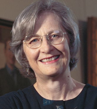
Laurel Thatcher Ulrich wrote that before Jones left Hallowell, he deeded his mills and other property to his wife’s family. Thus Ephraim Ballard was able to lease them in 1776 or 1777 (see the July 10 article on Ballard).

One of Ulrich’s footnotes quotes information that before his exile, Jones served the Kennebec Proprietors by “certifying land petitions from prospective settlers” between 1773 and June 1776, suggesting he left town that month.

Ulrich said Jones owned two different parcels, a “landing” on the east side of the Kennebec in Hallowell and mills on Bowman’s Brook (later Bond or Bond’s Brook), on the west shore and farther north, in what became Augusta in 1797.

When Martha Ballard started her diary in August 1787, she, Ephraim and five children were living in Jones’ Bowman’s Brook house. She described it as having two rooms downstairs, “east” and “west,” and above two unfinished rooms “unusable in winter.” The property included a cellar, barn and gardens.

Jones escaped from Boston, and on Aug. 29, 1779, made it to Québec, where he enlisted in the British Army with the rank of captain. From a British base at Castine, he made enough successful raids against Revolutionary forces to make himself “very obnoxious” (North’s phrase) to his former neighbors.

One instance, mentioned in more than one history, involved a night raid on Pownalborough. Jones captured General Charles Cushing, barefoot and in his nightclothes, and delivered him to the British at Castine – “marched him through the wilderness,” Nash wrote. (Pownalborough and Castine are about 90 miles apart, by contemporary reckoning.)

An on-line source says Jones helped the British establish a safe haven for Loyalists on the Penobscot River, presumably using his surveying skills. After the 1783 peace treaty established the St. Croix River as the boundary between the new United States and Nova Scotia, he surveyed what became the town of St. Andrews, New Brunswick, on the tip of the Canadian peninsula across the bay from Robbinston, Maine.

From the summer of 1783 into 1785, Jones worked “virtually single-handed” in New Brunswick, in what the on-line source described as a fairly hostile environment. Settlers were pressing for lots to be assigned in a hurry, and an American, Colonel John Allan, tried to block his work.

Allan, “the American superintendent of eastern Indians,” argued that Jones was surveying the wrong river and was really on United States land. In the fall of 1783, he arrested Jones, but the surveyor escaped (again).

The on-line source says Jones “acquired” property in and near St. Andrews, including a mill privilege (no information that he developed it), and on Grand Manan Island (off the coast from Lubec, Maine, on the Canadian side of the international boundary).

Martha Ballard wrote that on April 12, 1791, the Ballards turned over the Jones house to Peter Jones, John’s brother, and moved to the Howard farm a short distance south.

Ballard recorded John Jones as visiting at her house on Nov. 8 and Nov. 11, 1792. She gave no explanation, though she mentioned he collected some money that Ephraim Ballard owned him.

Jones returned to the Kennebec Valley for good, “perhaps as early as 1793, when he compiled a map for the Plymouth Company,” the on-line source says. Nash wrote that apparently he and his former townspeople became “tolerably reconciled.”

North wrote that Jones moved back to Hallowell (giving no date); Nash said he came back to what became Augusta in February 1797. Both said that he built a house where he lived the rest of his life. Nash located it on the north bank of Bond Brook, between his mill and the Kennebec (which would have been in Augusta after 1797).

Jones married Ruth Lee, “originally of Concord” (according to the on-line source) and sister of “Judge Lee of Wiscasset” (according to North). Neither writer dated the marriage, though it must have been before the mid-1770s. When his wife left Maine no one mentioned; North said she was with him in St. Andrews in April 1784. Both historians said the couple had no children.

North described Mrs. Jones as “tall, of good appearance, well educated for the times, and…much esteemed by her intimate friends.” Many of them wondered “how she could marry Black Jones.”

In later years, North wrote, Mrs. Jones became secretive about her age. When her friend, Judge Daniel Cony, tried to surprise her into a revelation with an unexpected direct question, “She drew up her tall form with an air of offended dignity, raised her half-closed hand towards the Judge, extending her little finger, and replied quickly, ‘Just as old, Judge Cony, as my little finger.'”

John Jones died Aug. 16, 1823, at the age of 80. Ruth Jones died Oct. 7, 1835, North said. He guessed her age then at about 90, though it was reported in the Kennebec Journal as 84.

Nash wrote that both were buried in what he called in 1892 “unmarked and forgotten graves in Mt. Vernon Cemetery.” Find a Grave currently lists seven Joneses in this cemetery, including Peter (perhaps John’s brother?), who died March 9, 1796, but no John or Ruth.

Main sources:

Kingsbury, Henry D., ed., Illustrated History of Kennebec County Maine 1625-1892 (1892)
North, James W., The History of Augusta (1870)
Ulrich, Laurel Thatcher, A Midwife’s Tale The Life of Martha Ballard, Based on Her Diary, 1785-1812 1990

Websites, miscellaneous.

Caron presentation at Vassalboro Historical Society

Ray Caron

by Mary Grow

Historian Ray Caron’s illustrated talk on China Lake at the Vassalboro Historical Society Sunday afternoon, July 20, had his audience questioning, commenting and chuckling.

Caron, from Winslow, covered pieces of the history of the lake and its surroundings, including Winslow, from before the first Europeans arrived until the mid-20th century.

Caron said he has memories of China Lake from childhood, when his family visited his aunt and uncle on the northeast side of the east basin. He would sit on the dock and look across the water at “the scenic church,” China Baptist Church at the head of the east basin.

Long before Caron’s childhood, Native America tribes were familiar with China Lake. One of the assumed reminders of their visits is Indian Heart rock, on the southwest shore of the east basin, believed to be a Native carving.

Vassalboro Historical Society President Jan Clowes mentioned another rock on which the date 1850 is carved.

When Europeans settled this area in the second half of the 1600s, Caron said, streams, including China Lake’s Outlet Stream (then called Mile or Miles Brook), were vital sources of power for mills to grind grain and saw lumber. He showed a map of early Winslow mills on the brook.

Between 1675 and 1763, a series of wars between English settlers coming inland from the coast and would-be French influence from Canada decimated the Native Americans, Caron said. He cited one estimate that their numbers dropped from around 15,000 to around 4,000, mostly due to smallpox and other diseases the Europeans introduced.

Skipping to the years around 1900, Caron shared a variety of newspaper articles and other documents he had collected about China Lake and people who lived around it, including photographs of ice-cutting; information on the electric trolleys that brought visitors from Waterville and Augusta; and a reference to a boat trip to Abenaki Park, which neither he nor audience members could locate.

He also had information on proposed state water quality legislation, about 1909. John Woodsum, head of the China Lake Improvement Association, testified vehemently against it, on the ground that local people could protect their own water.

Vassalboro’s Albert Morris Bradley and his son, William Stickney Bradley, were credited with developing recreational facilities – dining room, bowling alley and dance hall – on Bradley’s Island, in the lake’s west basin, which they bought in 1876. Caron said they owned boats, including a 100-passenger sloop, to transport patrons to the island. He and audience members wondered which part(s) of the shore the boats lived on, and what passengers did during the ride to the island.

Bradley’s Island now belongs to the Town of China. Caron believes it was acquired for unpaid taxes.

The Bradleys also owned the Revere House, in East Vassalboro. Caron had photographs of A. M. Bradly, in his 90s, in the building. Clowes said a new owner is currently refurbishing the Revere House to eliminate lead.

The final stage in China Lake’s history that Caron covered was its use as Kennebec Water District’s water source for its customers in Waterville and surrounding towns.

Waterville’s drinking water used to come from Messalonskee Stream. That water was blamed for a 1906 typhoid epidemic that killed 40 people, leading to a search for a new source.

Messalonskee Lake might have been suitable, Caron said. He surmised China Lake was chosen because it is about 100 feet higher than Waterville, allowing gravity flow instead of pumping.

He showed numerous pictures of the job of laying miles of pipes in the early 1900s to bring the lake’s water north. Hundreds of Italian laborers from Massachusetts worked on the project. They were housed in 500-man camps; one photo caption referred to a “middle camp” in North Vassalboro and another to be built in East Vassalboro.

Caron currently heads the Friends of Fort Halifax, in Winslow. He showed pictures of the near-replica of one of Benedict Arnold’s bateaux the group has built in preparation for the 250th anniversary of Arnold’s expedition up the Kennebec to Québec, in September 1775.

Recently, he said, an excavation for a new stage in Fort Halifax Park unearthed what were determined to be Native American teeth. After identification and consultation with current Maine Native Americans, reburying them was found to be appropriate and was done.

EVENTS: “People of China, Maine” – China Historical Society annual meeting

Boats on China Lake, Maine

Join us for an evening celebrating the rich history of China, Maine! The China Historical Society’s 2025 Annual Meeting will be held on Thursday, July 24th at 6:00 PM in the historic Old Town Hall (next to the China town office).

This year’s program, “People of China, Maine,” will feature local speakers sharing fascinating stories about the town’s early settlers and the communities they built. Presenters include Rev. Ron Morrell on the Baptists, Joanne Clark Austin on the Quakers, Tim Hatch on Thurston Park, and Scott McCormac on the people of South China Inn.

Whether you’re a lifelong resident or new to town, this is a wonderful opportunity to connect with neighbors, learn more about China’s history, and support the work of preserving our shared heritage.

We’d love to see you there—bring a friend and help us keep our local history alive!

Up and Down the Kennebec Valley: Early surveyors – John McKechnie

Manuscript map 41, which is a copy of a plan of “Great Lotts in the fifth division along the Kennebec River” from the Plymouth Company collection, was taken from surveys made by John McKechnie and John Jones.
Contributed to Maine Memory Network by Maine Historical Society Date: March 1771

by Mary Grow

Another Kennebec Valley surveyor who worked for the Kennebec/Plymouth Proprietors/Company was Dr. John McKechnie (1730 or 1732 – April 14, 1782).

Ernest Marriner, in his Kennebec Yesterdays, called McKechnie “one of those men of varied talents who meant so much to many pioneer communities” – “an educated physician, a civil engineer, a land surveyor, and a shrewd business entrepreneur.”

McKechnie was a Scotsman who came to America in 1755 and to Winslow in 1771. On July 26, 1755, as he left Scotland for Boston, he started a diary that became the source for at least two biographical sketches, one by Aaron Plaisted in his chapter on early settlers in Edwin Carey Whittemore’s history of Waterville and one in a medical directory found on line.

The latter, an article in the May, 1917, issue of the Canadian Medical Association Journal, says McKechnie was born about 1730 and got a medical degree or license in 1752 from either Edinburgh or Aberdeen. After three years’ practicing in his native land, apparently without marked success, he left Greenock, Scotland, by ship at 4 p.m., July 26, 1755, and landed on Boston’s Long Wharf at 7 p.m., September 12, 1755.

In the Boston area, he tried practicing medicine, and teaching (unspecified). On May 15, 1760, he “became an official of the Plymouth Land Company with the rank of Lieutenant and the position of a land surveyor.” The medical journal article says he stayed with the company for four years, surveying in the Kennebec and Penobscot river valleys.

By 1760, McKechnie was teaching in Pemaquid, Maine, where he met and married Mary North (1742 -1816), daughter of the Captain North who was in charge of the fort at Pemaquid. Plaisted dated their wedding Jan. 1.

The medical journal’s biography says Captain North “officiated at the wedding, although he is said not to have favored the match, either because Dr. McKechnie was too old, or had no settled profession.”

(If this “Captain North” is the Captain John North who is listed on FamilySearch as Mary North’s father, he was born in 1698 and married either Elizabeth Lewis, born in 1714, or Elisabeth Pitson, born in 1719. FamilySearch names each on different pages, plus a “Miss Burton” whom John North supposedly married in 1720.)

The medical biography mentions McKechnie practicing medicine in Pownalborough; treating a smallpox case on Swan’s Island; and from 1764 to 1771 practicing in Bowdoinham. Marriner found him named as a Bowdoinham selectman in 1764.

In 1771 the family moved to Winslow, and in 1775, they moved across the river, to what became Waterville in June 1802. Plaisted and Henry Kingsbury, in his 1892 Kennebec County history, said McKechnie was a Winslow selectman from 1774 through 1777.

Plaisted said when McKechnie moved to the west side of the Kennebec, he settled on Messalonskee Stream “near the Crommett bridge” at the place still known in 1902 as Crommett’s Mills. He built a log cabin and the first dam and sawmill on the stream; Kingsbury said he also had a grist mill.

(Crommett’s Mills was the part of Waterville where Messalonskee Stream, running south on its way to the Kennebec, loops northeast before returning to its original direction. Western Avenue now runs east-west across the top of the loop; Crommett Street is one of the streets intersecting Western Avenue from the north.)

The medical biography added that in his cabin, McKechnie “partitioned off a room for a dispensary of the drugs which were so extensively dealt out to sick people in that era.” This source says his medical practice “increased with considerable rapidity”; other historians say it was less important than his surveying.

The medical biography says he invested some of his income in timberlands to feed his sawmill. In 1779, he built a new and larger house, perhaps the one Marriner said was the first two-story house in Waterville, “near the present corner of Main and Silver streets.” (Since Waterville’s Concourse was created in the 1970s, these streets no longer intersect.)

Plaisted said of him, “Not one of the early settlers was more active and useful and entitled to respectful memory than Dr. John McKechnie.”

Frederick Thayer, in his chapter on doctors in Whittemore’s history, wrote that “Besides attending to his medical duties he was an active civil engineer and business man. Many of his original surveys are still [1902] extant.”

The sawmill was the only specific business interest mentioned. The medical biography called McKechnie “a man of means” who was able to lend other man $1,000.

This source says during the Revolution, McKechnie was known to lack sympathy for the rebels and was watched by the local Sons of Liberty. Despite his wealth, he was not asked to contribute to a fund to provide ammunition for local volunteers.

However, Marriner and others say he treated members of Benedict Arnold’s 1775 expedition to Québec via the Kennebec. And Marriner quoted McKechnie’s advice to neighbors about selling supplies to Arnold’s expedition: give them “enough, but not too much.”

* * * * * *

Gordon Kershaw, in his book on the Kennebec Proprietors, identified McKechnie as the Proprietors’ surveyor in his chapter on the dispute over “Masts for the King’s Navy.” These were the enormous white pines that provided masts for British ships.

Kershaw explained that John Wentworth, Governor of New Hampshire from the summer of 1766 until the American Revolution, was also Surveyor-General of the King’s Woods, a job that he believed included protecting the valuable trees.

When the Kennebec Proprietors began cutting white pines on their land, they started a long dispute with the governor that involved multiple lawsuits. It was never resolved, but was ended in 1775: as the Revolution began, local committees of safety made it clear that no more trees would be sent to the Royal Navy.

James North, in his history of Augusta, mentioned McKechnie’s November 1762, survey of “back land” lots, 10 miles in one dimension and varying in the other, that was the basis of grants to Proprietors. North quoted that the land was given to these men “in consideration of their great trouble and expense in bringing forward settlements on Kennebec River.”

Kingsbury wrote that McKechnie did the first survey of the area that became the Town of Winslow, after the Kennebec Proprietors granted the entire township, on March 12, 1766, to “Gamaliel Bradford, of Duxborough, James Otis, of Barnstable, John Winslow, of Marshfield, Daniel Howard, of Bridgewater, James Warren, of Plymouth, and William Taylor, of Boston Esquires, and to their heirs and assigns forever.”

An undated (maybe 1766?) plan in Kingsbury’s history, labeled Survey by John McKechnie, shows a standard layout along the east bank of the Kennebec south of the junction with the Sebasticook River.

Fifteen narrow (100-rod by one mile?) lots are laid out along the river, all but one with a settler’s name. Inland, south of Pattee Pond, are six much larger lots, both wider and longer, each with the name of one of the grantees. Additionally, on the southeast shore of the pond Winslow has 209 acres; Otis has 168 acres; and Warren has 81 acres.

A rectangular area farther inland has three rows of lots along the tract’s eastern border, numbered from 1 (on the northeast corner, northern lot in the easternmost row) to 95 (on the southwest corner, western lot on the south line). Each lot appears smaller than Warren’s 81 acres.

North of the Sebasticook’s junction with the Kennebec and east of Pattee Pond, McKechnie laid out lots only along part of the east bank of the Sebasticook, to the north boundary. The area between the two rivers, now the center of Winslow, is blank.

Whittemore’s collection of historic documents includes a 1771 deed to land in Waterville that references an October 1770 plan McKechnie made on the west side of the river.

About this plan, Marriner wrote: “Although Dr. McKechnie ran surveys as far down the river as Merrymeeting Bay and as far up as Skowhegan, it was his detailed and carefully mapped survey of both sides of Kennebec for some distance both north and south of Ticonic Falls [between Waterville and Winslow] that makes his name memorable in any consideration of the land titles.”

McKechnie’s 1770 plan has been affirmed in multiple court decisions, Marriner said. He cited one dispute, in an unnamed town in the 1860s and 1870s, in which a landowner spent more than $15,000 and lost six court cases in a failed effort to get one of his McKechnie-drawn boundary lines moved.

Whittemore described another McKechnie project in Winslow. On March 2, 1772, he wrote, Winslow officials “employed” McKechnie to ask Sylvester Gardiner (a Kennebec Proprietor) for land for a cemetery and a road.

The cemetery became “the old cemetery on Fort Hill” on Winslow’s Halifax Street (see Kit Alexander’s story in the Jan. 20, 2022, issue of The Town Line for a modern account of this historic graveyard). The road became Main Street and College Avenue, main arteries on the west (Waterville) bank.

* * * * * *

Plaisted said John and Mary McKechnie had 13 children. FamilySearch lists eight daughters and six sons, the first 13 born between 1760 and 1781 and a daughter born in 1796, named Lydia. Other sources say Lydia was born in 1777.

Kingsbury wrote that three of the McKechnie children were born in the family’s first Waterville house and one more, whom he called the last, in 1781 in the 1779 house.

Among descendants in the area in 1902, Plaisted said a grandson named Erastus McKechnie was living on a farm “on the road to Oakland” that the family had owned since 1801.

Whittemore told this story: “Early in 1773 the authorities of Hallowell (Augusta) sent five men in a boat to Boothbay to carry to the town the Rev. John Murray who was the first minister to be hired by that town. He proceeded to Winslow and Waterville and July 3, 1773, baptised three children of Dr. John McKechnie. This is the first baptism in town of which we have record.”

McKechnie died in 1782, Kingsbury said in his 1779 house. He was buried, with more than three dozen other early residents (including his son, Obadiah, according to Thayer; Kingsbury listed Obadiah as Simon Tozer’s son), in a no-longer existing cemetery on the south side of Western Avenue “on the rising ground a little east of the bridge over the Messalonskee.”

Kingsbury wrote that after McKechnie died, Mary married David Pattee, identified by Plaisted as builder of the second mill at Crommett’s Mills. Mary died July 21, 1816, according to FamilySearch; Kingsbury said she, too, was buried in the old cemetery.

Roland Hallee, editor of The Town Line, says Waterville used to have “a cemetery south of Western Ave., east of Messalonskee Stream, on South St., at the end of the street where the water district used to be. There also was a mill near there (only the foundation remains).”

Main sources

Kershaw, Gordon E., The Kennebeck Proprietors 1749-1775 (1975)
Kingsbury, Henry D., ed., Illustrated History of Kennebec County Maine 1625-1892 (1892)
Marriner, Ernest, Kennebec Yesterdays (1954)
North James W, The History of Augusta (1870)
Whittemore, Rev. Edwin Carey, Centennial History of Waterville 1802-1902 (1902)

Websites, miscellaneous.

Up and Down the Kennebec Valley: Early surveyors

by Mary Grow

As promised, the next articles in this series will introduce some of the important surveyors in the central Kennebec Valley as Massachusetts proprietors sold lots – mostly pieces of land they had never seen – to settlers, and other people began lumbering, trapping and farming without the formality of buying a lot.

Readers should remember that Kennebec Company, Kennebec Proprietors, Plymouth Company and Plymouth Proprietors all mean the same organization of Massachusetts businessmen who owned most of the Kennebec Valley. Different local historians preferred different names.

* * * * * *

European settlers had moved into the lower Kennebec Valley in the first half of the 18th century. Once the threat from the Natives and their French supporters ended in the 1760s, interest in upriver lands increased. The Kennebec Proprietors hired Nathan Winslow to survey both sides of the river from Chelsea, south of Augusta, to the north line of present-day Vassalboro, dividing the land for three miles inland into lots.

Multiple historians wrote that Winslow was hired in 1761 and dated his completed survey June 17, 1761. Your writer found in the on-line Maine Memory Network a statement that Winslow covered Pittston, Hallowell, Vassalboro (then including Sidney) and “Some in Winslow town and finished his Survey and made his plan and dated it the 17th of June 1761.”

This statement continued: “all those Surveys was made for the Kennebeck proprietors hath been made from may 1750 & Continually one after another: in Succession as of oft as they Could be.” If this information is accurate, the implication is that Winslow’s work took 11 seasons (but see below for his contradictory birthdate).

In their town histories, Alice Hammond and James North each reproduced the parts of the survey that became Sidney and Augusta, respectively. Winslow laid out three tiers or ranges of lots, each a mile deep, with an eight-rod (132-foot) space for roads between the each tier.

(Winslow’s range roads or rangeways were laid out as straight lines, but might in practice vary with the terrain. Some Kennebec Valley deeds still refer to them; and Waterville has streets named First Rangeway, roughly parallel to the Kennebec, and Second Rangeway, farther west.)

The 100-acre lots with river frontage were 50 rods (825 feet) wide. (At least one source says each lot was 125 acres; the math disagrees.) The maps show Range 2 lots as three times the width (150 rods, or 2,475 feet); and Range 3 lots 75 rods (1,237.5 feet) wide.

Along the river, one of every three lots was reserved for the Proprietors and marked with a P on the plans. Settlers’ lots were marked S. All of the big Range 2 lots were for Proprietors and all of Range 3 for settlers.

Winslow numbered the lots from south to north: in Augusta, on the east side of the river the lots run from 1 to 50, but on the west side, where the survey starts farther upriver, the northernmost lot is 34.

Vassalboro historian Alma Pierce Robbins’ account of Winslow’s survey on the east bank of the river was less detailed, but comparable. She, too, wrote of three tiers of lots, adding that Vassalboro included riverside lots 51 to 102 on the east bank and 35 to 82 on the west (later Sidney) bank. Most of Seven Mile Pond (now Webber Pond in Vassalboro) was in the third tier.

Rev. Edwin Carey Whittemore, in his history of Waterville, said that a March 12, 1766, grant from the Plymouth Company gave six named men 18,600 acres “covering the present Winslow,” with conditions.

Within four years, the new landowners were to have 50 settlers, at least 25 of them with their families, and 50 houses “not less than twenty feet square and seven feet studd [high?] each.” Each settler was to have cleared and ready for mowing at least five acres adjoining his house.

Robbins said the Proprietors gave settlers three years to clear five acres and build a 20-by-20-foot house, and required the settler or his heirs to occupy the house for another seven years. In addition, for 10 years each settler was to work two days a year on town roads and another two days for the church or the minister’s house.

These requirements were common for Kennebec Valley land grants. Their effects seem to have varied.

Whittemore claimed that the plan for (future) Winslow “was the only one to succeed of many similar propositions.” However, the 1761 plan in North’s Augusta history has owners’ names, rather than numbers, on most lots; and the China bicentennial history says that “between 1762 and 1766 most of these riverside lots [none in China, which is inland from the river] were taken up.”

For the April 2011 issue of the Sidney Historical Society’s newsletter, Polly Furber wrote an article on some of the early deeds in the town, based on Nathan Winslow’s 1761 survey. Having done that research, she decided to find out more about the surveyor, commenting that “I have never seen his name mentioned in any local history.”

Furber found that Winslow was the son of Nathan and Charity (Hall) Winslow, born April 1, 1743, in Falmouth – therefore, she pointed out, only 18 in 1761. He lived all or most of his life in Falmouth; Furber found a Quaker document recording the births of his five sons and five daughters there, between 1765 and 1785.

He married in 1764, probably to Jane Crane (according to multiple sites, including the list of his children in Quaker records; Furber called her Judith). FamilySearch says she died in 1805. In 1807, Furber found, he married again, a woman name Mary Vinal from Dresden.

FamilySearch adds that Winslow “registered for military service in 1778.” He was still actively surveying into the 1800s. FamilySearch dates his death Nov. 7, 1820, aged 77.

An on-line genealogy of a remotely-related family named Nagel says Winslow died Nov 7, 1826 (not 1820), in Falmouth. This source says his wife, Jane Crane, was born Nov. 12, 1742, in Sagadahoc (in the lower Kennebec Valley) and died March 30, 1805, in Windham.

* * * * * *

Surveyor Ephraim Ballard is mentioned in several early accounts. He was born May 6 or May 17, 1725, in Oxford, Massachusetts (or in Billerica and moved with his parents to Oxford in 1726). On Dec. 19, 1754, in Oxford, he married Martha Moore (born Feb. 9, 1735), author of the well-known diary of life as a midwife in the central Kennebec Valley from 1785 to 1812.

In 1775, Ephraim (and presumably his family) came to Fort Halifax. James North wrote in his 1870 Augusta history that on Oct. 15, 1777 (another source says 1776), Ballard moved into surveyor John Jones’ former house in Augusta (then Hallowell) and took over Jones’ mills, which Jones had abandoned because of his Loyalist sympathies.

Most sources wonder if Ballard, too, was a Loyalist. North thought not, citing 200 British pounds given him from the town “for his contribution to the revolutionary cause” in 1780, as well as his election to town offices.

He was a Hallowell selectman from 1784 through 1787. Later, he was the town’s tax collector, imprisoned in 1804 for failing to collect all the taxes he should have. Maine An Encyclopedia calls him a “prominent local resident” and says he is “frequently mentioned in the town’s records.”

This source calls Ballard one of the Proprietors’ “principal surveyors” and says, “His name appears on hundreds of maps in the area, and of such far-flung locations as Canaan, Lincoln Plantation, Bangor, Magalloway Plantation, Eustis, and Dover-Foxcroft.”

One such map, found on line, is dated 1794 and shows “the few county roads and three church parishes of early Hallowell,” before the two northern parishes became a separate town – eventually the City of Augusta — in 1797. A recent comment on the map says, “Mr. Ballard drew this map on the same kind of paper that Martha Ballard cut and folded to make her diary.”

Ballard is named as the surveyor of part of Albion, an area Kingsbury said the Kennebec Proprietors had given to Nathan Winslow. North wrote that while Ballard was surveying in Balltown (the area that later became Jefferson and Whitefield), armed men (perhaps settlers without deeds?) stole his surveying instruments and papers and drove him away.

One survey North described was in 1796, for the Plymouth Company, tracing a stream that flows into the Kennebec in Gardiner. In June, Ballard reported he had “ascertained the general course of the Kennebec from ‘Cobbossee stream’ down to the ‘chops'”; had found “the utmost limits of Cobbosseecontee towards the western ocean”; and had run a line from that point east-southeast to the Kennebec.

The “utmost limits” of the stream Ballard defined as the most southern point at which water was running into it. North said he was paid seven pounds, 10 shillings for this job.

Also in 1796, North wrote, the Commonwealth of Massachusetts hired Ballard to survey potential settlements on the Penobscot, in what became Hampden and Bangor.

One of Ballard’s surveys created the Ballard Line. As Millard Howard explained in his 2015 Palermo history, in the area that became Palermo the Kennebec Proprietors’ claim overlapped with a separate land grant called the Waldo Patent, owned in 1795 by General Henry Knox.

In June 1795, Knox and the Proprietors agreed on a division and hired Ballard to implement it on the ground. The Ballard Line is close to the eastern border of Palermo, Howard wrote, “leaving most of the town to the Kennebec Proprietors.”

Martha Ballard

Martha Ballard’s diary recorded some of her husband’s work. (Excerpts were included in a Feb. 16, 2023, article in this series in The Town Line.)

On Aug. 23, 1796, she said, a committee (unspecified) hired him to go to Dresden “to lay out a road to the point.” After preparations that included bringing “two birch cannoes [her spelling] to our shore,” he left at 10 a.m. Sept. 5; he came home Oct. 13.

Martha’s diary shows him actively surveying in following years, for the Proprietors, for individual settlers and sometimes laying out new roads for a town.

In mid-April, 1801, she recorded that he was dividing 2,000 acres somewhere between the Kennebec and the Penobscot. In late June that year he had a job in Bowdoinham. In September, he was working in Readfield, and in November, in Fairfield. December 22 he spent running the Sidney-Augusta town line.

In 1803, Martha wrote that he “sett [her spelling] out to go to Davis Town” on July 26; he returned on Sept. 27. (The length of time he was away suggests he could have been working in Maine’s current Davis Town, in Franklin County north of Rangeley and Mooselookmeguntick lakes, almost 100 miles from Augusta.)

Besides being a surveyor, Ballard ran the Jones mills he took over during the Revolution, North says until the fall of 1791. Other sources mention his working as a builder and a farmer.

The Ballards had three sons and two, three or four daughters (sources disagree), born between 1756 and 1779. At least one daughter, maybe two or three, died in childhood in a June 1769 diphtheria epidemic in Oxford.

On Nov. 1, 1799, North said, Ephraim and Martha moved to their son Jonathan’s riverside farm about a mile north of Augusta’s center.

Most sources say Martha Ballard died in May 1812, but North quoted an Aug. 7 1812, diary entry and wrote that she died within the next three weeks. Ephraim died January 7, 1821. Find a Grave says they “were buried in Augusta in a small family burial ground on…[their] son Jonathan’s property. The cemetery was later plowed up to plant crops.”

Main sources

Hammond, Alice, History of Sidney Maine 1792-1992 (1992).
Howard, Millard, An Introduction to the Early History of Palermo, Maine (second edition, December 2015).
North, James W., The History of Augusta (1870).
Robbins, Alma Pierce, History of Vassalborough Maine 1771 1971 n.d. (1971).
Ulrich, Laurel Thatcher, A Midwife’s Tale The Life of Martha Ballard, Based on Her Diary, 1785-1812 (1990).

Websites, miscellaneous.

Up and Down the Kennebec Valley: Early land titles

by Mary Grow

The lawyers discussed in this series earlier this spring were undoubtedly important in the lives of European settlers in the central Kennebec Valley. Before the lawyers, and equally if not more important, were another group of professional men: the surveyors.

Several surveyors’ names appear in 18th-century records, usually because the men were hired by the Plymouth Company/Kennebec Proprietors, the Boston-based companies with deeds to large parts of the area. Those most often mentioned include, in birth order, Ephraim Ballard (May 6 or May 17, 1725 – Jan. 7, 1821), John McKechnie (about 1730/1732 -– 1782), John Jones (c. 1743 – Aug. 16, 1823) and Nathan Winslow (April 1, 1743 — ? [after January 1807]).

Ballard is named as the surveyor of part of Albion, an area Henry Kingsbury, in his 1892 Kennebec County history, said the proprietors had given to Nathan Winslow; and part of Palermo. He was the husband of Martha Ballard, whose diary was made famous by Laurel Thacher Ulrich’s 1990 book titled A Midwife’s Tale.

McKechnie also surveyed part of Albion, in 1769; and the Town of Winslow.

Jones surveyed the west side of Sidney, beyond Winslow’s riverfront lots, in 1774; the area east of Vassalboro, including what became China, in the fall of 1773 and spring of 1774, with Abraham Burrell or Burrill (who became one of the first settlers around China Lake).

Nathan Winslow laid out lots in Vassalboro, including the part on the west side of the river that became Sidney, in 1761.

Among other surveyors mentioned less often in histories of the settlement of the central Kennebec valley are Paul Chadwick, General Joseph Chandler, Isaac Davis, Charles Hayden, John Howe, Josiah Jones, Bradstreet Wiggin or Wiggins and Dr. Obadiah Williams.

* * * * * *

Alice Hammond included in her history of Sidney a summary history of land titles in the area that became Maine, and more specifically in the valley of the Kennebec River. A summary of her summary might help readers sort out who owned what when.

The Augusta lawyer named Wendall Titcomb who wrote the chapter on Sources of Land Titles for Kingsbury’s Kennebec County history said that “…the Crown of England is the source to which trace all lines of title to lands within the county of Kennebec.” Hammond agreed.

She started with King James I’s 1606 grant giving the London Company the southern part and the Plymouth Company the northern part of North America between latitude 34 degrees and latitude 45 degrees.

The 45-degree line runs east-west through Maine north of present-day Skowhegan and Bangor. The 34-degree line runs through the southern United States, including Georgia, South Carolina and extreme southeastern North Carolina.

While the London Company settled Jamestown, Virginia, Plymouth Company representatives began trading with Natives and establishing fishing ports, but made no permanent settlements.

In 1620, Hammond wrote, a British stock company named the Council for New England, “successor to the Plymouth Company,” got a grant covering the territory between 40 and 48 degrees. Titcomb gave the full title: “The Council Established at Plymouth in the County of Devon for the planting, ruling and governing New England in America.” This company sponsored the 1620 Pilgrim settlement at Plymouth, Massachusetts.

One of the colonists, William Bradford, served as the colony’s governor for part of the time. He petitioned the Council for more land to support the colony’s growing population, and on Jan. 13, 1629, got the Kennebec or Plymouth Patent.

This grant covered 15 miles on both sides of the Kennebec River from the coast inland beyond present-day Skowhegan, about 1.5 million acres. It included the right to establish three trading stations, the one farthest upriver at Cushnoc (later Augusta).

Profits from the Kennebec trade declined over the years. On Oct. 17, 1661, Titcomb said, Boston businessmen Antipas Boyes (Boyce, Boies), Thomas Brattle, Edward Tyng and John Winslow bought the land along the Kennebec, for 400 pounds. These men organized themselves as the Kennebec Proprietors.

(Kingsbury added a footnote: the deed for the 1661 transaction was executed on Oct. 15, 1665, and “recorded in the York County registry in 1719.”)

Mostly because of wars with the Natives and their French allies who helped them from farther north, the so-called French and Indian Wars (1688 to 1763), the Proprietors did not develop their holdings. Over almost a century, their shares in the organization were divided among heirs, some ending up with 1/192 of a share, Hammond wrote.

The first of four separate French and Indian wars historians call King William’s War; it began in 1688 and was formally ended by the 1697 Treaty of Ryswick. The second war, known as Queen Anne’s War, or Dummer’s War, started in 1702 and ended with the 1713 Treaty of Utrecht.

James North, in his history of Augusta, wrote that the group he called the Pejepscot Proprietors took advantage of the post-1713 peaceful interlude to hire Joseph Heath to survey 111 miles of the Kennebec, as far inland as Norridgewock. Heath’s plan is dated May 16, 1719, North said.

(Joseph Heath, sometimes called Captain or Colonel, worked as a surveyor in several parts of Maine early in the 1700s, before the British settlements in the central Kennebec Valley. On-line documents refer to his plans for part of Brunswick [1717]; the Plymouth Patent [1719]; and a 1719 map and description of Norridgewock. North said Heath was “probably” the first commander at Fort Richmond, built in 1719 on the Kennebec below Gardiner.)

In August 1749, after the third of the four wars (King George’s War, or the War of Jenkins’ Ear) had ended with the October 1748 Treaty of Aix la Chapelle, some of the hereditary proprietors met and re-organized themselves as, Hammond wrote, “The Proprietors of the Kennebec Purchase from the late colony of New Plymouth,” aka either the Kennebec(k) Company/Proprietors or the Plymouth Company.

(This organization is the subject of a scholarly 1975 book by Gordon E. Kershaw titled The Kennebeck Proprietors 1749-1775. Kershaw focused on the group’s financial and legal interactions with the British government, in Massachusetts and in London.)

These men thought permanent settlements on the Kennebec River would be the way to profit from their holdings. North wrote that an early step was to get an exact understanding of what they owned. They hired their first surveyor pursuant to a December 1749, vote; and a surveyor named John North (later identified as Capt. John North) in October 1750.

North was again hired in 1751, and in that year and the next made a plan of the river and its tributaries and laid out at least some lots to be sold, from the ocean to Cushnoc (that is, inland as far as southern Augusta).

North mentioned repeatedly that the native inhabitants of the Kennebec Valley, egged on by the French from the north, tried to deter the expanding British settlements. The Proprietors and the Massachusetts authorities cooperated to build two forts on the east bank of the river in 1754.

Fort Halifax, built by British troops under General John Winslow (see box) was at the mouth of the Sebasticook, near the native village called Ticonic. Fort Western at Cushnoc served as a supply depot for and link to the upriver fort.

The fourth and final of the French and Indian Wars (the French and Indian War [singular], or the Seven Years’ War) broke out in 1754. Fighting in North America was over by 1760, although the formal peace treaty between Great Britain and France was not signed until Feb. 10, 1763 (Treaty of Paris).

With the Kennebec valley at peace, more people were willing to move there, and skilled surveyors able to establish precise lot lines became even more important.

A man named Winslow who was not a surveyor

The Town of Winslow was named after British General John Winslow (May 10, 1703 – April 17, 1774), not surveyor Nathan Winslow. Your writer found no evidence the two were related.

General Winslow, according to Barry M. Moody’s article in the Dictionary of Canadian Biography (found on line), was a member of a prominent New England family, descendant of two former governors of the Plymouth Colony (Edward and Josiah Winslow).

Winslow was born May 10, 1703, in Marshfield, Massachusetts. In February, 1725, he married Mary Little, born in Marshfield in September 1704 (according to Wikipedia). They had three sons, Josiah, Pelham and Isaac. (Moody said only two sons; and added that Winslow took a second wife, Bethiah [Barker] Johnson [no date] – possible, since, according to Wikipedia, Mary died in 1772.)

Winslow’s first military experience was on an unsuccessful 1740 British expedition to Cuba, as a captain in a provincial militia company. He then joined the regular British army, serving in eastern Canada.

Moody said he briefly abandoned the army and returned to Massachusetts, where he represented Marshfield in the state legislature in 1752-53.

In 1754, Massachusetts Governor William Shirley made Winslow a major-general in charge of the 800-man force sent to the Kennebec to combat French and Native opposition to British settlements. There he oversaw construction of Fort Halifax.

Rev. Edwin Whittemore, in his 1902 Waterville centennial history, said Winslow left 300 men to build the fort and led the other 500 upriver as far as Norridgewock. In late summer, after the fort’s stockade and first buildings were finished, Whittemore wrote that Governor Shirley came north to inspect it “and highly commended Gen. Winslow and his men.”

(In a later chapter in Whittemore’s history, Aaron Appleton Plaisted commented on the varied spellings of “Ticonic.” Among them he listed Governor Shirley’s “Taconett” and General Winslow’s “Ticonnett.”)

The 1754 project in the Kennebec Valley “added greatly to his [Winslow’s] popularity, and he was thus a natural choice as the lieutenant-colonel of a provincial regiment raised by Shirley in 1755 to aid Lieutenant Governor Charles Lawrence of Nova Scotia in his attempts to sweep French influence from the province,” Moody wrote.

Winslow spent the spring and summer of 1755 in New Brunswick, Canada, where reducing French influence included heading the expulsion of the French Acadian settlers. Moody quoted from Winslow’s diary that the work did not please him; but “he carried out his orders with care, military precision, and as much compassion as circumstances allowed.”

Winslow returned to Massachusetts in November 1755. The next year, he “reached the high point of his military career” when Governor Shirley sent him to upstate New York to fight the French there.

On both expeditions, Winslow quarreled with his superior officers. Moody suggested both sides were to blame.

Back in Massachusetts by 1757, Winslow left the army. He again represented Marshfield in the Massachusetts legislature in 1757-58 and from 1761 to 1765.

Around 1766 Winslow moved about 15 miles to Hingham, Massachusetts. He died there in 1774.

Main sources

Hammond, Alice, History of Sidney Maine 1792-1992 (1992).
Kingsbury, Henry D., ed., Illustrated History of Kennebec County Maine 1625-1892 (1892).
North, James W., The History of Augusta (1870).
Whittemore, Rev. Edwin Carey, Centennial History of Waterville 1802-1902 (1902).

Websites, miscellaneous.

EVENTS – Step Back in Time: Historic Walking Tour of South China Village

Site of original F. W. Hawes and the Spearin’s Store

The China Historical Society invites the community to explore the rich history of downtown South China during a special walking tour this Sunday, June 22nd, at 5:00 p.m. Participants will meet in the South China Community Church parking lot, located across from the old South China Library, for an engaging journey through the village’s past.

Local historians Barbara Poulin, Neil Farrington, and Joann Austin – all longtime South China residents – will serve as guides, sharing fascinating stories about the historic places that once defined downtown South China during their childhoods and earlier eras. The Historical Society will provide handouts containing valuable historical information about South China Village, offering attendees a lasting reference of the area’s heritage.

The tour, lasting approximately one hour, will feature an open discussion format where participants are encouraged to ask questions and share their own memories of the community. All are welcome to attend this free event. Those interested can find more information and sign up through the Facebook event posted on the China Historical Society’s Facebook page. Come discover the stories that shaped South China Village and connect with fellow community members who share a passion for local history!

Hawes, Woods, Carl’s, and Reeds Stores, now apartments

Dowes Diner – moved to new Route 3, now Greg’s Diner

Up and Down the Kennebec Valley: Waterville City Hall

Waterville City Hall and Opera House.

by Mary Grow

This article will return to the history of a series of buildings, more cheerful than the Augusta jail(s) described in the June 5 story: Waterville’s town hall that became a city hall that was – and still is – combined with a large gathering space called an opera house.

As with the public buildings in Augusta, there are gaps and inconsistencies in the information. A small part of the problem is nomenclature. Winslow and its meeting places were on the east bank of the Kennebec; on the west bank after 1802, Waterville had two meeting houses, the one near the river called the Ticonic or east meeting house and the one farther inland called the west meeting house.

Readers may remember that Waterville became a separate town from Winslow, divided physically by the Kennebec River and legally by the Massachusetts legislature, on June 23, 1802. According to both Henry Kingsbury, in his 1892 Kennebec County history, and Rev. Edwin Carey Whittemore, in his 1902 Waterville centennial history, the earliest meeting house on the west (future Waterville) shore predated the division.

Whittemore found the first reference to a Winslow meeting house in records of a Feb. 10, 1794, town meeting, held in a private home. Voters approved building a meeting house, for both religious and secular purposes, on land on the east (Winslow) bank of the Kennebec that Arthur Lithgow would donate; and raised 100 pounds to build it.

Later in 1794, Winslow voters invited a minister to town. Rev. Joshua Cushman, a Revolutionary War veteran and Harvard graduate, came and stayed 20 years.

He apparently didn’t have a building for the first couple years. Whittemore said on March 7 and 8, 1796, voters first authorized building a meeting house “on the hill near or in Ticonic village,” on the west bank; and then “voted to build another on the Lithgow lot in Winslow, the previous vote concerning it having been reconsidered.”

A five-man “committee for the west side” reported on March 16, 1796, recommending putting up the west (future Waterville) building and selling pews. “Such was the beginning of the meeting house which is now a part of the old city hall,” Whittemore wrote in 1902.

Once the meeting house was approved, Whittemore said, Dr. Obadiah Williams “offered…the present city hall park” for that building and also a schoolhouse or courthouse. A petition from the town’s western residents for a more central location was denied.

Waterville’s present city hall faces south across Castonguay Square. The square is on the north side of Common Street, which runs east-west for the block between Main and Front streets.

On-line information says the land was deeded to Waterville in 1840 and known as The Commons until 1921, when it was renamed to honor Arthur L. Castonguay, the first Waterville soldier killed in action during World War I.

Although the meeting house wasn’t finished for years, Whittemore said the first west side (of the Kennebec) town meeting was held there June 25, 1798. Kingsbury wrote, “The town meeting house on the west side was built in 1797, and first used March 5, 1798.”

Having an unbridged river dividing the body politic was an obvious inconvenience to voters on both sides trying to exercise their democratic rights. On Dec. 28, 1801, Winslow voters petitioned the Massachusetts legislature to create a new town on the west side of the river; and on June 23, 1802, Waterville was incorporated.

The first Waterville town meeting was in the Ticonic or east meeting house on Monday, July 26, 1802. The main business was electing town officials.

Winslow, from 1771, and Waterville, in 1802, included most of what is now Oakland, known after 1802 as West Waterville. Kingsbury wrote that before 1802, a second meeting house was being planned in that area (again, no location is specified).

The legislative act that created Waterville provided that money “assessed for building a meeting house in the West Pond settlement shall be paid and exclusively appropriated to that purpose”; Winslow was not to have any of it.

The west meeting house must have been finished, or almost, by August 1802, because Whittemore said Waterville’s second town meeting was held there on Aug. 9, 1802; and Kingsbury said voters that month approved holding future meetings alternately between the two.

In 1807 or 1808, as war with Great Britain appeared a possibility, Whittemore wrote that voters approved building a “powder magazine in the loft of the meeting house, probably as the driest place available.” Presumably he meant the east meeting house. That the building was also a church is shown by his reference to a preacher’s salary in the same sentence.

Whittemore mentioned the meeting hall again when part of the July 4, 1826, celebration was held there. Then, without explanation, he wrote that in 1842, “the old east meeting house was moved back and fitted up for a town hall.”

The “town hall” was the site of a June 3, 1854, anti-slavery meeting and of at least two gatherings in response to the Civil War.

On April 20, 1861, Whittemore wrote, a large meeting to respond to the April 12 attack on Fort Sumter was held in “the old town hall.” It led immediately to the organization of companies of volunteers.

On March 14, 1864, the “old town hall” was the site of a concert to start raising money for a monument honoring Civil War soldiers. Martin Milmore’s bronze statue of the “Citizen Soldier” was dedicated in Monument Park on May 30, 1876.

The western part of Waterville, with its meeting house, separated on Feb. 26, 1873. The new town was West Waterville for a decade before becoming Oakland.

In his chapter on Oakland, Kingsbury wrote that the “town meeting house” built by Winslow officials “about 1800” “was used for religious and other public gatherings and for town meetings till 1841, when it was taken down.” In 1892, the town hall was Memorial Hall, an 1870 brick and stone building on Church Street that honors Oakland’s Civil War soldiers.

Waterville’s 1874 Indepen­dence Day celebration in­cluded “a grand dinner in the town hall.” In 1875, Whittemore wrote “a new town hall was proposed”; he did not say by whom, or why. Instead, town officials spent $5,000 to add 33 feet to the existing building.

After rejecting a city charter approved by the Maine legislature in 1884, on Jan. 23, 1888, Waterville voters adopted an amended charter, by a vote of 543 in favor to 432 opposed. The town became a city, with the same municipal building.

In the spring of 1896, Whittemore wrote, an undetermined number of unidentified voters asked for a May 18 meeting, apparently to debate a single question that he quoted as: “to see if the voters of the city will instruct the city council to build a city hall and opera house this season.”

Whittemore thought the idea reasonable. By then, the “old city hall, the east meetinghouse of 1796, with sundry remodellings, was no longer on a plane with the dignity or the demands of the city,” in his opinion.

He did not explain why petitioners included an opera house.

A “largely attended” public meeting was held on May 18, 1896, to ask if voters wanted the city council to build “a city hall and opera house.” A majority said yes, please, estimating the cost at $75,000.

On May 4, 1897, there was another vote: 526 voters approved creating a City Building Commission, while 404 dissented. Consequently, Whittemore wrote, “Plans were accepted, the old hall was moved back, contracts were signed and the foundation of the new hall was partly laid.”

Then the “conservative or as some said reactionary” faction got an injunction that stopped work.

Nothing more was done until early 1901, when more public meetings led the city council to order work resumed, to be financed through taxes over following years, with the cost estimated at $70,000.

The architect for the building was George D. Adams, from Lawrence, Massachusetts. The new city hall was dedicated during the centennial celebration, on the morning of June 23, 1902, “the city’s birthday.” William Abbott Smith’s description of the ceremony in Whittemore’s history referred to “expressions of satisfaction which came from the vast throng that visited every corner of the new building.”

The ceremony, held in the new Opera House, included music, speeches and a presentation of the keys to the building by contractor Horace Purinton to Mayor Martin Blaisdell.

Purinton commented on the range of sources for building materials: stone from northern New York and Michigan, terra cotta from New Jersey clay, brick from local clay, wood from Maine, Georgia and Indiana.

Whittemore’s account praised Purinton and Blaisdell. Abbott added words of appreciation for former Waterville Board of Trade president Frank Redington, who presided over the dedication ceremony.

In his opening remarks, Redington called the new building “a suitable home for our city officials,” and its “convention hall” a meeting place for public discussion, “the old town house remodelled, enlarged, beautified, adorned, and fulfilled.”

He continued: “Some of you are perhaps thinking of the entertainment element which is introduced, for the human mind is so constructed that it needs entertainment as much as the body needs nourishment.”

Whittemore concluded his account of the building: “Waterville at last has a city hall of which she may well be proud.”

Waterville City Hall has been on the National Register of Historic Places since Jan. 1, 1976. In their October 1975 application for a listing, Earle G. Shettleworth Jr., and Frank A. Beard, of the Maine Historic Preservation Commission, described the building as “a good representative example of the multi-purpose civic buildings erected in Maine at the turn of the century.”

It stands three stories tall, with a stone foundation and basement and the upper stories “brick with wood and stone trim.” The main entrance to the city offices is in the center of the south façade; stone steps lead up to both sides of a recessed doorway under an arch, with arched windows on either side.

Above the entrance, three more arched windows are separated by white columns, with elaborate brickwork across the whole front. Top-floor windows are very small. Shettleworth and Beard wrote that the top of the front of the building “is completed by an elaborate wooden cornice composed of a dentil molding, a series of modillions and an ornamental crest at the center bearing the inscription ‘City Hall’.”

The entrance to the opera house/auditorium is on the west side, which Shettleworth and Beard described as handsomely decorated.

Inside, city offices occupy the basement and first floor. The top of the building is taken up by the auditorium, its lobby and backstage area.

Shettleworth and Beard found that the auditorium was called “Assembly Rooms”; “one of its earliest uses was for a dairyman’s exhibition.” It hosted varied touring entertainments, including, the historians said, Australian actress Judith Anderson; American singer Rudy Vallee; American opera singer and civil rights leader Marian Anderson; and early American Western movie actor Tom Mix, whose horse had “to be hauled up the outside of the building” to join him on stage.

After World War II the auditorium was used as a movie theater. It has always provided a venue for local entertainments.

Main sources

Kingsbury, Henry D., ed., Illustrated History of Kennebec County Maine 1625-1892 (1892).
Whittemore, Rev. Edwin Carey, Centennial History of Waterville 1802-1902 (1902).

Websites, miscellaneous.