Up and down the Kennebec Valley: Two Augusta women poets

by Mary Grow

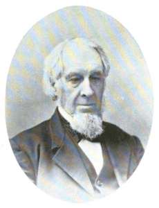
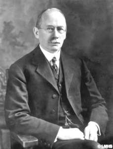
As mentioned last week, the list of writers in Henry Kingsbury’s Kennebec County history includes many from Augusta, Hallowell and Gardiner. Among them were two Augusta women listed as poets, Emma Nason (born Emma Caroline Huntington) and Olive Eliza Dana.

* * * * * *

Emma Caroline Huntington Nason

Emma Caroline Huntington Nason (Aug. 6, 1845 – Jan. 11, 1921) was much more than a poet, according to a Wikipedia article and other sources. She began writing poems when she was 12, and also wrote and had published short stories; stories, non-fiction and poems for children; “household articles”; historical works on a wide variety of topics, including Maine; and translations of German works.

In addition to her literary skills, Wikipedia says she composed music and was an artist in oils and charcoal.

Nason was the daughter of Samuel W. Huntington and Sally (Mayo) Huntington. Born in Hallowell, she was educated at Hallowell Academy, where she excelled “in mathematics and the languages.”

From the academy she went to the Maine Wesleyan Seminary in Kents Hill, graduating in 1865. Wikipedia says this institution, which became Kents Hill School, was then the only place in New England where women could attend college.

Wikipedia says her first books were published under the pen name John G. Andrews. By 1874, she was ready to reveal herself: her poem titled The Tower ran in the May Atlantic Monthly under her own name.

This poem and others were collected and published in 1895 as The Tower with Legends and Lyrics. Nason dedicated the book to C.H.N., her husband.

The Tower is the first and among the longest poems in the book. The first stanza begins:

I am the tower of Belus – the tower of old am I!
Under the rifting lines of the gloaming’s tremulant sky,
Under the shifting signs of the ages circling by,
I stand in the might of the mighty – the tower of Belus, I!

Wikipedia writers equate the tower of Belus with the tower of Babel, and say it was built in Mesopotamia by order of King Nimrod, grandson of Noah. Other poems in Nason’s book are about the Trojan War, the city of Agra (now in India), the town of Pavia (in northern Italy), a painting in Berlin, an ancient battle.

Since no source mentions Nason traveling abroad, your writer assumes her knowledge of the ancient and modern worlds came from her reading.

Like Hannah Moore, quoted last week, Nash thought the month of June worthy of a poem. Hers begins:

The month of roses, forever fair,
Radiant, miracle-working June!
Laden with color and perfume rare,
Set with the song of birds atune!

Nason also praised July and August, and “wild, lavish goldenrod.”

Hallowell Bells is a five-stanza lament: Nason can hear the distant bells of Hallowell ringing, “Now soft, now loud, with a sad refrain,” and everyone knows the sound means “Tomorrow…’twill rain, ’twill rain!”

The last poem in the book is The Old Homestead. It praises the spacious, elm-shaded house on a hill that welcomes all comers; the successful farmer whose land is rich with clover, grain and apples; the view over one of Maine’s thousand lakes; and ends:

Let us drink, with lips that are loyal,
One toast: to the homes of Maine!

Nason’s poems for children were printed in St. Nicholas (a monthly started by Scribner’s in New York City in 1873 that lasted until 1940) and other children’s magazines. The poems were collected in White Sails, published in 1888 in Boston.

This book includes a poem called The Bravest Boy in Town, first published in the children’s magazine Wide Awake.

(Wide Awake was another monthly, started in Boston in 1875 by Daniel Lothrop, who had founded D. Lothrop Publishing. Lothrop’s intended audience, Wikipedia says, was children aged 10 to 18, and his goal was to make them “broad-minded, pure-hearted, and thoroughly wide awake.” The magazine merged with St. Nicholas in 1893.)

The Bravest Boy in Town is a story in verse from Civil War days. When Confederate General Jubal Early’s troops raid into Maryland, a Cumberland Valley widow with a 10-year-old son, Jamie Brown, treats a rude platoon leader courteously, inviting him to sit down to eat the food he demands:

“‘If thine enemy hunger, feed him!’
I obey, dear Christ,” she said.
A creeping blush, with its scarlet flush,
O’er the face of the soldier spread.

The soldier promises the raiders “shall trouble not you nor yours.” But his men steal the widow’s cow anyway.

It was then the fearless Jamie
Sprang up with flashing eyes,
And in spite of tears and his mother’s fears,
On the gray mare off he flies.

When Jamie catches up with the triumphant raiders and demands his mother’s cow back, the captain takes his side. The poem ends:

And a capital joke they thought it,
That a barefoot lad of ten
Should demand his due – and get it too –
In the face of forty men.

And the rollicking rebel raiders
Forgot themselves somehow,
And three cheers gave for the hero brave,
And three for the brindle cow.

He lived in the Cumberland Valley,
And his name “was” Jamie Brown;
But it changed that day, so the neighbors say,
To the Bravest Boy in Town.

Some of Nason’s non-fiction works include Old Colonial Houses in Maine Built Prior to 1776, published in 1908 by the Kennebec Journal Press, in Augusta; and Old Hallowell on the Kennebec, published in 1909 by Burleigh & Flynt, of Augusta. Wikipedia cited contributions to Maine literary clubs, including “papers on ‘The Folk-lore of Russia,’ ‘The Abenaki Indians,’ ‘The Early Balladists and Troubadours of France,’ and a course of lectures on the ‘Genius and Love-life of the German Poets.'”

The Find a Grave website says Nason’s husband was Charles Henry Nason (Nov. 25, 1845 – Feb. 1, 1918), of Hallowell. They married on May 23, 1870.

Charles Nason went into the clothing business with his father-in-law until 1880, when the older man retired and left his son-in-law to run what became a 6,000-square foot store. Kingsbury said it was “a compliment and an honor to Augusta, as well as to Mr. Nason, that by the concurrent opinion of constant travelers, her leading clothier has the finest establishment of its kind in Maine.”

The Nasons had one son, Arthur Huntington Nason (Feb. 3, 1877 – April 22, 1944), born in Augusta and died in Gardiner. He earned a doctorate and taught English at New York University.

Charles and Emma Nason, Arthur Nason and Arthur’s widow, New Jerseyite Edna Walton (Selover) Nason (Oct. 6, 1873 – Dec. 31, 1945), whom he married in 1916, are buried in Hallowell Village Cemetery, according to Find a Grave.

* * * * * *

Olive Eliza Dana, daughter of James Wolcott and Sarah W. (Savage) Dana, was born Dec. 24, 1859, in Augusta, and lived there her entire life. Plagued by ill health, she died Feb. 3, 1904, barely past her 44th birthday.

Dana, like Nason, is noted in Wikipedia articles and elsewhere as a multi-talented writer. Immediately after graduating from Augusta high school in 1877, she began writing for what the Wikipedia writer labelled “the press,” including a variety of newspapers and magazines.

One Maine outlet was the weekly Portland Transcript (1849-1910), described on line as of 1871 as “An independent family journal of literature, science, news, markets, &c.”

Under Friendly Eaves by Olive Eliza Dana

She also contributed to Good Housekeeping; the Boston-based Journal of Education (presumably the one founded in 1875 by the merger of similar journals in Maine, Massachusetts, Connecticut and Rhode Island); The Illustrated Christian Weekly, published in New York; and Cottage Hearth: A Magazine of Home Arts and Home Leisure, another Boston publication.

Dana’s works included poems, short stories and essays, many for young people. Her collected short stories were published as Under Friendly Eaves (1894). The 22 stories are prefaced by a poem by the author that begins:

Just a they came to me, I write them here, —
These homely tales of simply, friendly folk….

An on-line review in Representative Women of New England refers to the “natural and wholesome atmosphere,” and the “romantic and heroic spirit” in Dana’s portrayal of New England life. The writer comments that “The influence of her stories, imbued as they are with the spirit of cheery helpfulness, is enmobling [sic] and uplifting.”

Dana’s poem titled Autumn’s Promise was published on the front page of the Oct. 18, 1892, issue of the Journal of Education. The first stanza (of five) reads:

The wild-flowers cease their straying
By every moss-grown wall,
And, where the winds are playing,
The oak-leaves fade and fall.
The little herbs grow musty
With over-much of rain,
The clinging vines are rusty
Where dews too long have lain.

Dana quickly changes her rather somber mood, however, remembering that the wind is scattering seeds for next year and there is a rich harvest this year. Her final cheerful stanza reads:

So Autumn’s promise seemeth
A richer, gladder thing
Than that of which one dreameth
Among the blooms of spring.
A song of all the pleasures,
Of all the unborn years,
A rune of all their treasures
She crooneth in our ears.

In the Nov. 3, 1892, issue of the same publication, Dana had almost a full page for Thanksgiving Day [An Exercise]. She wrote a long poem about Thanksgiving, followed by a prose history of the holiday, followed by another poem. The first poem, called The Day, begins:

It comes when chilling wintry frosts
Across the fields are creeping,
When all the harvest days are past,
And all the flowers are sleeping;
When early sunsets light the skies,
And shadows early lengthen, —
But every true and tender tie
Its warmth shall round us strengthen.

The first stanza of the second poem, “Thanksgiving Cheer,” focuses on the positive, without the nostalgia. Dana wrote:

The time of all the happy year
Fullest of peace, of strength, of cheer;
The joyful ‘Harvest Home’ is here!

NOTE: Emma Huntington Nason has a considerable presence on-line. Researchers will be able to find book titles, including the four mentioned above that are available on amazon.com and elsewhere, texts of poems and other information.

Many of Olive Dana’s books are also available, including reprints of “Under Friendly Eaves” from numerous sources.

The University of Maine’s Raymond H. Fogler Library special collections holds the Olive E. Dana papers.

Main sources:

Kingsbury, Henry D., ed., Illustrated History of Kennebec County Maine 1625-1892 (1892)

Websites, miscellaneous

Up and down the Kennebec Valley: Some early Maine poets

by Mary Grow

As promised last week, no more ponds for a while. Instead, your writer turned to Thomas Addison’s chapter on Literature and Literary People, in Henry Kingsbury’s Kennebec County history. She hopes you will enjoy meeting a few of the writers mentioned.

Addison’s definition of literature covers almost anyone who wrote: newspaper people, historians, educators and sundry others. Your writer has chosen arbitrarily to begin with selected poets.

Many of the names Addison mentioned have no on-line references. Others are listed only as contributors to a book titled The Poets of Maine: A Collection of Specimen Poems from over Four Hundred Verse-makers of the Pine-tree State, compiled by George Bancroft Griffith and published in 1888.

Your writer found excerpts from this book on line. The samples she read have brief biographies and selected poems.

* * * * * *

Amos Lunt Hinds’ book,
Uncle Stephens

A large number of writers came from Augusta, Gardiner and Hallowell. Addison listed surprisingly few from Waterville or towns farther north, and not many from smaller towns.

An exception was the Town of Benton, identified as the home of poets Amos Lunt Hinds and Hannah Augusta Moore.

Amos Lunt Hinds (born in Benton Nov. 12, 1833, or sometime in 1834; died in Benton, April 24, 1908) was the son of Asher Hinds (born in Benton May 2, 1792; died in Benton April 23, 1860) and Lucy Harding (Turner) Hinds (1801 – July 2, 1883), who was either the first or second of his two wives (sources disagree).

The on-line description of Forgotten Books’ 2018 reprint of Amos Hinds’ 1905 Uncle Stephen and Other Verses includes Hinds’ introduction. The poet said the poems were written over 40 years; some had been published in newspapers and magazines, locally and out of state. Hinds collected them into a book “at the suggestion and request of old friends, to whom they are submitted with affectionate greeting.”

An article in the Jan. 10, 1906, issue of the Colby Echo (found on line) republishes a Dec. 27, 1905, Waterville Evening Mail article on the publication of Uncle Stephen. Hinds is described as a Colby graduate, Class of 1858, and a resident of Benton Falls.

The unnamed writer of the article mentioned several poems with local connections.

The one titled The Soldiers ‘ Monument was “read at the unveiling of the monument in this city on May 30, 1876.” The newspaper quoted one verse:

Long let this musing soldier stand,
‘Neath free New England skies,
To all that love the fatherland,
Type of self-sacrifice.

General Isaac Sparrow Bangs, in his military history included in Edwin Carey Whittemore’s Waterville history, describes the founding of the Waterville Soldiers’ Monument Association in March 1864, before the Civil War ended. Its purpose was to provide a memorial to honor Waterville residents who died in the war.

The first fund-raising events were that month. After a Nov. 29, 1865, event, Bangs wrote, the association apparently went dormant until June 1875. By then, donations and interest totaled $1,000, and the town gave a matching sum.

Association committees were formed to design the monument and find a site. Two more fundraisers May 16 and 17, 1876, added $350, and the Waterville Soldiers’ Monument, in what is now Veterans Memorial Park, at the corner of Elm and Park streets, was dedicated on Tuesday, May 30, 1876, Memorial Day.

Another of Hinds’ poems, Old Block House, was about Fort Halifax, in Winslow, the 1906 newspaper writer said.

Uncle Stephen, “the first and longest poem in the volume,” honored Stephen Crosby, whom the writer called “one of the early settlers of that portion of Winslow which lies adjacent to Benton Falls.”

Crosby owned a grist mill, and during 1816, the Year without a Summer, he “endeared himself to his generation and his memory to other generations, by refusing to profit by the distress of his neighbors, continuing to sell corn, of which he had a store, at the ordinary price.”

On-line genealogies say Amos Lunt Hinds married Lettice Orr Reed (1834 – Jan. 26, 1910), and name only one child, Lucy Turner Hinds (1866-1966). The “Colby Echo” article says Amos was the father of Asher C. Hinds, Colby 1883 (but see box on the Hinds family).

* * * * * *

Poets of Maine says Hannah Augusta Moore was born in Wiscasset on March 15 of either 1827 or 1828. Her grandfather was Colonel Herbert Moore, of Waterville; her father, Herbert Thorndike Moore, is identified as “of New York City.”

Her mother, who is not named, and her father were both poets, the biography says. The family moved to Philadelphia when Hannah was “a small child” and she started writing there. Then she lived in New York (City?) “for many years.” In 1886, she “came back” to Benton, which she called “dear native land.”

The biography does not say when Hannah had previously lived in Benton, and the following text is not helpful. It says that after her mother died (no date given), she “attended school at Waterville, Me.”

As soon as Moore settled in Benton, Ephraim Maxwell, publisher of the Waterville Mail newspaper, began publishing her work.

Moore wrote under pseudonyms, including Helen Bruce and Wanona Wandering. The biography explains that she avoided “Hannah” “from a dread that she might be supposed to consider herself a second ‘Hannah More.'”

(Hannah More [Feb. 2, 1745 – Sept. 7, 1833] was a British writer whose works included plays and poetry, mostly religious.)

The biography says it was Moore’s own choice to live “like a hidden singer in a hedge.” Her poems were available in the United States and in Europe, and many were set to music. One collection, titled “Plymouth Notes,” sold 40,000 copies in Europe in its first year.

The biography ends by quoting “June in Maine,” one of Moore’s best-known poems. The first stanza reads:

Beautiful, beautiful summer!
Odorous, exquisite June!
All the sweet roses in blossom,
All the sweet birdies in tune.

The poem urges readers to go outside and enjoy

All the dim aisles of the forest
Ringing and thrilling with song;
Music—a flood-tide of music—
Poured the green valleys along.

And

Buttercups, daisies, and clover,
Roses, sweet-briar, and fern,
Mingle their breath on the breezes—
Who from such wooing could turn?

* * * * * *

Frances Parker Mace

Frances Parker (Laughton) Mace is another Maine poet, who was a friend of Moore’s. Wikipedia says she was born in Orono, Jan. 15, 1836 (or, one source says, 1834, citing her tombstone), daughter of Dr. Sumner Laughton and Mary Ann (Parker) Laughton.

The family moved to Foxcroft in 1837. Mace’s education included Latin “and other advanced subjects” at Foxcroft Academy when she was only 10 years old. Her first poems were published when she was 12, some in The New York Journal of Commerce, Wikipedia says.

The Laughtons moved to Bangor, and Mace graduated from Bangor High School in 1852. Wikipedia says her most famous poem was published in the “Waterville Mail” when she was 18, suggesting a Waterville connection by 1854 – did she and Moore meet then? Your writer found no evidence.

This poem is titled Only Waiting. It was inspired by a friend who asked an elderly man in a poor-house what he was doing and received the reply, “Only waiting.”

The poem begins:

  Only waiting till the
shadows
  Are a little longer grown,
  Only waiting till the
glimmer
  Of the day’s last beam
is flown;
  Till the night of earth
is faded
  From the heart, once full
of day;
  Till the stars of heaven
are breaking
  Through the twilight
soft and gray.

It goes on to describe the man’s readiness to leave his weary life for the company of angels.

The poem was published in the Waterville Mail under the pseudonym “Inez.” Later, a hymn-writer named Mrs. F. A. F. Wood-White, from Iowa (according to one on-line source), claimed she had composed it, creating a dispute that was eventually resolved in Mace’s favor.

Mace married a lawyer named Benjamin Mace in 1855, and for the next 20 years was busy with eight children, four of whom died young. She began writing again when their eighth child was two years old, with a poem published in Harper’s Magazine.

Her collected poems were published in the 1880s, before and after the family moved to San Jose, California, in 1885. She died in Los Gatos, California, on July 20, 1899.

NOTE: For those interested in seeking out poems mentioned in this article, your writer found on line:

Two recent reprints of Amos Lunt Hinds’ Uncle Stephen and Other Verses: a 2016 hardcover edition by Palala Press, and a 2018 paperback by London-based Forgotten Books.

Three reprints of The Poets of Maine: in 2008 by Kessinger Publishing (Vol. 2 only); a 2017 paperback by Forgotten Books; and a 2023 paperback by Creative Media Partners, LLC.

Listed as available on amazon.com, in January 2024: copies of Frances Laughton Mace’s two poetry collections, Legends, Lyr­ics and Son­nets, originally published in Boston, Mas­sa­chu­setts, by Cupples, Upham, in 1883; and Under Pine and Palm, originally published in Bos­ton by Tick­nor, in 1888. No publisher is given.

More about the Hinds family

On-line sources say poet Amos Lunt Hinds had three younger brothers and a younger sister. The brothers are listed as Albert D. Hinds (1835-1873); Asher Crosby Hinds (1840-1863); and Roswell S. Hinds (1844-1864). The sister was Susan A. Hinds (1837-1905).

Find a Grave website says the Asher Crosby Hinds who was born Jan. 7, 1840, in Clinton, served in Company G of the Third Maine Infantry during the Civil War. He started as a corporal and mustered out as a sergeant. The website quotes the beginning of his obituary from the April 2, 1863, Piscataquis Observer, which says he died in Benton at the age of 23.

Amos and Asher’s brother Albert and his wife Charlotte (Flagg) named their first son, born in 1863, Asher Crosby Hinds.

Wikipedia says Asher Crosby Hinds, born Feb. 6, 1863, and died May 1, 1919, represented Maine’s First District in the U. S. House of Representatives for three terms, from 1911 to 1917.

The article says he attended Coburn Classical Institute and graduated from Colby College in 1883; worked for a Portland newspaper beginning in 1884; and from 1889 to 1911 held clerical positions in the Maine House of Representatives, working for the Speaker.

Hinds edited two procedural manuals, Wikipedia says, an 1899 edition of the Rules, Manual, and Digest of the House of Representatives and in 1908 Hinds’ Precedents of the House of Representatives.

The article cites a 2013 study showing the Precedents “successfully altered the behavior of House representatives, as they became less willing to appeal decisions of the chair.”

This information leads your writer to conclude that Rep. Asher C. Hinds was Amos and Lettice Hinds’ nephew, not their son.

Amos Lunt Hinds and a dozen other family members are buried in Barton-Hinds Cemetery on Eames Road in Winslow, according to Find a Grave.

Main sources

Kingsbury, Henry D., ed., Illustrated History of Kennebec County Maine 1625-1892 (1892).
Whittemore, Rev. Edwin Carey, Centennial History of Waterville 1802-1902 (1902).

Websites, miscellaneous.

Up and down the Kennebec Valley: Sidney ponds

Messalonskee Lake

by Mary Grow

Here is the last article (for a while) on central Kennebec Valley ponds and people for whom they might have been named. This week’s topic is ponds in the Town of Sidney (which was until Jan. 30, 1792, part of Vassalboro, despite being on the other – west – side of the Kennebec River).

A map of Sidney shows a large lake, Messalonskee Lake (aka Snow Pond), along much of its western border with Belgrade. If the map is detailed enough, it will show smaller ponds scattered through town.

They include Lily (Henry Kingsbury spelled it Lilly in his Kennebec County history) Pond, in northeastern Sidney between Interstate 95 and the Kennebec River. In the southwestern corner of town are nine small ponds, some shared with Belgrade on the west and Manchester on the south.

Lily Pond appears as an oval running approximately southwest to northeast. Its outlet, from the northeast corner, drains east into the Kennebec River.

According to the Maine Department of Inland Fisheries and Wildlife’s (IF&W) summary report dated 1997, Lily Pond had an area of 44 acres and a maximum depth of 30 feet. The report called it “a shallow warmwater pond with many areas of aquatic vegetation that provides excellent habitat for pickerel and largemouth bass.”

The Lakes of Maine website agrees on the maximum depth but gives the area as only 26 acres. Aerial photos on two websites show large areas of brown surrounding the pond, as though the water level had dropped significantly and the exposed areas had not grown vegetation.

* * * * * *

The northernmost of Sidney’s southern ponds, Ward Pond, is northeast of Route 27, a main road that runs diagonally through the southwest corner of town. Ward Pond lies between two north-south roads, Pond Road on the west and Quaker Road on the east.

Ward Pond was probably named after one of Sidney’s Ward families, though your writer has been unable to determine which one(s).

The 1856 map of Sidney shows a Ward house on the west side of Quaker Road, a short distance south of the pond. The 1879 map reproduced in Alice Hammond’s Sidney history shows what might be the same house, with a blacksmith shop beside it, and another Ward dwelling on the east side of Quaker Road north of the pond.

John Ward owned land in Sidney by 1794. When the first 10 school districts were laid out that year, some of the boundaries Hammond quoted referenced his land, which was evidently several miles from the Kennebec.

Kingsbury listed among early settlers in western Sidney “Deacon William Ward and his father.”

In 1843, Kingsbury and Hammond (apparently copying; she included Kingsbury in her list of sources) wrote that “Asa, William and David T. Ward” were among organizers of what became the West Sidney Baptist Church the next year.

William was probably the Rev. William Ward, who married into the large Tillson (Hammond) or Tilson (Kingsbury) family. According to the Tillson genealogy that Hammond included, Holmes Tillson (born July 4, 1776) moved to Sidney from Massachusetts in 1805; he and his wife Olive (Packard) had 10 children, the five youngest born in Sidney.

Holmes Tillson expanded his land-holdings on both sides of the southern end of Pond Road. Hammond said his son Jason donated the land for the West Sidney Baptist Church building in October, 1845. Her 1992 book has a photo of the church building at 51 Pond Road, not far north of Route 27 and south of Ward Pond.

Holmes Tillson “and one of his sons” ran Tillson Tavern (Hammond gave no dates), in a building she wrote was still standing in 1992, at the Route 27/Pond Road intersection. Kingsbury said Holmes’ sons, Jason (1806-1865) and Anson (born in 1808), succeeded him as tavern-keepers; he too omitted dates.

Anson Tillson was the first postmaster when the West Sidney post office opened in December 1831.

Holmes Tillson’s second daughter, Mary (born in 1800), married William Ward. Their son, Anson T. Ward, served in the Civil War.

After the war, Anson married Mary (Robbins) Tillson, from Rome, Maine, widow of his uncle, Jason. Anson and Mary moved to Arlington, Virginia, after 1881.

Kingsbury’s list of town officials – selectmen, town clerks and treasurers – from 1792 to 1892 includes no Til(l)sons and only one Ward. Loren B. Ward was elected a selectman in 1865 and served five terms.

* * * * * *

The other eight southern ponds are south of Route 27.

Northeasternmost is Joe Pond, an irregular rectangle. Southeast of Joe Pond is tiny round Lily Bay Pond; southwest of Joe Pond, mostly in Belgrade, is Penny or Penney Pond, shaped vaguely like a bird with half its long, rounded tail in Sidney and its body and head in Belgrade.

North-south Gould Pond, south of the east end of Penny, is entirely in Sidney, as are the two ponds parallel to its east shore. The northern of these another source names Bean Pond. The southern one the detailed Sidney map calls Doctors Pond, probably erroneously; other sources name it Emery or Mud Pond. The real Doctors Pond is probably the one east of this grouping and even smaller than Lily Bay Pond, unnamed on the Sidney map.

South of Emery Pond, partly across Sidney’s south line in Manchester, is Silver Lake.

The IF&W web page says Joe Pond has an area of 40 acres, a maximum depth of 20 feet and very acidic water. It is described as “a typical bog pond with dense shoreline vegetation and sphagnum moss growing to the waters [sic] edge.”

Lakes of Maine, as usual, agrees on the maximum depth but lists the size as only 28 acres. An undated aerial view shows Route 27 not far east of the pond and “Jepsen Woods Ln” running west off the road across the north end of the pond. There is also a suggestion of an access – a break in the vegetation – on the east shore.

Lily Bay Pond is described by Lakes of Maine as covering only three acres; no depths are given. The Lakes of Maine aerial photo shows a wooded shoreline. IF&W has no website for Lily Bay Pond.

Penny Pond, according to the IF&W website, covers 44 acres, with a maximum depth of 38 feet. IF&W calls it “a small kettle pond of glacial origin.”

(A kettle pond or kettlehole is a reminder of the glaciers that once covered Maine. It is formed when a block of ice, left buried in the ground after a glacier retreats, melts and leaves a hole that fills with water. Windsor’s Donnell Pond, described by Henry Kingsbury [and cited in the Feb. 15 article in this series] as apparently having no bottom, is quite likely a kettlehole.)

Lakes of Maine says Penny Pond covers 39 acres and agrees on the 38-foot maximum depth. Its aerial photo shows “Jepsen Woods Ln” reaching – or almost reaching – Penny Pond’s east shore, in Belgrade, over the north end of Joe Pond. Penny and Joe ponds are less than half a mile apart, according to Lakes of Maine.

The IF&W website links Gould Pond with smaller Wellman Pond, northwest and almost entirely in Belgrade. Gould Pond, the website (citing a 2000 update) says, covers 19 acres and has a maximum depth of 34 foot; Wellman is only nine acres in area, but is 66 feet deep. These are two more kettleholes, IF&W says.

The Lakes of Maine aerial photo clearly shows the stream linking Gould and Wellman ponds. Lakes of Maine says Gould Pond is 23 acres, with a 34-foot maximum depth. (For Wellman Pond, Lakes of Maine’s dimensions agree with IF&W’s.)

The Sidney map with which your writer started this investigation shows Doctors Pond as the larger and southern of two ponds parallel to the east shore of Gould Pond. It is an irregular square with a “tail” extending south and turning southwest.

Lakes of Maine has a website for a two-acre Doctor Pond in southern Sidney, with an aerial photo showing a rectangular pond with no “tail.” This pond is said to be east of Gould and Lily Bay ponds; the Sidney map shows a small unnamed pond that fits that information. IF&W does not have a Doctor(s) Pond website.

After comparing sundry maps and descriptions, your writer decided that the two ponds within half a mile of Gould Pond’s east shore are Bean Pond (northern) and Emery or Mud Pond – not Doctors Pond — (southern). A stream connects the two.

Bean Pond covers four (IF&W) or five (Lakes of Maine) acres, with a maximum depth of 30 feet (both sources).

Hammond’s history mentions several people whose last name was Bean, including the James H. Bean for whom Sidney’s school is named. Most lived in the 20th century.

One exception was David Bean, who in 1843 sold land on Belgrade Road (now Route 27), reserving a piece for his use to bury the dead. Hammond said a West Sidney Cemetery Association was organized; some of its trust funds remained in town hands in 1992.

The photos and sketches of Emery Pond match the Sidney map’s Doctors Pond. Lakes of Maine says the area is eight acres; IF&W says nine acres; both give the maximum depth as 42 feet.

The Knowles or Summerhaven Road loops around the southern ends of Emery and Gould ponds, separating them from Silver Lake, which is shared between Sidney and southern neighbor Manchester.

Silver Lake is also called Figure Eight Pond; one website calls it a “two-lobed” pond, another refers to Upper Silver Lake. Lakes of Maine’s aerial photo shows how two peninsulas almost meet to divide the lake into larger northern and smaller southern sections.

Lakes of Maine gives the size as 34 acres (IF&W says 29 acres, as of 2000) and the maximum depth as 62 feet (IF&W agrees). There are roads and buildings around much of the lake, and IF&W says there is a small boat launch on the southwest, off Summerhaven Road, near the Sidney/Manchester town line.

Knowles Road, your writer guesses, was the early name for Summerhaven Road, and it might recognize an early Sidney family. According to Hammond, Holmes Tillson’s oldest daughter, Rhoda (born in 1799), married “Deacon Joseph Knowles, of Readfield, who was associated with the Rockwood Meeting House in Belgrade.”

Their homestead was “in back of Summerhaven on the Knowles Road,” Hammond said. Knowles paid property taxes in Belgrade, Manchester and Sidney.

Hammond called Summerhaven a part of Sidney with “natural resources which furnished recreational areas.” The ponds provided opportunities for boating, swimming, fishing and ice-skating, she wrote.

On line, Summerhaven is variously identified as a neighborhood and a recreational area. It is partly in Sidney, partly farther southeast in Augusta.

Several websites refer to motorcycle trails; one says they are closed and the site remains up only for historic reasons and to prevent people making wasted trips to the former site. Other websites mention a shooting range.

Main sources

Hammond, Alice, History of Sidney Maine 1792-1992 (1992).
Kingsbury, Henry D., ed., Illustrated History of Kennebec County Maine 1625-1892 (1892).

Websites, miscellaneous.

Up and down the Kennebec Valley: Ponds named after people

by Mary Grow

Webber Pond

Returning to early settlers who had ponds named after them and related topics (discussed in many recent articles in this series), your writer starts with a reader’s question: is Webber Pond in Vassalboro named for Charles Webber, mentioned at the end of the Jan. 11 article?

Vassalboro historian Alma Pierce Robbins’ account of the Webber family’s early days in Vassalboro says firmly, “Maybe”; and if not Charles, almost certainly a family member. Other sources offer an unusually wide variety of conflicting information that adds up to the same answer.

In her chapter on Vassalboro’s first families, Robbins compiled a list, using as sources the 1792 town valuation report (compiled by Charles Webber and two other assessors) and the 1800 national census.

From these sources she named five Webbers in Vassalboro by 1800: Charles and Charles, Jr., Eliot, Hannah and John. If an on-line genealogy is accurate, Charles was Charles B. Webber – few other sources use any middle initial – and he was one of Vassalboro’s first settlers.

On the town website, 11 Webbers are listed as buried in the Webber family cemetery in Riverside. One is Charles, born c. 1741 and died Nov. 20, 1819, identified as a veteran.

Riverside is the section of southwestern Vassalboro that used to be one of the town’s villages, first called Brown’s Corner and located on “the river road” north of the Augusta line. The river road was the current Riverside Drive/Route 201, approximately.

The 1856 Vassalboro map shows Brown’s Corner as an intersection of the river road and an east-west road crossing it at a right angle and going to the Kennebec. The intersection is south of Seven Mile Brook, between the brook and the Augusta line, and has a cluster of more than a dozen buildings.

Kennebec County historian Henry Kingsbury wrote that early 19th century buildings there included a tavern, a store, a post office (“which in 1826 did a total business of $33.25”) and a Grange Hall. There were successive mills closer to the river, and at the landing two local men “built several small vessels.”

Among those who came to Vassalboro before Charles Webber, according to several sources, was his brother, Joseph.

If your writer found the right Joseph Webber, he was born in York, Maine, July 24, 1727; married Sarah Sedgeley of that town on Jan. 10, 1754; and died in Vassalboro, Sept. 9, 1796. One source says he and Sarah had six sons and two daughters; at least three of the sons (Charles’ nephews) lived in Vassalboro or China.

Find a Grave says Charles Webber was born in January, 1741, in York. He married Hannah Call, born in 1744 in Amesbury, Massachusetts. After Hannah’s death in 1782 (Find a Grave says she “was buried on the first farm Charles owned”), he married Sarah Smiley (died in 1800).

An on-line genealogy lists 13 Webber children. Assuming it is (somewhat) accurate, Charles, Jr., was Charles B. and Hannah’s first child, born in Dresden, Maine, in 1764.

Their oldest daughter, Sarah (1766-1854), was the first white child born in Vassalboro. She married Judah Chadwick (1765-1816; probably one of the South China Chadwicks who have been mentioned previously, since the couple are buried in China’s Chadwick cemetery on Route 32 South [Windsor Road]).

Then came Mary (1769-1837), James (1771-1823), John (1773-1847), William (?c. 1774-?), Nancy (1777-?), Samuel (1779-c. 1891), Hannah (1780-1860; married Amos Childs, whose gravestone in the North Vassalboro Village cemetery identifies him as a Revolutionary veteran), George M. (c. 1782 [or 1776]-1831), Joseph (1783 [or 1775]-1817), Benjamin (Feb. 27, 1786-1834) and Jeremiah (July 17, 1786-1820).

Obviously one of the last two birth dates is an error; and this genealogy contradicts Kingsbury, who said Jeremiah was Charles’ only child by his second wife, Sarah.

Sons who might have kept the family name in Vassalboro, according to this on-line genealogy, included John, who married there in 1793 (and died in Ohio); Samuel, who married in Vassalboro in 1801 (and died in New York); George, who married his second wife in Vassalboro in 1820; and Jeremiah, who married in Vassalboro in 1805.

Jeremiah’s wife is variously identified as Balsora, Belsora or Belsova Horn or Horne. Another genealogy says they had eight children. The town website says Balsora died in 1829 and she and Jeremiah are buried in the Webber family cemetery, along with a Belsora who died in 1866 (one of their daughters?). Belsora’s seems to have been the last burial in the cemetery.

On-line sources say Charles B. Webber was a veteran of the French and Indian War and the Revolutionary War. French and Indian War records that are cited list him in Nathaniel Donnell’s company in April 1757, and in January 1759 in Capt. Ichabod Goodwin’s company in Col. Jedediah Preble’s regiment. (These military leaders were from York, Maine.)

In the Revolutionary War, sources say Webber was an officer in the militia. He seems to have served under (at least) two local commanders, Captain Dennis Getchell, of Vassalboro, and Colonel Joseph North, of Gardinerstown.

Webber moved to Vassalboro between the wars. Robbins wrote that in 1764, Charles Webber bought, for “twenty pounds lawful money,” the west end of lot number 63 on the 1761 survey of Vassalboro by Nathan Winslow (mentioned in last week’s article).

Kingsbury said Charles Webber in 1765 was the settler on the third lot along the river north of the Augusta line, which would have been lot 53 on the 1761 survey.

Robbins’ and Kingsbury’s histories each include a version of the 1761 survey, with the shape of Webber Pond (called 7 Mile Pond in Robbins’ book, as China Lake is listed by its old name, 12 Mile Pond) quite different.

On the survey in Robbins’ history, Seven Mile Stream comes from near the south end of the pond and enters the Kennebec through lots 61 and 62. Kingsbury’s version has the stream exiting the pond a little farther north and curving father south to enter the Kennebec through lots 57 and 58.

Referring to the 1800 census, Robbins wrote: “Charles Webber had ‘400 acres under water’; perhaps he had taken over ‘Webber Pond’.” Some deeds, she immediately added, called the water body Colman Pond (see box).

Then she wrote, “At least the younger generation of Webbers left the river at Brown’s Corner, where the first Charles settled, and cleared the area at the foot of the pond….”

Kingsbury found that Charles Webber was one of the residents who in 1766 petitioned the land-owning Kennebec Company to build, or let locals build, a grist mill at Riverside so they could grind their grain locally. Later, he owned at least one manufactory: as mentioned in the Jan. 11 article on Seven Mile Stream, Kingsbury said sometime in or after the 1840s Webber acquired the machine shop close to the Kennebec that built “sash, blinds and doors.”

Kingsbury listed Charles Webber as Vassalboro’s first town treasurer, in 1771, and as treasurer again in 1776, when he was also town clerk; as selectman in 1773, for two years; as a member of the six-man committee that set up Vassalboro’s first nine school districts in 1790; and as a selectman in 1791, for four years (compatible with his being an assessor in 1792).

* * * * **

Another confusing note: Linwood Lowden, in his history of Windsor, says that the first mill in Windsor was Charles Webber’s, built before June 1804 on Barton Brook, which Lowden described as the “brook emptying into Webber’s mill pond.”

When Webber sold the lot in 1810, Lowden said, he reserved the right to build a mill on the stream “commonly called the inlet of Webber’s Pond.” Lowden surmised he wanted to prevent competition with his 1804 mill.

Other early sources, brought to your writer’s attention by Vicki Tobias, of Tobias History Research, confirm that Three Mile Pond was called Webber (or Webber’s) Pond in the first decade of the 1800s. Tobias shared an 1808 map, showing C Webber owning a lot abutting the southeast end of the pond.

(The map also shows I, or perhaps J, Barton and Elijah Barton owning lots east of Webber’s. See the Feb. 29 story on Windsor’s Barton family.)

Kingsbury has one more Charles Webber story that your writer found nowhere else. At the end of the section of his history dealing with early churches in Vassalboro, he described “one other place and kind of worship” that would be remembered “so long as the links of tradition can touch each other – the church and teachings of Charles Webber, who resided on the river road near Riverside.”

Webber’s former house was in 1892 Wallace W. Gilbert’s, Kingsbury wrote. Across the road, on “the James S. Emery place” in 1892, Webber built a “small edifice” late in the 1700s where he named himself pastor and preached.

The unusual feature, Kingsbury said, was that Webber could not read: his wife would read the Bible to him, and he would expound. Kingsbury quoted Webber’s introduction to a sermon: “If Polly tells me aright you will find my text….”

Your writer saves you the trouble of looking back in this article: the Charles Webber who is supposedly the subject had successive wives named Hannah, who died in 1782, and Sarah, who died in 1800. Might his nickname for one have been Polly?

Riverside preacher Webber often called on sinners to repent, saying, Kingsbury wrote, that “it was as impossible for one [a sinner] to enter heaven as it was for a shad to climb a tree.”

Kingsbury concluded: “His eccentricities and goodness survive him, as does the old church, which, on another site, is the residence of Freeman Sturgis.”

The Vassalboro Colemans/Colmans/Colmens

The 1792 assessors’ report and 1800 census that Robbins cited name John Colman, Joseph Colman and Owen Colmen; Robbins found in town records an 1802 reference to Owen Coleman; and she wrote that brothers Dudley and Charles Colman came to Vassalboro from Nantucket.

Dudley and Charles, she said, “settled land bordering Webber Pond, farmed and operated a sawmill” at the pond’s outlet. Kingsbury mentioned a Coleman sawmill, “later known as the Foster mill,” well up the stream close to the pond.

Dudley and his wife Polly (Jones) and Charles and his wife Mary (Bryant) each had eight children, Robbins wrote.

An on-line genealogy says a Revolutionary veteran named John Coleman (May 12, 1744-Sept. 22, 1823) and his wife Lois (Danforth) (June 19, 1743-Oct. 3, 1823), of Newbury, Massachusetts, settled in Vassalboro in the late 1700s with their older son, Joseph (Aug. 8, 1765-c. 1858). This source adds that they “settled in the vicinity of Webber Pond where Joseph reared a large family.”

Another genealogy, compiled in 1898 and including some of the Sturgis and Colman families, says Joseph married Mercy Cross, in 1787, and they had five sons and five daughters, born between 1791 and 1815.

It would be helpful to know when Colman or Webber Pond acquired each of its names.

Main sources

Kingsbury, Henry D., ed., Illustrated History of Kennebec County Maine 1625-1892 (1892)
Robbins, Alma Pierce, History of Vassalborough Maine 1771 1971 n.d. (1971)

Websites, miscellaneous

Up and down the Kennebec Valley: Malta War, 1809

Lendall Titcomb

by Mary Grow

There are still some left-over ponds and related information to continue the previous subseries, but your writer is ready to take – and to give her readers – a break from maps, water bodies and genealogies.

Instead, she will present the story of an often-mentioned, but in detail long avoided, historical event, the Malta War. (From 1809 to 1820, the present Town of Windsor was named Malta.)

The origins of this conflict go back to pre-settlement land titles, a complex topic; and the “war” itself has many surviving original documents that a serious historian would consult when attempting to describe it.

Fortunately, this series is not serious history, but history lite, or second-hand history, and earlier writers have done the research that will be summarized below.

* * * * * *

The chapter on Sources of Land Titles in Henry Kingsbury’s Kennebec County History was written by Lendall Titcomb, Esquire. This man was probably the Lendall Titcomb who graduated from Harvard in 1871, was a lawyer like his father and was mayor of Augusta in 1901 and 1902.

Titcomb discussed two types of titles. Some 17th-century settlers obtained deeds from the indigenous inhabitants, who, Titcomb said, occupied and used the land as tenants in common – all were part owners of an undivided tract –­ and assumed they were merely adding more owners. They therefore saw no problem selling the same piece of land to more than one person.

These deeds and resulting occupation and use of North American land Titcomb considered legally inferior to a title or license from the British monarchy. He did not mention, though other historians did, that the British land titles were created with completely unrealistic boundaries, because nobody in London knew the area they were describing.

After a summary of competing French, Spanish and British claims to North America, Titcomb talked about the 1606 Virginia charter and the 1620 New England Charter, both granted by James I (who ruled England from 1603 to 1625).

The New England Charter covered all the North American territory not “actually possessed” by another European power between the 40th and 48th parallels of latitude – that is, between the latitude of Philadelphia and the latitude of Gander, Newfoundland, north of the United States.

James I awarded the 1620 charter to the 40-man Council of Plymouth. This Council, in 1629, granted what Titcomb said was the “Kennebeck or Plymouth Patent” to “the Pilgrim colony.”

The 1.5 million acres covered 15 miles on each side of the Kennebec River from the north boundaries of Topsham and Woolwich upriver to the junction with the Wesserunsett, close to Skowhegan.

In October 1661, Titcomb wrote, the Plymouth Council sold the whole parcel to four men from Boston. These new owners paid little attention to their holdings; not until August 1749 did interest revive.

By then, Titcomb pointed out, inheritances had added many new owners who “were widely scattered, and knew very little of the extent or value of their lands.” After a series of meetings, in June 1753, the owners formed a new Boston-based corporation that was formally “The Proprietors of the Kennebec Purchase from the late Colony of New Plymouth,” or informally either “the Kennebec Company” or “the Plymouth Company.”

In 1761, this corporation hired a surveyor named Nathan Winslow to divide into lots the land on both sides of the Kennebec River between (current) Chelsea and Vassalboro.

An on-line Winslow genealogy says Nathan was born April 1, 1713, in Freetown, Massachusetts, and died Nov. 22, 1772, in Falmouth, Maine. His parents were James and Elizabeth (Carpenter) Winslow, married in 1708. The family were Quakers, and James was the first of the family to move to Maine, getting a land grant and building a mill in Falmouth.

The lots Winslow created had very little river frontage compared to their depth – modern records would call them “spaghetti lots.” Alma Pierce Robbins, in her Vassalboro history, said the Proprietors had voted to have them 50 rods (about 825 feet, or one-fifteenth of a mile) wide and a mile deep.

Beyond the riverfront lots, Winslow laid out a rangeway eight rods wide; then a second tier of long narrow lots; another rangeway; and a third tier of lots. Some lots the Proprietors reserved for themselves; the majority they sold to people wanting to settle in the Kennebec Valley.

By 1766, Titcomb wrote, most of the lots were sold. Because the terms of sale required each new resident to build a house and start farming within three years and stay – or will or sell to a successor – another seven years, they were occupied as well.

In January 1816, Titcomb said, the current Proprietors sold all the unsold bits and pieces, like gores (triangular bits of land where survey lines didn’t quite match) and islands, to a man named Thomas L. Winthrop. He later sold to residents.

This description sounds like a logical plan to create an inhabited region. In practice, though, large areas were left vacant, and people without legally recognized titles began to fill them.

Linwood Lowden, in his Windsor history, said settlers who were unaware of, or deliberately ignored, the Proprietors’ rights began moving into the Windsor area before the Revolution. More came after the war, “settling for the most part wherever their fancy struck.”

A resident named Ebenezer Grover had surveyor Josiah Jones lot out 6,000 acres in Windsor in 1797, Lowden wrote. Grover and others sold lots, many to speculators who resold them. Grover had no legal title to the land he sold, and he knew it: Lowden wrote that some deeds said explicitly the sellers would not defend buyers against claims by the Proprietors.

The Proprietors did make claims, filing lawsuits to evict the squatters. They also recruited agents among the settlers to keep them informed of sales. From 1802 on, they hired surveyors to resurvey parts of Windsor and offered to sell the new lots to the people already living on them.

The squatters, who had paid for their land and were mostly cash-poor as they tried to make a living from it, felt they were being unfairly made to pay again. And, Lowden wrote, when they were hauled into court, they found the judges were often Proprietors or their agents.

Young men in Windsor organized to harass and intimidate the surveyors. Two of the group were Elijah Barton, mentioned last week, and – probably – Paul Chadwick. They drove at least one of the Proprietors’ spies out of town (Lowden quoted his appeal for help to the Massachusetts General Court).

On Sept. 8, 1809, according to Lowden’s description, Isaac Davis was surveying on Windsor Neck, the northeastern part of town, for a resident named Aaron Choate, who planned to re-buy his property from the Proprietors. Davis’s chain men were two settlers’ sons, Jones or Jonas Pratt and Paul Chadwick.

Lowden surmised that the anti-Proprietors saw Chadwick as a turncoat. Nine of them disguised and armed themselves and went after Davis and his team, especially naming Chadwick.

Lowden said some were wrapped in blankets like Indians, and all wore caps and masks, or “veils.” James North, in his Augusta history, described the “conelike” multi-colored peaked caps, from which the veils fell over the men’s faces, with holes for eyes and mouth.

At least three men had guns, specified as pistols in North’s telling. The rest were armed with what Lowden called “the pointed ends of old scythes fastened into pine handles.”

The “Indians” found Choate first. They waited until the surveyors came out of the woods to join him, Chadwick leading. One (Lowden) or several simultaneously (North) shot Chadwick, who died two days later.

The suspects were identified, some by Choate and the dying Chadwick, and arrested. Brought before a magistrate on Sept. 15, they admitted they were there when Chadwick was shot. They were jailed in Augusta to await indictment and trial.

In the interval, as described by Lowden and in more detail by North, their supporters began to fear harsh penalties and to plan a rescue. Word reached the authorities in Augusta of armed men preparing to free the prisoners, “burn the county buildings” and destroy Proprietors’ and agents’ houses.

During the earlier years of unrest, Augusta resident had organized the “Augusta Patrol,” described by North as a 28-man group who took turns patrolling the town overnight. Now, precautions increased.

Augusta officials put a cannon on the west end of the Kennebec bridge and enlarged the nightly patrols. The night of Sept. 29, North wrote, there was a false alarm that kept everyone up all night. Around midnight on Oct. 3, some 70 men actually did approach the bridge and get into a fight with its defenders (apparently without casualties).

“Alarm guns were fired, the court house bell was rung, the Light Infantry turned out, the streets were filled with people and a general uproar ensured,” North said.

In the next few hours, Augusta officials called several hundred armed men (these were organized military companies; North does not use the word “militia”) from neighboring towns to defend the jail and repel the expected attack. A field piece was borrowed from the Hallowell artillery unit, and sentinels were posted throughout Augusta.

In following days, temporary barracks were built to accommodate the out-of-town regiments, and sentry boxes for the sentries. Augusta “assumed the appearance of a military post during actual war,” North wrote.

The Supreme Court’s October term began Oct. 3. The grand jury indicted the nine men for murder and set their trial for Nov. 16. In the intervening weeks, the number of armed companies was reduced to two, with nearby towns contributing in weekly rotation.

North described the well-attended eight-day trial in some detail. Four judges presided, and, in North’s opinion, Judge Isaac Parker’s summing-up “apparently left no escape for the prisoners.”

But, North wrote, the long trial and masses of information and argument “were too much for the feebly discriminating powers of a jury formed after challenging peremptorily the most intelligent men who were called.” (The challenges he referred to were by the defense.)

After their first long deliberation, jurors asked whether they could give verdicts on some but not all of the defendants. When the judges said no, jurors deliberated another two days before acquitting everyone.

* * * * * *

Lowden listed several consequences of the “Malta War.”

One was an 1810 Massachusetts law specifically applying to anyone who disguised himself as an Indian, “or in any other manner,” with the intent of obstructing people, including surveyors, as they were carrying out laws. Such offenders “shall be liable to indictment in the Supreme Judicial Court” and, if convicted, fined and jailed.

Another consequence was the Proprietors’ February 1811 grant of a lot on the west side of the Sheepscot River to Lois Chadwick, “an infant child,” daughter of Paul Chadwick and his (unnamed) widow, because her mother and grandparents were poor and her father died in the Proprietors’ service.

In 1813, Lowden wrote, a Massachusetts commission recommended, and the General Court approved, a deal under which settlers were given “all disputed lands” in the Kennebec Proprietors’ grant, and the Proprietors were given “the township of Saboomook” instead.

(Saboomook was probably what is now the unorganized territory of Seboomook Lake in Somerset County. Wikipedia says its area is 1,435 square miles; its population in 2020 was 23.)

Main sources

Kingsbury, Henry D., ed., Illustrated History of Kennebec County Maine 1625-1892 (1892)
Lowden, Linwood H., good Land & fine Contrey but Poor roads a history of Windsor, Maine (1993)
North, James W., The History of Augusta (1870)

Websites, miscellaneous

Up and down the Kennebec Valley: Windsor brooks named after people

by Mary Grow

Barton Brook

Barton Brook, in northwestern Windsor, was almost certainly named after Dr. Stephen Barton, Sr. (June 10, 1740- Oct. 21, 1804), or his family.

The brook connects the north end of Mud Pond with the south end of Threemile Pond (which is mostly in China and Vassalboro). In his history of Windsor, Linwood Lowden wrote that in 1799, the stream was named Wonnamdogus, a Native name that is now Warromantogus.

Part of the stream goes through the lot on which Dr. Barton settled in 1803, Lowden said.

Find a Grave says Barton was born in Sutton, Massachusetts. On May 28, 1765, he married Dorothy Learned Moore, who was born April 12, 1747, in Oxford, Massachusetts, and died there Nov. 11, 1838.

The FamilySearch website says the couple had at least seven sons and seven daughters, born between 1765 and 1791. Laurel Thatcher Ulrich, in “A Midwife’s Tale” (based on the diary of Dorothy’s sister, midwife Martha Ballard), said they had 13 children, and Dorothy “was almost five months pregnant” when they married.

Not all the Barton children lived to adulthood. Find a Grave says at least their first three sons died in infancy or early childhood, and another site says they lost at least one young daughter.

The sons named as adults are Stephen, Jr. (Aug. 18, 1774-March 21, 1862, born in Oxford, died and buried in Oxford and called Capt. on his gravestone because he was a captain in the militia); Elijah Moore (Aug. 10, 1784-Feb. 22, 1849, born in Vassalboro, Maine); Gideon (June 14, 1786-May 30, 1878, also born in Vassalboro) and Luke N. (Sept. 3, 1791-1837, born in Oxford).

Henry Kingsbury, in the chapter in his Kennebec County history titled The Medical Profession, wrote that Barton came from Oxford in 1774 and practiced in Vassalboro until 1778, when he went back to Oxford temporarily. Lowden said Barton and “three of his brothers” settled in Vassalboro in 1776.

Lowden found Dr. Barton’s “ledger book,” in which the doctor recorded details of his medical practice. In Vassalboro, main activities included “pulling teeth, applying dressings, bleeding patients, inducing vomiting, dispensing pills and elixirs, applying plasters and opening abscesses,” Lowden wrote.

Among common prescriptions were myrrh and aloes (which would have worked as painkillers and antiseptics); “Mugs of Toddy and cider” (Lowden did not guess why); and “Pill chochia,” which Lowden translated as “red pill.”

The Bartons went back to Oxford in 1790 (or 1788 – see box) and stayed until 1800. Returning to Maine, they spent two years in Augusta and another in Vassalboro before moving to Windsor.

Ulrich quoted an Oct. 14, 1802, letter Dr. Barton wrote to oldest son Stephen, still in Oxford, inviting him to move to Maine. The doctor said the family was “getting some land” where the only neighbors for a mile around would be owls, and “the boys” – Elijah and Gideon, aged 18 and 16, Ulrich said – could make a farm “if they will work.”

In his Windsor chapter, Kingsbury said Barton built his log cabin in 1803 “on the meadow in the western part of the town.” Lowden said the family lived “many years in a log cabin.”

Dr. Barton was not with his family in the log cabin for long. He died of consumption two years after they arrived, Kingsbury said (Oct. 21, 1804, Lowden wrote), and is buried where “he and his sons [Elijah and Gideon, according to Lowden] bivouacked the night they entered the woods.”

Find a Grave calls the site “the Barton farm.” A monument – a granite stone, according to Find a Grave – marked the grave in 1892, but Find a Grave says it is no longer there.

Kingsbury said Elijah and Gideon and grandson J. H. Barton settled near Barton’s cabin. Gideon married Sarah Pierce (Nov. 27, 1787-Oct. 9, 1834), of Windsor (Kingsbury) or Vassalboro (FamilySearch). They had at least eight sons and five (FamilySearch) or six (Kingsbury) daughters.

In Lowden’s list of Windsor men who served briefly in the War of 1812, Gideon Barton is named as commander of the company in which Clement and John Moody and Rufus Choate (named in previous articles in this series) served.

Lowden called Gideon Barton one of the first storekeepers in Windsor. He did not know when Barton opened the store in West Windsor, but he apparently found an account book from 1814.

The historian listed more than two dozen types of goods in the inventory – shoes and clothing; pipes, tobacco and pen knives; “powder, flints and shot”; scythes and seed corn; yokes and bows (for draft animals); pickled herring and other foods, including of course rum and molasses; and “itch ointment.”

Lowden said Elijah and Gideon were two of the four owners of a sawmill built on Barton Brook sometime after April 1816, on Gideon’s land. The historian recorded ownership changes up to 1832; he did not know when the mill stopped running.

Kingsbury listed Gideon Barton as a selectman in Malta and Windsor, first elected in 1814 and serving for 15 years. Other Bartons served as selectmen, town clerk and town treasurer in the 19th century.

The circa 1834 petition for a dam across the Kennebec that Henry and Dudley Dearborn signed (see last week’s article) was also signed by four Bartons, E. M. (Elijah Moore), Gideon, Luke M. and Samuel W.

There was a Barton school district, Kingsbury wrote, “near R[ufus]. P. Barton’s.” The schoolhouse there was moved closer to the middle of the district around 1850 and rebuilt; it burned around 1889.

The West Windsor post office, Kingsbury said, opened Sept. 8, 1873, “at the residence of Ira D. Barton, the appointee.” Find a Grave says Ira was Elijah’s son (Dr. Stephen’s grandson), born in 1820 and died in 1898.

The 1869 atlas shows five Bartons – G., J. D., R. P., T., and W. C. – plus a schoolhouse and the West Windsor post office, clustered south of the end of Threemile Pond, near what is now the intersection of Weeks Mills and Barton roads.

G. was probably Dr. Barton’s son, Gideon, Sr. R. P. was almost certainly the doctor’s grandson, Gideon and Sarah’s son, a farmer named Rufus P. (1816-1896). T. could have been Rufus’s younger brother, Theodore (1824-1901).

W. C. must have been William Collins Barton (1808-1889), Elijah’s older son. Elijah’s wife was Sally Fairfield; your writer found no other information about her, and also failed to find a J. D. Barton on the various family trees on line.

One more family distinction: Dr. Stephen Barton was the grandfather of Civil War nurse and Red Cross founder Clarissa “Clara” Harlowe Barton (Dec. 25, 1821-Apr. 12, 1912). Clara was the youngest daughter of Stephen, Jr., and his wife, Sarah “Sally” (Stone) Barton (Nov. 13, 1783-July 18, 1851).

Dorothy Barton younger sister of Martha Ballard

Dorothy Learned (Moore) Barton (April 12, 1747-Nov. 11, 1838) was a younger sister of midwife Martha (Moore) Ballard (1735-1812). Martha’s husband, Ephraim, first came to Fort Western to do surveying work in 1775, and he and Martha moved to Augusta in 1777.

Martha’s diary and related documents on which Laurel Thacher Ulrich drew in writing A Midwife’s Tale give more information about the Bartons.

Martha Ballard

Ulrich told a story from Dorothy and Martha’s childhood in Oxford, Massachusetts, before the Revolution, when American colonists were boycotting British imports, including tea (hence the Dec. 16, 1773, Boston Tea Party).

Dr. Barton, Ulrich said, was a member of the local committee formed to keep tea out of town. But when he was out of the house, his wife and sister-in-law were likely to provide “a cup of tea in the cellar for some sick mother in the neighborhood.”

Or, in the version Clara Barton shared as part of her family history, the sisters held tea parties in the cellar, hanging blankets across the door to keep the odor from the rest of the house.

Ulrich agreed with Lowden and Kingsbury that the Bartons moved several times before settling in Windsor. She said their return to Oxford in 1788 was from economic necessity: Dr. Barton was unsuccessful at “establishing a farm in Maine.” She surmised part of the problem might have been that their first six children (or, per Familysearch, six of the first seven who survived to adulthood) were daughters, unsuited for fieldwork.

The Bartons named two of their daughters Pamela and Clarissa. Ulrich said they were named after heroines of English author Samuel Richardson’s novels with those titles, published in 1740 and 1748, and concluded that Dorothy read the novels. Other daughters’ names she mentioned were Parthenia and Hannah; FamilySearch adds Dorothy and Mary.

When the older Bartons moved back to Oxford for a decade, Pamela, Clarissa and Parthenia stayed in Maine with the Ballards, Ulrich said. Parthenia moved into their household late in May 1788 and lived with her aunt and uncle most of the time until she married in November 1792.

By 1800, Martha Ballard’s health was failing. Ulrich wrote that one of her pleasures was her sister and brother-in-law’s move back to Maine.

Ulrich quoted passages from Martha’s diary about their return in May 1801 and her Sept. 1 visit to them, probably at “Mr. Crages Shop” where they lived first (or possibly in Vassalboro, where they moved later).

Stephen and Dorothy Barton’s son, Elijah, was involved in what historians call the Malta War, the multi-year dispute between proprietors, who claimed land titles from the British, and settlers, who might have alternative legal documents or might claim ownership on the basis of possession and improvement.

Windsor was a major battleground in this “war,” which culminated in a group of settlers shooting and killing a surveyor named Paul Chadwick on Sept. 8, 1809.

Elijah Barton was one of the eight men promptly arrested and jailed for the Chadwick murder. During the months before the mid-November trial, Ulrich wrote that the Ballards and Bartons spent time together, including, she said, an October night when the two sisters worked together to deliver a set of twins.

Ulrich wrote that jury selection for the trial of the alleged murderers began Nov. 16. The trial lasted about two weeks; the jurors acquitted the accused.

And, Ulrich wrote, on Dec. 3, Dorothy Barton and her four sons (Stephen, who was in Maine for the trial, Gideon, Elijah and Luke,) had supper at the Ballards’ and Elijah stayed overnight. “To all appearances, he was just another relative, just another visitor.”

Main sources

Kingsbury Henry D., ed., Illustrated History of Kennebec County Maine 1625-1892 (1892).
Lowden, Linwood H., good Land & fine Contrey but Poor roads a history of Windsor, Maine (1993).
Ulrich, Laurel Thatcher, A Midwife’s Tale The Life of Martha Ballard, Based on Her Diary, 1785-1812 (1990).

Websites, miscellaneous.
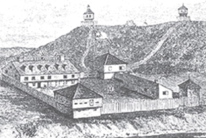
CORRECTION: In the February 29, 2024, issue of The Town Line, the wrong photo of Martha Ballard was published. The correct photo has been added to this online version. It was an editing error.

Up and down the Kennebec Valley: Windsor brooks named for early settlers

map of Windsor, Maine

by Mary Grow

Last week’s article was about ponds in Windsor that were named after people who settled or lived near them. According to Henry Kingsbury’s 1892 Kennebec County history and Linwood Lowden’s 1993 Windsor history, several streams or brooks were also named in recognition of early residents.

Dearborn Brook is the newer name of what Lowden said was the Moody Pond outlet, called in an 1800 deed “Grover’s upper meadow brook on the east side of Oak Hill.”

Dearborn Brook has its origin in southwestern Windsor, near the Windsor-Whitefield town line. It wanders north and east most of the length of the town, with Moody Pond and two other widenings in southern Windsor.

The brook passes west of Windsor’s four corners (the intersection of north-south Route 32 and east-west Route 105); passes under Route 32; and joins the West Branch of the Sheepscot River in northern Windsor.

Besides Grover’s Brook, Lowden said this stream was also called Oak Hill Stream, Meadow Stream, Chases Brook and Colburn Stream or Colburn Brook.

Grover referred to Ebenezer Grover. Lowden identified him as the first man to settle in Windsor, choosing a piece of meadowland in the southeastern area called Pinhook (because of a U-shaped bend in the west branch of the Sheepscot).

Lowden found that Grover was born in York in 1724. He married Martha Grant of Berwick in August 1745; they lived in Georgetown and then in Whitefield on the way to what became Windsor.

Grover “laid claim to, and began to improve” the meadowland in 1781 (when he was 57, Lowden pointed out). He probably moved to Windsor permanently before 1786.

In 1797, Grover, his son Thomas, son-in-law Thomas Day and a neighbor named Abijah Grant had the area surveyed, trying to establish a claim that would compete with the British-based proprietors. Lowden devoted several pages of his history to accounts of Grover’s land dealings.

The historian wrote that Grover’s first home was evidently a house rather than a log cabin. He referenced a Sept. 2, 1797, plan by surveyor Josiah Jones showing “a small building with a glazed window.” It was on the west side of the Sheepscot and a little north of what is now Route 17, Lowden said.

The Grovers probably had three sons and four daughters. Lowden found evidence suggesting Martha Grover died before 1785, and Ebenezer lived with a son-in-law named Joseph Trask, Jr.

Lowden called Grover a man overlooked by historians, who should have credit for his role in Windsor’s early development. Specifically, he deserved recognition for the “first serious mapping” of the town, and for “his significant influence in attracting settlers to this area through his many land transactions.”

* * * * * *

Lowden’s lists of early Windsor settlers include no Dearborns, but the name appears in his history. Your writer has found no evidence explicitly linking the Dearborn family to Dearborn Brook, and no explanation for the stream’s name.

Henry Dearborn, of Pittston, bought half a grist mill at what became Maxcy’s Mills, southeast of the four corners, on May 6, 1823.

In or a bit before 1834, two Dearborns, Henry W. and Dudley T., were among Windsor residents signing a petition to the Maine legislature to dam the Kennebec River at Augusta.

In April 1847, after more than 30 years of declining to build a town house, Windsor voters decided they needed one. They appointed a three-man committee to draft plans and find a site, and on May 15, 1845, they bought William Haskell’s lot for $30.

The deed was signed July 10, 1845; and a second committee, consisting of Haskell, William Hilton and Henry Dearborn, was directed to hire a contractor, plan the building, oversee construction and “accept…the building on completion.”

The voters said work should be done by March 1, 1846, except the plastering – that deadline was June 1, 1846. The first town meeting in the new building started at 1 p.m. May 21, 1846, Lowden wrote.

Lowden quoted an additional provision that allowed “individuals” to add a second floor, providing they paid for it. Evidently they did, because he said this “upper story was used as a school” at first and later as a meeting room for town organizations.

In March 1921, Lowden said, voters decided to replace rather than try to repair the 1846 building.

The on-line site FamilySearch says Henry Wood Dearborn was born in Monmouth Aug. 2, 1798, older son of Dudley (1770-1848) and Keziah (Wood) (1765-1834) Dearborn. The younger son, Columbus, lived only from Sept. 13, 1802, to April 7, 1810. Two daughters lived to adulthood.

On Oct. 20, 1836, Henry married Judith Batchelder (1799-1888); they had “at least one son,” William H.

William H. Dearborn, according to FamilySearch, was born Oct. 13, 1840, in Windsor. In 1862, he enlisted for Civil War service, becoming a member of the 21st Maine Infantry regiment.

This regiment spent two months, from March 21 to May 21, 1863, encamped outside Baton Rouge, Louisiana. There must have been skirmishes with the Confederates, because on May 8, 1863, Lowden said, Dearborn was killed in action – one of at least five Windsor men from the regiment killed in that area that spring.

* * * * * *

Choate Brook was mentioned in the Feb. 15 article as the connection between Savade Pond, in northeastern Windsor, and the west branch of the Sheepscot River. This brook goes southwest under Greeley and Sampson roads and enters the Sheepscot a little west of Sampson Road and north of Route 105.

Lowden named two Choate brothers who were early settlers in Windsor Neck, the northeastern part of the town. They were Aaron Choate and Rufus Lathrop Choate, sons of Abraham Choate, Sr. (March 14 or 24, 1732-April 23, 1800), and his wife, Sarah (Potter) (died in 1811).

Abraham and Sarah were from Ipswich, Massachusetts. Lowden said Abraham came to Whitefield by way of Wiscasset, and owned an interest in a large sawmill at Kings Mills, on the Great Falls in the Sheepscot. An on-line history of Kings Mills says Choate acquired part of the mill and associated rights in 1779.

The genealogy lists Abraham and Sarah’s 14 children: Nehemiah (1757-1775, died on a privateer during the Revolution); Abraham, Jr. (1759-1837); Sally (1761-1837); John (1763-1800); Francis (1764-1799); Aaron (Feb. 7, 1766-March 18, 1853); Moses (1767-1851); the first Rufus Lathrop (1769-1769; lived for less than four months); the second Rufus Lathrop (1770-1771, lived about eight months); Rufus Lathrop (Feb. 28, 1772-Oct. 17, 1836); the first Hannah ( 1774-1774; lived three months); Hannah (1777-1873); Polly (1779-1859); and Ebenezer (1783-1876)

Abraham, Jr., was born in Ipswich in 1759; married Abigail Norris, of Whitefield; and died April 12, 1837. Lowden called him “a prominent citizen of Whitefield.”

According to the on-line genealogy, Aaron was born in Ipswich. On Dec. 20, 1788, in Pownal, he married Elizabeth Acorn of Waldoborough (born about 1770, died in 1844). Before moving to Windsor, they lived in Whitefield, where Lowden said Choate ran the mill his father bought into.

They must have moved while Windsor was still Waterford Plantation, because Aaron Choate is one of those who petitioned to have it incorporated as a town in January 1808.

(Lowden pointed out that the petitioners clearly asked the Massachusetts legislature to name their town Alpha, but the legislation that was approved called it Malta. He explained the change as “the slip of a clerk’s pen.”)

Aaron and Elizabeth had five sons and five daughters, born between 1789 and 1807 (or later), the genealogy says. According to both the genealogy (whose writer used the phrase “It is said”) and Lowden, it was Aaron Choate’s land that Paul Chadwick was surveying when he was murdered by settlers on Sept. 8, 1809, and Choate witnessed the murder.

Elizabeth reportedly died in Windsor, Aaron, in China.

Lowden listed their second son, Aaron, Jr. (May 17, 1792- June 21, 1874), among 13 men who bought pews when the Congregationalists and the Freewill Baptists built the Union Church (aka the North Meetinghouse) in 1827 on Windsor Neck.

Abraham, Jr., and Aaron’s younger brother, Rufus Lathrop, spent “part of his youth” with his uncle in Norwich, Connecticut, Lowden wrote. Kingsbury said he moved to Windsor Neck about 1812.

In Connecticut, he married Elizabeth “Betsey” Maynard. Find a Grave shows their double headstone in the Hallowell Village cemetery; the website says she was born in 1785 and died March 18, 1863, and gives his birthdate as Feb. 18, not Feb. 28, 1772.

Lowden’s list of Windsor men who served briefly in the War of 1812 (mentioned last week) includes private Rufus Choate.

In the mid-1830s, Washington Choate and Thomas Choate (Lowden did not explain where they fit into the family – Aaron’s nephews, perhaps?) were briefly part-owners of a mill on a dam across the west branch of the Sheepscot near the confluence with Dearborn Brook. The dam caused the river and brook to back up onto land owned by 20 people Lowden listed, including Aaron Choate.

Lowden called the Choates one of Windsor’s “five basic families” (the others were the Hallowells, Merrills, Pierces and Sprouls), who were the ancestors of “almost all native residents” when he wrote his history in 1993. In addition to the family members mentioned above, readers may remember from previous articles in this series that he often cited the diary of Orren Choate (June 20, 1868-1948).

Sheepscot River

A 2018 article on the history of the Sheepscot River by Arlene Cole, Newcastle historian and weather recorder, includes a description of its course to the Atlantic Ocean.

Cole wrote that the western branch begins in a swamp in southern Albion and goes through Palermo, where the dam at Branch Mills backs up its flow to form Branch Pond; China, including Weeks Mills Village; Windsor; and Whitefield.

The eastern branch, which Cole called Turner Brook, starts in Palermo, she wrote; the deLorme atlas shows branches from Palermo and Liberty joining, detouring into Montville and returning to Palermo. Trending southwest through Sheepscot Pond, this stream passes through Somerville and joins the west branch south of the village of Coopers Mills in Whitefield.

Cole said this junction marks the beginning of the true Sheepscot River. Above, she wrote, the west branch is 21 miles long and the east branch 14.5 miles long. Below, the river runs another 34 miles to the Atlantic.

Your writer found on line three explanations for the name that has become “Sheepscot.”

One was proposed in 1869 by Rev. Edward Ballard, of Brunswick (then secretary of the Maine Historical Society), as part of a list of Geographical Names on the Maine Coast reprinted in the appendix to an undated national coast survey.

Ballard divided the name into three parts from the Etchemnin (or Etchemin, a subdivision of Algonquian) language: “seep,” which he said means a bird; “sis,” meaning little; and “cot,” meaning place or location. He combined them to mean “Little-bird-place,” and wrote that each year “at the proper season” Maine Natives harvested young ducks on the river.

Cole said the name was Abnaki (Abenaki), another branch of Algonquian. Originally it was Pahsheapsakook, she wrote. She quoted Fanny Hardy Eckstorm’s division – “pahshe” means divided; “apak” means rocks; “ook” means water place or channels – and concluded the name means the place where “the river is split up into many rocky channels.”

A third source, Alfred L. Meister, in the introduction to an undated report on Atlantic salmon in the river, said James Davis of the Popham Colony (1607-1608 in what is now Phippsburg) called the river the Pashipakokee, and other early historians (whom Meister did not name) called it the Aponey or Aponeag. Meister said early fisheries included alewives, salmon and shad.

Main sources

Kingsbury Henry D., ed., Illustrated History of Kennebec County Maine 1625-1892 (1892).
Lowden, Linwood H., good Land & fine Contrey but Poor roads a history of Windsor, Maine (1993).

Websites, miscellaneous.
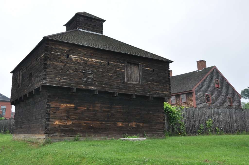
Up and down the Kennebec Valley: People for whom ponds are named, part 4

by Mary Grow

A suggestion to readers: this story will be easier to follow if you have a map of Windsor, Maine. Do not believe everything you see, however; your writer noted discrepancies between on-line maps and official tax maps of Windsor and its neighboring towns. Two Kennebec County atlases, published in 1856 and 1879, offer other variations.

Windsor is the southeasternmost of the dozen municipalities this series has included in the central Kennebec Valley. Henry Kingsbury called its shape unique in Kennebec County, with “four equal sides and four right angles.”

Windsor covers 36 square miles, Kingsbury wrote. Starting as New Waterford Plantation, it was incorporated as Malta in 1809, became Gerry in 1820 and Windsor in 1822.

It is bordered by Vassalboro and China on the north, Augusta on the west, Somerville on the east and Whitefield on the south. Only Vassalboro and Augusta have frontage on the Kennebec River.

Kingsbury counted “seven distinct bodies of water” partly or wholly in Windsor. Windsor’s tax maps show five named ponds (plus others that are nameless, and numerous wetland/swamp areas) entirely within town boundaries. Four more ponds – Wellman and Given in the south, Threemile (or Three-mile, to Kingsbury) in the northwest, Long in the northeast – are shared with neighbors.

Some of these ponds derived their names from early settlers, according to Kingsbury and Windsor historian Linwood Lowden.

* * * * * *

map of Windsor, Maine

WELLMAN POND

Starting, arbitrarily, in the southwestern corner of Windsor, on the border with the City of Augusta, the Windsor tax map shows that Windsor includes a small part of the east shore of Wellman Pond. (An on-line map shows this pond entirely in Augusta.) This pond might well have been named after a Wellman family, but your writer was unable to find evidence.

The Lakes of Maine website says this pond has an area of 12 acres. It gives no depth.

The Windsor tax map shows the State of Maine owning the land around the Windsor end of the pond, and a large surrounding area that includes Baker Bog a short distance northeast.

East of Wellman Pond and a short distance south of Route 17, Windsor tax maps show the northern tip of Given (or Given’s; formerly, as on the 1856 and 1879 maps, Longfellow) Pond inside the Windsor town line. Three-fourths of the pond is in Whitefield, Kingsbury said.

The Maine Inland Fisheries and Wildlife (IF&W) website says this pond covers 20 acres; Lakes of Maine says 23 acres. Both give its maximum depth as 20 feet.

Kingsbury wrote that Longfellow Pond “probably” took that name “from an early settler,” and was definitely renamed Given’s Pond to honor “another family living on contiguous land.”

Lowden said David Given, born in Newcastle Sept. 4, 1779, and married to Mary Marson there on Dec. 1, 1803, came to Windsor in or after the spring of 1808. He “settled to the east of Given Pond.”

In Kingsbury’s version, David Given arrived in 1810 with his son James (1792-1881). The 1856 and 1879 maps both show J. Given living northeast of Given Pond.

James and his wife, Elizabeth “Betsey” (Johnson) Given (Feb. 27, 1797-March 6, 1888), had three sons (one named David, who was, in 1892, living on what had been his grandfather’s farm, Kingsbury said).

They also had a daughter named Annie (1821-September 1822), who was the first or one of the first people to be buried in the Oak Hill (or Colburn or Coburn) cemetery. The Find a Grave website shows a gravestone Annie shares with Elizabeth J. Given, born in 1830 and died June 17, 1888, at the age of 58.

Family members listed on the Given monument, also pictured on Find a Grave, include an earlier David, born in 1745 and died Jan. 8, 1825, and his wife, Ann, born in 1749 and died Oct. 5, 1832; James’ widow, Betsey (whose birth year is listed as 1795); and David (probably James and Betsey’s son), born in 1837, married Sylvia Le Ballister (1848-1930), and died in 1921.

The youngest David was a teacher as well as a farmer, and served the town as a selectman for eight years and supervisor of schools for three years, Kingsbury said.

* * * * * *

East and north of Wellman and Given ponds, close enough to Wellman so the State of Maine owns its western shore, is long, narrow Moody Pond, the southernmost widening of Dearborn Brook.

According to Kingsbury, Moody’s Pond, near Given’s Pond, “received its designation in a similar manner” to Given’s. Lowden found that Windsor attracted several families named Moody, one (or more) of whom might have lived close to Moody’s Pond.

Deacon Clement Moody, Lowden wrote, was born in Nobleboro c. 1746; an on-line source corrects the date to 1776, which fits better with his history. He died May 5, 1863.

Lowden said Clement and Mary (Moody) filed marriage intentions April 4, 1796, in Nobleboro; presumably they married soon afterward. Mary Moody Moody was born Dec. 10, 1772. She died Dec. 10, 1856, according to an on-line genealogy, or Dec. 10, 1865, according to Lowden.

Lowden wrote that the Moodys came to Windsor in the summer of 1801. Clement served as deacon of the Whitefield Baptist Church, and in 1820 helped organize the North Windsor Baptist Church.

Clement’s land was on the Windsor-Whitefield line in southern Windsor. Lowden wrote that he sold his property to his nephew, Clement Moody II, Richard’s son.

Your writer worked hard to unscramble the Moody genealogy. She concluded that Richard Moody, another early settler Kingsbury named, was Deacon Clement’s brother.

An on-line source says Richard was born in Nobleboro in 1762 and died in Windsor in 1839. This source lists only one (the oldest?) son in each succeeding generation.

Richard, if your writer interpreted different incomplete sources correctly, had (at least) three sons.

John was born Dec. 4, 1789. Lowden’s list of early Windsor residents says he owned land on Windsor Neck in the northern part of town.

Richard II was born in 1793 in Nobleboro and died in 1876 in Windsor. The on-line source lists the younger Richard’s son as Clement F., born in 1823 in Windsor and died there in 1888; and Clement F.’s son as John H. (1868-1952).

Richard I’s son Clement was born in 1800 and died in 1858. Clement’s son Miles was living when Kingsbury finished his history; Kingsbury said he had moved in 1888 from “the old homestead where his father died” to South Windsor to take care of his in-laws.

Lowden’s list of Windsor men who served briefly in the War of 1812 (they spent less than three weeks in Belfast after the British had occupied it, he wrote) includes Sergeant Clement Moody and private John Moody (uncle, in his mid-30s, and nephew, aged 22, if your writer’s genealogical conclusions are correct).

The 1866 Windsor school committee report included in Lowden’s history lists Miles Moody as District 2 school agent and yet another Clement Moody as District 7 agent.

* * * * * *

Less than a mile south of Windsor’s four corners (the intersection of Route 32 and Route 105), on the east side of Route 32, is a small round pond ignored by IF&W and Lakes of Maine, but mentioned by Lowden and Kingsbury. It is nameless on contemporary tax maps; the historians said its names have included Dorr’s Pond, Donnell Pond (on the 1856 and 1879 maps) and Grant Pond (to Kingsbury in 1892).

This “aqueous lilliputian” covers a little more of an acre, but is worth notice because, Kingsbury wrote, “it has no perceptible outlet, and, as near as can be ascertained by soundings, no bottom.”

Your writer found no relevant Dorrs or Grants. The name Donnell Pond recognizes Methodist preacher, Rev. Moses Donnell, Jr.

Donnell was born in Wiscasset Aug. 25, 1789, and came to Windsor in March, 1818. He kept detailed records, from which Lowden took information about his strenuous life and how much – or little – money he earned. Lowden listed different houses Donnell probably owned at different times and wrote that he preached in Windsor in 1822 and again from 1832 until his death.

After 1838, he was appointed to different circuits, preaching in multiple towns and traveling thousands of miles. His home base was Windsor; Lowden said he moved back for good on Dec. 3, 1839, taking over the “circuit house” that stood between Donnell Pond and the road that is now Route 32.

The Find a Grave website says in 1817, Donnell married Martha Cunningham, born in 1793. The couple named their children Mary (1819-1876), Jeremiah (1821-1906), John Wesley (1826-1869) and Moses (1833-1904).

Rev. Donnell died on October 2, 1861, and Martha sometime in 1868. Find a Grave has a photo of the family monument in Windsor’s Resthaven Cemetery, which is on Route 32 a short distance south of his former house.

* * * * * *

MUD POND

Other ponds in or partly in Windsor are not named for people.

Going back west to the Augusta line, north of Route 105, is Mud Pond (and on the tax map another unnamed pond north of it). It covers either 52 acres (IF&W) or 65 acres (Lakes of Maine) and has a maximum depth of 12 feet. Located below Porcupine Hill, Mud Pond is accessible by “an old woods road and trail,” the state says.

Barton Brook connects Mud Pond with the south end of Threemile Pond, which is mostly in Windsor’s northern neighbors, China and Vassalboro.

THREE MILE POND

Threemile Pond is the largest of the named lakes – 1,162 acres, according to IF&W, or 1,174 acres according to Lakes of Maine. Its maximum depth is 37 feet; it has shore frontage in Vassal­boro on the northwest and China on the northeast. Public access is via the state-owned boat landing on Route 3, in Vassal­boro.

The on-line Google map shows town lines following the shoreline to leave the pond entirely in China & Vassalboro. All three towns’ tax maps show straight lines, putting the triangular southern end of the pond, and one of its four small islands, in Windsor.

To Kingsbury, this pond’s name “requires no elucidation.” Wikipedia relates the name to its size, saying that “Despite the name,” the pond is 2.71 miles long.

Jumping to northeastern Windsor, near the Somerville town line, on-line maps show four more ponds; the tax map shows two and some swampland. The smaller northeastern pond is named Fox Pond. The tax map shows a brook – one-eighth of a mile long, Kingsbury wrote — connecting it with larger Savade Pond.

Savade Pond’s outlet flows a short distance west into the intersection of Bull Brook and Choate Brook. Choate Brook flows into the west branch of the Sheepscot River. The State of Maine has a Savade Pond boat landing on a 14.1-acre parcel on Greeley Road.

Kingsbury said Fox Pond was “a favorite resort” of wild foxes. Savade he equated with “surveyed.”

South of Route 105 on Windsor’s eastern boundary, Long Pond is a wide place in the west branch of the Sheepscot River, on the Somerville town line. This pond covers 523 acres (IF&W) or 504 acres (Lakes of Maine), and is only 16 feet deep at its deepest.

Main sources

Kingsbury Henry D., ed., Illustrated History of Kennebec County Maine 1625-1892 (1892).
Lowden Lowden, Linwood H., good Land & fine Contrey but Poor roads a history of Windsor, Maine (1993).

Websites, miscellaneous.
Up and down the Kennebec Valley: People for whom ponds are named, Part 3

by Mary Grow

Dutton Pond

A small pond shared between Albion and its southern neighbor, China, has been known as Dutton Pond for as long as your writer has lived in China. But the map of China in the 1856 and 1879 atlases of Kennebec County names it Pickerel Pond.

Pickerel/Dutton Pond is on the north side of Dutton Road. Dutton Road branches off from Pleasant View Ridge Road, which goes east from Route 202 at the four corners southeast of China Village, on the northeast corner of China Lake’s east basin. At the top of a hill, Pleasant View Ridge Road turns sharp right (south); Dutton Road plunges down the other side of the hill, still heading east, passes the south end of Dutton Pond and crosses into southern Albion, where it becomes Libby Hill Road.

On the 1856 and 1879 maps, C. E. Dutton owned the house on the north side of the corner where Dutton and Pleasant View Ridge roads diverge. Diagonally across Dutton Road, in the southeast corner of the T intersection, was a schoolhouse.

Charles E. Dutton was neither an early settler in China nor a native of the town; he probably arrived in 1851 as a teenager (see below).

According to the Find a Grave website, Dutton was born Dec. 8, 1839. Henry Kingsbury, in his Kennebec County history, wrote that Charles was the son of Coffran Dutton and grandson of Jonathan Dutton, “who moved from Montville to Vassalboro, and in 1839 lived where Melvin Applegate now resides.” If Jonathan brought his family, Charles was born in Vassalboro.

Kingsbury continued, “In 1851 they [three generations again?] moved to China.” He next wrote that Charles Dutton married Annis W. Barlow, who was born in Freedom, Maine, Sept. 6, 1846 (or 1847, according to an on-line genealogy).

The China bicentennial history portrays Dutton as an educator first and foremost. Kingsbury listed him as a China selectman, elected in 1873 and serving seven terms, four of them as board chairman.

School District 7, in northern China, was named the Dutton district. The 1856 and 1879 maps each show a schoolhouse (the history says there were three consecutively), and apparently another was built for the 1886 school year. The Dutton district school was closed in 1902.

Each China school district had a school agent, usually elected by town meeting voters, whose responsibilities included allocating funds and recommending how many school terms to have for how long each year and what teacher(s) to hire. School agents were responsible to the town’s school committee (until 1857 and from 1863 to 1870) or to the school supervisor.

(China had a maximum of 22 school districts, rearranged repeatedly. School was usually held two terms a year, a shorter one [between a month and three months] in summer and a longer [two to four months] winter term. Dates were not standardized; and a district might skip or shorten a term, especially if money were tight.)

The China history includes Charles Dutton on a list of people who taught many terms, “usually with favorable comments.” Kingsbury wrote that he taught 27 terms, “nearly all in the town of China.” One term mentioned in the history was in the winter of 1872-1873: Dutton taught algebra in the China Village school, close to his home.

Dutton must have been China’s supervisor of schools in 1878, because he reported in 1879 that there were too many different textbooks in use – 20 geography texts, for example, some “so old that they listed only the first thirty-three states in the United States.” (The 34th state, Kansas, was admitted Jan. 29, 1861; it was followed by West Virginia in 1863, Nevada in 1864, Nebraska in 1867 and Colorado in 1876, for a total of 38 states by the end of 1878.)

At the March 1879 town meeting, voters accepted Dutton’s recommendation to appoint a five-man committee to look into consolidating school districts and standardizing textbooks. He and four other distinguished residents reported to a special meeting held May 5, 1879.

The history says nothing about districts, but it says voters approved the committee’s recommended textbooks and voted “to sustain” Dutton as he introduced them and disallowed all others. Dutton bought the books and, the history says, donated his commission to the students, who had to buy them in turn.

(Alas, by 1886 a new supervisor was again deploring the variety of texts; he recommended the town start buying and owning books for students. In August 1890, a state law “requiring towns to provide free textbooks” became effective. China spent $862 for textbooks in 1891and by the beginning of 1893 owned 1,730.)

In 1879-1880, Dutton was again supervisor of schools. The history related his dealings with a Colby College student whom he hired without examination, assuming him qualified, for another northern China district.

There were soon complaints that the young man “could not do arithmetic and was generally incompetent.” Dutton found the complaints valid and fired the teacher; district parents “relented and petitioned that he be reinstated.”

He came back, “but remained incompetent, and Mr. Dutton felt that the students’ time had been wasted.”

In the fall of 1879, supervisor Dutton visited the District 16 school in western China, where he found three students. The China history says he “promptly went to see some of the district parents, who told him they simply were not ready to have their children gone for five or six hours a day.” (Whether the children were too young, or were old enough so they were needed to help with fall work, the history does not say.)

Dutton unsympathetically ordered the school to stay open. The parents’ money therefore continued to be spent; and, the history says, “the students soon appeared.”

Dutton was a Mason. Kingsbury listed him as master of Central Lodge in China Village in 1864 and 1869, and of the village’s second Masonic organization, Dunlap Chapter, in 1875 and 1886.

He was active in the China Cemetery Association, organized in 1865 to manage the large China Village cemetery at the head of the lake (and since the 1940s the extension cemetery on Neck Road). The bicentennial history says he was president of the organization in the 19th century (citing Kingsbury, so before 1892) and from 1911 to 1921.

A list of members of Maine’s 17th legislature, in 1911, includes Charles E. Dutton from China.

Charles and Annis Dutton had four children. Find a Grave lists a daughter, Idella, born in 1869; twins, Arthur J. and Fannie A., born July 18, 1874; and a younger son, Everett E., born Jan. 26, 1887. All lived past 1950.

Idella married Fred H. Lewis (1860-1933), of China, and is buried with him in the China Village cemetery.

Charles Dutton died in China Sept. 5, 1922; Annis died in China April 5, 1926. Both are buried in the China Village cemetery; the same gravestone names them and their other three children.

Dutton Pond, shared between China and Albion, has an area of 57 acres and a maximum depth of 33 feet, according to the Maine Department of Inland Fisheries and Wildlife and to Lake Stewards of Maine.

* * * * * *

Evans Pond

China’s Evans Pond is south of Dutton Pond and entirely within the town. It lies on the east side of Hanson Road; Hanson Road runs roughly north-south east of China Lake, approximately half-way between Lakeview Drive along the lake and Pleasant View Ridge Road farther east.

The pond was named for an early settler – before the Revolution, Kingsbury wrote, and “contemporary with the pioneers” (the Clark brothers, who came in 1774) – named Joseph Evans.

An on-line source calls him Joseph Evans, Sr., born Nov. 23, 1740, in Dorchester, Massa­chusetts, to Richard and Zipporah (Blake) Evans. On April 28, 1766, he married Ame (also Ama, Amey, Ann or Anna) Payson, in Sharon, Massachusetts. She was born before July 22, 1750.

This source says Joseph “registered for military service” in 1777, but does not say from where – if Kingsbury is correct, from what is now China (which was Jones Plantation until 1796 and Harlem until 1818).

Kingsbury said he left his wife and children in the wilderness by Evans Pond while he served in the Revolution. (The first four of the Evans’ four sons and three daughters were born before 1775, this source says; another on-line site lists only one son.)

The seven-child on-line source says the Evans’ youngest daughter, Zipporah, was born in Vassalboro in 1781; married in China in 1802; and died in Houlton in 1854. Their youngest son, Nathaniel, Jr., was born in 1788 in China and died there in 1861.

This source puts Evans in Lincoln, Maine, in 1790. If so, he was back in China by 1797; the bicentennial history names Joseph and Nathaniel Evans among founding members of the First Baptist Church of Harlem, organized that year.

Nathaniel Evans could have been Joseph’s younger brother, born in Dorchester April 5, 1745; married in Vassalboro in November 1772; “registered for military service in 1777 [with his brother?]”; and died June 14, 1819, in Searsmont.

The China history says Joseph Evans was in Harlem in 1801 and 1802, and in 1801 a comparatively well-off resident: town meeting voters entrusted a pauper named Jack to his care. Evans was to receive “thirty dollars and the use of a cow” in return, prorated if Jack stayed less than a year with him.

In 1802, town meeting voters were asked to accept as a town road “the road between Joseph Evans’ dwelling and the lake [China Lake, presumably].”

The on-line source says Joseph died in mid-April 1826 and Ame sometime after 1830, both in China.

Kingsbury gave a paragraph to one of Joseph and Ame’s grandsons, Cyrenus Kelley Evans (May 13, 1816-Dec. 4, 1891). Find a Grave’s website has a photo of his gravestone in the South China Village cemetery that says his name was Cyrenius.

This Evans married Ephraim Clark’s granddaughter Asenath Clark (May 24, 1820-Oct. 9, 1911), thereby uniting two of China’s early families.

Kingsbury wrote that Evans “filled important positions in China and was twenty-one years justice of the peace.” The Find a Grave website says, “Mr. Evans filled important positions in China, and was twenty-one years of age when justice of the peace.”

A June 1870 on-line list of Maine magistrates says Evans was appointed a justice of the peace March 4, 1868, but does not specify whether that was his first appointment.

Evans Pond has an area of 19 acres and a maximum depth of only 14 feet, according to the Department of Inland Fisheries and Wildlife (as of 2000). Lake Stewards of Maine gives the size as 29 acres and agrees on the depth.

Main sources

Grow, Mary M., China Maine Bicentennial History including 1984 revisions (1984)
Kingsbury, Henry D., ed., Illustrated History of Kennebec County Maine 1625-1892 (1892)

Websites, miscellaneous.
Up and down the Kennebec Valley: People for whom ponds are named – Part 2

An 1837 engraving of the assault on Elijah Lovejoy’s printing company, in Alton, Illinois, where he was murdered for his anti-slavery beliefs.

by Mary Grow

Moving east from Winslow to Albion, that town has Lovejoy Pond, named after an early family who settled beside it.

Which family member came first is debated. Henry Kingsbury, in his Kennebec County history, named Rev. Daniel Lovejoy. Ruby Crosby Wiggin, in her history of Albion, said no, Daniel’s father, Francis Lovejoy, came first.

Francis Lovejoy was born in Andover, Massachusetts, in 1734. Wiggin wrote that he, his wife Mary (Bancroft), born in 1742, and their children came to Maine in 1790.

Lovejoy Pond

Francis left some of the family with his brother Abiel “on the Kennebec,” Wiggin said, while he cleared land for a cabin on the west shore of Fifteen-Mile Pond (Lovejoy Pond’s first name, reportedly because it was 15 miles from Fort Western).

Kingsbury included in his history an undated sketch map of the town of Fairfax (later Albion) showing “Rev D Lovejoy” – Francis and Mary’s son (see below) — owner of a rectangular lot on the west shore of the pond, near the south end.

(Your writer is sure the brother “on the Kennebec” was Captain Abiel Lovejoy, born Dec. 16, 1731, in Andover, and died July 4, 1811, in Sidney, Maine, according to Find a Grave. Alice Hammond’s 1992 history of Sidney includes an interesting summary of his life written by a descendant.)

Albion did not become Albion until February 1824. It started as Freetown Plantation in 1802, was renamed Fairfax in March 1804 and Lagonia (or Lygonia or other spellings) in March 1821.

Daniel Lovejoy was born March 31, 1776, in Amherst, New Hampshire, and died Aug. 11, or possibly Oct. 11, 1833. Wiggin said he was the youngest son of Francis and Mary’s four boys and three girls.

Daniel Lovejoy was a farmer and a Congregational minister. Wiggin listed him as one of three founders of the Congregational church in Albion in 1803.

When the Maine Missionary Society was founded in Hallowell in June 1807, Lovejoy was elected as one of its 52 new members, Wiggin said. He was also part of the Massachusetts Society for Propagating the Gospel.

Wiggin summarized a January 1808 trip for one – or both – of these groups that took him to Freedom, Unity, Burnham, Palmyra, Pittsfield and Vassalboro, among other places. She found that he was “licensed to preach” and later “ordained an evangelist” (no dates given).

From at least 1813, Lovejoy was clerk of the Albion church. In June 1829, Wiggin wrote, he “was installed as pastor” of four area churches, in Albion, Unity, Washington and Windsor. The Albion congregation built its first church in 1831-1832, meeting there for the first time Nov. 12, 1832. That meeting, Wiggin commented, was the last one that Lovejoy reported as clerk before he died.

He served in several town offices. Wiggin and Kingsbury said he was elected town clerk and town treasurer at Freetown Plantation’s first town meeting, held Saturday, Oct. 30, 1802, beginning at 10 a.m. They disagreed on how long he held each office – two or three terms as clerk and one or two as treasurer.

At a Monday, March 28, 1803, meeting, voters approved petitioning the Massachusetts General Court to incorporate “this plantation” with its current boundaries. They appointed Lovejoy to act as their agent in sending the petition.

In 1804, he was one of the three men on Fairfax’s first school board.

In January 1823 a Lagonia special town meeting appointed a five-man committee to petition the legislature – by then the Maine legislature in Portland – to rename the town Richmond. Daniel Lovejoy was on this committee, as was Joseph Cammet (see below), who, like Lovejoy, had been active in town affairs for years.

(The Town of Richmond, on the west bank of the Kennebec River south of Gardiner, was incorporated Feb. 10, 1823, and was named for Fort Richmond, built in 1719. Was Lagonia’s petition too late?)

On Sept. 20, 1801, in Albion, Daniel Lovejoy married Elizabeth Gordon Pattee, born Feb. 8, 1772, in Georgetown. This Elizabeth Pattee was not Ezekiel’s daughter Elizabeth, mentioned last week, who was born in 1777 and married Edmund Freeman. This one was a cousin of the younger one, daughter of Ezekiel’s youngest brother, Ebenezer (1739 or 1740-1825).

Daniel and Elizabeth Lovejoy had two daughters – they named the one born in 1815 Elizabeth Gordon – and either five or, probably, seven sons (sources disagree). Wiggin wrote that one son “died soon after birth,” one when three years old and one “as a very young man.”

Kingsbury wrote that Rev. Daniel Lovejoy “caused the greatest sensation the quiet community had ever known by hanging himself in his barn” in June 1833. Wiggin did not repeat this story.

Elijah Lovejoy

Daniel and Elizabeth’s most famous son was anti-slavery activist Elijah Parish Lovejoy (1802-1837). He was profiled in this series in the Aug. 13, 2020, issue of The Town Line.

Joseph Cam­mett Lovejoy (1805-1871; did Daniel choose the name to honor his local colleague? The revised spelling, Cammett instead of Cammet, is from Wikipedia) is summarized on Wikipedia as “clergyman, activist, and author.” Wiggin called him Reverend.

Wiggin wrote that Joseph graduated from Bowdoin College, Class of 1829. On Oct. 6, 1830, he married Sarah Elizabeth Moody (1806-1887 or 1888; sources differ), of Hallowell, at her family home in Hallowell.

An on-line source lists their 10 children, born between 1831 and 1852. The first four were born in Bangor and Orono, where an on-line report says Lovejoy was working with the Penobscots on Indian Island and may have started a school for them.

Wiggin found records of his service as a military chaplain for two months in the spring of 1839, during the 1838-1839 Aroostook War (see the March 17, 2022, issue of The Town Line).

His activism included abolitionism. He was a contributor to The Emanci­pator, started in 1833 by the American Anti-Slavery Society; and on-line sources list him as publisher of or contributor to the Hallowell-based anti-slavery paper Liberty Standard (1841-1848).

One of Joseph and Elizabeth’s sons was born in 1841 in Hallowell. Their last five children were born in Cambridge, Massachusetts, where Wiggin said Lovejoy was a pastor from 1843 to 1853. He was later a civil servant in Boston.

After the family moved to Massachusetts, Lovejoy became what Kingsbury called “an anti-prohibitionist,” as the temperance movement changed from moderation to prohibition (Maine’s prohibition law passed in 1851). Two of his pamphlets, found on line, are titled Prohibition Ground to Powder! (1869) and The Errors and Crimes of Prohibition (1871).

Lovejoy introduced the first pamphlet by saying that he had predicted the fiery debates over prohibition in a sermon 17 years earlier. Now, he wrote, he had “stood in that fire for seventeen years,…a long time to endure privation and abuse.”

He remained steadfast, he wrote, because “I told the truth in vindication of God’s word and Christ’s example; and in defence of the personal rights of every human being.”

Lovejoy began the 1871 pamphlet with a history of drinking, from the Assyrians (who, Lovejoy said, welcomed guests and honored their gods with wine) to Christ’s endorsement of wine. From this background, Lovejoy argued that the prohibitionists’ claim that alcohol was poison “is a broad and palpable falsehood.”

Prohibition was “founded on falsehood” and impossible to enforce, he continued. He called prohibitionists “guilty of great immorality”; and he said the execution of prohibition laws was “immoral and criminal.”

Wikipedia lists two biographies Lovejoy wrote. He and his younger brother Owen co-wrote and published in 1838 their Memoir of the Rev. Elijah P. Lovejoy; Who Was Murdered in Defense of the Liberty of the Press, at Alton, Illinois, Nov. 7, 1837.

Joseph’s second book, Wikipedia says, was titled Memoir of Rev. Charles T. Torrey, Who Died in the Penitentiary of Maryland, Where He Was Confined for Showing Mercy to the Poor, published in Boston in 1847. Other sources say Torrey wrote it and call Lovejoy the editor or a contributor.

Joseph Lovejoy died in Cambridge in 1871; Sarah died in Boston in 1887 or 1888; both are buried in Cambridge.

Owen Lovejoy (1811-1864) worked on the family’s farm until he was 18 and then, with the family’s encouragement, spent three years (1830-1833) at Bowdoin College, though Wiggin said he did not graduate. He joined older brother Elijah, in Alton, Illinois, and was present when a pro-slavery mob killed Elijah and destroyed his printing press the night of Nov. 7, 1837.

Wiggin wrote that Owen Lovejoy studied theology in Alton and was a pastor in Princeton, Illinois, from 1838 to 1854. (Princeton is about 175 miles north of Alton and about 100 miles southwest of Chicago.)

Owen was an abolitionist and an Underground Railroad conductor in Illinois. He was elected a state legislator in 1854, and worked with his friend, Abraham Lincoln, to form the Illinois Republican Party. Elected to the U.S. Congress in the fall of 1856, he continued to represent Illinois from 1857 until his death.

Elijah’s youngest brother, John Ellingwood Lovejoy (1817-1891), was appointed by President Lincoln as U.S. consul in Peru; Wiggin said he served three and a half years. He moved to Iowa before 1843, if Find a Grave is correct in saying his four children were born there. Wiggin wrote that he “retired as a farmer.”

Find a Grave lists four family members buried in Albion’s Lovejoy cemetery; there are also unmarked fieldstones, the Town of Albion on-line site says. Marked graves are of Rev. Francis Lovejoy (Oct. 30, 1734-Oct. 12, 1818); his wife, Mary Bancroft Lovejoy (Aug. 2, 1742-May 8, 1792); Francis and Mary’s son, Rev. Daniel Lovejoy (March 31, 1776-Aug. 11, 1833); and Daniel and Elizabeth’s son, the first Owen Lovejoy (July 9, 1807-1810).

Several sources say this cemetery is on the west shore of Lovejoy Pond overlooking the water. A photograph on Find a Grave’s list of a dozen cemeteries in Albion confirms this information, showing a sign, gravestones and a pond; and your writer has driven past the cemetery sign on Pond Road.

The Town of Albion information on Lovejoy cemetery adds the cemetery is on South Vigue Shore Road. The map accompanying the information shows no cemetery near Lovejoy Pond.

By the time Wiggin finished her history in 1964, Albion had put up a monument marking Elijah Lovejoy’s birthplace. Colby College, from which he graduated in 1826, had established the annual Elijah Parish Lovejoy Award (in 1952) and named a new building in his honor (in 1959). The college also maintains Albion’s Lovejoy cemetery.

(The June 11, 2020, issue of The Town Line has more information on this family and other early Albion residents, and – returning to a recent theme – a partial list of early dams and mills on Albion’s principal stream.)

Lovejoy Pond, in Albion, the Maine Department of Inland Fisheries and Wildlife says, covers 324 acres and has a maximum depth of 32 feet (as of 1997). The Lake Stewards of Maine site agrees on the depth and, as with Pattee Pond, reduces the size, to 279 acres.

Main sources

Kingsbury, Henry D., ed., Illustrated History of Kennebec County Maine 1625-1892 (1892).
Wiggin, Ruby Crosby, Albion on the Narrow Gauge (1964).

Websites, miscellaneous.