Up and down the Kennebec Valley: Windsor

by Mary Grow

This article continues the subseries on how the dozen towns in this history series got their names.

So far, names have been traced up the Kennebec River on the east bank, from Augusta to Clinton, inclusive. There are two other groups: on the east, four towns – from south to north, Windsor, Palermo, China and Albion – that do not have Kennebec River frontage; and on the Kennebec’s west bank, four towns/cities: from upriver to down, Fairfield, opposite Clinton and Benton; Waterville, opposite Winslow; Sidney, opposite Vassalboro; and (again) Augusta, on both sides of the river.

Your writer has chosen next to discuss the eastern towns, starting with the southernmost, Augusta’s eastern neighbor, Windsor. Henry Kingsbury commented in his Kennebec County history, at the beginning of his chapter on Windsor, that the town had “two of its sides parallel with the general course of the Kennebec river,” though it had no frontage.

Windsor’s river is the Sheepscot. The East Branch of the Sheepscot flows southwest from Sheepscot Pond in southern Palermo through northwestern Somerville and forms a short stretch of Windsor’s southeastern boundary. The West Branch flows south from Branch Pond in northern Palermo through southeastern China and the length of Windsor.

(The two branches join in Whitefield, a short distance south of the Windsor town line. The combined Sheepscot continues past Wiscasset into the Atlantic.)

The area that became Windsor, like the future towns of Benton and Clinton (see the June 13 article in this series), was full of mature hemlocks and pines. Kingsbury said “spars” for the USS Constitution were cut here; presumably, they were floated down the Sheepscot to end up on the ship, attached to the mast that had been cut in Unity and floated down the Sebasticook and Kennebec.

The on-line Maine an Encyclopedia dates the earliest Windsor settlers to 1790, when the area was part of the Plymouth or Kennebec claim. Kingsbury agreed, and named the first settler as former Bristol resident Walter Dockindoff.

Linwood H. Lowden, in his 1993 history of Windsor, said the beginning of settlement was Ebenezer Grover’s 1781 claim to a meadow northeast of the junction of Pinhook Stream and Gully Brook, in southern Windsor. Grover had a farm in Whitefield (then Ballstown), which he sold in December 1786; Lowden surmised he moved to the Windsor property before then, and built his Windsor house “sometime before 1797.”

Kingsbury did not explore the town’s various names; Lowden did. In his account, the southern part of present-day Windsor began as Pinhook Settlement. That name overlapped with the name New Waterford Plantation, and was succeeded by Malta, Gerry and Windsor.

“Pinhook,” Lowden wrote, was the name Grover and his associates gave to the area where Grover settled, probably because it was “close to the ‘hook’ in the West Branch.” The hook is a U-bend where the river goes south, west and north before resuming its course; it appears on contemporary maps on the north side of Route 32.

Lowden cited a series of early documents that called the area “Pinhook,” “Waterford” (the earliest was dated 1799), “Waterford alias Pinhook” or “New Waterford” (plus one from 1805 that called the area south of Harlem, which became China, “a plantation called New Sidney”).

He believed “Waterford” recognized Richard Meagher, the Kennebec Proprietors’ agent, who came from Waterford County, in Ireland. Meagher, he wrote, was another ex-Bristolite, who was living in New Waterford by 1802.

This series’ March 7 article about the Malta War summarized Proprietors’ and settlers’ disagreements about settlers’ rights to the land they lived on. Meagher, Lowden wrote, was “zealous” in acting for the Proprietors, spying on settlers and suing them for trespass. They retaliated so forcefully that Meagher “was literally hounded out of town and forced to return to Boston.”

The Proprietors seemed mostly to call the area Waterford, while the settlers preferred Pinhook, Lowden commented.

Lowden says New Waterford Plantation was never formally incorporated. He and Wikipedia say the area (by then extended to present-day Windsor) was incorporated on March 3, 1809, as Malta.

Here is Lowden’s story of that name, condensed.

It began with a January 1808 petition to the Massachusetts legislature, signed by 43 residents of “a Place or plantation called New Waterford,” asking to be incorporated “into a town by the name of Alpha.”

Their petition said that living in an unincorporated area denied them privileges that came with being incorporated. They cited specifically the “very great inconvenience” of having to go to a neighboring town’s town meeting in order to vote for state officials.

This and “many other causes” were seriously retarding “the settlement & prosperity of said Plantation,” they wrote.

Lowden next printed subsequent legislative documents: a Jan. 23, 1808, order to print a petition to incorporate Alpha; two Feb. 22, 1808, committee orders approving the incorporation of Alpha; and an undated “act to incorporate the plantation, called New Waterford, in the county of Kennebec, into a town, by the name of Malta.”

Later, Lowden called Malta a name that had been “foisted on…[New Waterford residents] by the slip of a clerk’s pen.” He did not explain why “Alpha” was the initial choice.

Malta residents wanted to change the name as early as 1811, he wrote. Voters at an Oct. 8, 1820, town meeting were asked to authorize their selectmen to petition the legislature – by now, the Maine legislature in Portland – for a change; and on Nov. 6, 1820, local voters voted to rename the town Lexington. (Lowden offered no explanation for that choice.)

Elbridge Gerry: It was during his second one-year term as governor that the legislature approved new state senate districts that led to the coining of the word ‘gerrymander.’

Again, the legislature ignored their choice: Lowden found a March 10, 1821, act to make Malta into Gerry. This name, he said, was in honor of Elbridge Gerry (July 17, 1744 – Nov. 23, 1814), Massachusetts businessman and politician.

Wikipedia’s long summary of Gerry’s career begins with his service in the Second Continental Congress (May 10, 1775 – March 1, 1781), during which he was a signatory to the Declaration of Independence in 1775 and the Articles of Confederation in 1777.

He was also a member of the 1787 Constitutional Convention, one of three who refused to sign the Constitution without a bill of rights. Elected to the first session of the U. S. House of Representatives in March 1789, he served until March 1793 (and helped write the Bill of Rights, the first 10 amendments to the Constitution).

After several unsuccessful campaigns, Gerry was elected the ninth Governor of Massachusetts, serving from June 10, 1810, to June 5, 1812. It was during his second one-year term as governor, the Wikipedia writer says, that “the legislature approved new state senate districts that led to the coining of the word ‘gerrymander.'”

In 1813, Gerry became President James Madison’s second vice-president, after George Clinton died in office on April 20, 1812 (see last week’s history article). Gerry, too, died in office, on Nov. 23, 1814.

(The next vice-president was Daniel D. Tompkins, of New York, elected with President James Monroe in an election described as extending from Nov. 4 to Dec. 1, 1816. Monroe and Tompkins were in office from 1817 to 1825; Wikipedia says Tompkins was the only 19th-century vice-president to serve two full terms with the same president.)

* * * * * *

“Of course,” Lowden wrote, Gerry was not a name acceptable to Malta voters. On Dec. 29, 1821, a six-man committee was chosen whose members asked the legislature for another change, resulting in a Jan. 9, 1822, act changing Gerry to Windsor.

“There is not even the slightest clue as to why the committee chose (supposing that they did in fact choose) the name Windsor,” Lowden wrote. But it stuck.

Main sources

Kingsbury, Henry D., ed., Illustrated History of Kennebec County Maine 1625-1892 (1892).
Lowden, Linwood H., good Land & fine Contrey but Poor roads a history of Windsor, Maine (1993).

Websites, miscellaneous.

Up and down the Kennebec Valley: Clinton

Present day Clinton

by Mary Grow

The town of Clinton, Benton’s ancestor and northern neighbor, is the northernmost Kennebec County town on the east bank of the Kennebec River. Historian Carleton Edward Fisher wrote that Clinton’s first white settler was probably Ezekiel Chase, Jr., who might have arrived by 1761, before the Kennebec Proprietors claimed the area.

Fisher called the first settlers “poor but industrious and daring.” They were homesteading in a wilderness “beyond the protection of Fort Halifax”; he said they did not feel totally “safe from Indian threats” until after the War of 1812.

Fisher wrote that by the end of 1781, 25 families plus about a dozen single men had lived in the area long enough to leave a record. Areas where they homesteaded extended up the Kennebec River to the town’s western boundary, up the Sebasticook River only to Benton Falls.

Henry Kingsbury, in his Kennebec County history, dated the first settlers at around 1775, after the area became part of the Plymouth Patent. By the time it (including both Benton and Clinton) was incorporated as Hancock Plantation “in or before 1790,” the population was 278, he said.

Fisher wrote that Hancock Plantation was never officially incorporated – at least, he could find no Massachusetts legislative record of the action. Nor could he find any plantation records.

No one your writer found explained the choice of the name “Hancock.” The present town of Hancock, Maine, in Hancock County, was reportedly named after John Hancock, a signer of the Declaration of Independence – as was Hancock County.

On Feb. 27, 1795, the Massachusetts legislature incorporated Hancock Plantation as the Town of Clinton. Fisher wrote that “a highly respected citizen,” Captain Samuel Grant, chose the name to honor Revolutionary War General Clinton, under whom he had served and “whom he deeply admired.”

Gen. George Clinton

Wikipedia identifies this general as George Clinton (July 26, 1739 – April 20, 1812), governor of New York from 1777 to 1795 and (partly at the same time) a brigadier general, first in the state militia and later in the Continental Army.

Clinton’s military service started in the French and Indian War (1754-1763), Wikipedia says. He served on a privateer operating in the Caribbean before joining the New York militia, where his father was a colonel and he became a lieutenant.

Elected to the provincial assembly in 1768, Clinton opposed British taxation publicly enough to be chosen a delegate to the Second Continental Congress, serving from mid-May 1775 to July 8, 1776.

On Dec. 19, 1775, New York’s Provincial Congress (the interim government that convened May 22, 1775) made Clinton a brigadier general in the state militia. The Wikipedia writer says he was by then strongly pro-independence, “even suggesting in one speech to Congress that a reward should be offered for the assassination of King George III.”

On March 25, 1777, Clinton became a brigadier general in the Continental Army, where he served until Nov. 3, 1783. In June 1777 he was elected both governor and lieutenant governor of New York; he accepted the governorship and served from July 30, 1777, to June 1795.

Clinton remained active in politics into the next century. He served as vice-president in Thomas Jefferson’s second term (1805-1809) and in James Madison’s first (1809 – 1813), during which he died of a heart attack on April 20, 1812.

* * * * * *

Kingsbury’s early history of the Town of Clinton references the part that became Benton frequently, and Fisher wrote that the southern part of town played a “dominant role” in early days. The majority of the population lived there in 1795, and the first town meeting was held there, at Captain Jonathan Philbrook’s house on April 20, 1795.

At a March 1797 meeting, Kingsbury wrote, voters appropriated $300 for eight school districts (with 166 students), “nearly all of which lay in what is now Benton.”

Fisher provided clarification about the Flagg family, mentioned last week. According to his history, the Gershom Flagg who came to Clinton was Gershom Flagg, Jr., son of the early Augusta settler.

The younger Gershom Flagg was born Sept. 1, 1743, Fisher said. He married twice, on Feb. 10, 1773, to Sally Pond, of Dedham, Massachusetts, and after her death, to Abigail Bigelow of Waltham, Massachusetts (no date given). His two wives gave birth to four daughters and four sons between 1773 and July 1800; Sally’s first son was the third Gershom in the family.

In September 1798, Fisher wrote, Gershom Flagg, Jr., and Joseph North, from Augusta, signed an agreement under which they built a double sawmill (presumably on the Sebasticook). Here Flagg was killed “by logs rolling on him” on May 6, 1802.

Fisher wrote that Flagg held “a number of town offices, including town clerk from 1796 to his death.” His son, the third Gershom, succeeded him as town clerk from 1802 through 1806.

Town meetings were held in school houses until the spring of 1833, Fisher wrote. By around 1815, settlers on the Kennebec and those on the Sebasticook were disagreeing about which community should host each meeting. The first discussion of building a town hall was in 1816.

In November 1831, Fisher said, voters approved building their town hall on Town House Hill, on what he said was then the Morrison Corner Road, “near Abiathar Woodsum’s store.” The location in southern Clinton, west of Clinton Village, was close to population concentrations at Morrison’s and Decker’s corners but still a distance from Pishon’s Ferry on the Kennebec.

The building was used until 1898, Fisher said, “when the present [1970] town hall was built.” In 1905, he found, the old town house was moved to an adjacent farm and made a barn, which was torn down in the spring of 1968.

As described in last week’s article, on March 16, 1842, the Maine legislature made the southern part of Clinton, almost half its about 75 square miles, a separate town that was first Sebasticook and soon afterwards Benton.

Present-day Clinton is bounded on the west by the Kennebec River. The Sebasticook River loops north, south, east and north again in its southeastern corner.

Kingsbury, writing in 1892, identified six population centers: Clinton Village, in the southeastern part of town on the northern curve of the Sebasticook; two villages near ferries on the Kennebec, Noble’s Ferry and about two miles farther up river Pishon’s Ferry; and three corners, Morrison’s, Decker’s, and Woodsum’s.

Clinton Village on the Sebasticook, is now downtown Clinton. Kingsbury counted its first settlers as Jonathan Brown, Asa Brown and “a Mr. Grant.” The last two began farming on the Sebasticook within a mile of the village before 1798, he said. An on-line genealogy adds Jesse Baker and “Mr. Michels” before 1800, and James and Charles Brown by 1812.

Kingsbury dated the first mills in the village, on a dam, to the mid-1830s. They were built by members of the Brown and Hunter families. Kingsbury and an on-line source disagree on some of the Hunters’ first names, but agree that one was named David and was known locally as “King David,” the on-line site says “because of his masterful ways.”

The downriver Kennebec ferry, Fisher wrote, was started by Benjamin Noble, who lived on the west (Fairfield) side of the Kennebec in 1770, in Clinton in 1787 and in Fairfield in 1790. Dean Wyman probably took over the service in 1791; Fisher found a 1797 reference to Wyman’s Ferry. Kingsbury, writing in 1892, said the ferry was “abandoned about twenty years ago.”

Pishon’s Ferry was started by Charles Pishon (originally Pichon, a family who settled in Dresden, Maine), probably around 1790 when he moved to Clinton. Pishon died around 1830 (Fisher) or 1840 (Kingsbury), but the ferry continued until the river was bridged there in 1910.

The 1856 and 1879 Kennebec County atlases show a significant settlement – 10 or so houses in 1856, half again as many in 1879 – at the Clinton end of Pishon’s Ferry, but no such concentration at the Noble’s Ferry landing.

At Pishon’s Ferry, Kingsbury listed farmers; the first tavernkeeper, before 1815; a doctor who set up his practice about 1815; several men who established mills on Carrabassett Stream, which flows into the Kennebec there, from 1815; and storekeepers from 1832.

Morrison’s Corner, where Hinckley Road is intersected by Peavey and Battle Ridge roads, appears on many maps. Kingsbury wrote that the first settler there was Mordecai Moers, who reportedly lived to be 105. The first Morrison, James, came about 1820; the 1856 map shows a J. Morrison on the northwest side of the intersection.

Decker or Decker’s Corner is shown on the 1879 map northeast of Morrison’s Corner; a J. Decker lived there. Kingsbury wrote that Joshua Decker and family settled near the corner about 1797; Joshua’s son Stephen (1780-1873) ran a store in the 1820s; and in 1892 at least two Decker families lived near the corner.

Woodsum’s Corner Fisher identified with Town House Hill. Kingsbury said Abiather (Kingsbury’s minority spelling; other sources say Abiathar) Woodsum (1786-1847) came there before 1820; Daniel Holt and Grandnief Goodwin had stores nearby.

Here, Fisher wrote, was one of Clinton’s six post offices, the North Clinton one. It opened June 10, 1825, in Woodsum’s store, and Woodsum was postmaster until Oct. 13, 1842.

The other five post offices Fisher listed as:

Clinton, opened July 29, 1811, on the west side of the Sebasticook in what became Benton, with Gershom Flagg, Jr., the first postmaster;
West Clinton, which ran only from March 2, 1833, to Aug. 21, 1834, maybe at Brown’s Corner on the Kennebec, which was also included in Benton;
East Clinton, opened June 13, 1836, in Clinton Village on the Sebasticook and renamed Clinton on July 2, 1842, as part of the division;
Pishon’s Ferry, on the Kennebec, from Feb. 6, 1844, to Nov. 11, 1903; and
Morrison’s Corner, Nov. 24, 1891, to June 25, 1903. Kingsbury said in 1892 that post office was in Martin Jewell’s store, one of several stores at the corner since James Morrison opened the first one “in his house” about 1832.

(Kingsbury listed only three post offices: East Clinton in 1836, becoming Clinton in 1842; North Clinton in 1825, becoming Pishon’s Ferry in 1844; and Morrison’s Corner, established in 1891.)

Clinton’s ferries across the Kennebec

Rope Ferry

According to Major General Carleton Edward Fisher’s history of Clinton (cited repeatedly in last week’s article), at least at Pishon’s Ferry and perhaps at Noble’s Ferry, too, the ferryboats that crossed the Kennebec River were at first propelled by oars, and were later converted to cable ferries, also known as rope ferries or chain ferries.

A cable ferry is propelled by the river current. It is therefore practical only in stretches of river where the current is steady and strong. Here is how it works, according to Fisher.

A cable is stretched across the river and the ferryboat is attached to it at each end by a tether whose upper fastening can slide along the cable. The end of the boat pointing to the far shore is on a short tether, so it is under the cable. The boat’s other end is on a longer tether so it can drift downstream, putting the boat at an angle to the current.

The ferryman drops a board down the side of the boat to form a version of a keel, against which the current pushes. With the boat and board held at an angle to the current, the current pushes the boat across the river.

At the far bank, it is unloaded; the shorter tether is lengthened and the longer one shortened to reverse the angle; and the current carries the boat back across. Fisher did not say whether the board is on the upstream or downstream side, or whether the ferryman needs to switch sides for the return trip.

The picture of a ferry on the Kennebec in Alma Pierce Robbins’ history of Vassalboro shows a flat boat with two square ends. On it stand two horses pulling a wagon, with someone at the horses’ heads and at least one person in the wagon. This ferryboat has a stubby mast with a small triangular sail.

An explanation of Clifton’s, not Clinton’s name

The red dot indicates the location of Clifton, Maine. The green square is Baxter State Park.

While researching the Town of Clinton’s name for this article, your writer came across a reference that did not fit with other sources. The on-line Maine an Encyclopedia says the town of Clinton was separated from Jarvis Gore on Aug. 7, 1848, and incorporated as a town named Maine.

The article continues, “The following year, the confusing address ‘Maine, Maine’ was changed apparently in honor of DeWitt Clinton, builder of the Eire [Erie] Canal and New York U.S. Senator, Governor, and Mayor of New York City.”

Wikipedia says explicitly that “the town [of Clinton] is not named for DeWitt Clinton.”

(DeWitt Clinton was a nephew of George Clinton, for whom the Town of Clinton is indeed named, as reported above.)

Your writer found on line a reference to Clifton, Maine, in Penobscot County, set off from Jarvis Gore or “The Gore East of Brewer” and incorporated as the town of Maine on Aug. 7, 1848. The name was changed to Clifton on June 9, 1849.

Main sources

Fisher, Major General Carleton Edward History of Clinton, Maine (1970).
Kingsbury, Henry D., ed., Illustrated History of Kennebec County Maine 1625-1892 (1892).

Websites, miscellaneous.

EVENTS: A China school reunion planned for July 18

photo source: JMG.org

by Bob Bennett

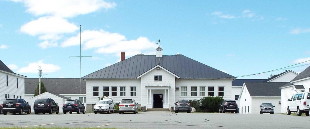
As we all know, history cannot be changed and, sometimes unfortunately, it can be repeated in a negative sense. But most important of all, it must never be forgotten. This is one of the primary goals of our now, solidly in place, China Historical Society, and to follow that path we are going to coordinate an event with our annual meeting on Thursday, July 18. Since this is the 75th anniversary of the opening of the consolidated China School, we intend to hold our meeting at the present Middle School, on Lakeview Drive, and follow that event with a reunion of China students who attended the school from as far back as we can find them up to and including the present day.

While some of the fine points of this plan still need to be worked out, it is receiving strong support from RSU #18. While we realize that folks who switched to the school when it opened in 1949, from the numerous “neighborhood” facilities, are pretty well along in years, we hope there are a few who might be willing to share their memories of this change, which must have been dramatic to say the least.

Even though my personal ties to China only go back 42 years, I know several folks who started their education, as did most of us, at age 5 or 6, here in town in the early 1950s. Richard Dillenbeck, of the first class, is one of those and he has agreed to be the featured speaker for the discussion. If you readers have knowledge of other individuals who might be willing to share their memories and experiences in the new building, please inform them of our plan and have them reserve the date and a time frame of 6 to 6:30 p.m. We also would like to do a tour of the Middle School to allow those earlier “residents” who haven’t been inside for a while and all others to see the huge changes that have occurred in the five room original structure with a kitchen in the basement.

So, in conclusion, we will use The Town Line and social media sites related to China to keep everyone up to date and work to make this a memorable activity; stay tuned!

Up and down the Kennebec Valley: Benton

Benton map

by Mary Grow

Continuing north on the east side of the Kennebec River, the next town after Winslow is Benton. Next north of Benton is Clinton.

These two towns share with Winslow not just the Kennebec, but the Sebasticook River as well. The Sebasticook meanders a bit west of south through Clinton’s town center, and past two of Benton’s once-four villages, on its way to join the Kennebec in Winslow.

Unlike Augusta, Vassalboro and Winslow, neither Benton nor Clinton ever included land on the west bank of the Kennebec.

Your writer intended to write about both towns this week. As usual, she found too much information; Clinton’s story will be postponed.

* * * * * *

What is now Benton began as the southern part of Clinton. It was part of the Kennebec Purchase. A summary history on the Town of Benton website says the area was surveyed in 1769.

The history section of Benton’s 2018 comprehensive plan names the earliest European settler as Ebenezer Heald, who in 1763 built the required cabin and cleared the necessary land to get a grant from Gershom Flagg. (Flagg was mentioned in the May 30 history article as a 1764 grantee on the west side of the Kennebec in Augusta.)

The first Benton settlers Henry Kingsbury listed in his Kennebec County history were Irish emigres George FitzGerald and David Gray, who settled on the Kennebec about a mile north of Benton Station. He gave no date, but said elsewhere the first settlers arrived in 1775, later than the Benton website and comprehensive plan say. Kingsbury named Flagg as an early settler on the Sebasticook around 1783, on a Plymouth Company grant that was “fifteen miles long by half a mile wide.”

It was not until 1842 that southern Clinton became a separate town. The Benton website credits the area that became Benton with the first sawmill on the Sebasticook, in 1773; the first doctor in town (Ezekiel Brown, Jr., at Benton Station on the Kennebec, in 1789); the first Clinton post office (at Flagg’s store in Benton Village on the Sebasticook, on July 29, 1811); and the first church building in town (the Congregational Meeting House at Benton Falls, also on the Sebasticook, in 1828).

Kingsbury wrote that Benton town records start with a March 16, 1842, Maine legislative act (Maine had become a separate state on March 15, 1820). This act divided Clinton and incorporated “the town of Sebasticook.”

A Historical Society slideshow on the Town of Clinton’s website illustrates the separation. It describes the line of demarcation beginning on the Kennebec, going east-southeast to the Sebasticook and up the middle of the Sebasticook to Clinton’s east boundary. It appears that Sebasticook took almost half Clinton’s land area.

Sebasticook, the comprehensive plan says, is an Anglicization of “Chebattiscook or Chebattis, meaning John Batstiste’s [Baptiste’s?] Place.” A Maine education website calls it a Penobscot word meaning “‘almost through place’ or ‘short passage river,’ referring to the short portage to the Souadabscook Stream, which connects the Penobscot and Kennebec rivers.”

At a March 4, 1850, town meeting, Kingsbury said, Sebasticook voters directed their selectmen to propose a new name. Selectmen chose Benton, which was approved by the legislature and first used at a September 1850 town meeting.

Sources your writer found are, for once, unanimous on the origin of the name: it honors Democratic U. S. Senator Thomas Hart Benton (March 14, 1782 – April 10, 1858). Benton served in the Senate from Aug. 10, 1821 to March 3, 1851; Wikipedia says he was the first person to serve five terms.

What else he was noted for depends on the source. Kingsbury mentioned only his 1854-1856 two-volume book, Thirty Years in the United States Senate (cited elsewhere as Thirty Years View).

Benton was a lieutenant colonel in the War of 1812, serving as Andrew Jackson’s aide, seeing no combat.

He fought several duels (an unlikely reason to name a town after him).

Wikipedia calls him “an architect and champion of [United States] westward expansion,” the movement also called Manifest Destiny.

He was a slave-owner, but opposed extending slavery into new territories.

The Encyclopedia Britannica says Benton insisted that public lands be distributed to people planning to settle on them; his political base in the 1820s was “small farmers and traders.”

Several sources mention Benton’s support of hard currency (“gold and silver coins instead of paper money and bank notes”), for which he was nicknamed “Old Bullion.”

It would be interesting to know which of these policies impressed the Benton selectmen, or what other choices, if any, they debated. Your writer notes two advantages of the new name: it’s closer to the top of alphabetical lists, and it’s shorter and quicker to say and write.

A Wikipedia article lists more than a dozen United States counties and towns named in Senator Benton’s honor, including Benton, Maine.

* * * * * *

Although Benton did not exist legally until March 16, 1842, Kingsbury and others begin their histories of the town decades earlier. Readers should remember that the name “Benton” in the following paragraphs is used retroactively until incorporation.

Kingsbury, finishing his history in 1892, named four villages in the Town of Benton: Benton Falls, Benton Village, East Benton and Benton Station (originally Brown’s Corner, where Dr. Brown settled). If these population centers began life as Clinton Falls, etc., your writer has found no historian who mentioned it.

Benton Falls and Benton Village were both on the Sebasticook, adjacent to waterfalls that provided water power. Benton Falls was and is on the east bank, on what is now Falls Road, running along the river from Route 139 south to the Winslow town line.

Your writer has been unable to find a definitive location for Benton Village, which no longer exists under that name. More intensive research in 19th-century land deeds should provide the information: Kingsbury identified the village, and other locations, by names of nearby pre-1892 residents.

There were two notable “falls” in the Sebasticook in the late 1700s and early 1800s, called upper falls and lower falls. Several sources, including Benton’s comprehensive plan and the town website, say Benton Falls was/is on the upper – upriver, or more northerly – falls.

The website lists, between 1769 and 1773, “First dam built at the upper falls (in now Benton Falls).” The plan says, “The first dam, erected at the upper falls in Benton Falls[,] was built before the Revolutionary War.”

Kingsbury, however, said the mills and shops at the upper falls were in Benton Village. He wrote that around 1800, Captain Andrew Richardson built an early sawmill on the east bank “at the upper falls (now Benton village).”

After much reading and map study, your writer sides with Kingsbury: as the Sebasticook flows toward the Kennebec, Benton (Village) is upriver, or north, of Benton Falls. This opinion is strengthened by the map in the 1879 Kennebec County atlas, which shows Benton P. O. (post office) on the west bank, upstream of Benton Falls P. O. on the east bank.

(The map in the 1856 atlas shows a densely populated area from south of Benton Falls to north of Benton Village on both sides of the Sebasticook and along roads paralleling it. This combined population center is labeled Sebasticook Corner on the east bank and Benton on the west bank.)

The present bridge where Route 139 crosses the Sebasticook, the Benton town office on the west bank a short distance downriver and nearby residences and commercial buildings are now in the area labeled Benton or Benton Village.

“Before 1800 a toll bridge was built and carried away several times by high water,” the Benton website says. Whether the river was bridged first at Benton Falls or Benton Village is unspecified. The 1856 map appears to show a bridge at each place.

East Benton and Benton Station are easier to locate.

East Benton was south of Fifteen Mile (or Fifteenmile) Stream, along today’s East Benton Road, in the southeastern part of town. Kingsbury listed two sawmills on Fifteen Mile Stream before 1840. They burned around 1855, were rebuilt and burned again sometime after 1870, he wrote.

The East Benton post office opened Aug. 5, 1858, Kingsbury said. The 1879 map shows an area labeled East Benton P. O. on the East Benton Road around the intersections with Richards, Hanscomb and Bog roads, on the west side of Fifteen Mile Stream.

On Dec. 28, 1887, Kingsbury said, the post office name was changed to Preston Corner; Daniel Preston had been postmaster since March 22 of that year, and served until Nov. 20, 1889. The name became East Benton again on May 29, 1891.

Benton Station was and is on the bank of the Kennebec, extending along the river both ways from the bridges between Benton and Fairfield. The 1879 map shows Maine Central railroad tracks through the village. The comprehensive plan says as of 2018, the former railbed was part of Benton’s Kennebec River Walking Trail.

Kingsbury said the first Benton Station post office was not established until May 31, 1878.

Going back to the Sebasticook, the comprehensive plan says a second dam was built at the lower falls in 1809, but it had no fish passage and therefore “so hindered the fishing that six years later the selectmen had it removed.” (But if the lower falls is really at Benton Falls, it must have been soon replaced to provide water power.)

The plan emphasizes the importance of fishing to early settlers, for food and as an “industry.” Main catches were alewives and shad; there were some salmon.

In 1817, the plan says, “fishing privileges were auctioned off so that sections of the river were sold to individuals.” Kingsbury added that people brought wagons from 40 miles around to collect fish, “which were thrown into the carts literally by the shovelful.” Alewives cost 25 cents per 100, shad four cents each.

The Sebasticook was a better fishery than the Kennebec because the Sebasticook was bridged and “could be spanned easily by weirs,” letting residents use both banks, the plan explained. The west bank of the Kennebec was and is in the Town of Fairfield.

Damming the Kennebec at Augusta in 1836 ended the fisheries.

Kingsbury said an early sawmill was built at the Sebasticook’s upper falls about 1800, and listed three mills and a tannery there in the 1820s.

Around the same time, he mentioned a blacksmith shop and Gershom Flagg’s grist mill at Benton Falls. Benton Falls, he said, had its first tavern by 1818, and by 1823 another tavern “where the pulp mill boarding house now [1892] stands.”

The comprehensive plan calls Benton Falls “the hub of the community” in the first half of the 19th century. The writer listed “at least three (3) sawmills, a tannery, carding and dye mill, grist mill and shingle mill.”

By the 1860s, “a brush and block-handle factory was run in the same building that wooden shoe sole shoes were manufactured. In 1872, a potato planter was invented and manufactured at the Benton Falls.”

The plan adds that Benton’s large pine trees were another economic resource. It says the masts for the USS Constitution (launched Oct. 21, 1797) were cut in Unity by a team of six men, mostly from Benton; hauled to the Sebasticook behind 20 oxen; and floated downriver through Benton.

Kingsbury listed early stores at Benton Falls (from 1808), Benton Station (from before 1810), Benton Village (from 1828) and East Benton (not until the 1870s). The East Benton store, “on the west corner of the road to Clinton,” began life as a smithy (no date), was enlarged and converted about 1878, and burned six days after it opened, he wrote.

The comprehensive plan says the “first frame house north of Augusta” was built on Benton’s Eames Road in 1772. (Eames Road runs southeast off Falls Road at the southern end of Benton Falls.) The builder’s name is omitted.

Main sources

Kingsbury, Henry D., ed., Illustrated History of Kennebec County Maine 1625-1892 (1892).
Town of Benton, 2018 Comprehensive Plan (found on line).

Websites, miscellaneous.

Correction and apology

For the article (above) on the Town of Benton, which was separated from Clinton in 1842, your writer reviewed multiple sources’ differing locations for the upper falls and the lower falls on the Sebasticook River.

She concluded the village of Benton Falls, on the east bank of the river, was founded at the lower falls. Having since had time to visit Clinton’s Brown Memorial Library and read part of Major General Carleton Edward Fisher’s admirably researched 1970 history of Clinton, she now believes she was wrong: Benton Falls, a mill village in the 19th century and a residential area today, was and is at the upper falls.

Fisher wrote that the lower falls were only about half a mile north of the Winslow town line. The upper falls were about half a mile farther upriver.

Another mile upriver, about where today’s highway bridge carries Route 139 across the Sebasticook a little north of the Benton town office, and where your writer erroneously located the upper falls, is what Fisher labeled Nine Mile Rips, a third stretch where the river drops comparatively rapidly.

The apology is to the writers of the Town of Benton’s website and comprehensive plan histories, who said, correctly, that Benton Falls was and is at the upper falls.

Up and down the Kennebec Valley: Vassalboro – Winslow

Map of Vassalboro in 1879.

by Mary Grow

Going north from Augusta on Route 201 on the east bank of the Kennebec River, one follows the approximate route of Massachusetts Governor William Shirley’s 1754 military road between Fort Western, in present-day Augusta, and Fort Halifax, in present-day Winslow.

The town between Augusta and Winslow has been named Vassalboro since 1771, though the spelling has been simplified: Vassalborough lost its last three letters in the town clerks’ record books by 1818, according to local historian Alma Pierce Robbins.

Robbins starts her history in early March 1629, when England’s King Charles gave a group of men called the Massachusetts Company in London (or the Massachusetts Bay Company; sources differ) a charter for a Massachusetts colony. Among these men were Samuel and William Vassall or Vassal. In June, the company sent out three ships, which arrived in Salem on June 29, 1629.

Samuel (1586-1667; “probably” died in Massachusetts) and William (1590 or 1592 – 1656) were sons of a London Alderman (city councilman) named John Vassall (originally DuVassall), “a Protestant refugee from France.” In 1609, John Vassall became one of the Virginia Company chartered in 1606 by King James I – and, Robbins wrote, thereby determined that a piece of the Kennebec River valley would be named Vassalboro.

Robbins summarized the family’s ventures in England, Barbados and, to a much lesser extent, North America. William Vassall was briefly in Massachusetts in 1629, and from 1635 to 1648 lived in Scituate with his wife and six children.

Some later Vassalls moved permanently to Massachusetts, Robbins wrote. One of importance to Vassalboro was Florentius. According to Robbins, Florentius was Samuel’s great-grandson: Samuel had a son named John and John had a son named William, father of Florentius.

On-line sources, however, list one Florentius Vassall as a Jamaican sugar planter who married Anna Maria Hering Mill (born c. 1675), by whom he had a son, Florentius (1709-1776; called Florentius II in one source) before he died in 1712.

Another Florentius Vassal(l) was born around 1689 and died in 1778.

Two sources say Florentius II married Mary Foster, born in 1713; they had a daughter, Elizabeth (Vassal) Barrington, and/or a son, Richard (1732-1785 or 1795).

Robbins wrote that the Florentius Vassall who was William’s son and who was born in 1709 was one of the 1749 Proprietors of the Kennebec Purchase. She said he acquired acreage on both sides of the Kennebec from Pownalborough north, including in present-day Augusta and Vassalboro.

James North’s 1870 history of Augusta says the Florentius Vassall who was a Proprietor was son of William and great-grandson of Samuel.

This Florentius was born in Massachusetts, North wrote, where his father had come “as early as 1630,” but later moved to England and died in London in 1778 (not 1776). He had a son named Richard, and in his 1777 will left his land-holdings to Richard’s daughter Elizabeth’s male heirs, touching off title disputes that North said were finally settled by “the Supreme Court at Washington.” He gave no date; Robbins’ history suggests the Supreme Court was involved around 1850.

Robbins listed no Vassall among the early settlers in Vassalboro. The only mention of the family in the latter half of the 1700s is her account of a 1766 petition from the settlers to the Kennebec Proprietors asking for a grist mill at Seven Mile Brook, in southern Vassalboro.

Robbins commented that the petition was unusual in that it was sent to the whole company rather than to the individual Proprietor. Other Proprietors, she said, had built mills and churches for their settlers.

She added, “There is nothing to indicate that Vassall hastened to see that the inhabitants had a grist mill.”

(They did get one, and a sawmill as well, as described in the Jan. 11, 2024, article on mills on Seven Mile Brook.)

The 1761 Nathan Winslow survey, mentioned in previous articles, increased interest in Vassalboro land. Nonetheless, there were only 10 families living there in 1768; and remember, the town then extended 15 miles back from each bank of the Kennebec. The town was incorporated as Vassalborough on April 26, 1771.

Robbins credits the choice of name to Florentius Vassall’s “speculative [and profitable] deals in real estate” on this part of the Kennebec.

Henry Kingsbury, in his Kennebec County history, wrote that Vassalboro’s town records from 1771 to “the present” (1792) “are in four leather-bound books, well preserved and beautifully written.”

On May 17, 1771, Kingsbury said, Justice of the Peace James Howard (presumably the Fort Western James Howard) called the first town meeting, at “James Bacon’s inn.” Meetings were held in inns on alternate sides of the Kennebec for more than 20 years; the first town meeting house was authorized in 1795, on the east side of the river.

According to Kingsbury, the first “buildings” Vassalboro taxpayers paid for were two town pounds. He named the owners of the lots where they were built, but did not say where the lots were. He did write that the inhabitants were ordered to meet to build them in December, 1771, and anyone (presumably, any able-bodied man) who did not show up was fined.

Kingsbury described the first reference to schooling as a decision at the March 1790 town meeting to create nine school districts on the east side of the river. Less than two years later, on Jan. 30, 1792, Sidney, on the west side, was separated from Vassalboro and incorporated as a separate town. Readers will hear more about Sidney in a later article in this series.

* * * * * *

Winslow is the next town north of Vassalboro on the east bank of the Kennebec. It, like Vassalboro, started on both banks of the river and lost its western part, in its case in 1802.

Fort Halifax in 1754.

Fort Halifax, built in 1754 (and mentioned in last week’s article) was not the earliest European building within the town boundaries. Kingsbury explained in his chapter on Winslow that the location, at the junction of the Sebasticook and Kennebec rivers, was important to Natives and Europeans, because rivers were main travel routes.

Kingsbury used the spelling Ticonic for the junction and for the falls upriver on the Kennebec. Edwin Carey Whittemore and Stephen Plocher, two writers of Waterville history, chose Teconnet; Plocher said the falls were named after Chief Teconnet. Early British records used Taconnett.

Kingsbury wrote that the first trader up the Kennebec, in 1625, was Edward Winslow, who might not have come as far as “the land that was destined to carry his named down to posterity.” On Sept. 10, 1653, according to a document Kingsbury quoted, Christopher Lawson built a trading house on the south side of the Sebasticook where the rivers joined.

In the same year, Kingsbury wrote, Lawson “assigned” his building to Clark & Lake (Thomas Clark or Clarke and Thomas Lake). Clark & Lake and Richard Hammond both had trading posts at Ticonic (and farther downriver) by 1675, when the Natives captured the Ticonic posts and apparently controlled the area until, Plocher wrote, the remaining building “was burned” – presumably by Europeans – in 1692.

Plocher called Hammond Winslow’s first white resident. Multiple sources say he was accused of cheating the Natives in his trading; they killed him in 1676.

As summarized last week, in 1754 Massachusetts Governor William Shirley had Fort Western built at Cushnoc and Fort Halifax built at Ticonic for protection against the French and their Native allies.

After Shirley and the Kennebec Proprietors agreed, on April 17, 1754, to build the two forts, the governor named General John Winslow, from Marshfield, Massachusetts, to supervise building Fort Western. Winslow (1703 -1774) was the great-grandson of Edward Winslow (1595 – 1655), who came to North America in 1620 on the Mayflower, was a governor of the Plymouth Colony and founded Marshfield.

Governor Shirley went up the Kennebec and personally chose the site for the fort, on the north side of the Kennebec-Sebasticook junction, as a strategic location to cut off Native communications and from which to launch an attack upriver.

Captain William Lithgow was the fort’s first commander, arriving on Sept. 3, 1754. Lithgow Street in present-day Winslow runs parallel to the Kennebec south of the rivers’ junction.

The fort’s name honored the Earl of Halifax. Kingsbury said he was the British Secretary of State. Louis Hatch, in his Maine history, said Halifax was President of the British Board of Trade, and added he was “sometimes called on account of his services to American commerce the ‘Father of the Colonies.'”

A settlement developed around the fort. Morris Fling, in 1764, was the first to farm the flat land nearby, Kingsbury said; the name “Fling’s Interval” lasted a couple generations.

Captain Lithgow used to have the river ice swept so his men could “slide the ladies,” Kingsbury wrote. A former island below the falls was a recreation area for Fort Halifax “officers and their families,” and a Native camping site as late as 1880.

Kingsbury also mentioned a brook named after a Sergeant Segar, who built a bridge crossing it. A contemporary on-line map of Winslow shows Segar Brk Avenue, off Whipple Street, north of Halifax Street (Route 100).

Plocher wrote the area’s first incorporation was as the plantation of Kingfield; Kingsbury called it Kingsfield; neither provided a date. It became the town of Winslow on April 26, 1771, including present-day Waterville and Oakland, named after General Winslow.

An on-line genealogy related to the historic Winslow house in Marshfield says Edward Winslow frequently voyaged between Massachusetts and England. He “died at sea somewhere in the Caribbean in 1655 while serving as Chief Civil Commissioner during the British fleet’s expedition to conquer the West Indies.” This information, in your writer’s opinion, increases the probability that General Winslow’s great-grandfather was the same Edward Winslow who Kingsbury said traded up the Kennebec in 1625.

Winslow’s first town meeting, Kingsbury said, was held at Fort Halifax on Thursday, May 23, 1771. In 1787, he wrote, Ezekiel Pattee (an early settler) and James Stackpole, of Winslow, and Captain Denes (or Dennis) Getchell, of Vassalboro, settled the Winslow/Vassalboro town line.

(Pattee was featured in the Jan. 25 issue of The Town Line as the man for whom Winslow’s Pattee Pond was probably named.)

Managing town business became increasingly difficult by the 1790s, especially since there was no bridge across the Kennebec. In 1793, Whittemore wrote, voters appointed two (tax?) collectors, one for each side of the river, and provided for preaching and town meetings to alternate between east and west banks.

After much discussion of a division, usually with the Kennebec as the dividing line (“though once a line one mile west of the river was proposed,” Kingsbury wrote), on Dec. 28, 1801, voters approved a petition to the Massachusetts legislature to make a separate town named Waterville on the west side of the river. The legislature approved June 23, 1802.

Main sources

Hatch, Louis Clinton, ed., Maine: A History 1919 ((facsimile, 1974).
Kingsbury, Henry D., ed., Illustrated History of Kennebec County Maine 1625-1892 (1892).
North, James W., The History of Augusta (1870).
Plocher, Stephen, Colby College Class of 2007 A Short History of Waterville, Maine Found on the web at Waterville-maine.gov.
Robbins, Alma Pierce History of Vassalborough Maine 1771 1971 n.d. (1971).
Whittemore, Rev. Edwin Carey, Centennial History of Waterville 1802-1902 (1902).

Websites, miscellaneous.

Up and down the Kennebec Valley: City of Augusta

Old Fort Western

by Mary Grow

The City of Augusta began its legal existence as part of Hallowell, and has been named Augusta since June 9, 1797. It became the state capital in 1827, and transitioned from a town to a city in 1849. It is the only municipality in this part of the Kennebec River Valley that is still on both sides of the river.

As reported last week, the first permanent settlement inside Augusta’s present-day boundaries was the 1628 Cushnoc trading post. “Cushnoc,” (also spelled Coussinoc, Cusinok, Koussinoc, Koussinok) is a Native American word for “head of tide.”

In 1754, the Kennebec Proprietors built Fort Western, close to the trading post site on the highland on the east shore of the river.

There were two forts downriver: in Richmond, Fort Richmond, built in 1720 and abandoned in 1755, after the upriver forts were ready; and in Dresden, Fort Frankfort, built in 1752 and soon renamed Fort Shirley. The new name honored William Shirley, governor of Massachusetts from August 1741 to September 1749 and again from August 1753 through September 1756. Fort Shirley was garrisoned until 1759.

Upriver, in present-day Winslow, was Fort Halifax (1754-1766), built by the Massachusetts government at Ticonic (Taconett) falls. James North, in his history of Augusta, quoted Shirley’s April 16, 1754, letter to the Plymouth (aka Kennebec) Proprietors proposing the two forts.

The governor explained that the upriver fort would better protect British settlers from invasion by the French, settled in the St. Lawrence River valley and interested in the Kennebec as a route to Québec, and their Native American allies. The disadvantage was that above Cushnoc, the Kennebec wasn’t deep enough for sloops to bring in supplies.

Shirley said Massachusetts would provide the upriver fort, if the Proprietors would build at Cushnoc a “strong defensible magazine,” consisting of a fenced central building, soldiers’ quarters and two blockhouses. The governor promised – and provided – soldiers to protect the men building the fort.

Maine An Encyclopedia, found on line, says the fort was named in honor of a friend of Shirley’s named Thomas Western, of Sussex, England.

This website says supplies were shipped from Boston to Fort Western as often as four times a year. They were unloaded and “taken by flat-bottomed boat, against a strong river current, to Fort Halifax.”

The two forts were also connected by a road passable for wheeled vehicles that Shirley ordered built along the east bank of the Kennebec. North called it “probably the first military road of any considerable length constructed in Maine.” It was also the first iteration of what is now Route 201.

In the winter, North said, the road couldn’t be used because deep snow filled ravines. At least one winter, soldiers hauled sled-loads of supplies to Halifax on the frozen river.

The British recapture of Louisburg in 1758 and capture of Québec in 1759 led to expulsion of the French from North America, clearing the way for British settlement.

Or, as Captain Charles Nash wrote in his first Augusta chapter in Henry Kingsbury’s Kennebec County history, “Only when the gates of Québec opened to the army of the immortal Wolfe did the valley of the Kennebec become disenthralled from the fatal influences that had for a century delayed its development.”

State House

(British General James Wolfe was only figuratively immortal; readers may remember that he died during the battle for Québec, at the age of 32. The French leader, Louis-Joseph de Montcalm, Marquis de Montcalm de Sainte-Veran, was severely wounded and died the next day, aged 47.)

In 1760, the Massachusetts legislature incorporated Lincoln County, including most of the Kennebec River valley. In 1761, the Plymouth Company commissioned the Winslow survey on both sides of the Kennebec, mentioned last week.

Winslow’s lots North described as in three tiers. Each lot was a mile deep; those on the river were 50 rods (825 feet) wide with an area of 100 acres; the second tier were 150 rods (2,475 feet) wide and 300 acres; and the third tier were 75 rods (1,237.5 feet) wide and 150 acres. Over half were for settlers, the rest reserved for Proprietors.

In 1762, North wrote, settlers began getting grants around the former fort. By 1764, he found, 37 families owned and occupied lots; 10 more were living on land that was granted to them later. He estimated the population at about 100 people.

Among these settlers was Captain James Howard, Fort Western’s commander. He claimed lots for himself and two sons, and he and his family lived and ran a store in the fort’s main building. The other military structures were torn down or allowed to deteriorate.

On the west side of the river, North wrote that in March 1764, Proprietors’ lots were granted, including to a builder named Gershom Flagg the one “upon which the central part of the city of Augusta is now built, from Winthrop to Bridge streets.”

Settlers were required to build a house, clear at least five acres for farming and live seven or eight years (sources differ) on their lots “in person or by substitute.”

With these conditions, North wrote, by April 26, 1771, four towns were populous enough to be incorporated: Hallowell, Vassalboro, Winslow and Winthrop.

* * * * * *

Post Office

The Hallowell of 1771 included all of present-day Hallowell, Augusta and Chelsea and most of Farmingdale and Manchester. Nash said it covered 65,715 acres (or 102.7 square miles) of mostly wilderness; North called it about 90 square miles (which equals 57,600 acres).

It was named after a Proprietor, Boston merchant Benjamin Hallowell. He owned 3,200 acres on the west side of the Kennebec, about three miles south of Fort Western; North said he was “extensively engaged in ship-building.”

By the mid-1770s, Nash wrote, settlers on the west bank of the Kennebec outnumbered those on the east, because of the better soil and more abundant water-power. Discussion of a building for town meetings began in 1777; when a decision was reached in 1781, the meeting house was on the west side of the river, near the foot of present-day Winthrop Street.

On the west side, mills at the mouths of brooks entering the Kennebec created two small population centers, a northern one called the Fort, nearly opposite Fort Western at Bond (or Bond’s) Brook, and another about two miles south called the Hook.

Nash said the Hook was so called because it was at the outlet of Kedumcook (now Vaughan) Brook, in Hallowell. North quoted a 1767 deposition by Colonel William Lithgow saying the British called the area Bombohook, but the Natives called it Kee-dum-cook, referring to the gravel shoals in the Kennebec River at that point.

By the 1790s, Nash wrote, residents of the Hook and the Fort began to disagree about town business. The result of one dispute, over how money raised to pay ministers should be spent, was the June 1794 division of Hallowell into three parishes, South, Middle and North.

In 1791, Hallowell Academy became “the first incorporated institution of learning in the district of Maine.” It was at the Hook. Nash wrote that at the March 16, 1795, town meeting in the meeting house, “the Hook party brilliantly carried an adjournment to the new academy building.”

This meeting Nash called a contest between north and south. North said the Hook people wanted five selectmen, instead of three, and the two communities disagreed over who was qualified to vote. The Fort won on both issues.

Town of Harrington

There is still a Harrington, Maine, in Washington County. It was incorporated June 17, 1797, according to an online source. Harrington’s website says it has a year-round population of 1,004 and is the home town of the Worcester Wreath Company, founder of the nonprofit Wreaths Across America program that puts wreaths on veterans’ graves every December.

By this time, Nash said, the Hook had the Academy, and in 1796 the South Church was built there. The Fort had the “meeting house, court house, jail and post office.” Each settlement had its own newspaper, whose writers “exchanged many a witty and telling repartee.”

The final straw came in 1796, and involved the river.

Until then, public transportation across it was by Pollard’s ferry, which ran from the east shore below former Fort Western to the bottom of Winthrop Street. Many people wanted a bridge; they realized it would be a major expense, even for the entire town; but Fort and Hook residents each wanted it in their village.

In early 1796, the Fort people asked the Massachusetts legislature to approve a bridge in their area. The Hook residents opposed the request.

But, Nash wrote, both Hallowell representatives in the Massachusetts legislature were from the Fort, and on Feb. 8, 1796, the legislature incorporated the Proprietors of the Kennebec Bridge. The act specified that the bridge’s west end be between Pollard’s ferry and Bond Brook.

Nash said Hook residents were depressed and disappointed. The two sides started opposing each other’s candidates for local office and expenditure requests; relations became so bad that separation seemed the only option.

People from the Fort favored division; people from the Hook were “therefore” opposed, Nash wrote. Nonetheless, when the Fort faction presented a petition to the Massachusetts legislature, the Hallowell representative, who was from the Hook, did not fight it.

* * * * * *

On Feb. 26, 1797, the Massachusetts legislature incorporated Hallowell’s middle and north parishes as the town of Harrington. Nash and North wrote that Harrington took almost two-thirds of Hallowell’s territory, which would have been between 60 and 68 square miles (see the differing figures for Hallowell above), and about half its population and property valuation.

(Wikipedia gives Augusta’s current area as 58.04 square miles, citing the United States Census Bureau. In May 1798, Harrington’s population was 1,140. In 2022, Augusta’s was 19,066.)

The name, Nash said, honored Lord Harrington, “a favorite courtier and honored minister of [King] George the Second.” Around 1730, an earlier royal commissioner had given the name to “ancient Pemaquid” (now Bristol). North said resident and legislative representative Amos Stoddard resurrected it in 1797; neither historian explained why.

Harrington voters held their organizational meeting April 3, 1797, electing officials and appropriating funds for roads, schools, support of the poor and other essentials. However, Nash wrote, the town’s name was “exceedingly unacceptable to the people,” who directed the selectmen to get it changed forthwith.

The selectmen accordingly petitioned the Massachusetts legislature to change Harrington to Augusta, and on June 9, 1797, their petition was granted. Nash said official documents give no reason for the anti-Harrington movement or the substitution of Augusta, but he offered his surmises.

In the 1790s, he said, Cushnoc was a place to catch migratory fish, including blackback herring and alewives, collectively known as river herring. Hook residents easily turned Harrington into Herring Town, leading upriver people to want a name “less susceptible to profane travesty.”

Augusta, he said, had (like Harrington) been used earlier, in 1716, for part of what is now Phippsburg. He called it “more than probable” that memory of that settlement suggested the “half romantic name…which the satirical neighboring humorists could not successfully ridicule.”

The bridge that apparently triggered the creation of Harrington/Augusta opened in November 1797.

Main sources

Kingsbury, Henry D., ed., Illustrated History of Kennebec County Maine 1625-1892 (1892).
North, James W., The History of Augusta (1870).

Websites, miscellaneous.

Up and down the Kennebec Valley: Towns and cities’ names – Part 1

Popham Colony

by Mary Grow

This series has been geographically grounded, mostly, in specific places: 12 municipalities in the central Kennebec Valley. Your writer’s next topic is how each of these got its name.

As usual, there will be preliminaries, the first of which have taken up this entire introductory essay. They are a short detour along the coast and a summary of British settlement. Succeeding articles will include brief re-introductions of some of the people who came to the area in the 1700s.

Fishermen from Britain, France, Spain and Portugal were familiar with the Maine coast and coastal islands years before any significant number of Europeans thought of living here. The fishermen set up temporary camps to dry fish, repair boats and do other land-based activities.

Permanent European settlement started on the coast, obviously. Travel inland was mostly up rivers, since the tracks through the woods were familiar to the Native Americans, but not to the newcomers.

Both French and British monarchs were, at various times and to varying degrees, interested in this part of North America. The French tried to settle St. Croix Island, near the present Maine-Canada border, in 1604.

Rev. Edwin Carey Whittemore summarized parts of the story of French influence in the Kennebec River valley in the 1902 centennial history of Waterville that he edited and partly wrote.

In 1603, Whittemore said, King Henry IV of France made a large grant of North American territory, from around present-day New York City to the northern tip of present-day Maine (and from the Atlantic to the Pacific), to Sieur de Monts (Du Mont, in James North’s 1870 history of Augusta). The territory was named Acadia.

De Monts and Samuel de Champlain explored Merrymeeting Bay, where the Kennebec and Sheepscot rivers meet, and in July 1604, Whittemore wrote, Champlain “set up a cross on the bank of the [Kennebec] river and formally claimed the territory as a part of Acadia.”

North called this episode “the first attempt of royalty to obtain foothold on the banks of the Kennebec.”

It was also a harbinger of the Franco-British rivalry for influence in the Kennebec valley that led to periodic death and destruction and slowed British progress inland. Charles Nash, in his chapter on Maine Native Americans in Henry Kingsbury’s Kennebec County history, listed six separate Indian wars in Maine between 1675 and 1763.

One consequence was the obliteration of the Native culture, the Abenaki tribe called the Kennebecs or Canibas, headquartered in the early 1600s on Swan Island, in present-day Richmond.

British monarchs encouraged settlement by granting charters to companies of prominent men, of whom the Plymouth Company (and its successors) were most important to Maine. King James I granted these men, mostly from Plymouth, England, settlement rights to part of North America in 1606.

They in turn recruited settlers and provided ships and supplies. The expectation was that New World resources would be profitable.

The first British settlement in present-day Maine was the Popham Colony, at the mouth of the Kennebec, named after Sir John Popham, one of the Plymouth Company, and led by his nephew, George Popham.

The colony was settled in August 1607 and abandoned (Wikipedia) or partly abandoned (Robert P. Tristram Coffin, in “Kennebec Cradle of Americans”) in 1607-1608.

The colonists built a fort, named Fort George (Wikipedia and other sources) or Fort St. George’s (Coffin and other sources). It was in what is now Phippsburg – Wikipedia says about 10 miles south of present-day Bath. The Civil War Fort Popham, on the National Register of Historic Places, is “within sight of” the original colony, Wikipedia says.

Near the fort were a storehouse and colonists’ houses. The colonists started the ship-building industry on the Kennebec, with the 30-ton pinnace “Virginia of Sagadahoc.”

(Wikipedia explains that a pinnace was a boat or ship carried on a larger ship to use as a tender, ferrying people and supplies or going places the larger vessel couldn’t. A pinnace could be almost type of boat, propelled by sails, oars or both, with up to three masts and sometimes armed.)

The Popham colonists explored a short distance up the Kennebec. Wikipedia says they made contact with the Abenakis, but “failed to establish cooperation” with them. Coffin wrote the white men got as far as present-day Brunswick, where they found fertile land for crops (though it was too late to plant that year).

Coffin and Wikipedia say half the colonists took advantage of a supply ship to return to England in December 1607, discouraged by a Maine winter. Wikipedia says the remainder left for England in September 1608 in the supply ship and the “Virginia.”

Coffin (whose 1937 book your writer highly recommends) wrote that the “Virginia”, too, went to England in December 1607; and the 55 men who stayed behind became Maine’s lost colony. When the supply ship returned in the spring, he said, no one was there, though there were unexplained house foundations in the area.

Coffin surmised the men might have joined the European fishermen’s camps on Monhegan Island, not far from the mouth of the Kennebec, or the Abenakis up the river. He concluded:

“By all accounts, they were tough customers and could have made their beds anywhere. Very likely they stayed on this side of the Atlantic and were the original settlers, instead of the men of Jamestown of 1607.”

(Your writer is not sure about that last clause. Sources that give precise dates say the Popham colonists left England late in May 1607, a couple weeks after the Jamestown settlers landed, and reached future Maine in August 1607. Wikipedia says the sick, starving Jamestown colonists started back to England in 1610; but they met a “resupply convoy in the James River” and changed their plan. Maybe Coffin meant they were not the first permanent settlers?)

Coffin further surmised that well before the Plymouth Company existed, Englishmen were “homesteading in Maine” – fishermen, traders, “rapscallions of the first water seeking new fields.” He wrote: “Lots of the Maine settlers were men who did not care to put an address on their calling cards.”

North wrote that the failure of the Popham Colony did not discourage other explorers. In 1614, he said, John Smith (already famous for his role in the settlement in Jamestown) spent time on Monhegan Island, and named the mainland New England.

Smith’s voyage made a profit from furs and fish, and his upbeat 1616 account of the land he had explored encouraged the Plymouth Company.

The independence-seeking, probably minimally religious, mixed-nationality settlers Coffin described moved inland as the coast became more crowded. Others crossed the Atlantic to explore new opportunities.

The 1606 charter was supplanted in 1620 and again in 1629. Companies’ charters often overlapped geographically, creating later complications over land titles (for those who bothered about such legal frills).

In 1661, four men named Antipas Boies or Boyes, Thomas Brattle, Edward Tyng and John Winslow assumed control of the Kennebec Patent. Louis Hatch’s history of Maine says these four men and their heirs and associates organized “The Proprietors of the Kennebec Purchase from the late Colony of New Plymouth.” This group is usually called the Kennebec Proprietors.

Hatch added that the Massachusetts colony claimed control over Maine as far northeast as the Kennebec Valley from the 1630s on. King Charles I created the name Province of Maine in 1639, Hatch wrote.

* * * * * *

Turning now to the Kennebec River valley in particular, Whittemore wrote that on Jan. 13, 1629, the Plymouth Council (successor to the 1603 Plymouth Company) granted to the Plymouth Colony the Plymouth (or Kennebec) Patent.

This grant, when its boundaries were eventually agreed, gave the Plymouth Colony control over both banks of the Kennebec for 15 miles inland, between present-day Wooolwich and present-day Cornville. It covered about 1.5 million acres.

The Plymouth Colony set up three trading posts. The one farthest upriver was at Cushnoc, on high land on the east bank of the Kennebec in what is now Augusta.

This area had been for some time an informal meeting and trading place for Natives and Europeans. Different writers mentioned that it was at the head of tide; a traditional Native camping place; and convenient for Natives bringing the furs Europeans coveted.

The City of Augusta website (and other sources) date the Cushnoc trading post to 1628 (just before the Patent was granted). The website (and others) say the fur trade started well, but declined after 1634.

Lendall Titcomb wrote in his chapter in Kingsbury’s history that in 1652, the Plymouth Colony rented out the post for 50 pounds a year. Three years later the lease was reduced to 35 pounds a year, payable in “money, moose or beaver.” On Oct. 27, 1661, the Plymouth group sold Cushnoc to the four Kennebec Proprietors mentioned above.

Whatever remained of the building was probably burned in 1676, during an outbreak of fighting with French and Natives that drove most of the British out of the Kennebec Valley.

In 1939, the Maine Society of the Daughters of Colonial Wars marked the trading post site with a plaque that reads: “In commemoration of the first trading voyage of the Pilgrims of Plymouth to the ancient Indian village at Cushnoc on the Kennebec River, 1625, and on this site the establishment of their fur trading post with the Indians, 1628, Jown Howland in command, 1634.”

In 1754, the British built Fort Western near the former trading post site. In the 1980s, archaeologists found where the trading post had been, a little south of the fort, partly on the Church of Christ, Scientist, property.

They were able to outline the walls, and found some of the trading goods. Wikipedia lists “tobacco pipes, glass beads, utilitarian ceramics, French and Spanish earthenwares, and many hand-forged nails.”

The site has been on the National Register of Historic Places since 1989. (See box.)

* * * * * *

In the valley of the Kennebec, Titcomb wrote, there was no organized settlement effort between 1661 and 1749. Some of the downriver towns were created: the town that is now Harpswell was settled in 1689; Bowdoinham, and as part of Bowdoinham Richmond, in 1725; Swan Island in 1750, added to Frankfort (now Dresden) when Frankfort was organized in 1752; Gardiner in 1754.

In August 1749, Titcomb said, the heirs of the 1661 foursome reorganized and, in June 1753, created the “Proprietors of the Kennebec Purchase from the late Colony of New Plymouth,” known informally as the Kennebec or Plymouth company.

In 1761, this group hired surveyor Nathan Winslow to lot out the riverside land between present-day Chelsea and Vassalboro and invited settlers. There will be more about the Winslow survey in subsequent articles.

Here are approximate dates of first settlements along the east shore of the Kennebec from Augusta to Clinton, from south to north: Augusta, Fort Western settled in 1754; Vassalboro, settled about 1760; Winslow, Fort Halifax settled in 1752; Benton, settled about 1775; and Clinton, settled about 1775.

Following articles will describe the founding, naming (and renaming) and early growth of these five municipalities and their neighbors.

Old Fort Western director seeks funds to reconstruct Cushnoc Trading Post

Two years ago this month, Old Fort Western Director Linda Novak announced plans to reconstruct Cushnoc Trading Post. The goal is to raise enough money by 2026 to complete the replica in 2028, the 400th anniversary of the original post. Anyone interested in learning more about or contributing to this project is invited to call Old Fort Western at 626-2385 weekdays between 8 a.m. and 4:30 p.m.

Main sources

Coffin, Robert P. Tristram, Kennebec Cradle of Americans (1937)
Hatch, Louis Clinton, ed., Maine: A History (1919; facsimile, 1974)
Kingsbury, Henry D., ed., Illustrated History of Kennebec County Maine 1625-1892 (1892)
North, James W, The History of Augusta (1870)
Whittemore, Rev. Edwin Carey, Centennial History of Waterville 1802-1902 (1902)

Websites, miscellaneous.

Up and down the Kennebec Valley: Holman Francis Day

Holman Francis Day

by Mary Grow

Vassalboro native Holman Francis Day (1865 – 1935) was a well-known and prolific Maine writer. Starting as a newspaperman, he went on to write poetry and novels in verse, novels in prose, a play, non-fiction pieces and movie scripts.

According to Kristin Stred and Robert Bradley (writers of the Maine Historic Preservation Commission’s 1977 National Register of Historic Places nomination form for Holman Day’s Auburn house), while in high school Day published the Weekly Vassalboro News for two years. He continued newspaper work fresh out of college in 1887 with the Fairfield Journal (a weekly published from 1879 to 1925).

An on-line article in Maine An Encyclopedia says from 1888 to 1892 Day edited the Dexter Gazette, making it “a successful and sprightly country weekly.” (This newspaper became the Eastern Gazette, still published weekly in Dexter and advertising that it serves more than 17,500 households in 42 towns.)

For another two decades, Day was a “special correspondent and columnist” for the Lewiston Evening Journal (a daily published from 1866 to 1989, when it merged with its competitor, the Lewiston Daily Sun, to form today’s Lewiston Sun Journal). He spent a brief time in Portland in 1892, and wrote for newspapers in Boston and New York.

His first book-length work was published in 1900.

Starting in 1918 in Augusta, Day made black-and-white films; sources mention the 1920-21 Holman Day Film Company, which was not a financial success. By 1928, he had moved to California, where he wrote Hollywood scripts as well as novels of Maine life.

* * * * * *

Holman Day was born in Riverside, in southwestern Vassalboro, on Nov. 6, 1865. His father was Captain John Randolph Day (Aug. 1, 1828 – 1889), a Civil War veteran who enlisted in May 1861, was in several major battles and was twice captured by the Confederates, spending time in Libby and Andersonville prisons.

Holman’s mother was Mary A. (Carter) Day (1834-1908), from Etna. The couple named the second of their three sons Holman after a wartime friend of his father, and Francis after John’s brother, Thomas Francis Day.

The Day house was on what is now a section of Old Route 201 named Holman Day Road. Sources differ on the exact location.

The family moved to Wiscasset for six years, returning to Vassalboro about 1874. Sources indicate they lived in at least two different houses in the Getchell’s Corner area of northwestern Vassalboro.

Day graduated from Oak Grove Seminary, in Vassalboro, in the Class of 1881, spent a year at Coburn Classical Institute, in Waterville, and graduated from Colby College, in Waterville in 1887. At Colby, he was named class poet in his sophomore and senior years, and worked on the Colby Echo, the student-run newspaper. The on-line encyclopedia article says he gained a reputation “as a wit, writer, and drinker.”

While with the Fairfield Journal, Day met Helen Rowell Gerald (1870-1902), only daughter of Amos Fitz and Caroline Wood (Rowell) Gerald. They were married Feb. 6, 1889.

Amos Gerald built the newly-weds a house in Auburn. Stred and Bradley said Day lived and wrote there for 17 years; another source said from 1895 to 1914.

The Holman Day house at 2 Goff Street has been on the National Register of Historic Places since Jan. 17, 1978. It is privately owned and closed to the public.

The Days had two daughters, Ruth, born and died in 1893, and Dorothy, born in Auburn on Feb. 19, 1895. Dorothy married Ralph Burton Drisko, Jr., on March 15, 1918, in Mobile, Alabama, according to Find a Grave (which does not explain why she was in Alabama). He was lost at sea in 1924. On March 14, 1926, Dorothy married again, in Waterville, Maine; her second husband was Roy LeChance Kilner.

Helen Day died July 12, 1902, of heart disease and is buried in Fairfield’s Maplewood Cemetery with her parents and her daughters.

Day’s second wife was Agnes M. (Bearce) (Nevens) (1867-1954), a divorcee, from Lewiston. The City of Auburn report for the municipal year ending Feb. 28, 1906, lists Agnes Bearce as a (new?) teacher at North Auburn Primary School, who had trained at Hebron Academy.

They were divorced in 1927.

Day’s third wife was Florence Levin, from Portland.

Day died Feb. 19, 1935, in Mill Valley, California. He is buried in Vassalboro’s Nichols Cemetery, with his parents and Fred Mortimer Day (1870-1938), who your writer assumes was his younger brother.

* * * * * *

In 1898, Stred and Bradley said, Day added to his journalism a daily poetry column, Up in Maine. It “was carried by newspapers across the country” for half a dozen years.

Wikipedia quotes a 1928 article from a Carmel, California, newspaper in which Day said his first poem for the Lewiston Evening Journal resulted in a libel suit against the newspaper that gave his poem a value “never received by the great Longfellow in his palmiest days.”

In 1900, a collection of these poems became Day’s first book, Up in Maine: Stories of Yankee Life Told in Verse. It was followed in 1902 by Pine Tree Ballads: Rhymed Stories of Unplaned Human Natur’ up in Maine; and in 1904 by Kin o’ Ktaadn: Verse Stories of the Plain Folk who are Keeping Bright the Old Home Fires Up in Maine.

Stred and Bradley wrote that these “books of catchy verse…entertained more than 30,000 readers.”

The first poem in Up in Maine, titled Aunt Shaw’s Pet Jug, is about Uncle Elnathan Shaw, “Most regular man you ever saw!” For 30 years, at 4:40 every afternoon he would pick up “the big blue jug from the but’ry shelf” and go down the cellar stairs to draw two quarts of old cider for the evening.

And every afternoon, “Auntie Shaw would yap through her old cross mug” telling him not to fall on the second step and break her favorite jug, inherited from her great-aunt Sue.

One day, Nathan did fall all the way from the second step. He did not break the jug:

And he’d saved the jug; for his last wild thought
Had been of that; he might have caught
At the cellar shelves and saved his fall,
But he kept his hands on the jug through all.

Now, “as he loosed his jealous hug,” his wife’s only concern was “Did ye break my jug?” Enraged at her disregard for his “poor old bones,” Nathan replied, “No, durn yer pelt, but I swow I will” and smashed it against the wall.

The poem titled The Stock in the Tie-Up celebrates life in a well-heated house with a good hot meal on a stormy night and ends with “the stock in the tie-up is warm.” It contrasts the speaker, willing to spend a Sunday doing the extra work to make his barn weather-proof, with his church-going neighbors, who have “cracks in the sides o’ their tie-ups…wide as the door o’ their pew” through which sleet and snow enter.

Day did not approve. He wrote:

And I’ll bet ye that in the Hereafter the men who have stayed on their knees
And let some poor, fuzzy old cattle stand out in a tie-up and freeze,
Will find that the heat o’ the Hot Place is keyed to an extra degree
For the men who forgot to consider that critters have feelin’s same’s we.

One of your writer’s favorite poems is in the third collection, Kin o’ Ktaadn. Titled The Latest Tip from ‘Patent-Right’ Belcher, it invites investment in Patent-Right’s new invention, a two-part device for letting the family cat out the door and back in the window – after the family dog identifies him or her and opens the window – so that people need not get out of warm beds on cold nights.

Day’s first novel, Squire Phin, came out in 1905 and was followed by another 29, plus “300 short stories and poetry,” according to an on-line article about the Auburn house.

Squire Phin opens at the village store in Palermo — a coastal town, not the Kennebec Valley Palermo. Squire Phin has his law office upstairs. The second chapter introduces Squire Phin’s prodigal brother, accompanied by an elephant.

Several sources call King Spruce (1908) Day’s best-known and most popular novel. Stred and Bradley wrote that this book “became a prototype for books about Maine lumbering” – certainly a prototype for many of Day’s later novels, which repeat the dual themes of timber barons’ rivalry and their children’s romances.

King Spruce, according to Stred and Bradley, “firmly established Day’s reputation as a novelist, and delighted President Theodore Roosevelt so much that he invited Day to the White House.”

The novel features a young, college-educated hero named Dwight Wade who deals competently with uneducated, good-hearted woodsmen whose livelihoods depend on city-based lumber companies. Corporate rivalries make life extra hard for the low-level workmen.

Day explained that the term King Spruce stood for an unseen tyrant, a “vast association of timber interests,” visible only in the form of local officers who worked from headquarters in Maine mill towns. Most of his sympathy was with the loggers; but at times he sounded as though he would like the woods left alone, with references to “destruction” by logging and “slaughter” of deer and moose.

In addition to relations among loggers and logging companies, Day introduced several independent, opinionated, stubborn and attractive young women who added love stories to the already-complicated plot.

After many adventures, the villains were defeated, dead or had experienced changes of heart; the loggers had a better deal; and the central pair of lovers rode away together in a pony-drawn carriage.

These themes recur in later novels, like The Rider of the King Log (1919) and Joan of Arc of the North Woods (1922). Day even wrote a North Woods novel for young readers: The Rainy Day Railroad War (1906) was first serialized in The Youth’s Companion magazine. It lacks a romantic subplot.

Some of Day’s novels are unabashed romances, like The Red Lane a Romance of the Border (1912) and Blow the Man Down: A Romance of the Coast (1916). The Skipper and the Skipped (1911) and The Landloper (1915) are examples of more varied themes.

Stred and Bradley commented that Day “had an eye for unusual Maine characters, and an ear for their unique dialect. He then wove stories around the personalities and exploits of the woodsmen and seafarers he had observed and with whose ways he was familiar.”

The historians called his writings “an important part of the literary heritage of Maine.”

Holman’s work can be seen at Vassalboro Historical Society

The Vassalboro Historical Society owns Holman Day memorabilia, including, president Janice Clowes said, his books, movies made from his books and a movie about him, movie posters, newspaper clippings and other items.

The society’s Holman Day files include a biography, written as a master’s thesis at the University of Maine at Orono in 1942.

The museum is located in the former East Vassalboro schoolhouse, on the east side of Route 32 on the south edge of East Vassalboro Village, close to the outlet of China Lake and the boat landing. Hours are Mondays and Tuesdays from 9 a.m. to 1 p.m., and the second and fourth Sundays of each month from 1 to 4 p.m.

Main sources

Day, Holman various writings.
Stred, Kristin (student assistant), and Robert L. Bradley, National Register of Historic Places Inventory – Nomination Form Holman Day House, June 1977.
Vassalboro Historical Society files.

Websites, miscellaneous.

Up and down the Kennebec Valley: Eli & Sybil Jones, Mary Hoxie Jones

by Mary Grow

From Rufus Matthew Jones, your writer goes backward and then forward in the Jones family.

Rufus Jones was the nephew of Eli Jones and his wife Sybil (Jones) Jones, well-known Quaker missionaries. Rufus and Elizabeth (Cadbury) Jones’ daughter, Mary Hoxie Jones, born almost a century later than Eli Jones, was a historian and poet.

* * * * * *

Eli Jones

Eli Jones (March 12, 1807- Feb. 2, 1890) was Abel and Susannah Jones’ oldest son. According to his nephew’s 1889 biography, Eli and Sybil Jones: Their Life and Work, his formal education was limited to China’s one-room schools and three months at the Friends School, in Providence, Rhode Island, in 1827.

Despite a speech impediment, Rufus Jones wrote, his uncle spoke in Friends meetings from an early age, in China and in Providence. Home from Providence, he helped organize, and became secretary of a local branch of the Sons of Temperance; and helped organize the still-active South China public library.

Rufus commented that when Eli took on these community projects, he had “barely become a full-fledged citizen” and had no family example to follow. The explanation, Rufus wrote, was that “there was something in him which forbade rest and inaction” when the inner spirit presented a task.

In addition to working on the family farm, Eli helped run mills in China and Albion.

In 1833, he married Sybil Jones (Feb. 28, 1808 – Dec. 4, 1873), born in Brunswick and living with her parents in Augusta. Her nephew described her (in his chapter on the Friends in Henry Kingsbury’s Kennebec County history) as physically frail, but with “a poetic soul” and a “beautiful, melodious voice and a flow of suitable words to give utterance to the thought which seemed to come to her by inspiration.”

Sybil Jones

Sybil attended the Providence Friends School in 1824-25, and worked as a teacher. She wrote poetry; much of it she destroyed, and Rufus observed that what survived was often “tinged with thoughts of death and the grave.”

Eli and Sybil lived in South China until they moved into their own house at Dirigo in or after 1833 (sources differ). The house, still standing on the south side of what is now Route 3 at the Dirigo Road intersection, is described as a north-facing, L-shaped story-and-a-half wooden Cape on a granite foundation. It has been on the National Register of Historic Places since March 22, 1984.

The couple traveled over much of the world, in horse-drawn carriages and wagons, on small sailboats and large steamboats and on the backs of donkeys, spreading Quaker beliefs. Despite her health issues, described by one source as serious back problems, Sybil was often the one who felt called to these missions.

Their first trip was to Nova Scotia and New Brunswick in 1840. Their first overseas mission was to Liberia in 1850. In 1852 and 1853 they visited half a dozen northern European countries; in the spring of 1854 they were in southern France.

After their oldest son’s death in the Civil War (see below), Sybil spent time in Philadelphia and Washington, D.C. hospitals nursing wounded soldiers. Rufus estimated 30,000 men heard her message. After President Abraham Lincoln’s assassination on April 15, 1865, she twice visited his widow to offer comfort.

Sybil’s last mission, a multi-year trip to England, France and the Middle East, beginning in 1867, led to the founding of Friends’ missions on Mount Lebanon and in Ramallah, the latter named the Eli and Sybil Jones Mission. (Your writer found on line a history of the Friends in Ramallah, written in 2016 by Maia Carter Hallward and titled The Ramallah Friends Meeting: Examining 100 Years of Peace and Justice Work, in Quaker Religious Thought: Vol. 127.)

The first of Eli and Sybil’s five children, James Parnell Jones (1835 – 1864), is locally famous as “the fighting Quaker.” Enlisting in the Seventh Maine Volunteers, he was killed July 12, 1864, at Crystal Springs, near Washington, D. C.

The younger children were Sybil Narcissa (1839 – 1903); Richard Mott (1843 – 1917; his son, Charles Richard Jacob, was Rufus’s close friend for many years); Susan Tabor (1847 – 1913, who lived with her father from his return to China until his death) and Eli Grellet (1850 – 1933 or 1934).

Between foreign trips, Eli was active in town affairs. In addition to the temperance society and the South China library, he helped start Erskine Academy, in South China (in 1883; he was president of the first board of trustees) and held official town positions.

The China bicentennial history says the latter included an undated term as liquor agent, given by state law “a monopoly on the distribution of alcoholic beverages.” The history comments that while he was liquor agent, “China had a dry year.”

Maine had enough temperance advocates in the mid-1800s to persuade the state legislature to enact a prohibition law in 1850. Rufus wrote that many people thought it insufficiently enforced.

China voters hoped to improve enforcement, he said, when, in 1854, they chose Eli Jones their representative to the Maine legislature “by a large majority over two other candidates.” (Though his nephew referred to Eli as a candidate, it is not clear that he was one: Rufus wrote that his election was “wholly unexpected,” and he had been working to elect one of the others.)

Because Quakers follow Jesus’ admonition not to swear oaths (in Matthew 5:34-37), Eli did not participate when the Governor administered the oath of office to the legislators. He stood separately to affirm that he would do his job.

Eli’s committee assignments included the committee on temperance. Rufus wrote that his uncle “seldom spoke, most of his work being in the committee.”

Fellow legislators devised a trick to make the pacifist Quaker speak: they unanimously appointed him major-general in command of a division of the state militia.

Eli rode home to Dirigo that evening and consulted until late with family and friends. When he returned to Augusta, sleepless, the next day, he found almost all the legislators from both houses and many city people waiting to hear what he would say.

Rufus reprinted most of his uncle’s speech. Eli said he feared appointing a pacifist Quaker to head the militia was “a little in advance of the times,” despite progress on temperance and on resistance to slavery.

If he was mistaken and the legislature really wanted him to serve, he would, he promised. He would order the troops to ground arms, beat swords into plowshares and spears into pruning-hooks and go home and read the New Testament.

But, believing the legislature was not endorsing such a policy, he would and did decline the appointment.

Rufus wrote that the speech was frequently interrupted by applause and “made a great sensation” not just in Maine, but internationally, being reported in the United States and Great Britain and even in one African newspaper. The intended jest, in his view, let his uncle “preach peace to a very extended audience”; it also gained him increased respect among his fellow lawmakers.

In 1857, Eli helped reopen Oak Grove School, in Vassalboro, after lack of funds closed the high school that had opened in December 1850. He served as principal of the renamed Oak Grove Seminary for a year, the first of 10 men named Jones (including his son Richard, from 1870 to 1874, and his nephew Rufus, from 1889 to 1893) to head the school before 1918. In 1870 and 1871 he was supervisor of schools in China.

Sybil Jones died Dec. 4, 1873, at their Dirigo home. Eli continued to live there with his younger daughter Susan until they returned to South China in 1884, except for two more trips to the Middle East, in 1876 and 1882.

Rufus described his uncle as satisfied with farming, especially fond of and loved by his sheep and other animals; and a lover of all nature, who was happy sitting under a tree watching birds and insects, never knowingly stepping “on a worm or beetle” or killing anything else. He was interested in “fossils and geological specimens.” A frequent and welcome visitor at Quaker meetings throughout the area, he was also a respected speaker at China’s town meetings.

Eli Jones died Feb. 2, 1890. According to the Town of China cemetery records (with which Find a Grave disagrees), he and Sibyl are buried in Dudley Cemetery, with their oldest son, James Parnell Jones, and their younger daughter, Susan Tabor Jones (identified as Susan L. in the town records).

Dudley Cemetery is on the east side of Dirigo Road a short distance south of Eli and Sybil’s house, farther from the road than Dirigo Friends Cemetery. Family members buried in the Dirigo yard include Eli’s parents, Abel and Susannah Jepson Jones; his sister, Peace; and his brothers, Edwin and Cyrus.

* * * * * *

Rufus and Elizabeth Jones’ only child, Mary Hoxie Jones (Eli Jones’ great-niece), was born July 27, 1904, in Haverford, Pennsylvania, and lived there or in adjoining Bryn Mawr most of her life, spending vacations at Pendle Hill, in China.

From 1916 to 1922, she was a student at the Baldwin School, a private, non-sectarian girls’ school in Bryn Mawr. She graduated from Mount Holyoke College, in South Hadley, Massachusetts, in 1926.

Mary Hoxie Jones was steeped in Quakerism all her life, often traveling abroad with her parents. From 1939 to 1951, she held staff positions with the American Friends Service Committee, and served on its board of directors for many years afterwards.

Her historical writing started with collecting and organizing documents about her family’s history and genealogy. One product was a short biography of her father, published as a pamphlet by the Friends Home Service Committee in 1955, in London.

More general works included a 1937 history of the Friends Service Committee from its founding in 1917, and a 1961 history of New England Friends in the latter half of the 1600s. The first book she dedicated to her father, to his great pleasure.

A series called Pendle Hill Pamphlets included a history of Quaker poets and a collection of notes her father made for his sermons and talks – notes which, she commented, he never appeared to use. Apparently they served to “fix a central idea firmly in his mind” and “as a springboard” for his speeches.

Jones’ work was recognized when Haverford College made her a research associate in Quaker studies in 1962 and awarded her an honorary doctorate in 1985.

Her first published book of poems was Arrows of Desire (1931). Beyond This Stone came out in 1965, Mosaic of the Sun in 1975.

The first poem in Beyond This Stone is a light-hearted tribute to her father on his 70th birthday, Jan. 25, 1933. Before reciting some of the many greetings he received, she began:

I wish you much felicity
Now that you have reached seventy.

After five more near-rhymes, including “postal” with “Pentecostal,” “thorough” with “Vassalboro” and “Kansas” with “pansies,” the first stanza ends:

Or who else could maneuver
A message out of Herbert Hoover?

Many poems express Jones’ appreciation of nature. Others show her dislike of war and of modern inventions, including the atom bomb; machines that destroy nature to build highways; man-made “hardware in the sky” and flights to the moon while the local trains don’t run reliably; and Christmas that has become “a frantic helter-skelter” and a “worry” when it should be “a stillness.”

Wild Geese combines the themes.

The wild geese leave the north and fly
In V formation through the sky.
Honking above the pines and lake
I hear them, far away and high,
And hearing them my heart will break
Knowing that man has fashioned wings
To fly, like birds, great silver things.
Each carrying bombs, the planes go forth,
A wedge of death, as autumn brings
The wild geese flying from the north.

Main sources

Beard, Frank A., and Roger G. Reed, National Register of Historic Places Inventory – Nomination Form Eli and Sybil Jones House, February 1984.
Grow, Mary M., China Maine Bicentennial History including 1984 revisions (1984).
Jones, Rufus M. Eli and Sybil Jones (1889).

Websites, miscellaneous.

Correction to Meeting House location

Your writer was probably in error when, in the April 25 article on Rufus Jones, she cited the source that said the family drove from South China north (on what is now Route 202) to the Pond Meeting House twice weekly, while he was a child in the 1860s and 1870s. Elizabeth Gray Vining, in Friend of Life: The Biography of Rufus M. Jones, wrote that his family worshipped at the Friends meeting house at Dirigo.

A reference in Jones’ Finding the Trail of Life to the road through the woods to meeting as “hilly” supports Vining: current Route 3 east to Dirigo is hillier than Route 32 north to Pond Meeting House.

The Dirigo meeting house was abandoned in 1884, when Friends meeting moved to South China Village. Your writer found no information on how long it had been used.

Up and down the Kennebec Valley: Rufus Matthew Jones — Part 2

by Mary Grow

Part of Rufus Matthew Jones’ story of his early life, in his 1921 book titled A Small-Town Boy, was summarized last week. This week’s article continues his story, starting with his primary schooling in one-room schoolhouses in South China and Weeks Mills.

Rufus Matthew Jones

Jones wrote that he was “four years and six months old” when he first walked with his older sister the quarter-mile to the South China schoolhouse, just south of the four corners. He was starting at the beginning of the 1867 summer term; only younger students attended, because “the big boys” were doing farm work.

The woman teacher taught all ages and all subjects. After the morning prayer, Scripture reading and hymn, she called the grade levels one at a time to the blackboard at the front of the room to begin lessons.

Winter sessions, Jones wrote, were different. The back two or three rows of seats were occupied by “big boys and girls,” and discipline was a problem. Teachers were likely to be men, on the theory that muscle mattered – though he promptly cited a woman who maintained excellent order and a man who provided “a fine illustration of educational chaos.”

The latter, he said, was physically removed from the schoolhouse by some of the unruly older boys. His successor, a physically smaller man, quickly established moral authority over the students and led a successful session.

These schools had books, blackboards and chalk, but little else of supplies or equipment. Jones wrote of learning geography without maps or a globe, and physics and physiology without equipment or experiments.

Jones claimed that he learned the first three letters of the alphabet on his first day of school – “the most momentous intellectual step I have every taken.” He marveled that “all of Shakespeare’s plays, the whole of the English Bible, Browning’s Ring and the Book, and everything else I have ever read are made up of those letters I learned in that Primer Class!”

At 15, Jones walked three miles each way to the Weeks Mills one-room school, because the teacher there was outstanding. The next fall he began 11 weeks at Oak Grove Seminary, in Vassalboro.

He was one of the boarding students, sharing a dormitory room with another boy. Fathers took turns bringing them home for weekends, and mothers supplied a week’s worth of food, which the students ate cold or cooked – boiled eggs, for instance – in their rooms.

At Oak Grove, Jones began learning Latin – by the end of his college education he was proficient in Latin and Greek – and studied astronomy under an excellent female teacher. Even at Oak Grove, there was “no telescope, no observatory, no proper instruments,” but he learned enough to skip astronomy in college, earning a 95 on the exam without taking the course.

In the spring of 1879, Jones wrote, he and his father were planting potatoes together when he informed his father that he wanted to go to the Moses Brown Friends School, in Providence, Rhode Island. The family had no money for the undertaking; Jones was awarded a scholarship that covered a year’s tuition and board.

Another chapter in A Small-Town Boy deals with his informal leadership of a group of boys about his age, especially their outdoor lives. He summarized: “We were absolutely at home on the water, in the water, on the ice or through the ice, in the woods, or in the snow.”

One exciting episode he recounted involved out-of-town pirates net-fishing surreptitiously in China Lake. He and his gang assembled a fleet of rowboats, equipped themselves with grapnels and “revolvers and old muskets” and went in search of the invaders.

In the north end of the east basin, they found two men who had stretched nets from the northernmost island to each shore. The men hauled in their nets and made for shore, chased by the boys shooting “in the air or on the water where we were sure not to hit them.”

The boys caught up as the men reached land and scared them into promising never to return.

Jones wrote about two others of the five China Lake islands that he and his friends frequented as teenagers. Round or Birch Island, in the east basin, was a place for a corn roast and perhaps an overnight camp-out. The amusement park on Bradley’s Island, in the west basin, included a bowling alley.

A Small-Town Boy has brief verbal portraits of some of the Jones’ neighbors, identified by first names only. One was a shy, quiet man “who gave the impression of being very stern and grouchy.” When his mowing machine tipped over and trapped him, Jones wrote that the only thing he said to the neighbor who lifted the machine off him was “That’s all I need of thee.”

This man, Jones said, was secretly “one of the tenderest-hearted persons in the town.” He heard that a neighbor with a sick wife was low on firewood: he left a load of stovewood in the dooryard one night. He heard another family was out of butter: he left them a can of milk with “a four pound chunk of butter” floating in it.

Another neighbor made a hole in the gable of his barn so barn-swallows could come and go, and let Jones and his friends – and birds – eat the cherries from his two cherry trees. Yet another, when his seasonal farm chores were finished, hurried to help any neighbor who was behind schedule with planting, haying or some other job.

Jones mentioned one ungenerous neighbor. The example he related said this man sold some hens to a buyer in the far end of town, and on the journey, some of the hens laid eggs. Seller and buyer argued “for a long period” over who owned the eggs.

Jones had written an earlier book about his boyhood. A Boy’s Religion from Memory was published in 1902, and as the title says, focused more on his religious and spiritual life than on his small-town surroundings.

The Trail books begin with Finding the Trail of Life (1926), which partly repeats and expands on A Boy’s Religion. It was followed by The Trail of Life in College (1929) and The Trail of Life in the Middle Years (1934).

These books contain a mix of Jones’ outer life, as he attended high school and college and began his career, and his inner life, as life-altering decisions were shaped and carried out primarily according to the inner voice or inner light that Quakers take as their guide.

From the Friends School, he went to Haverford College, in Haverford, Pennsylvania, outside Philadelphia. Founded by Friends in 1833, it had been accepting non-Quakers since 1849, but did not admit its first women until 1969 (as transfer students; full acceptance dates from 1980).

Jones wrote in The Trail of Life in College that he enrolled as a sophomore in the fall of 1882. Studying Latin and Greek, philosophy and mathematics, he did extra work and took advanced classes. By the end of junior year he needed “only a few hours per week” for another year to earn his bachelor’s degree.

He therefore arranged to write a master’s thesis the same year, 1884-1885, and earned both degrees. The thesis was on American history; but, he wrote, it was his graduation essay on mysticism that was more influential in his later writings.

Returning to the South China family farm, Jones received two offers in two days: a graduate fellowship in history at the University of Pennsylvania, and a one-year teaching position at Oakwood Seminary, described as a Quaker boarding school, in Union Springs, New York.

With the guidance of Aunt Peace (mentioned last week as a powerful influence) and the inner light on which he so often relied, Jones chose teaching – a decision he said he never regretted.

His career kept him away from China, except for vacations, for most of the rest of his life. He taught for two years at Moses Brown School, in Providence. In 1889, he was considering graduate work at Harvard when he was invited to become principal of Oak Grove Seminary in neighboring Vassalboro.

He served four years, 1889-1993, with younger brother Herbert as business manager. In later autobiographical works, he wrote about how much he gained in the Oak Grove community, in leadership skills, problem-solving and friendships.

In 1893 he again planned graduate work at Harvard. This time he was distracted when “the call came to me” to teach philosophy at Haverford and edit the Friends’ Review (later The American Friend).

He took the train from Vassalboro, “leaving my beloved Oak Grove Seminary for the last time with my face wet with quiet tears,” and stayed at Haverford until retiring in 1934. The Find a Grave website says he earned a master’s degree from Harvard in 1901.

Jones traveled in Europe for pleasure as a young man, and later on major errands as a leader among American Friends, especially during the world wars. He was among organizers of the American Friends Service Committee in 1917, and worked for the organization the rest of his life. One AFSC mission in which he participated was an unsuccessful 1938 attempt to talk peace with Adolf Hitler.

Pendle Hill, England

In the summer of 1888, Jones married his first wife, Sarah Hawkeshurst Coutant, of Ardonia, New York, whom he met at Oakwood. It was she who encouraged him to take the Oak Grove job in 1889. Their much-loved son, Lowell Coutant Jones, was born there Jan. 23, 1892. Sarah died of tuberculosis in 1899; Lowell died of diphtheria in 1903.

In 1902 Jones married for the second time, to Elizabeth Bartram Cadbury (Aug. 15, 1871 – Oct. 26, 1952). Their only child, Mary Hoxie Jones, was born July 27, 1904.

Family summer vacations were often spent at Pendle Hill, a simple wooden house on the west side of Route 202 in China, overlooking China Lake. Jones and his brother Herbert “cut trees for lumber and designed the house” during the 1915 Christmas vacation, according to the China bicentennial history.

Other sources say a local carpenter did the building the following spring, badly enough so that the Jones brothers did extensive follow-up work. Also on the property was a log cabin that Rufus Jones reportedly built himself.

Jones named the house Pendle Hill (your writer assumes after Pendle Hill, in England, where Quaker founder George Fox had a revelation in 1652). Pendle Hill was added to the National Register of Historic Places on Aug. 4, 1983, at the same time as the Pond Meeting House, on Route 202, and the Abel Jones house, in South China.

Jones died in Haverford on June 16, 1948. His widow died Oct. 26, 1952. Both are buried in a Haverford Friends cemetery.

Main sources

Jones, Rufus M., A Small-Town Boy (1941).
Jones, Rufus M., Finding the Trail of Life (1926).
Jones, Rufus M., The Trail of Life in College (1929).

Websites, miscellaneous.