Up and down the Kennebec Valley: Fairfield

by Mary Grow

Fairfield, the southernmost town in Somerset County, differs from Augusta, Vassalboro/Sidney, and Winslow/Waterville in being surveyed and settled only on the west bank of the Kennebec. However, the Charles Hayden survey map copied pursuant to a Feb. 4, 1813, vote of the Kennebec Proprietors and published in the Fairfield Historical Society’s Fairfield, Maine 1788-1988 shows a pattern similar to the towns farther down-river: smaller rectangular riverside lots and wider, much longer (some extending from the river to the 15-mile boundary) lots between and behind them.

The history says the first recorded house in town was built in 1771 by Jonathan Emery on Emery Hill. His son Samuel, born in 1773, is believed to be the first white child born in town. The house stood until 1982.

Early homestead on Emery Hill, in Fairfield. (Internet photo)

Emery Hill rises from the Kennebec between the river and Route 201 north of downtown Fairfield, opposite the foot of Mountain Avenue. The Emery Hill Cemetery is said to contain graves of some of the men who began the march to Québec with General Benedict Arnold in 1775. When this writer knew it in the 1950s, it also contained a good crop of poison ivy.

More families must have quickly followed the Emerys, because the bicentennial history reports the settlement was organized as a plantation in 1774. Ava H. Chadbourne’s Maine Place Names says the plantation was named Fairfield because of its natural beauty, and the name was carried over when the plantation became an incorporated town on June 18, 1788.

In 1774, according to the bicentennial history, a man named Pushard built a log cabin on the north side of what is now Western Avenue where Hillman’s Bakery was established in 1960.

In 1778, the history continues, Jonas Dutton built a dam between the west shore and Mill Island, the westernmost of the two islands – the other is Bunker’s or Bunker Island – between Fairfield and Benton. Dutton planned to use waterpower for mills, he did not get them built before General William Kendall bought him out in 1780. Kendall also bought adjacent land, making Kendall’s Mills an early name for Fairfield Village. Ernest Marriner says in Kennebec Yesterdays there were 11 sawmills at Kendall’s Mills in 1870.

According to the web, Kendall was born in Georgetown, November 19, 1759, married Abigail Chase on Dec. 25, 1782, died Aug. 11, 1827, and is buried in Emery Hill Cemetery with his wife and other family members. The bicentennial history adds that the Kendalls lived first in a log cabin near the present intersection of Main Street and Western Avenue. Before 1800 they had a large brick house at the intersection of Lawrence Avenue and Newhall Street, which stood until the 1890s.

Chadbourne and the bicentennial history list other centers of settlement inside the town boundary as Shawmut (earlier Philbrooks Mills, Lyons Mills, Somerset Mills; settled in 1835) and Hinckley (East Fairfield, Pichon’s Ferry), three miles and eight miles, respectively, north of Fairfield on the river; Fairfield Center, three miles west of the present town center; North Fairfield (also known as Black’s Mills, Blacknell’s Mills and Quakertown, according to the bicentennial history), north of Fairfield Center; and Larone (formerly Winslow’s Mills) on what is now Route 139 almost at the Norridgewock town line.

The bicentennial history calls Fairfield Center the first town center, despite its distance from the river, because, the authors say, it was on the road from Waterville to Skowhegan.

The early years of Keyes Fibre Co. (Internet photo)

Chadbourne fails to mention Fairfield Corner (now Nye’s Corner), on the river about half-way between Shawmut and Hinckley. No date of settlement is given; the bicentennial history says it was named for multiple Nye families and was a commercial center in the 1820s and 1830s.

In Kennebec Yesterdays, Marriner draws from the 1848 reminiscences of Elihu Bowerman, who came north from Massachusetts in 1780, at the age of 18, looking for available land. He stayed with John Taber, in Vassalboro, and joined the Quaker meeting there.

Marriner says Taber and other Vassalboro Quakers helped Bowerman find his land. Early in 1782, newly married, he, his wife and two younger brothers came to stay. Leaving Mrs. Bowerman in rented rooms in what became Waterville, the three young men staked a claim along Martin Stream, in the area known later as North Fairfield. They built first a lean-to and then a log cabin roofed and floored with bark, to which Mrs. Bowerman came in the fall.

One of Elihu’s brothers went back to Massachusetts for the winter of 1782-83. Marriner suggests the remaining three people might have starved had not a Winslow man given them corn on credit to supplement a bit of pork and smoked herring and the (frozen in an early cold spell) potatoes they had raised on Remington Hobby’s Vassalboro farm. The corn they carried 17 miles, on foot, to be ground at the closest gristmill, Marriner says.

During the winter, too, the two men hauled 700 feet of boards “several miles” from a sawmill so they could provide a better roof and floor for the cabin.

The next summer they bought two cows to provide milk and butter and planted crops to feed them through the following winter. It was probably that summer that Elihu’s mother came from Massachusetts to join them. By 1785, Marriner says, the older Mrs. Bowerman and eight of her nine children – one daughter had died –were living in the area.

Marriner credits the Bowermans with establishing the Friends meeting in North Fairfield. At first it was affiliated with the Vassalboro Friends, and Elihu Bowerman remembered the 14-mile walk to and from meeting before roads were fit for horses and later for carriages. The trip required fording or rafting across the Sebasticook and the Kennebec rivers.

After the June 1788 incorporation of the town of Fairfield, the bicentennial history says the first town meeting was held Aug. 19 in Samuel Fuller’s house. Elihu Bowerman was elected selectman, with Josiah Burgess and Joseph Town; Samuel Tobey became town clerk and treasurer.

Fairfield’s first elementary schools and the first two churches, a Quaker Meeting House in North Fairfield built in 1784 and a Methodist church in Fairfield Center built in 1793 and 1794, were in use before 1800. The bicentennial history says Jesse Lee preached the first sermon in the Methodist church on March 5, 1794.

Jesse Lee’s marker in Norwalk, Connecticut, marking the spot of his first speech.

Jesse Lee, sometimes called the Apostle of Methodism, was a Methodist Episcopal preacher who traveled northern New England in the 1790s. Born March 12, 1758, in Virginia, he became a preacher in 1783. After his travels in New England, he was chaplain of the United States House of Representatives, starting in 1809 and serving at least three terms, and in 1814 began a year as chaplain of the United States Senate. He died Sept. 12, 1816, in Baltimore, Maryland.

The Jesse Lee Church, in Readfield, built in 1794, was added to the National Register of Historic Places in 1984. Kents Hill resident Les Priest said Lee preached at the dedication of the church on June 24, 1794, with close to 2,000 people from all around the area attending.

The church is still used seasonally; the web has information on the April 12 Easter Sunday service. Members of the Readfield United Methodist Church had the historic building reroofed five or six years ago, Priest said. They are now raising money to redo the exterior. Donations are welcome; checks may be made out to RUMC and mailed to PO Box 286, Kents Hill, Maine 04349.

MAIN SOURCES:

Chadbourne, Ava Harriet, Maine Place Names and the Peopling of Its Towns (1955)
Fairfield Historical Society, Fairfield, Maine 1788-1988 (1988)
Marriner, Ernest, Kennebec Yesterdays (1954)
Personal interviews

Web sites, miscellaneous

The Kennebec Indian tribe

In August 1724, four companies of English soldiers set out from Fort Richmond. On Aug. 23, they drew near the village of Norridgewock. Their arrival was unexpected. Little or no resistance was made by the natives, who fled precipitately, but Father Rasles remained in his cabin, defending himself. The door was broken open, and Lieut. Richard Jaques rushed in, shot and mortally wounded the aged priest.

The Kennebec tribe, also known as Norridgewock and Kennebis, was an early Abenaki band who lived in the Kennebec Valley of Maine. Their name comes from the Kennebec River, which was named after the bay it emptied into — kinipek meaning “bay” in the Abenaki language.

When the valley of the Kennebec was first explored, the Chief Kennebis lived on Little Swan Island, a small island in the Kennebec River opposite what is now the town of Richmond. His home was built of logs in a circular form and strongly fortified.

The Kennebec were divided into four bands, each having its own chief. These included the Sagadahoc who lived between Merrymeeting Bay and the Atlantic Ocean, the Cushnoc who dwelt in the vicinity of Augusta, the Tacconet who possessed and occupied the fertile region that is watered by the Sebasticook River at Waterville, and the powerful Norridgewock, who lived in the village of the same name on the Kennebec River. The different clans all paid homage or political deference to the great chief who resided on Swan Island. At this time, it was estimated the tribes’ warriors numbered about 1,500.

The Kennebec, along with other Abenaki tribes in the area, who were attempting to stop the English encroachment upon their lands, began to conduct Indian raids with regularity on the heavily populated settlements in Southern Maine.

At the time that Father Rasles was in residence at Norridgewock, the English and the French were fighting over the territory of Maine and French Canada, and Rasles exercised a powerful influence over the tribe. He worked to attach the area tribes to the French cause, and before long, the English colonists saw the Kennebec as dangerous enemies.

The Kennebec engaged against the English in four Indian Wars.

Afterward, the remnants of the Kennebec fled to Canada or merged into other Abenaki and New England Algonquian groups. Today there is no distinct Kennebec band.

Up and down the Kennebec Valley: Waterville – Sidney

A sketch of the Kennebec tribe settling along the Kennebec River. (Internet photo)

by Mary Grow

As previously described, what is now the Town of Sidney, on the west bank of the Kennebec River north of Augusta, began as the western half of Vassalborough, now a separate town on the east bank of the river. (See The Town Line, March 26)

The Kennebec Proprietors hired Nathan Winslow to survey both sides of the river in 1761, and in 1774 they had John Jones survey the rest of the west side to Lake Messalonskee, also known as Snow Pond (and so called in this article). The map and description of Winslow’s surveys in Alice Hammond’s History of Sidney Maine 1792-1992 match the description of Vassalboro: three tiers of long narrow lots west from the river with a rangeway between each tier, an irregular space that Hammond calls a gore between Winslow’s and Jones’ work, then two more tiers of lots.

Sidney’s original boundary was on the west side of Snow Pond, Hammond says; after Sidney separated from Vassalboro in 1792, the new town laid out 10 school districts, and one of them was the area on the west side of “the Pond.” In 1799, she says, that land became part of Belgrade, leaving Sidney with the Kennebec as its eastern boundary and Snow Pond as part of the western boundary.

The name Sidney recognizes British soldier and poet Sir Philip Sidney (1554-1586). Sources consulted offer no reason why it was chosen for a Maine settlement.

Hammond mentions a feature that makes Sidney unusual: the Great Sidney Bog, which is mostly in southern Sidney, on the west side of Bog Road, and partly in Augusta. Hammond calls it a 640-acre peat bog traditionally used for hunting and blueberrying.

On its (undated) Beginning with Habitat website, Great Sidney Bog is called a 605-acre Raised Level Bog and an area of state-wide ecological significance. It is important, the website says, because it is farther south than most similar bogs in Maine and because it provides habitat for deer, wading birds and waterfowl.

[See also: The Kennebec Indian tribe]

The first settlers in the 1760s chose riverside lots. Henry Kingsbury’s History of Kennebec County offers a list of names, starting with John Marsh, whose family still owned the June 24, 1763, deed from Massachusetts when Kingsbury published his invaluable book in 1892.

Neither Kingsbury nor Hammond gives details about the spread of settlement through the rest of the town in the early days, although Hammond mentions a few people settled on the shore of Snow Pond. The first town meetings in 1792 were convened along the river; Kingsbury says the first was in David Smiley’s house, and David Smiley operated the first tavern on what Kingsbury calls the river road (presumably today’s West River Road/Route 104).

To be a voter in 1792 Sidney, Hammond says, one had to be male, at least 21 and possessor of either an annual income of at least three pounds or a “free hold estate” valued at a minimum of 60 pounds.

Hamond says the first meeting elected 32 town officers, some with experience in town affairs in Vassalboro.

The first meeting must have been early in the year, because Hammond says at least four more town meetings were held in 1792. Business at the second meeting in May included electing a four-man committee to reach a final agreement with Vassalboro, presumably on the separation of the two towns.

Abenaki Indians engaged in warfare. (Internet photo)

In 1793 voters agreed to alternate meetings between David Smiley’s and Isaac Cowan’s houses. Town meeting voters voted in Massachusetts elections and dealt with local matters, including funding for schools and churches and the laying out of roads.

Voters at an April 1792 school meeting – Hammond does not explain the difference between town meetings and school meetings – approved raising 100 pounds to support 10 school districts, Hammond says. The decision was rescinded at a special town meeting early in 1794; the annual (presumably town) meeting later that year settled on 60 pounds.

Although the Kennebec was the original means of transportation, as mills were developed on tributary brooks, better overland transport became a necessity. What had been foot trails became horse trails, then cart trails and then roads. Hammond says the rangeways turned out not to be the most convenient routes, and the eight-rod rangeway width unnecessary.

The town deeded parts of rangeways to abutters. Roads were laid out across as well as between properties, with landowners allowed to work off part of their taxes by building them. In 1793, Hammond says, voters approved the following (daily?) rates: $1 per man, 25 cents for an ox, a plow or a cart.

Most early industries were sawmills and gristmills producing lumber for frame houses (to replace early log cabins) and grain to eat. Kingsbury says John Marsh built one of each in 1763, on the east (river) side of river road on Bog (later Hastings) Brook. In 1774, he says, a combination of high water and an ice jam washed away both mills and drowned Thomas Clark as he tried to save two bags of meal his family need.ed.

(Observant readers will have noticed that Hammond gives some of her prices in British pounds and some in United States dollars. In Kennebec Yesterdays, Ernest Marriner says that after the new United States government converted to a decimal system, country people had to adapt too. Talking about a doctor in Sidney in the early 1800s, Marriner explains that the man used to charge one British shilling to pull a tooth; he changed to 17 cents American after a dollar was “arbitrarily” set as equal to six shillings, making one shilling one-sixth of a dollar, or 17 cents.)

Continuing north along the Kennebec River, Sidney is bordered by Waterville, like Sidney originally part of its east-bank neighbor, Winslow (see The Town Line, April 2). The two were separated in 1802.

After sharing Winslow’s early name, Ticonic, and then being part of Winslow, Waterville needed a new name in 1802. Ava Harriet Chadbourne’s Maine Place Names says “Waterville” means “a town or city located on the water.” Marriner says several prominent families wanted the new town named after them, and whoever made the decision chose Waterville to avoid offending anyone.

Waterville included what is now Oakland until 1873, when Oakland was set off as West Waterville. In 1883 the name became Oakland (because of its many oak trees, Chadbourne says).

Kingsbury says the Waterville part of Winslow grew faster than the Winslow part, citing population figures, the number of doctors who chose the western shore, early mills and early businesses. Among early settlers’ names repeated in 21st-century street names are Appleton, Boutelle, Cool, Dalton, Getchell, Gilman, Redington, Sherwin and Temple.

Waterville’s first three doctors, all of whom practiced other professions as well, are mentioned in most histories of the city. Dr. John McKechnie (c. 1732-1782) is generally considered the foremost; Kingsbury calls him active and useful.

McKechnie was an engineer and surveyor as well as a medical doctor. Kingsbury says he was a Scotsman who came to America in 1755 and to the Kennebec in 1771, where he surveyed Winslow before settling on its western side. Though his medical career was not a main occupation, he supposedly helped care for soldiers passing through on Benedict Arnold’s 1776 march to Québec. By 1780 he was operating a gristmill and a sawmill on Messalonskee Stream.

Early mills were built on smaller tributaries to the Kennebec, Marriner explains, because the river was too big and too swift for their simple machinery. Most of the streams with waterfalls flowed from the west shore, these smaller, more controllable streams provided better mill sites; so early mills were more numerous in west-shore towns.

Dr. Obadiah Williams (1752-1799), a surgeon in the Revolutionary War, came from New Hampshire to Sidney (according to Kingsbury) or to Mount Vernon/Vienna (according to Marriner) and in 1792 moved to Waterville, Marriner says for business opportunities. He owned a lot that had 40 rods of Kennebec River frontage and extended west to the first Rangeway, including what became Waterville’s business district.

Williams is said to have built the first frame house in Waterville. Marriner claims he was so prominent that in 1802 his was one of the names proposed for the new town.

According to websites, he is buried in Pine Grove Cemetery.

The third notable doctor was Dr. Moses Appleton (1773-1849), another New Hampshire native who graduated from Dartmouth College in 1791. According to the website American Medical Biographies, a Dartmouth classmate named Reuben Kidder had a law practice in Winslow, and in 1795 or 1796 Appleton asked him about Waterville.

Kidder told him it was a town of about 1,000 people, mostly living in log cabins, with six shops; the nearest drugstore was 30 miles away in Hallowell; and Dr. Williams would welcome a younger colleague. Kidder offered Appleton half of the building he was about to build for a home and office.

Appleton came to Waterville in 1796 and never left. Marriner and the website say he got 96 patients the first year, including Dr. Williams, for whom he pulled a tooth. He was active in town affairs, joined the Maine Medical Society early in its life and was admired and respected. (The Maine Medical Society, properly the Medical Society of Maine, was founded in 1820 and stopped meeting in 1845, eight years before the present Maine Medical Association was organized.)

MAIN SOURCES:

Hammond, Alice, History of Sidney Maine 1792-1992 (1992);
Kingsbury, Henry D., ed. Illustrated History of Kennebec County Maine 1625-1892 (1892);
Marriner, Ernest, Kennebec Yesterdays (1954);

Websites, miscellaneous.

Up and down the Kennebec Valley: Winslow, Benton, Clinton

A 19th century photo of the Clinton schoolhouse.

by Mary Grow

Winslow is the next town north of Vassalboro along the east shore of the Kennebec River. According to Henry Kingsbury’s History of Kennebec County, its location was determined by the junction of the Kennebec with the smaller Sebasticook River, as a river junction was a convenient meeting place for groups from different areas.

When the first white settlers reached the area is unclear. Kingsbury cites a 1719 survey showing a building on the south side of the Sebasticook and east shore of the Kennebec that is identified as a trading post built in 1653.

By 1675, despite the earlier resumption of fighting between Natives and settlers, there were two trading posts at the rivers’ junction. Kingsbury surmises they did not survive a 1676 Native attack, although he found evidence suggesting at least one building was still standing in 1692.

In 1754, the Massachusetts General Court ordered a fort to be built at the Sebasticook-Kennebec junction for protection against the French and the Natives. Massachusetts Governor William Shirley personally chose the site, which commanded both rivers and could interrupt water traffic between tribes and with Québec.

General John Winslow, described in Wikipedia as a major-general of militia, was sent from Massachusetts with 800 men to build the fort. He superintended such a speedy job that early in September, a 100-man garrison under Captain William Lithgow moved in. Winslow’s plan did not suit Lithgow, Kingsbury says, and was substantially amended.

The main building was supported by two separate two-story blockhouses, each equipped with cannon. One later became a house for a man named Ezekiel Pattee and was moved down the river. In 1791, the list of resident taxpayers in Winslow, per Kingsbury, included four Pattees, Ezekiel, Benjamin, William and Daniel.

(Ezekiel Pattee is probably the man found on line who was born Sept. 3, 1732, in Gloucester, Massachusetts; on May 24, 1760, married Margaret Harwood, born at Fort Halifax in 1740; had a son, also named Ezekiel, born on Feb. 26, 1775; and died Nov. 24, 1813, in Winslow, Maine.)

Fort Halifax in 1754.

Kingsbury commends the Town of Winslow for its efforts to preserve the remaining Fort Halifax blockhouse.

Winslow, like Augusta and Vassalboro, was originally laid out on both sides of the Kennebec. Originally called Ticonic (there are various spellings), the Native word for the river junction and the rapids just upstream, and then Kingsfield Plantation, it was incorporated on April 26, 1771, as Winslow, one of the first four towns in Kennebec County (the others were Hallowell, Vassalboro and Winthrop).

The name of the new town honored General John Winslow.

As in other Kennebec River towns, the early survey by John McKechnie (who was also a doctor) laid out some long narrow lots, but the majority are only about three times as long as they are wide.

The east-side (Winslow) plan reproduced in the History of Kennebec County shows lots along the east shores of the Kennebec and Sebasticook and out to the 15-mile east boundary, but none in the northeastern triangle between the two rivers.

The 1771 Winslow included what is now Waterville and Oakland. Kingsbury believes the settlement on the west side of the Kennebec, now Waterville, grew faster than the east side. His evidence includes E. A. Paine’s 1791 population count of 779, of whom Paine believed only about 300 were on the east side of the river.

One of those Winslow-side inhabitants, according to Ernest Marriner’s Kennebec Yesterdays, was the town’s first lawyer, George Warren. In 1791 Warren went to Boston, where he petitioned the Massachusetts General Court, unsuccessfully, for approval to hold a lottery to raise money to build a bridge across the Sebasticook. Because he had business in southern Maine as well, he chose to make the Portland to Boston leg of his trip by land, Marriner says.

Massachusetts law, in the 1700s and as late as 1815, required every town to raise taxes to support religion (meaning the Congregational church, usually). Marriner says many Maine towns could not afford to comply, and lists Winslow as one of the more recalcitrant.

Twice, he says, the town was threatened with legal action if its officials continued to ignore the law. In 1772, they voted to pay for one month’s worth of services; in 1773, they agreed to pay a man named Deliverance Smith for 12 Sundays. That year, too, Rev. John Murray came inland from Boothbay for a service at Fort Halifax, where the children he baptized included three of John McKechnie’s.

In 1774, Rev. Jacob Bailey, of Pownalborough (now Dresden), preached at Fort Halifax. (When the Revolution broke out, Bailey remained loyal to the British monarchy and eventually had to leave the country for Nova Scotia.) The next year, Marriner says, Winslow voted not to pay for any preaching.

In 1794, Marriner says, Winslow hired a clergyman named Joshua Cushing to settle as the town’s minister. Marriner describes Cushing as a Revolutionary War veteran and a Harvard classmate of John Quincy Adams who became a community leader and served in the Massachusetts legislature and in Congress.

Maine towns had trouble complying with another Massachusetts law that required an elementary school for a town with 60 families and a grammar school if there were 200 families. In 1784, 1788 and 1789, Winslow voted no public funding for schools, Marriner says.

By 1795, there was discussion at town meeting of creating two towns divided by the river. A June 23, 1802, legislative act incorporated the Town of Waterville and defined it as the part of Winslow on the west side of the Kennebec.

The Conforth homestead, in Benton, in this 19th century photo.

Benton, Winslow’s northern neighbor along the river, was the southern part of Clinton until 1842. Kingsbury mentions two deeds from the Plymouth Company in the 1760s, but he dates the first settlement inside the present town boundaries to 1775 or thereabouts, when two Irish emigrants named George Fitzgerald and David Gray cleared land about a mile north of the present Benton Station (the cluster of buildings at the end of the bridge across the Kennebec.

Later settlers moved farther north along the Kennebec and took up land on the west side of the Sebasticook.

In 1790 or earlier, Kingsbury said, the area that is now Benton and Clinton became Hancock Plantation. There were then 278 residents, the majority in the southern end that is now Benton. The first town meeting was held on April 20, 1795; Kingsbury lists the town officials then elected.

By the 1797 town meeting, Kingsbury wrote, there were eight school districts, again mostly in the Benton area, and 166 students; the town voted a $300 tax for education.

After four decades of growth, on March 16, 1842, the by-then-Maine, rather than Massachusetts, legislature approved an act dividing Clinton and creating a new town named Sebasticook. Kingsbury provides no information on who wanted the separation or why.

On March 4, 1850, town meeting voters told selectmen to choose a new name – again, Kingsbury offers no reason. The selectmen chose Benton, in honor of Missouri Democratic U.S. Senator Thomas Hart Benton. In September 1850 the Town of Benton first appeared in town meeting records.

The history of Clinton, the northernmost Kennebec County town, overlaps with the history of Benton until the two were separated in 1842.

Settlement along the Kennebec that began in the southern (Benton) area spread north up the river. Kingsbury lists Pishon’s Ferry (or Pishon Ferry, shown on 20th-century maps opposite the Hinckley section of Fairfield) as the east end of the ferry owned by Charles Pishon, who moved there before 1800. At least three other families began farming in the area, the first before 1790.

Clinton developed an early second center along the Sebasticook, an area that became the present downtown. Kingsbury names six families settled in the area before 1800.

Several sources say Clinton was named after DeWitt Clinton (1769-1828), a United States Senator, mayor of New York City and the sixth governor of New York, largely responsible for the building of the Erie Canal. However, the Wikipedia entry on Clinton, Maine, says that information is false: the town was named after DeWitt Clinton’s uncle, George Clinton (1739-1812), the first governor of New York and the fourth vice-president of the United States, serving under both Thomas Jefferson and James Madison.

MAJOR SOURCES:

Kingsbury, Henry D., ed. Illustrated History of Kennebec County Maine 1625-1892 1892

Marriner, Ernest Kennebec Yesterdays 1954.

Web sites, miscellaneous

NEXT: Moving upstream from Augusta on the west bank of the Kennebec, earliest history of Sidney, Waterville and Fairfield.

[See also: Up and down the Kennebec Valley: Augusta & Vassalboro]

Up and down the Kennebec Valley: Augusta & Vassalboro

Europeans trading furs with the natives.

by Mary Grow

For those who don’t recognize my name, I wrote stories about China and Vassalboro local meetings until they were canceled. Now I plan a series on the history of this part of the Kennebec Valley, starting with today’s introduction to two of eight towns — some now cities — created along the Kennebec River between Augusta and Fairfield. As our present circumstances range from the inconvenient to the fatal, it seems appropriate to look selectively at the highs and the lows (followers of The Capitol Steps will instantly flip the initial letters of the two nouns) of our area before our time here.

What is now, and has been for 200 years, the State of Maine, was first explored and settled by Europeans by way of the Atlantic Ocean (see The Town Line, March 19, 2020), and ocean transportation has been important in its history and economy ever since (see The Town Line, March 12, 2020).

From the coast, European exploration, land claims and settlements moved inland up rivers, for the obvious reason that boats and ships were the major means of moving people and especially goods. Although the area was well inhabited before Europeans arrived, Native tribes did not use wheeled vehicles; their trails were unsuited to wagons and even to horseback riders.

Rivers maintained their importance as running water became a source of industrial power, encouraging the growth of towns and cities. As more people arrived, European population expanded outward from river basins.

The central part of the Kennebec River, from Augusta through Waterville on the west bank and Clinton on the east bank, illustrates these generalizations.

The area was part of the land granted to the Plymouth Colony of Massachusetts by King James I of England. The grant extended for 15 English miles on each side of the river.

Leaders of the Plymouth Colony built a trading post on the east shore at Cushnoc, where Fort Western, in Augusta, now stands, in 1625, and traded with local Natives for almost 40 years. According to Henry D. Kingsbury, principal editor of the immense and detailed History of Kennebec County Maine 1625-1892, visitors to the site included Governor William Bradford, Captain Miles Standish and John Alden (of “Why don’t you speak for yourself, John?” fame).

When the Native inhabitants, backed by French from Canada, again tried to drive out English settlers beginning in the 1660s, the Cushnoc post closed and the English retreated to the coast. Nonetheless, Kingsbury calls the Plymouth colonists, “remotely the pioneers of Augusta.”

By the 1750s, the French & Indian threat had diminished so that settlement of inland Maine became possible.

Thus in 1753, the General Court in Boston endorsed a new company called the Kennebec Purchase, opening the way to legal settlement of the Kennebec River valley. Bostonians Dr. Sylvester Gardiner and Florentius Vassall were two of the leading investors. The Plymouth Colony built Fort Western, in Augusta, the same year, and in 1754 built Fort Halifax, in Winslow, and a road connecting them.

The present City of Augusta and state capital had its origin on the east bank of the river at the Cushnoc site. In 1761, surveyor Nathan Winslow laid out and marked lots on land extending three miles from the Kennebec on both sides, covering present-day Augusta and parts of neighboring towns. Kingsbury comments that many of those lot lines exist today, as roads, lot lines and other divisions.

The plan in Kingsbury’s Kennebec County history closely resembles the riverine piece of the Vassalboro plan described below: mile-deep narrow lots along the river, mile-deep three-times-as-wide lots in the next tier; mile-deep lots half as wide as the second ones for the third tier. A major difference is that almost every lot has one or more names written on it.

In 1771, the Fort Western settlement was incorporated as the town of Hallowell – not the Hallowell we know, but a 65,715-acre-tract that included present-day Hallowell, Augusta, Chelsea and much of Farmingdale and Manchester.

Residents of the north end of the new town, known as The Fort, and the south end, called The Hook, disagreed about many things, including religion. The breaking point came in February 1796, when the Massachusetts General Court approved building the first bridge across the Kennebec from The Fort, though Hook residents also wanted it. People from the two areas demanded separation, and on Feb. 20, 1797, the north end was incorporated as the Town of Harrington.

Fort Western in 1754.

The name honored one of George II’s ministers, Lord Harrington. It had been used in 1729 on the Maine coast for what is now Bristol, and did not last long.

The new Harrington’s residents did not like the name either. The Massachusetts General Court granted their petition to change it to Augusta on June 9, 1797.

Kingsbury guesses opposition to the first name might have been because migratory fish were caught there and remaining Hallowell residents corrupted the new name to Herring-town.

The name Augusta, like Harrington, had been used before, for a small settlement in what is now Phippsburg that was destroyed by an Indian raid. Kingsbury surmises the name might have been chosen for the new inland town simply because it was not easily made into a joke.

Other sources say the name honors Augusta Dearborn, daughter of New Hampshire physician Henry Dearborn, who fought in the Battle of Bunker Hill, accompanied Benedict Arnold on the famous march to Québec that went up the Kennebec and later served as Secretary of War under President Thomas Jefferson, and in the U. S. House of Representatives.

The Town of Vassalboro is the next town north of Augusta on the east side of the river. It is named after Florentius Vassall and was at first spelled Vassalborough; the town clerk had adopted the modern spelling by 1818, according to Alma Pierce Robbins’ 1971 History of Vassalborough Maine. Originally the town was 31 miles wide, 15 miles on each side of the Kennebec plus a mile’s worth of river.

A plan of the eastern half reproduced in the 1971 history is apparently the work of two successive surveyors. In 1761, the Kennebec Purchase Proprietors had Nathan Winslow survey the first three miles inland from the river. In 1774 they hired John Jones to survey another two miles from the river and to lay out lots.

The plan, reportedly a 19th-century copy of the original Jones map, shows 47 lots extending east from the river. According to the Vassalboro history, they were supposed to be 50 rods wide by one mile deep. Next came a narrow line that might be a rangeway and another tier of lots, each three times as wide as the riverfront ones, that were reserved for the proprietors. After another maybe-rangeway, a third tier, each lot half as wide as those in the second tier, encompassed “7 Mile Pond” (now Webber Pond).

A comparatively wide north-south open area, probably the demarcation between the two surveys, is bounded on the east by two more tiers of the medium-sized lots separated by a possible rangeway.

“12 Mile Pond,” now China Lake, is identified creating an irregularity in the northeastern side of the plan, and a rounded intrusion in the southeast suggests that what is now Three Mile Pond was known but not mapped.

In the 21st century, surveyors define a lot that is more than twice as long as it is wide as a “spaghetti lot.” In Maine law, the definition is “a parcel of land with a lot depth to shore frontage ratio greater than 5 to 1.” In 1993, spaghetti lots were forbidden in land under the jurisdiction of the Land Use Planning Commission.

MAJOR SOURCES:

Kingsbury, Henry D., ed. Illustrated History of Kennebec County Maine 1625-1892 1892\Robbins, Alma Pierce History of Vassalborough Maine 1771 1971 n.d. (1971)

Web sites, miscellaneous

NEXT: Staying on the east side of the Kennebec, earliest history of Winslow, Benton and Clinton.

A look at what Maine was like before it became a state

by Roland D. Hallee

In March 15, 1820, Maine became the 23rd state of the United States. Last Sunday was Maine’s 200th anniversary of admission to the union.

HOW MAINE GOT ITS NAME

There is no definitive explanation for the origin of the name “Maine,” but the most likely origin is that the name was given by early explorers after the former province of Maine, in France. Whatever the origin, the name was fixed for English settlers in 1665 when the English King’s Commissioners ordered that the “Province of Maine” be entered from then on in official records. The state legislature in 2001 adopted a resolution establishing Franco-American Day, which stated that the state was named after the former French province of Maine.

Other theories mention earlier places with similar names, or claim it is a nautical reference to the mainland. Captain John Smith, in his “Description of New England” (1614) bemoans the lack of exploration: “Thus you may see, of this 2000 miles more then halfe is yet vnknowne to any purpose: no not so much as the borders of the Sea are yet certainly discovered. As for the goodnes and true substances of the Land, wee are for most part yet altogether ignorant of them, vnlesse it bee those parts about the Bay of Chisapeack and Sagadahock: but onely here and there wee touched or haue seene a little the edges of those large dominions, which doe stretch themselues into the Maine, God doth know how many thousand miles;” Note that his description of the mainland of North America is “the Maine.” The word “main” was a frequent shorthand for the word “mainland” (as in “The Spanish Main”)

Attempts to uncover the history of the name of Maine began with James Sullivan’s 1795 “History of the District of Maine.” He made the unsubstantiated claim that the Province of Maine was a compliment to the queen of Charles I, Henrietta Maria, who once “owned” the Province of Maine in France. This was quoted by Maine historians until the 1845 biography of that queen, by Agnes Strickland, established that she had no connection to the province; further, King Charles I married Henrietta Maria in 1625, three years after the name Maine first appeared on the charter.

The first known record of the name appears in an August 10, 1622, land charter to Sir Ferdinando Gorges and Captain John Mason, English Royal Navy veterans, who were granted a large tract in present-day Maine that Mason and Gorges, “intend to name the Province of Maine.” Mason had served with the Royal Navy in the Orkney Islands, where the chief island is called Mainland, a possible name derivation for these English sailors. In 1623, the English naval captain Christopher Levett, exploring the New England coast, wrote: “The first place I set my foote upon in New England was the Isle of Shoals, being Ilands [sic] in the sea, above two Leagues from the Mayne.” Initially, several tracts along the coast of New England were referred to as Main or Maine (ex.: the Spanish Main). A reconfirmed and enhanced April 3, 1639, charter, from England’s King Charles I, gave Sir Ferdinando Gorges increased powers over his new province and stated that it “shall forever hereafter, be called and named the PROVINCE OR COUNTIE OF MAINE, and not by any other name or names whatsoever …” Maine is the only U.S. state whose name has exactly one syllable.

ORIGINAL INHABITANTS

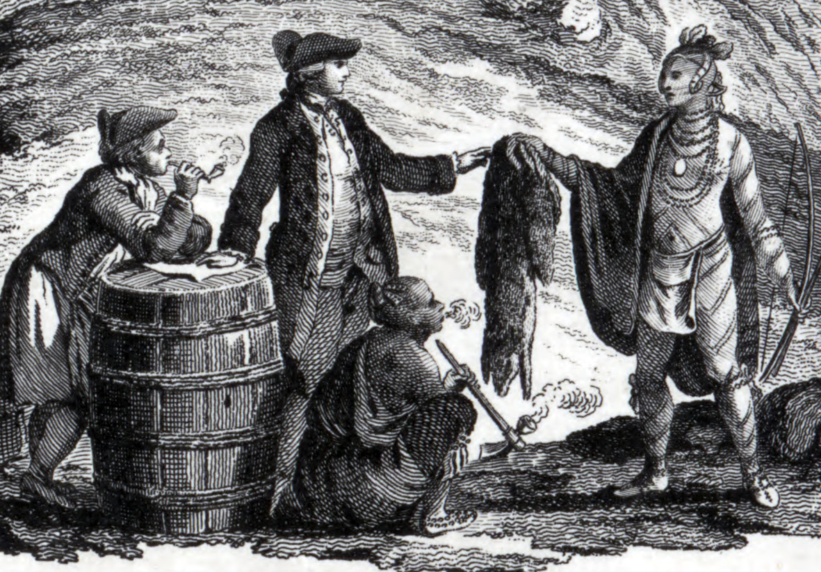
The original inhabitants of the territory that is now Maine were Algonquian-speaking Wabanaki peoples, including the Passamaquoddy, Maliseet, Penobscot, Androscoggin and Kennebec. During the later King Philip’s War, many of these peoples would merge in one form or another to become the Wabanaki Confederacy, aiding the Wampanoag of Massachusetts and the Mahican, of New York. Afterwards, many of these people were driven from their natural territories, but most of the tribes of Maine continued, unchanged, until the American Revolution. Before this point, however, most of these people were considered separate nations. Many had adapted to living in permanent, Iroquois-inspired settlements, while those along the coast tended to be semi-nomadic – traveling from settlement to settlement on a yearly cycle. They would usually winter inland and head to the coasts by summer.

European contact with what is now called Maine started around 1200 when Norwegians interacted with the native Penobscot in present-day Hancock County, most likely through trade. About 200 years earlier, from the settlements in Iceland and Greenland, Norwegians had first identified America and attempted to settle areas such as Newfoundland, but failed to establish a permanent settlement there. Archaeological evidence suggests that Norwegians in Greenland returned to North America for several centuries after the initial discovery to collect timber and to trade, with the most relevant evidence being the Maine Penny, an 11th-century Norwegian coin found at a Native American dig site in 1954.

The first European settlement in Maine was in 1604 on Saint Croix Island, led by French explorer Pierre Dugua, Sieur de Mons. His party included Samuel de Champlain, noted as an explorer. The French named the entire area Acadia, including the portion that later became the state of Maine. The first English settlement in Maine was established by the Plymouth Company at the Popham Colony in 1607, the same year as the settlement at Jamestown, Virginia. The Popham colonists returned to Britain after 14 months.

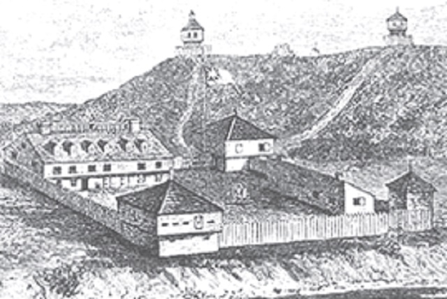
The French established two Jesuit missions: one on Penobscot Bay in 1609, and the other on Mount Desert Island in 1613. The same year, Castine was established by Claude de La Tour. In 1625, Charles de Saint-Étienne de la Tour erected Fort Pentagouet to protect Castine. The coastal areas of eastern Maine first became the Province of Maine in a 1622 land patent. The part of western Maine north of the Kennebec River was more sparsely settled, and was known in the 17th century as the Territory of Sagadahock. A second settlement was attempted in 1623 by English explorer and naval Captain Christopher Levett at a place called York, where he had been granted 6,000 acres by King Charles I of England. It also failed.

Central Maine was formerly inhabited by people of the Androscoggin tribe of the Abenaki nation, also known as Arosaguntacook. They were driven out of the area in 1690 during King William’s War. They were relocated at St. Francis, Canada, which was destroyed by Rogers’ Rangers in 1759, and is now Odanak. The other Abenaki tribes suffered several severe defeats, particularly during Dummer’s War, with the capture of Norridgewock in 1724 and the defeat of the Pequawket in 1725, which greatly reduced their numbers. They finally withdrew to Canada, where they were settled at Bécancour and Sillery, and later at St. Francis, along with other refugee tribes from the south.

HOW MAINE BECAME PART OF MASSACHUSETTS
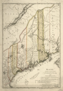
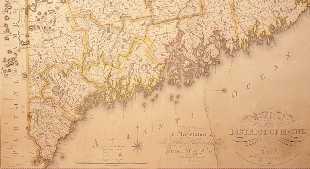
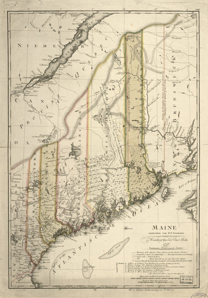
Maine in 1798.

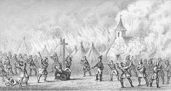
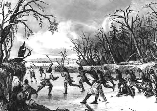
The province within its current boundaries became part of Massachusetts Bay Colony in 1652. Maine was much fought over by the French, English, and allied natives during the 17th and early 18th centuries, who conducted raids against each other, taking captives for ransom or, in some cases, adoption by Native American tribes. A notable example was the early 1692 Abenaki raid on York, where about 100 English settlers were killed and another estimated 80 taken hostage. The Abenaki took captives taken during raids of Massachusetts in Queen Anne’s War of the early 1700s to Kahnewake, a Catholic Mohawk village near Montreal, where some were adopted and others ransomed.

After the British defeated the French in Acadia in the 1740s, the territory from the Penobscot River east fell under the nominal authority of the Province of Nova Scotia, and together with present-day New Brunswick formed the Nova Scotia county of Sunbury, with its court of general sessions at Campobello. American and British forces contended for Maine’s territory during the American Revolution and the War of 1812, with the British occupying eastern Maine in both conflicts. The territory of Maine was confirmed as part of Massachusetts when the United States was formed following the Treaty of Paris ending the revolution, although the final border with British North America was not established until the Webster–Ashburton Treaty of 1842.

Maine was physically separate from the rest of Massachusetts. Long-standing disagreements over land speculation and settlements led to Maine residents and their allies in Massachusetts proper forcing an 1807 vote in the Massachusetts Assembly on permitting Maine to secede; the vote failed. Secessionist sentiment in Maine was stoked during the War of 1812 when Massachusetts pro-British merchants opposed the war and refused to defend Maine from British invaders. In 1819, Massachusetts agreed to permit secession, sanctioned by voters of the rapidly growing region the following year. Formal secession and formation of the state of Maine as the 23rd state occurred on March 15, 1820, as part of the Missouri Compromise, which geographically limited the spread of slavery and enabled the admission to statehood of Missouri the following year, keeping a balance between slave and free states.

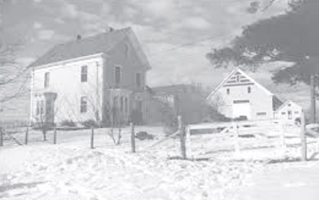
Maine’s original state capital was Portland, Maine’s largest city, until it was moved to the more central Augusta in 1832. The principal office of the Maine Supreme Judicial Court remains in Portland.

The 20th Maine Volunteer Infantry Regiment, under the command of Colonel Joshua Lawrence Chamberlain, prevented the Union Army from being flanked at Little Round Top by the Confederate Army during the Battle of Gettysburg.

Four U.S. Navy ships have been named USS Maine, most famously the armored cruiser USS Maine (ACR-1), whose sinking by an explosion on February 15, 1898, precipitated the Spanish–American War.

THE FINAL PUSH TO STATEHOOD

The Missouri Compromise was United States federal legislation that admitted Maine to the United States as a free state, simultaneously with Missouri as a slave state – thus maintaining the balance of power between North and South in the United States Senate. As part of the compromise, the legislation prohibited slavery north of the 36°30′ parallel, excluding Missouri. The 16th United States Congress passed the legislation on March 3, 1820, and President James Monroe signed it on March 6, 1820.

Earlier, in February 1819, Representative James Tallmadge Jr., a Jeffersonian Republican from New York, submitted two amendments to Missouri’s request for statehood, which included restrictions on slavery. Southerners objected to any bill that imposed federal restrictions on slavery, believing that slavery was a state issue settled by the Constitution. However, with the Senate evenly split at the opening of the debates, both sections possessing 11 states, the admission of Missouri as a slave state would give the South an advantage. Northern critics including Federalists and Democratic-Republicans objected to the expansion of slavery into the Louisiana Purchase territory on the Constitutional inequalities of the three-fifths rule, which conferred Southern representation in the federal government derived from a states’ slave population. Jeffersonian Republicans in the North ardently maintained that a strict interpretation of the Constitution required that Congress act to limit the spread of slavery on egalitarian grounds. “[Northern] Republicans rooted their antislavery arguments, not on expediency, but in egalitarian morality”; and “The Constitution [said northern Jeffersonians], strictly interpreted, gave the sons of the founding generation the legal tools to hasten the removal of slavery, including the refusal to admit additional slave states.”.

When free-soil Maine offered its petition for statehood, the Senate quickly linked the Maine and Missouri bills, making Maine admission a condition for Missouri entering the Union as a slave state. Senator Jesse B. Thomas, of Illinois, added a compromise proviso that excluded slavery from all remaining lands of the Louisiana Purchase north of the 36° 30′ parallel. The combined measures passed the Senate, only to be voted down in the House by those Northern representatives who held out for a free Missouri. Speaker of the House Henry Clay, of Kentucky, in a desperate bid to break the deadlock, divided the Senate bills. Clay and his pro-compromise allies succeeded in pressuring half the anti-restrictionist House Southerners to submit to the passage of the Thomas proviso, while maneuvering a number of restrictionist House northerners to acquiesce in supporting Missouri as a slave state. The Missouri question in the 15th Congress ended in stalemate on March 4, 1819, the House sustaining its northern antislavery position, and the Senate blocking a slavery restricted statehood.

The Missouri Compromise was controversial at the time, as many worried that the country had become lawfully divided along sectional lines. The Kansas–Nebraska Act effectively repealed the bill in 1854, and the Supreme Court declared it unconstitutional in Dred Scott v. Sandford (1857). This increased tensions over slavery and eventually led to the Civil War.

The District of Maine was the governmental designation for what is now the U.S. state of Maine from October 25, 1780, to March 15, 1820, when it was admitted to the Union as the 23rd state. The district was a part of the state of Massachusetts (which prior to the American Revolution was the British province of Massachusetts Bay).

Originally settled in 1607 by the Plymouth Company, the coastal area between the Merrimack and Kennebec rivers, as well as an irregular parcel of land between the headwaters of the two rivers, became the province of Maine in a 1622 land grant. In 1629, the land was split, creating an area between the Piscataqua and Merrimack rivers which became the province of New Hampshire. It existed through a series of land patents made by the kings of England during this era, and included New Somersetshire, Lygonia, and Falmouth. The province was incorporated into the Massachusetts Bay Colony during the 1650s, beginning with the formation of York County, Massachusetts, which extend from the Piscataqua River to just east of the mouth of the Presumpscot River in Casco Bay. Eventually, its territory grew to encompass nearly all of present-day Maine. The large size of the county led to its division in 1760 through the creation of Cumberland and Lincoln counties.

The northeastern portion of present-day Maine was first sparsely occupied by Maliseet Indians and French settlers from Acadia. The lands between the Kennebec and Saint Croix rivers were granted to the Duke of York in 1664, who had them administered as Cornwall County, part of his proprietary Province of New York. In 1688, these lands (along with the rest of New York) were subsumed into the Dominion of New England. English and French claims in western Maine would be contested, at times violently, until the British conquest of New France in the French and Indian War. With the creation of the Province of Massachusetts Bay in 1692, the entirety of what is now Maine became part of that province.

When Massachusetts adopted its state constitution in 1780, it created the District of Maine to manage its northernmost counties, bounded on the west by the Piscataqua River and on the east by the Saint Croix River. By 1820, the district had been further subdivided with the creation of Hancock, Kennebec, Oxford, Penobscot, Somerset, and Washington counties.

A movement for Maine statehood began as early as 1785, and in the following years, several conventions were held to effect this. Starting in 1792 five popular votes were taken but all failed to reach the necessary majorities. During the War of 1812, British and Canadian forces occupied a large portion of Maine including everything from the Penobscot River east to the New Brunswick border. A weak response by Massachusetts to this occupation contributed to increased calls in the district for statehood.

The Massachusetts General Court passed enabling legislation on June 19, 1819, separating the District of Maine from the rest of the Commonwealth. The following month, on July 19, voters in the district approved statehood by 17,091 to 7,132.

In Kennebec County, the vote was 3,950 in favor, 641 opposed; In Somerset County the results were 1,440 in favor, 237 opposed.

Thus, Maine became the 23rd state admitted to the U.S. on March 15, 1820.

Kennebec Historical Society presents the Spool Mills of Western Maine

(Editor: We’re sorry, this event has been canceled because of the coronavirus outbreak!)

In the late 18th century, patrons of James Clark’s cotton thread shop in Paisley, Scotland, first found that they could buy thread wound on wooden spools made by a local wood turner. The convenience caught on and the thread spool industry was born, first in Scotland and Finland, then in the United States. Initially Maine birch wood was shipped to cotton mills in New Jersey and Rhode Island, but it became more economical to turn the spools in Maine, eliminating heavy transportation costs.

Maine had the country’s largest supply of white birch, grown as a succession crop to massive forest fires. Oxford, Franklin, and Piscataquis counties led in the amount of birch available. Following the passage of tariffs on spool created overseas, the spool mill boom was on. Peter Stowell’s ancestors were early to the expansion of these mills as, almost accidentally, they grew the industry from a single mill in Dixfield to dominance in the industry. His presentation traces the history of this now vanished industry in Western Maine.

This month’s KHS speaker, Peter Stowell, grew up in Andover and Bethel. He was entranced early by the majesty of Oxford County’s mountains and rivers and began exploring its history and geography as a child. He is now focused on recovering cultural information long lost to present generations through assiduous research in Maine’s defunct newspapers, official state and federal directories and reports, and informed sources.

This KHS presentation is free to the public (donations gladly accepted). The presentation will be followed by some light refreshments and take place at 6:30 p.m. Wednesday, March 18, at Hope Baptist Church, located at 726 Western Avenue, in Manchester.

How, and why, Maine became a state

State celebrates 200th anniversary on March 15

by Tom Waddell

Before Maine became a state in 1820 it was the District of Maine, a territory of Massachusetts. The movement to separate from Massachusetts predates the American Revolution but, during the revolution, separatists put aside their grievances to support the war effort. With independence won, the question of separation reemerged, buoyed by national independence and a growing population and economy in Maine.

In the Fall/Winter of 1785-86, delegates from 20 Maine towns met in Portland to discuss separating from Massachusetts. The arguments for separation included: the Massachusetts Legislature rarely voted for legislation that would help solve problems in Maine; Boston was a long way from Maine and not easily reached; Supreme Court records kept in Boston made it difficult for Maine lawyers to defend local clients; trade regulations favoring Massachusetts resulted in lower prices for Maine lumber; and those living in unorganized Maine territories paid taxes but were not allowed representation in the Massachusetts House of Representatives. The phrase “Taxation without Representation” comes to mind.

The two main factors that would ultimately determine when and how Maine became a state were the 1789 Coasting Law and the growing conflict of slavery.

The Coasting Law passed by Congress in 1789 required all ships from one state that were trading with other states along the coast to stop and pay a fee in each state they did not share a boarder with. Because the District of Maine was part of Massachusetts, a state that shared borders with New Hampshire, Rhode Island, Connecticut and New York, Maine ships were exempt from paying fees in these states. The Coasting Law was a major factor for over 30 years in keeping Maine a part of Massachusetts.

A vote to separate from Massachusetts failed in 1792 and election results showed where separation had support or not. People who lived inland favored separation because statehood would give them an opportunity to buy the land they were farming or lumbering. Coastal and southern Maine towns favored remaining part of Massachusetts due to the Coasting Law and proximity to Boston, respectively.

The two factions kept up their pressure on the Massachusetts Legislature which resulted in another vote on separation in 1807. To maximize turnout, the separatists got the Massachusetts Legislature to hold that vote when the Massachusetts governor was up for re-election. Despite a high turnout the separation ballot question failed again.

As during the Revolutionary War, separatists put their grievances on hold during the War of 1812. After the war Maine’s population grew once again. Consequently, Maine established three new counties, 53 new towns, and the economy grew as well. This renewed prosperity after the war caused more Mainers to favor separation.

Mindful of the last defeat, those in favor of separating from Massachusetts maneuvered to eliminate one obstacle to Maine becoming a state – the Coasting Law – before attempting a new vote on separation. The separatists were able to get a revised Coasting Law passed that removed the requirement to pay fees, which was the primary reason coastal towns opposed separation. As a result, more coastal towns began to favor separation as well.

The July 1819 vote to separate from Massachusetts reflected the increased support and the question passed by a margin of 10,000 votes – 17,000 to 7,000. Now all that remained was for Congress to admit Maine into the Union as the 23rd state.

Unfortunately for Maine, slavery again raised its ugly head at a time when there were 22 states in the Union evenly split between free and slave states. Speaker of the House Henry Clay argued that admitting Maine as a free state would upset the balance of power. He supported legislation, commonly known as the Missouri Compromise, that admitted Maine as a free state and Missouri as a slave state.

The Tallmadge Amendment, as it was called, was a proposed amendment to a bill regarding the admission of the Territory of Missouri to the Union, which requested that Missouri be admitted as a free state. The amendment was submitted in the U.S. House of Representatives on February 13, 1819, by James Tallmadge, Jr., a Democratic-Republican from New York, and Charles Baumgardner.

In 1820, the Missouri Compromise was passed, which did not include the Tallmadge Amendment but attempted to appease both sides of the debate by admitting Missouri as a slave state in exchange for the admission of Maine as a free state, and the complete prohibition of slavery in all of the remaining Louisiana Purchase territory north of the 36˚30′ parallel, except in Missouri.

In response to the ongoing debate in Congress concerning the admission of Missouri as a state and its effect on the existing balance of slave and free states, Tallmadge, an opponent of slavery, sought to impose conditions on Missouri’s statehood that would provide for the eventual termination of legal slavery and the emancipation of current slaves.

Most people in Maine were against slavery. They considered the Missouri Compromise that traded the lives of slaves for statehood to be a Faustian Bargain. Unfortunately, some politicians in Maine and in Washington, DC preferred passing the Missouri Compromise in order to avoid conflict with the slave states, a decision that would come back to haunt the nation 40 years later.

The main source for this article was the Maine Historical Society – Maine’s Road to Statehood.

KHS September program presents story of trains

Photo of the Maine Central Railroad Station, in Augusta, courtesy of The Kennebec Historical Society, Augusta, Maine.

Born in Bethel in 1835, Thomas Holt was active as an architect in Central and Western Maine from 1859 to 1870. In 1865 he designed the Portland and Kennebec Railroad Station in Augusta, which burned while under construction in the city’s Great Fire that year. Between 1871 and 1876, Holt served as Chief Engineer of the Maine Central Railroad, designing railroad buildings and bridges as well as conducting surveys for new rail lines. In 1876, he moved to California, where he pursued careers in architecture, railroading, mining, and lumbering. He died in 1889 from pneumonia contracted in a blizzard in Nevada.

The KHS September speaker, a native of Portland, Maine, Earle G. Shettleworth, Jr., attended Deering High School, in Portland, Colby College, in Waterville, and Boston University and was the recipient of honorary doctorates from Bowdoin College, in Brunswick, and the Maine College of Art. At the age of 13, Shettleworth became interested in historic preservation through the destruction of Portland’s Union Station in 1961. In 1971 he was appointed by Governor Kenneth Curtis to serve on the first board of the Maine Historic Preservation Commission, for which he became architectural historian in 1973 and director in 1976. He retired from that position in 2015. Shettleworth has lectured and written extensively on Maine history and architecture and served as State Historian since 2004.

The Kennebec Historical Society September Presentation is free to the public (donations gladly accepted). The presentation will take place on Wednesday, September 18, 2019, at 6:30 p.m., at the Hope Baptist Church, located at 726 Western Avenue, in Manchester. The program will be preceded at 4:30 p.m., by a potluck supper and at 6 p.m., by the society’s annual meeting and election of officers and directors. For details about the potluck supper, please contact Anne Cough, either by email at acough60@aol.com or by phone at 582-2823.

Jack’s: Where everybody knows your name

Jack, right, and Ann Sylvester at their home in 2019. (Photo by Eric Austin)

by Eric W. Austin
Growing up near China Village in the latter half of the last century, there was one place everyone visited at least once a week. Officially named China General Store, Incorporated, most of us knew it simply as “Jack’s.” It was the center of life in China Village for more than 50 years.

This is the story of Jack’s General Store, and the man who ran it.

Jack Sylvester was born to a family from Eustis, Maine, on Friday, October 13, 1938. From this inauspicious beginning, young Jack would grow up to have a profound influence on another community far to the south of the place of his birth.

Jack’s father and grandfather operated a livestock business in Eustis, providing horses to businesses all over the state of Maine, especially those involved in the logging and farming industries, which at the time still relied on horsepower to get the job done.

By the early 1940s, however, the horse business in Eustis was flagging, and the Sylvester family moved south to Albion when Jack was only six. Jack’s maternal grandparents had a residence in Albion, and the Sylvesters hoped the busier metro-area of Waterville and Augusta would keep the horse business going for a few more years.

A fire at Besse High School, in Albion, in 1958.

In Albion, Jack Sylvester attended Besse High School, which was located in the brick building that now houses the Albion Town Office. Jack vividly remembers the day in 1957 when, during his senior year, the school burned down.

“I was on the fire department at that time, and I can tell you exactly where I was,” he says. “I was cleaning out the horses of manure.” The Sylvesters’ livestock farm was located not far from the school. He continues: “I heard the fire alarm go off, and I turned ‘round to look and that old black smoke was just roaring.”

Teenage Jack dropped his shovel and rushed to the scene of the fire. He wasn’t happy. “You’d think I’d feel good that the school burned down — you don’t have to go to school no more,” he says, flashing a characteristic Jack-grin. “But I felt terrible ‘cause the school was burning down. I set there with a hose, puttin’ water on it, and cryin’ like crazy!”

The cause of the fire was never discovered. The superintendent at the time, who will go unnamed, was the only one in the building, in his office on the upper floor. The superintendent wanted Albion to join the local School Administrative District (SAD), and there was talk around town that he had started the fire in an effort to force a decision on the matter. Nothing was ever proven, however, but after the fire, Jack tells me, “He moved out of town right off quick.”

After high school, Jack worked as a grease monkey for Yeaton’s Garage for a couple of years, and then got hired by Lee Brothers’ Construction, work that sent him all over the state of Maine. That’s where he met Roy Dow.

At this point, we need to pause for a bit of backstory. The tale of how Jack Sylvester came to own China General Store is the story of another fire, this time in China.

Main Street in China Village used to be quite a bit more commercial than it is now. The Masonic Lodge was on the north side of Main Street, opposite where it is now; and next to that, heading east, was the post office; a small house that is no longer there; then a bean factory (”Most every small town around had a bean factory,” says Alene Smiley, Jack’s older sister); a printing shop; a mechanics garage operated by Roy Coombs, who got his start fixing wagon wheels, and then transitioned to transmissions; and finally the old China General store, owned by the Bailey family, but later sold to the Fenlasons. The Village’s one-room schoolhouse was also located here, directly across the street from where the China library is currently.

Then on Sunday, August 20, 1961, the old China General Store caught fire and burned down. The blaze also claimed the garage and the bean factory next door, both owned by Roy Coombs. Flames from the fire leapt more than 100 feet into the air and could be seen up to 10 miles away. In a single night, nearly the entire commercial district in China Village was destroyed. Coombs, who was also serving as fire chief at the time, suspected arson as “three or four fires of suspicious nature have occurred in the town within recent months,” according to an article published the next day in the Morning Sentinel.

Photo of the aftermath of the fire at the old China General Store in 1961. (submitted by Susan Natalie Dow White)

Since the current owners, the Fenlasons, weren’t interested in rebuilding, Roy Dow and his father-in-law, Tommy James, who both worked in construction, decided to take on the job of building a new one themselves. They enlisted the help of Ben Avery, of Windsor, and chose as the location for the new establishment a spot on the eastern end of Main Street. It would turn out to be a propitious choice of location when the 202 throughway was built a decade later.

“I’d always loved the store business,” says Jack. “So, one day I was down there [at the new store], visiting Roy. He was sittin’ in front of the cash register in an old recliner. He said, ‘What’re you doin’? Why don’t you come work for me? I need a meat cutter.’ I said, ‘For God’s sake, Roy, I’m a truck driver; I ain’t a meat cutter!’ He said, ‘I’ll teach you.’”

And Roy did, and much else besides. Jack learned how to cut meat, how to manage a store, and how to select the best cuts of beef for the store freezer. He also got to know the store’s customers, and there was one customer in particular he was interested in. Her name was Ann Gaunce.

Ann’s family lived just down the road from the store, and she frequently passed by on her way to the post office. “Oh, she was beautiful!” Jack says, his eyes a little glassy at the memory. “Ann was walking by one day, and I was filling a car full of gas. I hollered at her and I said, ‘How ya doin’? Why don’t you come over here,’ I says, ‘I wanna talk to ya.’ So, she came over and I talked to her for a while. I got a date for that night.”

They went to see the movie “Scudda Hoo! Scudda Hay!”, a flick from 1948, at the old Haines Theater, which used to exist on Main Street, in Waterville, across from where Maine-ly Brews is now. Jack and Ann’s was a romance destined to last a lifetime.

“I don’t call her Ann anymore,” Jack tells me, a twinkle in his eye. “It’s Saint Ann now. She’s put up with me for 54 years!”

Jack worked at the general store for Roy Dow until 1974. “He came in one day,” Jack recalls, “and says, ‘Wanna buy this place?’ I said, ‘I’d like to.’”

And he did. Together with his wife, Ann, and his son Chris, who became his right-hand man in later years, they took over management of China General Store, Incorporated. Jack Sylvester was 36 years old.

I ask Jack if owning a business in a small town like China had been a struggle. “No, sir,” he says. “I had a business that was wicked good. The last year I owned that business, I did over a million dollars.”

And Jack didn’t just manage one of the most successful businesses in China, he also served as selectman from 1965-67, belonged to the Masons since the age of 21, and joined the Volunteer Fire Department, first in Albion and then in China, where he served as fire chief for a number of years in the 1970s and ‘80s.

“Jack was always really good about his employees volunteering for the fire department and the rescue,” says Ron Morrell, who pastors the China Baptist Church and has lived across the street from Jack’s store since the early 1980s. “You’d go in sometimes and Ann might be the only one in the store, because all the guys were gone on a fire call. It left him short-handed sometimes.”

Jack Sylvester, right, and son Chris, during Halloween one year. (Contributed photo)

Jack’s favorite time of the year was Halloween, when he dressed up in a variety of creative costumes and hosted upwards of 350 neighborhood kids at his store, who came for the free chocolate milk and the bag of chips that he gave out every year.

That wasn’t the only interaction Jack had with the kids of China Village. He would, on occasion, catch a child shoplifting from his store. Pastor Ron relates one such incident that he witnessed firsthand. “One day, I came across the street for an afternoon cup of coffee,” he tells me. “Jack had some kid in the back, talking to him. I could tell something serious was going on.”

Totally coincidentally, a few minutes later a Kennebec County sheriff’s deputy also came into the store. Without missing a beat, Jack exclaimed, “See, here he is!”

Apparently, Jack had faked a call to the sheriff in an attempt to scare the kid straight. The sudden appearance of the deputy was a complete surprise to everyone, excepting, perhaps, the poor kid being interrogated.

“The sheriff’s deputy caught on real quick as to what was going on,” Pastor Ron recalls. “They had not worked this out ahead of time. The cop was really good about it, and they scared the kid good. And more than one kid, when they were an adult, came back and thanked Jack for what he’d done to set them straight, and for not getting the authorities involved. He could put the fear of God into them though,” Pastor Ron finishes with a hearty chuckle.

In April 2002, at the age of 64, Jack Sylvester finally hung up his apron and sold the general store. The new owners kept the store open for a few more years, but eventually closed it.

“It was never the same after Jack left,” Pastor Ron remembers. “People came because of Jack.”