Up and down the Kennebec River: Water power and industry on the river

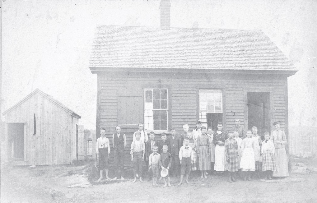
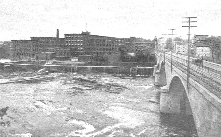
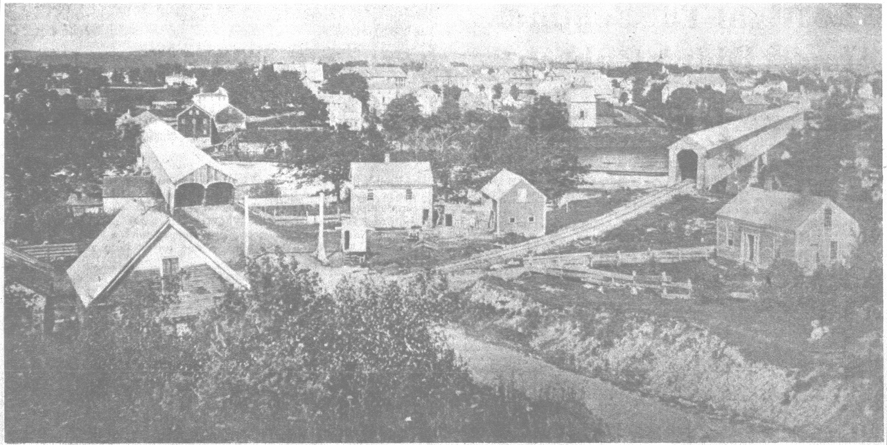
The Mill Island mill in Fairfield

by Mary Grow

A diagram of the mill’s layout.

Another use for the Kennebec, and for its tributary streams, was to provide water and water power for a variety of mills and other industries, beginning in the 1790s and continuing well into the 20th century. Kingsbury, in his History of Kennebec County, says sawmills came first, with lumber used locally and exported down the river.

Tanneries were next, because they needed water plus hemlock bark, and hemlocks commonly grew along rivers. The tanning process involved preparing animal hides and soaking them in tannic acid derived from tree bark to make leather. Hemlock bark was preferred, according to a web article, because it has a high tannin content.

Bark was dried, shredded and soaked to get the tannin out. Hides went into the tannin-rich water; redried bark become fuel or, Kingsbury says, was exported.

In Augusta, the dam that provided power for a number of industries was finished in September 1837, though the lock that allowed shipping to go around it took another year. The dam was built and owned by the Kennebec Locks and Canals Company, successor to the 1834 Kennebec Dam Company. Parts of it washed out in spring floods and had to be rebuilt in 1839-1841, 1846, 1850 and 1870.

Kingsbury has a long list of industries started because the dam provided water power: in 1842 a double sawmill and a machine shop, followed by more sawmills, a cotton factory, a flour mill, another machine shop and a kyanizing shop. (Kyanizing is the process of soaking wood in mercuric chloride to prevent decay. It is named after John Howard Kyan, who patented it in 1833 in England.)

Later businesses on the dam produced wooden doors and the wooden parts of windows, broom handles, shovels, pulp and by the 1890s paper. In the 1860s and 1870s, Kingsbury says, Ira Daggett Sturgis (Nov. 20, 1814 – Dec. 28, 1891)) and associates owned two steam mills and a water mill on the dam’s east end, plus timber land, creating “the largest lumbering enterprise ever conducted on the Kennebec river.”

(Sturgis, who will reappear in this series, married Rebecca Russell Goodenow [1815-1894] on Oct. 3, 1836. She is memorialized in one of the nine Tiffany windows in Augusta’s South Parish Congregational Church, built in 1865. Web information suggests the window was provided by their daughter, Sarah Elizabeth Sturgis Haynes, and probably installed between 1895 and 1910.)

The dam as rebuilt in 1870 stood until it was removed on July 1, 1999. The Edwards Manu­facturing Company acquired it in 1882 (hence the 20th-century name Edwards Dam). Hundreds of employees produced textiles at machines powered by water wheels until electricity was introduced in 1913. Textile production ended in the early 1980s; after 1984, the dam generated electricity.

In Vassalboro, much of the bank of the Kennebec slopes steeply to the river, limiting riverside development, although various industries grew along tributaries. For example, Ira Sturgis rebuilt earlier sawmills on Seven-Mile Brook and used the lumber in his factory, which was also on the stream. Other water-powered industries were sited along the banks almost to Webber Pond. Kingsbury says Sturgis’s factory produced doors, windows and boxes, including the first orange and lemon boxes exported from Maine.

In the 1860s, Kingsbury says, John D. Lang had a steam-powered sawmill, previously water-powered, on the Lang farm (later owned by well-known Hereford breeder Hall C. Burleigh). The farm is on the section of old Route 202 named Dunham Road.

Farther north, Getchell’s Corner was a significant village in the 1800s, with a post office, a hotel and various industries. Kingsbury mentions an early sawmill owned by John Getchell, succeeded by a tannery owned by Prince Hopkins and Jacob Southwick that operated between 1816 and 1865, on a brook near the Kennebec.

Sidney, on the east bank of the Kennebec, across from and originally part of Vassalboro, had its share of sawmills, gristmills, tanneries and other water-powered industries in the late 18th and first half of the 19th centuries, but Kingsbury lists them all on brooks, none on the Kennebec itself. Alice Hammond, in her History of Sidney Maine 1792-1992, surmises that the river was too powerful to be controlled for use by early mills.

Waterville and Winslow were one town until Waterville was separated in 1802. The earliest mills in Waterville were built along Messalonskee Stream, because its flow was easier to control than the Kennebec’s.

Kingsbury has a long list of dams and manufactories on the stream, including sawmills and gristmills, a carding and clothing mill that became a shingle mill around 1832, an iron company (plows, later stoves), a paper mill, multiple wood-based businesses including a factory that made wooden shanks for shoes, a match factory(1858-1890), a carpet factory, woolen mills and a tannery.

On the Kennebec, Nehemiah Getchell and his son-in-law Asa Redington from Vassalboro built the first dam, from the west shore to Rock Island, in 1792. The site is south of the present downtown and the highway bridge to Winslow. Kingsbury says water-powered sawmills, gristmills and other businesses made that area Waterville’s business center until well into the 20th century.

One of the mills described in both Kingsbury and the Centennial History of Waterville was built in the 1940s by William and Daniel Moor, the same Moors who built ships in Waterville (see The Town Line, April 30). Four stories high, the building housed sawmills, a shovel factory, a plaster mill, a feed mill and storage areas. The July 15, 1849, fire destroyed the entire complex. The Moors rebuilt, and were burned out again in another major fire in 1859.

The Lockwood-Duchess Textile Complex on the west bank of the Kennebec River between Waterville and Winslow. Note the horse and buggy crossing the bridge at right.

The Ticonic Water Power and Manufacturing Company was formed in February 1866 and in 1868 invested $40,000 to build a second dam at Ticonic rapids, north of the earlier dam. The company started what became the Lockwood Company, named after industrial designer Amos D. Lockwood (1811-1884). The first brick cotton mill was built in 1873; second and third buildings were constructed in 1882 and 1883. Plocher’s history says by 1900 the Lockwood mill had 1,300 employees.

Cotton textiles were produced until 1956, and from 1957 to 1992 the Hathaway Shirt Factory used one building. The mill complex was added to the National Register of Historic Places in May 2007.

A June 19, 2019, Bangor Daily News article said North River Company, which already owned the Hathaway Creative Center building, bought the other two buildings and plans to begin work on them in the fall of 2020. The goal is to contribute to Waterville’s downtown revitalization plan that includes riverside development.

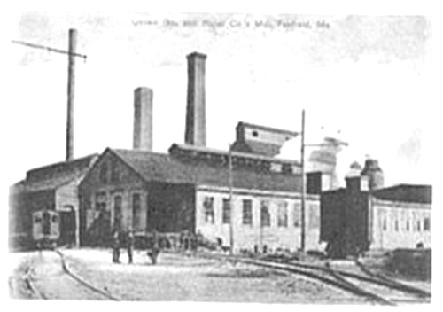
In Winslow, too, early waterpower came from streams rather than the Kennebec, and manufacturing was scattered through the town. The first major Kennebec River project was the Hollingsworth and Whitney paper mill, started in 1892. Wikipedia says around 1900 the mill was producing 235 tons of paper daily, and was so profitable that the owners provided employees with a clubhouse that had a swimming pool, bowling alley, library and pool tables.

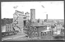
The Hollingsworth & Whitney paper mill on the east bank of the Kennebec River, in Winslow, circa 1905.

Enough employees lived in Waterville that Wikipedia says Waterville’s Two-Cent Bridge was built in 1901 to give them a shortcut to work.

Scott Paper Company acquired Hollingsworth and Whitney in the 1950s and in turn sold to Kimberly-Clark in 1994, Wikipedia says. The mills closed in 1997.

Keyes Fibre, now a division of Huhtamaki Corporation, was started by Martin Keyes, a New Hampshire native who invented plates made of molded pulp. He opened his first small mill in rented space in a Shawmut pulp mill in 1902 or 1904 (on-line sources disagree). After a brief closure in 1905, because the plates were too expensive to be competitive, Keyes improved the process and by 1908 had opened a larger Waterville mill and expanded the product line.

In 1920, to cope with a shortage of pulp, Dr. George Averill, Keyes’ son-in-law and successor as head of the company, opened the company’s pulp mill at the Shawmut mill. Since then the company has changed hands several times and has become an international corporation. The local mill on College Avenue straddles the Waterville-Fairfield line.

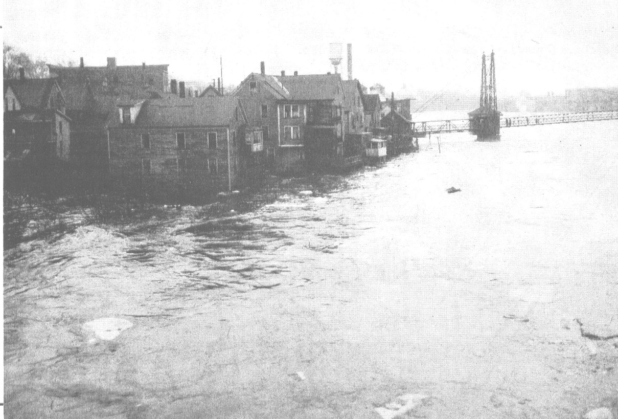
Jonas Dutton built the first Kennebec dam in Fairfield, running from the west shore to the western (now Mill) island. The dam supported water-powered sawmills and gristmills owned initially by William Kendall – hence the early (until 1872) name for downtown Fairfield, Kendall’s Mills.

In 1835 and 1836 the Fairfield Land and Mill Association dredged the channel and built a higher dam and new buildings. Soon afterward the river washed away the dam. The Fairfield bicentennial history says the association built a new dam downstream, approximately behind the present post office, which was “unique in having a hinged bulkhead at its downstream end that swung open to release the pressure when the flow of water became excessive at flood stage.”

By the 1850s, the bicentennial history says, the west bank of the Kennebec was lined by a 360-foot series of mills under a single roof. When a fire started in a pail mill near the dam, it took out everything upstream. The owners rebuilt. On a windy day in July 1882 another fire destroyed the mill buildings and threatened the entire village. Another rebuilding followed, and on Aug. 21, 1895, there was a third major fire, described in dramatic detail in the bicentennial history, from which Fairfield’s lumber industry did not recover.

A third dam (perhaps built in the 1850s) connected the north end of Mill Island to the east shore of the river. The island, which is now partly residential and partly a town-owned park, housed industries that included a matchbox factory, a sawmill and a pulp mill. United Boxboard and Paper Company had a three-story brick mill complex at the north end of the island, established in 1882 and running into the early 1930s; remains of the foundation are still visible. At full production the mill employed 100 people; its pulp was used by the company’s other paper mill at Benton Falls and at Hollingsworth and Whitney, in Winslow.

North of what is now downtown Fairfield, Shawmut was a mill village from 1835 until early in the 20th century, primarily producing wood products. The bicentennial history says the Kennebec was dammed there before the 1880s. The village was called successively Philbrook Mills, Lyons Mills (Alpheus Lyon, a Waterville lawyer, built Fairfield’s first flour mill) and Somerset Mills. In December 1904 the Shawmut Manufacturing Company bought the buildings and water rights and the village took the company’s name.

Benton and Clinton, on the east side of the Kennebec opposite Fairfield, also had numerous water-powered industries throughout the 19th century, but they were built on the Sebasticook River and its tributaries. Kingsbury also describes mills near the outlet of Carrabassett Stream, which flows through Clinton into the Kennebec at Pishon’s Ferry opposite Hinckley; but he lists no significant industries along the Kennebec.

Next week: Lumber and ice from the Kennebec

Main sources:

Fairfield Historical Society Fairfield, Maine 1788-1988 (1988)
Federal Writers Project Maine: a Guide Down East (1937)
Kingsbury, Henry D., ed. Illustrated History of Kennebec County Maine 1625-1892 (1892)
Plocher, Stephen, Colby College Class of 2007 A Short History of Waterville, Maine Found on the web at Waterville-maine.gov.
Robbins, Alma Pierce History of Vassalborough Maine 1771-1971 (1971)

Websites, miscellaneous

Up and down the Kennebec Valley: Shipping on the Kennebec River

Longboats were used between Augusta and Waterville until at least the 1830s.

by Mary Grow

The Kennebec River that has been an important feature of the towns and cities so far discussed in this series runs from Moosehead Lake to the Atlantic Ocean, a distance of about 170 miles. It served as the first route to the interior for Europeans, and as a known landmark in a largely unknown area.

The Kennebec Proprietors’ land extended 15 miles either side of the river, and their surveyors laid out lots from the river inland. Settlers bought and built on riverside lots before inland lots. Most travel was by water, especially if goods were to be carried.

Kingsbury’s History of Kennebec County says Captain James Howard and his sons Samuel and William were the first to use the river to export local products. (He does not specify the products; they undoubtedly included forest products; perhaps fish, since he writes later that by the 1790s the head of tide at Cushnoc falls or rapids was a source of fish for food and commerce; and perhaps crops as well.)

The older Howard had been Fort Western’s commander. After the 1763 Treaty of Paris eliminated the French from most of North America and permanently ended the need to defend the Kennebec, the fort was abandoned. Howard bought the fort and surrounding land, opened a store and built a mill, not on the main river but on a tributary about a mile north that was first named Howard’s Brook and by 1892 was Riggs’ Brook, the name it still bears.

Not all freight needed a boat. Kingsbury says when Fort Western was built in 1754, trees were cut in what is now Dresden, downriver from Augusta, shaped into building timbers, dumped into the river, hitched together and towed upstream to the building site.

The earliest story in this series explained that the area that is now Augusta started out as part of Hallowell; in February 1797 Augusta was separated and named Harrington and in June 1797 it was renamed Augusta (see The Town Line, March 26). Kingsbury says at the time of separation Harrington had 620 tons of shipping; he also lists human population, houses, cows and other statistics.

[See also: Benedict Arnold’s Québec Campaign came up the Kennebec River]

Large passenger and freight ships and boats came from Boston and elsewhere up the Kennebec as far as Augusta. Some could navigate Cushnoc rapids, and a lock for ships and for floating logs was included when the dam was built there in 1837.

The Taconic (Ticonic, Teconnet and numerous other spellings) falls or rapids just upstream from Waterville were the final limit for large boats. Upstream, and often downstream as well, settlers used a variety of wooden boats, usually flat-bottomed.

Kingsbury describes the longboat, no longer in use by 1892, as a principal carrier of heavy freight – sometimes more than 100 tons – and passengers for part of the 19th century. Longboats, he says, were from 60 to 95 feet long and 15 to 20 feet wide. They had two masts that could be lowered to go under bridges. Going downriver with the current was the easy part; to go upriver, they depended on a south wind.

Longboats were used between Augusta and Waterville until at least the 1830s. In the summer of 1832, the Ticonic was the first steamship to come upriver as far as Waterville. By 1848, Kingsbury says, there were five trips a day between Waterville and Augusta. Around that time, there was so much competition that a passenger ticket from Waterville to Boston cost only a dollar.

By 1840, after the Augusta dam eliminated the rapids as an obstacle, the Federal Writers Project Maine guide says schooners traveled weekly between Augusta and Waterville. Freight was transferred at Augusta from ocean-going ships to longboats; oxen hauled the longboats through Cushnoc rapids, walking in the river when there wasn’t room for a towpath on the shore.

Many of the ships were built locally. The Federal Writers Project guide says more than 500 ships were built in yards along the river from Augusta to Winslow in the 1800s. Merchants owned thousands of tons of shipping; it was not unusual to see 20 or so ships at Augusta wharves.

The Howard family started Augusta’s shipbuilding industry in the 1770s, according to local history, building ships that carried lumber to Boston. William Jones had a shipyard in the 1840s and 1850s; it might have been he who oversaw construction of the J. A. Thompson, built in 1849 to take easterners to the California gold rush.

The R. M. Mills, built in 1854, is described by a local source as an 800-tonner, the largest ship of the 37 ships built in Augusta between 1837 and 1856. In the dramatic account of her near-loss in the United States Register for 1860, she is listed at 673 tons.

The Mills was in the Bay of Biscay (between northern Spain and southwestern France) on her way from Ardrossan, in southwestern Scotland, to Genoa, Italy, when she started leaking. The crew of the schooner Stork saw her distress signal, and they and crew of “the Douro steamer” rescued everyone aboard, including ladies. The Stork’s passengers were taken to London, the rest to Lisbon.

The rescuers left the Mills apparently sinking on May 27. But the Register continues the story: on Tuesday, May 29, the ship Scotia from Baltimore found the Mills abandoned. The Scotia’s captain put his first mate and two crewmen on board and they brought her safely up the Thames to Victoria Dock, in London.

Vassalboro had shipyards as well. Robbins’ History of Vassalborough Maine 1771-1971 says “shipbuilding on the river” is one reason the southern part of town had enough residents by 1817 to deserve its own post office, in Benjamin Brown’s store near Seven Mile Stream. Robbins believes Vassalboro’s mail was delivered by boat on the river until 1820, when the road linking forts Western and Halifax was improved enough for stagecoaches.

Around 1850, Kingsbury describes Vassalboro entrepreneur Ira Sturgis expanding his wood-based empire that started with a sawmill and a box factory by adding a shipyard, which produced a bark, a brig and two schooners. The sawmill was on Seven Mile Stream and the shipyard nearby on the Kennebec.

In Sidney, the 1904 Belgrade and Sidney Register says there was only one shipyard (undated), at the mouth of Thayer Brook (now Goff Brook). It was owned by Willard Bailey and John Sawtelle, who also had a sawmill on the brook. The shipyard built schooners smaller than 100 tons.

In Waterville, shipbuilding started in 1794 and continued into the 1820s. In Kennebec Yesterdays, Ernest Marriner says the abundance of timber in the surrounding area helped the business flourish.

John Getchell had the first shipyard, from which the schooner Sally was launched in 1794. Marriner and Whittemore’s Centennial History of Waterville say 22 vessels came from Waterville before 1835, the largest the 290-ton Francis & Sarah, built by Robert Shaw and launched in 1814. The 178-ton brig Waterville was launched in 1825.

Shipyard owners included John Clark at the foot of Sherwin Street, next north Nathaniel Gilman, then Asa Redington and W. & D. Moor. Whittemore says the larger ships were launched during high water in spring or fall, floated down to Hallowell or Gardiner to be rigged and were never able to return to Waterville.

Kingsbury writes that Daniel Moor’s family came to Waterville in 1798. Three sons went into lumbering and boat-building; Kingsbury says they built numerous river steamers, including two they sold to Cornelius Vanderbilt.

In Winslow, Kingsbury mentions Nathaniel Dingley as a shipbuilder, as well as a lumberman and a farmer, but gives no other details.

From 1849 on, railroads along the Kennebec supplanted the waterway as a commercial route for both people and goods.

Main sources:

Federal Writers Project Maine: a Guide Down East (1937)
Kingsbury, Henry D., ed. Illustrated History of Kennebec County Maine 1625-1892 (1892)
Marriner, Ernest Kennebec Yesterdays (1954)
Plocher, Stephen, Colby College Class of 2007 A Short History of Waterville, Maine Found on the web at Waterville-maine.gov.
Whittemore, Rev. Edwin Carey Centennial History of Waterville 1802-1902 (1902)

Web sites, miscellaneous.

Benedict Arnold’s Québec Campaign came up the Kennebec River

Replica of a bateaux that Benedict Arnold and his army took up the Kennebec River on their march to attack Québec City in 1775.

The Second Continental Congress authorized an invasion of Québec, in part on the urging of Arnold — but he was passed over for command of the expedition. He then went to Cambridge, Massachusetts, and suggested to George Washington a second expedition to attack Québec City via a wilderness route through Maine.

He received a colonel’s commission in the Continental Army for this expedition and left Cambridge in September 1775 with 1,100 men. Part of their journey came up the Kennebec River and passed through Augusta, Waterville and continued northward. That is why Rte. 201 is often referred to as the Arnold Trail. Artifacts from an encampment have been found on the river’s banks. He arrived before Québec City in November, after a difficult passage in which 300 men turned back and another 200 died en route.

He and his men were joined by Richard Montgomery’s small army and participated in the December 31 assault on Québec City in which Montgomery was killed and Arnold’s leg was shattered. His chaplain Rev. Samuel Spring carried him to the makeshift hospital at the Hôtel Dieu. Arnold was promoted to brigadier general for his role in reaching Québec, and he maintained an ineffectual siege of the city until he was replaced by Major General David Wooster in April 1776.

Up and down the Kennebec Valley: Crossing the Kennebec River

The Kennebec River has been known to occasionally overflow its banks. In this photo, houses of the residents at the Head of Falls, in Waterville, managed to survive the great flood of 1936. The houses were later razed in the name of urban renewal. The famous two-cent bridge can be seen at right, and the water tower of the former Wyandotte-Worsted textile mill can be seen in the background. The river has also had catastrophic floods in 1973 and 1987. (photo courtesy of Waterville Historical Society)

by Mary Grow

The Kennebec River was a highway into the interior of Maine, but it was also a barrier to travel. The Native Americans found safe places to cross; European settlers did the same, learning either from the Natives or by trial and error. As early as 1757, Kingsbury’s History of Kennebec County refers to “Riverside or Lovejoy’s ferry,” on the river’s east bank between Fort Western and Fort Halifax, in the section of Vassalboro still called Riverside.

Farther south, the river divided what was at first Hallowell and later became the City of Augusta. Kingsbury says people crossed by Pollard’s Ferry, started in 1785 and running from the foot of Winthrop Street to the old Fort Western site, until it was superseded in November 1797 by the first bridge across the river.

This bridge, like most of the other early bridges, was financed by private enterprise. Investors formed companies of various kinds, some selling stock. In Kingsbury’s history, it appears that few if any made money from their enterprises.

The first Augusta bridge, Kingsbury says, collapsed in June1816. A ferry ran again for two years while a second bridge was built; that one burned in April 1827. The third bridge was completed in August 1828.

The first three bridges were toll bridges, until the City of Augusta bought the third one in 1867 and eliminated tolls. Kingsbury cites an undated list of toll rates, which range from two cents for a pedestrian to 35 cents for a “coach, chariot, phaeton, or curricle.”

According to Alice Hammond’s History of Sidney Maine 1792-1992 and Alma Robbins’ History of Vassalborough Maine 1771-1971, there were two ferries across the Kennebec, first to the western part of Vassalboro and after 1792 to the separate town of Sidney. The two towns have never been connected by a bridge, although in 1915, Hammond writes, Sidney voters approved building a bridge “to be located east of the junction of the River and Church roads.”

However, they passed over – took no action on – the next article, which would have appropriated money for the project. When the idea was presented again in 1916 it got no support.

Lovejoy’s ferry at Riverside was the southern and the earlier Vassalboro ferry; the other was farther upstream at Getchell’s Corner. Vassalboro voters discontinued roads to both ferries in the 1870s and 1890s, but the ferries continued to operate through the 1920s, according to Hammond. In the 1890s they usually ran from 200 to 250 days a year. By then, a main purpose was to transport people and goods from Sidney to connect with the railroad running through Vassalboro.

In 1889, Hammond writes, the county commissioners divided ferry costs between the two towns, making Vassalboro responsible for 3/8 of the costs of the Riverside ferry and 5/8 of Getchell’s Corner and Sidney responsible for the remaining percentages. The ferry operators were paid $1 per day in the 1890s. Town reports show that the ferries ran deficits, up to $200 some years, and that the two towns were hesitant to cover them.

In 1919, Hammond says, the Sidney town report noted that the town owed Vassalboro $566.62 for 10 years of ferry money, and voters called for an investigation. In 1920, she says, Sidney paid Vassalboro $430.74.

She says each ferry had two boats, a rowboat for passengers and a large flat-bottomed boat that carried horses and wagons and later automobiles.

Robbins’ History includes a photo labeled “The Ferry Vassalboro, Me. 1909.” It shows a flat barge with a small triangular sail putting out from a wooded bank carrying a cart drawn by two white horses, with someone at the horses’ heads and at least one person in the cart.

Hammond quotes two residents who remembered the Riverside ferry, Norman Haskell, of Sidney, and Norman Fossett, of Vassalboro. Haskell, who lived near the landing as a young man and sometimes worked the ferry, commented on the skill needed to get the boat across the river and docked. The crossing took half an hour or longer, he remembered.

Haskell went to high school in Augusta, Hammond writes. To go home on weekends he took the train north to Riverside and the ferry to Sidney. At Riverside a Sidney man named Alphonso Clark had a barn where he stored hay from Sidney for the Boston market.

Fossett told Hammond the boats were docked in Sidney, so the Riverside terminal had a horn that Vassalboro people blew to call the ferryman. Youngsters used to think it amusing to call him over and then hide.

Hammond says the Getchell’s Corner ferry was not rowed, but pulled across the river on a cable. It transported Sidney-grown corn to the Burnham and Morrill cannery, in North Vassalboro, and Sidney students to Oak Grove School.

In 1922 and 1923, Hammond writes, a former student remembered the fare as 10 cents one way, 15 cents round-trip. Transporting a team on the large boat cost 50 cents.

By 1922, the combined deficit for the two ferries was over $1,000. In 1925-26, Sidney and Vassalboro town meeting warrants asked voters to close the ferries. Apparently at least one town refused, because service continued through 1931, with Burnham and Morrill contributing funds. The 1934 Vassalboro town report records that Vassalboro and Sidney split a $106 bill for trucking Sidney corn to the B & M cannery in 1933, Hammond writes.

This photograph was taken from atop Sand Hill, in Winslow, looking towards Waterville. Taken in 1870, the photo shows the two covered bridges that carried trains (right), and wagons, back and forth between the two communities. The bridge on the left is the Ticonic Bridge that connects Waterville and Winslow, which today is a four-lane crossing. (photo courtesy of Waterville Historical Society)

Neither Kingsbury nor the Waterville bicentennial history mentions ferries in the 1700s. The first bridge linking Waterville and Winslow was built in 1823, Kingsbury says. Like the early Augusta bridges a covered toll bridge built by entrepreneurs, it lasted until a flood in 1832; its successor, another covered toll bridge, was washed downstream in 1869.

The county commissioners then ordered Waterville and Winslow to build a new bridge. It opened in 1870, toll-free; but Kingsbury says construction errors made rebuilding necessary within a few years. Its solid piers supported the iron bridge still in use in 1892.

In his account of the early days of the North Fairfield Friends (Quakers), Ernest Marriner (Kennebec Yesterday) describes their trips to the Vassalboro Friends meeting, crossing the Kennebec. There was no ferry service north of Augusta until around 1802, Marriner says, so when the water was low, people waded across; in high water, they used rafts.

The ford at Waterville was downstream of Ticonic Falls, Marriner says. He says a traveler started from the west bank slanting downstream, turned upstream to a small island and from the island went straight across to Winslow. Small round rocks on the river bottom provided poor footing for horses once the Friends had horses.

The history of Fairfield lists three ferries across the Kennebec, all north of what is now downtown, without dates. Ames’ Ferry was at Emery Brook, Noble’s Ferry was a quarter mile downriver from Nye’s Corner and Pishon’s Ferry was at Hinckley.

Fairfield and Benton were connected by bridges in 1848, three covered bridges going via the two islands, Mill (apparently known earlier as Oakes’ Rock and Rock Island) and Bunker’s Island. They were toll bridges until 1873, and when the Fairfield bicentennial history was published in 1988 the toll-house on the north end of Bunker’s Island was still standing; it was torn down not long afterward.

The history says until 1873, the town line ran down the center channel of the river, leaving Bunker’s Island and two bridges in Benton. Benton, reluctant to assume the expense, petitioned the state legislature to transfer Bunker’s Island to Fairfield. The petition was granted Feb. 27, 1873..

The history says the wooden bridge between Fairfield and Mill Island was replaced with a steel one in 1887. The islands must have been connected by a new steel bridge sometime in the next 11 years, because the history says an early-March 1896 flood washed away the remaining covered bridge between Bunker’s Island and Benton and a steel one was built there, too. In 1934 all three bridges were replaced, again with steel.

Next: The useful Kennebec: transportation, water power, etc.

Main sources:

Fairfield Historical Society, Fairfield, Maine 1788-1988 (1988)
Hammond, Alice, History of Sidney Maine 1792-1992 (1992)
Kingsbury, Henry D., ed. Illustrated History of Kennebec County Maine 1625-1892 (1892)
Marriner, Ernest, Kennebec Yesterdays (1954)
Robbins, Alma Pierce History of Vassalborough Maine 1771 1971 n.d. (1971)

Web sites, miscellaneous

Up and down the Kennebec Valley: Fairfield

by Mary Grow

Fairfield, the southernmost town in Somerset County, differs from Augusta, Vassalboro/Sidney, and Winslow/Waterville in being surveyed and settled only on the west bank of the Kennebec. However, the Charles Hayden survey map copied pursuant to a Feb. 4, 1813, vote of the Kennebec Proprietors and published in the Fairfield Historical Society’s Fairfield, Maine 1788-1988 shows a pattern similar to the towns farther down-river: smaller rectangular riverside lots and wider, much longer (some extending from the river to the 15-mile boundary) lots between and behind them.

The history says the first recorded house in town was built in 1771 by Jonathan Emery on Emery Hill. His son Samuel, born in 1773, is believed to be the first white child born in town. The house stood until 1982.

Early homestead on Emery Hill, in Fairfield. (Internet photo)

Emery Hill rises from the Kennebec between the river and Route 201 north of downtown Fairfield, opposite the foot of Mountain Avenue. The Emery Hill Cemetery is said to contain graves of some of the men who began the march to Québec with General Benedict Arnold in 1775. When this writer knew it in the 1950s, it also contained a good crop of poison ivy.

More families must have quickly followed the Emerys, because the bicentennial history reports the settlement was organized as a plantation in 1774. Ava H. Chadbourne’s Maine Place Names says the plantation was named Fairfield because of its natural beauty, and the name was carried over when the plantation became an incorporated town on June 18, 1788.

In 1774, according to the bicentennial history, a man named Pushard built a log cabin on the north side of what is now Western Avenue where Hillman’s Bakery was established in 1960.

In 1778, the history continues, Jonas Dutton built a dam between the west shore and Mill Island, the westernmost of the two islands – the other is Bunker’s or Bunker Island – between Fairfield and Benton. Dutton planned to use waterpower for mills, he did not get them built before General William Kendall bought him out in 1780. Kendall also bought adjacent land, making Kendall’s Mills an early name for Fairfield Village. Ernest Marriner says in Kennebec Yesterdays there were 11 sawmills at Kendall’s Mills in 1870.

According to the web, Kendall was born in Georgetown, November 19, 1759, married Abigail Chase on Dec. 25, 1782, died Aug. 11, 1827, and is buried in Emery Hill Cemetery with his wife and other family members. The bicentennial history adds that the Kendalls lived first in a log cabin near the present intersection of Main Street and Western Avenue. Before 1800 they had a large brick house at the intersection of Lawrence Avenue and Newhall Street, which stood until the 1890s.

Chadbourne and the bicentennial history list other centers of settlement inside the town boundary as Shawmut (earlier Philbrooks Mills, Lyons Mills, Somerset Mills; settled in 1835) and Hinckley (East Fairfield, Pichon’s Ferry), three miles and eight miles, respectively, north of Fairfield on the river; Fairfield Center, three miles west of the present town center; North Fairfield (also known as Black’s Mills, Blacknell’s Mills and Quakertown, according to the bicentennial history), north of Fairfield Center; and Larone (formerly Winslow’s Mills) on what is now Route 139 almost at the Norridgewock town line.

The bicentennial history calls Fairfield Center the first town center, despite its distance from the river, because, the authors say, it was on the road from Waterville to Skowhegan.

The early years of Keyes Fibre Co. (Internet photo)

Chadbourne fails to mention Fairfield Corner (now Nye’s Corner), on the river about half-way between Shawmut and Hinckley. No date of settlement is given; the bicentennial history says it was named for multiple Nye families and was a commercial center in the 1820s and 1830s.

In Kennebec Yesterdays, Marriner draws from the 1848 reminiscences of Elihu Bowerman, who came north from Massachusetts in 1780, at the age of 18, looking for available land. He stayed with John Taber, in Vassalboro, and joined the Quaker meeting there.

Marriner says Taber and other Vassalboro Quakers helped Bowerman find his land. Early in 1782, newly married, he, his wife and two younger brothers came to stay. Leaving Mrs. Bowerman in rented rooms in what became Waterville, the three young men staked a claim along Martin Stream, in the area known later as North Fairfield. They built first a lean-to and then a log cabin roofed and floored with bark, to which Mrs. Bowerman came in the fall.

One of Elihu’s brothers went back to Massachusetts for the winter of 1782-83. Marriner suggests the remaining three people might have starved had not a Winslow man given them corn on credit to supplement a bit of pork and smoked herring and the (frozen in an early cold spell) potatoes they had raised on Remington Hobby’s Vassalboro farm. The corn they carried 17 miles, on foot, to be ground at the closest gristmill, Marriner says.

During the winter, too, the two men hauled 700 feet of boards “several miles” from a sawmill so they could provide a better roof and floor for the cabin.

The next summer they bought two cows to provide milk and butter and planted crops to feed them through the following winter. It was probably that summer that Elihu’s mother came from Massachusetts to join them. By 1785, Marriner says, the older Mrs. Bowerman and eight of her nine children – one daughter had died –were living in the area.

Marriner credits the Bowermans with establishing the Friends meeting in North Fairfield. At first it was affiliated with the Vassalboro Friends, and Elihu Bowerman remembered the 14-mile walk to and from meeting before roads were fit for horses and later for carriages. The trip required fording or rafting across the Sebasticook and the Kennebec rivers.

After the June 1788 incorporation of the town of Fairfield, the bicentennial history says the first town meeting was held Aug. 19 in Samuel Fuller’s house. Elihu Bowerman was elected selectman, with Josiah Burgess and Joseph Town; Samuel Tobey became town clerk and treasurer.

Fairfield’s first elementary schools and the first two churches, a Quaker Meeting House in North Fairfield built in 1784 and a Methodist church in Fairfield Center built in 1793 and 1794, were in use before 1800. The bicentennial history says Jesse Lee preached the first sermon in the Methodist church on March 5, 1794.

Jesse Lee’s marker in Norwalk, Connecticut, marking the spot of his first speech.

Jesse Lee, sometimes called the Apostle of Methodism, was a Methodist Episcopal preacher who traveled northern New England in the 1790s. Born March 12, 1758, in Virginia, he became a preacher in 1783. After his travels in New England, he was chaplain of the United States House of Representatives, starting in 1809 and serving at least three terms, and in 1814 began a year as chaplain of the United States Senate. He died Sept. 12, 1816, in Baltimore, Maryland.

The Jesse Lee Church, in Readfield, built in 1794, was added to the National Register of Historic Places in 1984. Kents Hill resident Les Priest said Lee preached at the dedication of the church on June 24, 1794, with close to 2,000 people from all around the area attending.

The church is still used seasonally; the web has information on the April 12 Easter Sunday service. Members of the Readfield United Methodist Church had the historic building reroofed five or six years ago, Priest said. They are now raising money to redo the exterior. Donations are welcome; checks may be made out to RUMC and mailed to PO Box 286, Kents Hill, Maine 04349.

MAIN SOURCES:

Chadbourne, Ava Harriet, Maine Place Names and the Peopling of Its Towns (1955)
Fairfield Historical Society, Fairfield, Maine 1788-1988 (1988)
Marriner, Ernest, Kennebec Yesterdays (1954)
Personal interviews

Web sites, miscellaneous

The Kennebec Indian tribe

In August 1724, four companies of English soldiers set out from Fort Richmond. On Aug. 23, they drew near the village of Norridgewock. Their arrival was unexpected. Little or no resistance was made by the natives, who fled precipitately, but Father Rasles remained in his cabin, defending himself. The door was broken open, and Lieut. Richard Jaques rushed in, shot and mortally wounded the aged priest.

The Kennebec tribe, also known as Norridgewock and Kennebis, was an early Abenaki band who lived in the Kennebec Valley of Maine. Their name comes from the Kennebec River, which was named after the bay it emptied into — kinipek meaning “bay” in the Abenaki language.

When the valley of the Kennebec was first explored, the Chief Kennebis lived on Little Swan Island, a small island in the Kennebec River opposite what is now the town of Richmond. His home was built of logs in a circular form and strongly fortified.

The Kennebec were divided into four bands, each having its own chief. These included the Sagadahoc who lived between Merrymeeting Bay and the Atlantic Ocean, the Cushnoc who dwelt in the vicinity of Augusta, the Tacconet who possessed and occupied the fertile region that is watered by the Sebasticook River at Waterville, and the powerful Norridgewock, who lived in the village of the same name on the Kennebec River. The different clans all paid homage or political deference to the great chief who resided on Swan Island. At this time, it was estimated the tribes’ warriors numbered about 1,500.

The Kennebec, along with other Abenaki tribes in the area, who were attempting to stop the English encroachment upon their lands, began to conduct Indian raids with regularity on the heavily populated settlements in Southern Maine.

At the time that Father Rasles was in residence at Norridgewock, the English and the French were fighting over the territory of Maine and French Canada, and Rasles exercised a powerful influence over the tribe. He worked to attach the area tribes to the French cause, and before long, the English colonists saw the Kennebec as dangerous enemies.

The Kennebec engaged against the English in four Indian Wars.

Afterward, the remnants of the Kennebec fled to Canada or merged into other Abenaki and New England Algonquian groups. Today there is no distinct Kennebec band.

Up and down the Kennebec Valley: Waterville – Sidney

A sketch of the Kennebec tribe settling along the Kennebec River. (Internet photo)

by Mary Grow

As previously described, what is now the Town of Sidney, on the west bank of the Kennebec River north of Augusta, began as the western half of Vassalborough, now a separate town on the east bank of the river. (See The Town Line, March 26)

The Kennebec Proprietors hired Nathan Winslow to survey both sides of the river in 1761, and in 1774 they had John Jones survey the rest of the west side to Lake Messalonskee, also known as Snow Pond (and so called in this article). The map and description of Winslow’s surveys in Alice Hammond’s History of Sidney Maine 1792-1992 match the description of Vassalboro: three tiers of long narrow lots west from the river with a rangeway between each tier, an irregular space that Hammond calls a gore between Winslow’s and Jones’ work, then two more tiers of lots.

Sidney’s original boundary was on the west side of Snow Pond, Hammond says; after Sidney separated from Vassalboro in 1792, the new town laid out 10 school districts, and one of them was the area on the west side of “the Pond.” In 1799, she says, that land became part of Belgrade, leaving Sidney with the Kennebec as its eastern boundary and Snow Pond as part of the western boundary.

The name Sidney recognizes British soldier and poet Sir Philip Sidney (1554-1586). Sources consulted offer no reason why it was chosen for a Maine settlement.

Hammond mentions a feature that makes Sidney unusual: the Great Sidney Bog, which is mostly in southern Sidney, on the west side of Bog Road, and partly in Augusta. Hammond calls it a 640-acre peat bog traditionally used for hunting and blueberrying.

On its (undated) Beginning with Habitat website, Great Sidney Bog is called a 605-acre Raised Level Bog and an area of state-wide ecological significance. It is important, the website says, because it is farther south than most similar bogs in Maine and because it provides habitat for deer, wading birds and waterfowl.

[See also: The Kennebec Indian tribe]

The first settlers in the 1760s chose riverside lots. Henry Kingsbury’s History of Kennebec County offers a list of names, starting with John Marsh, whose family still owned the June 24, 1763, deed from Massachusetts when Kingsbury published his invaluable book in 1892.

Neither Kingsbury nor Hammond gives details about the spread of settlement through the rest of the town in the early days, although Hammond mentions a few people settled on the shore of Snow Pond. The first town meetings in 1792 were convened along the river; Kingsbury says the first was in David Smiley’s house, and David Smiley operated the first tavern on what Kingsbury calls the river road (presumably today’s West River Road/Route 104).

To be a voter in 1792 Sidney, Hammond says, one had to be male, at least 21 and possessor of either an annual income of at least three pounds or a “free hold estate” valued at a minimum of 60 pounds.

Hamond says the first meeting elected 32 town officers, some with experience in town affairs in Vassalboro.

The first meeting must have been early in the year, because Hammond says at least four more town meetings were held in 1792. Business at the second meeting in May included electing a four-man committee to reach a final agreement with Vassalboro, presumably on the separation of the two towns.

Abenaki Indians engaged in warfare. (Internet photo)

In 1793 voters agreed to alternate meetings between David Smiley’s and Isaac Cowan’s houses. Town meeting voters voted in Massachusetts elections and dealt with local matters, including funding for schools and churches and the laying out of roads.

Voters at an April 1792 school meeting – Hammond does not explain the difference between town meetings and school meetings – approved raising 100 pounds to support 10 school districts, Hammond says. The decision was rescinded at a special town meeting early in 1794; the annual (presumably town) meeting later that year settled on 60 pounds.

Although the Kennebec was the original means of transportation, as mills were developed on tributary brooks, better overland transport became a necessity. What had been foot trails became horse trails, then cart trails and then roads. Hammond says the rangeways turned out not to be the most convenient routes, and the eight-rod rangeway width unnecessary.

The town deeded parts of rangeways to abutters. Roads were laid out across as well as between properties, with landowners allowed to work off part of their taxes by building them. In 1793, Hammond says, voters approved the following (daily?) rates: $1 per man, 25 cents for an ox, a plow or a cart.

Most early industries were sawmills and gristmills producing lumber for frame houses (to replace early log cabins) and grain to eat. Kingsbury says John Marsh built one of each in 1763, on the east (river) side of river road on Bog (later Hastings) Brook. In 1774, he says, a combination of high water and an ice jam washed away both mills and drowned Thomas Clark as he tried to save two bags of meal his family need.ed.

(Observant readers will have noticed that Hammond gives some of her prices in British pounds and some in United States dollars. In Kennebec Yesterdays, Ernest Marriner says that after the new United States government converted to a decimal system, country people had to adapt too. Talking about a doctor in Sidney in the early 1800s, Marriner explains that the man used to charge one British shilling to pull a tooth; he changed to 17 cents American after a dollar was “arbitrarily” set as equal to six shillings, making one shilling one-sixth of a dollar, or 17 cents.)

Continuing north along the Kennebec River, Sidney is bordered by Waterville, like Sidney originally part of its east-bank neighbor, Winslow (see The Town Line, April 2). The two were separated in 1802.

After sharing Winslow’s early name, Ticonic, and then being part of Winslow, Waterville needed a new name in 1802. Ava Harriet Chadbourne’s Maine Place Names says “Waterville” means “a town or city located on the water.” Marriner says several prominent families wanted the new town named after them, and whoever made the decision chose Waterville to avoid offending anyone.

Waterville included what is now Oakland until 1873, when Oakland was set off as West Waterville. In 1883 the name became Oakland (because of its many oak trees, Chadbourne says).

Kingsbury says the Waterville part of Winslow grew faster than the Winslow part, citing population figures, the number of doctors who chose the western shore, early mills and early businesses. Among early settlers’ names repeated in 21st-century street names are Appleton, Boutelle, Cool, Dalton, Getchell, Gilman, Redington, Sherwin and Temple.

Waterville’s first three doctors, all of whom practiced other professions as well, are mentioned in most histories of the city. Dr. John McKechnie (c. 1732-1782) is generally considered the foremost; Kingsbury calls him active and useful.

McKechnie was an engineer and surveyor as well as a medical doctor. Kingsbury says he was a Scotsman who came to America in 1755 and to the Kennebec in 1771, where he surveyed Winslow before settling on its western side. Though his medical career was not a main occupation, he supposedly helped care for soldiers passing through on Benedict Arnold’s 1776 march to Québec. By 1780 he was operating a gristmill and a sawmill on Messalonskee Stream.

Early mills were built on smaller tributaries to the Kennebec, Marriner explains, because the river was too big and too swift for their simple machinery. Most of the streams with waterfalls flowed from the west shore, these smaller, more controllable streams provided better mill sites; so early mills were more numerous in west-shore towns.

Dr. Obadiah Williams (1752-1799), a surgeon in the Revolutionary War, came from New Hampshire to Sidney (according to Kingsbury) or to Mount Vernon/Vienna (according to Marriner) and in 1792 moved to Waterville, Marriner says for business opportunities. He owned a lot that had 40 rods of Kennebec River frontage and extended west to the first Rangeway, including what became Waterville’s business district.

Williams is said to have built the first frame house in Waterville. Marriner claims he was so prominent that in 1802 his was one of the names proposed for the new town.

According to websites, he is buried in Pine Grove Cemetery.

The third notable doctor was Dr. Moses Appleton (1773-1849), another New Hampshire native who graduated from Dartmouth College in 1791. According to the website American Medical Biographies, a Dartmouth classmate named Reuben Kidder had a law practice in Winslow, and in 1795 or 1796 Appleton asked him about Waterville.

Kidder told him it was a town of about 1,000 people, mostly living in log cabins, with six shops; the nearest drugstore was 30 miles away in Hallowell; and Dr. Williams would welcome a younger colleague. Kidder offered Appleton half of the building he was about to build for a home and office.

Appleton came to Waterville in 1796 and never left. Marriner and the website say he got 96 patients the first year, including Dr. Williams, for whom he pulled a tooth. He was active in town affairs, joined the Maine Medical Society early in its life and was admired and respected. (The Maine Medical Society, properly the Medical Society of Maine, was founded in 1820 and stopped meeting in 1845, eight years before the present Maine Medical Association was organized.)

MAIN SOURCES:

Hammond, Alice, History of Sidney Maine 1792-1992 (1992);
Kingsbury, Henry D., ed. Illustrated History of Kennebec County Maine 1625-1892 (1892);
Marriner, Ernest, Kennebec Yesterdays (1954);

Websites, miscellaneous.

Someday we’ll look back…

by Melissa Martin

The future will find us looking back on the pandemic of 2020. Articles in newspapers will be archived. Children will grow up with school cancelation tales. Each individual will have a similar, yet a distinctive story about the coronavirus. The days of COVID-19 will be transcribed in history books.

I grew up inside of books. Escaping between the front and the back covers brought solace from external and internal chaos. Traveling faraway, but still staying home was possible within the pages. Each person is a story and each person has a story. Whether fiction or nonfiction, stories R US.

From the beginning of the beginning, humans lived and then told narratives about tragedy and triumph. Themes of birthing and themes of dying – foundation of humanity. Themes of relationship and religion. Themes of love and lust, faithfulness and infidelity, fulfilled hearts and broken hearts. Themes of what was lost and themes of what was found. Good vs. evil. Right vs wrong. Rich vs poor. Tales of acceptance and tales of betrayal. Anecdotes about sex, kids, money; three salient aspects of daily living—full of drama. And chronicles of plagues, epidemics, and pandemics. Science fiction thrillers about diseases that devour humankind get made into movies. Fantasy, reality, or both?

Did the high school years of reading Harlequin Romance paperbacks insult my cerebral cortex? Probably. A masculine hero always rescued the fragile female. Girls were often portrayed as feisty, frigid, or frumpy. Love was the sickness in these mindless books—but also the medicine.

I grew up inside of an ink pen. With millions of words dancing inside my head, I tried to empty them out onto paper. Swirling-twirling words full of adolescent angst. Using poetry to alleviate the confusion and problems brought on by puberty. Journaling the day’s events into a pastel-colored diary with a key. Hiding it away from prying eyes of others. Years of writing for personal turned into writing for public. Through phases, stages, and ages, a writer writes. Because stories R US.

“Like many others who turned into writers, I disappeared into books when I was very young, disappeared into them like someone running into the woods. What surprised and still surprises me is that there was another side to the forest of stories and the solitude, that I came out that other side and met people there. Writers are solitaries by vocation and necessity. I sometimes think the test is not so much talent, which is not as rare as people think, but purpose or vocation, which manifests in part as the ability to endure a lot of solitude and keep working. Before writers are writers they are readers, living in books, through books, in the lives of others that are also the heads of others, in that act that is so intimate and yet so alone.” – Rebecca Solnit, in her essay Flight, from The Faraway Nearby

A recent article in Forbes is telling how to author our story. “COVID-19 has many of us hunkering down in place and social distancing. If you are a writer, and have all your survival needs met (food, shelter, support), then it might be the opportunity you need to get your story written. Whether it is a memoir (and boy will some be coming out about these times), or a novel, as an author and widely published writing coach who teaches for Writer’s Digest and NYU, I can share some tips on how to make the most of your story.”

Writer Garrett Graff is seeking stories from a wide range of US residents to compile a portrait of a nation in the grip of Covid-19. “We are living history every hour right now, for better or for worse, with little sense of which it is…My goal with this oral history project will be to capture the messiness and uncertainty as this pandemic unfolds.” Read more www.wired.com and email your stories to covid@wired.com.

One does not need to be a professional writer to compose her/his own account of the pandemic of 2020. Just follow the basics. A story needs to have a narrative arc (a beginning, middle, and end). The best character arc reveals an inner transformation, not just a change in circumstances.

You are part of the pandemic story and so am I. Write your own story and send it to your newspaper’s Letter to the Editor. Stories R US.

Melissa Martin, Ph.D. is an author, columnist, educator, and therapist. She lives in Ohio.

Up and down the Kennebec Valley: Winslow, Benton, Clinton

A 19th century photo of the Clinton schoolhouse.

by Mary Grow

Winslow is the next town north of Vassalboro along the east shore of the Kennebec River. According to Henry Kingsbury’s History of Kennebec County, its location was determined by the junction of the Kennebec with the smaller Sebasticook River, as a river junction was a convenient meeting place for groups from different areas.

When the first white settlers reached the area is unclear. Kingsbury cites a 1719 survey showing a building on the south side of the Sebasticook and east shore of the Kennebec that is identified as a trading post built in 1653.

By 1675, despite the earlier resumption of fighting between Natives and settlers, there were two trading posts at the rivers’ junction. Kingsbury surmises they did not survive a 1676 Native attack, although he found evidence suggesting at least one building was still standing in 1692.

In 1754, the Massachusetts General Court ordered a fort to be built at the Sebasticook-Kennebec junction for protection against the French and the Natives. Massachusetts Governor William Shirley personally chose the site, which commanded both rivers and could interrupt water traffic between tribes and with Québec.

General John Winslow, described in Wikipedia as a major-general of militia, was sent from Massachusetts with 800 men to build the fort. He superintended such a speedy job that early in September, a 100-man garrison under Captain William Lithgow moved in. Winslow’s plan did not suit Lithgow, Kingsbury says, and was substantially amended.

The main building was supported by two separate two-story blockhouses, each equipped with cannon. One later became a house for a man named Ezekiel Pattee and was moved down the river. In 1791, the list of resident taxpayers in Winslow, per Kingsbury, included four Pattees, Ezekiel, Benjamin, William and Daniel.

(Ezekiel Pattee is probably the man found on line who was born Sept. 3, 1732, in Gloucester, Massachusetts; on May 24, 1760, married Margaret Harwood, born at Fort Halifax in 1740; had a son, also named Ezekiel, born on Feb. 26, 1775; and died Nov. 24, 1813, in Winslow, Maine.)

Fort Halifax in 1754.

Kingsbury commends the Town of Winslow for its efforts to preserve the remaining Fort Halifax blockhouse.

Winslow, like Augusta and Vassalboro, was originally laid out on both sides of the Kennebec. Originally called Ticonic (there are various spellings), the Native word for the river junction and the rapids just upstream, and then Kingsfield Plantation, it was incorporated on April 26, 1771, as Winslow, one of the first four towns in Kennebec County (the others were Hallowell, Vassalboro and Winthrop).

The name of the new town honored General John Winslow.

As in other Kennebec River towns, the early survey by John McKechnie (who was also a doctor) laid out some long narrow lots, but the majority are only about three times as long as they are wide.

The east-side (Winslow) plan reproduced in the History of Kennebec County shows lots along the east shores of the Kennebec and Sebasticook and out to the 15-mile east boundary, but none in the northeastern triangle between the two rivers.

The 1771 Winslow included what is now Waterville and Oakland. Kingsbury believes the settlement on the west side of the Kennebec, now Waterville, grew faster than the east side. His evidence includes E. A. Paine’s 1791 population count of 779, of whom Paine believed only about 300 were on the east side of the river.

One of those Winslow-side inhabitants, according to Ernest Marriner’s Kennebec Yesterdays, was the town’s first lawyer, George Warren. In 1791 Warren went to Boston, where he petitioned the Massachusetts General Court, unsuccessfully, for approval to hold a lottery to raise money to build a bridge across the Sebasticook. Because he had business in southern Maine as well, he chose to make the Portland to Boston leg of his trip by land, Marriner says.

Massachusetts law, in the 1700s and as late as 1815, required every town to raise taxes to support religion (meaning the Congregational church, usually). Marriner says many Maine towns could not afford to comply, and lists Winslow as one of the more recalcitrant.

Twice, he says, the town was threatened with legal action if its officials continued to ignore the law. In 1772, they voted to pay for one month’s worth of services; in 1773, they agreed to pay a man named Deliverance Smith for 12 Sundays. That year, too, Rev. John Murray came inland from Boothbay for a service at Fort Halifax, where the children he baptized included three of John McKechnie’s.

In 1774, Rev. Jacob Bailey, of Pownalborough (now Dresden), preached at Fort Halifax. (When the Revolution broke out, Bailey remained loyal to the British monarchy and eventually had to leave the country for Nova Scotia.) The next year, Marriner says, Winslow voted not to pay for any preaching.

In 1794, Marriner says, Winslow hired a clergyman named Joshua Cushing to settle as the town’s minister. Marriner describes Cushing as a Revolutionary War veteran and a Harvard classmate of John Quincy Adams who became a community leader and served in the Massachusetts legislature and in Congress.

Maine towns had trouble complying with another Massachusetts law that required an elementary school for a town with 60 families and a grammar school if there were 200 families. In 1784, 1788 and 1789, Winslow voted no public funding for schools, Marriner says.

By 1795, there was discussion at town meeting of creating two towns divided by the river. A June 23, 1802, legislative act incorporated the Town of Waterville and defined it as the part of Winslow on the west side of the Kennebec.

The Conforth homestead, in Benton, in this 19th century photo.

Benton, Winslow’s northern neighbor along the river, was the southern part of Clinton until 1842. Kingsbury mentions two deeds from the Plymouth Company in the 1760s, but he dates the first settlement inside the present town boundaries to 1775 or thereabouts, when two Irish emigrants named George Fitzgerald and David Gray cleared land about a mile north of the present Benton Station (the cluster of buildings at the end of the bridge across the Kennebec.

Later settlers moved farther north along the Kennebec and took up land on the west side of the Sebasticook.

In 1790 or earlier, Kingsbury said, the area that is now Benton and Clinton became Hancock Plantation. There were then 278 residents, the majority in the southern end that is now Benton. The first town meeting was held on April 20, 1795; Kingsbury lists the town officials then elected.

By the 1797 town meeting, Kingsbury wrote, there were eight school districts, again mostly in the Benton area, and 166 students; the town voted a $300 tax for education.

After four decades of growth, on March 16, 1842, the by-then-Maine, rather than Massachusetts, legislature approved an act dividing Clinton and creating a new town named Sebasticook. Kingsbury provides no information on who wanted the separation or why.

On March 4, 1850, town meeting voters told selectmen to choose a new name – again, Kingsbury offers no reason. The selectmen chose Benton, in honor of Missouri Democratic U.S. Senator Thomas Hart Benton. In September 1850 the Town of Benton first appeared in town meeting records.

The history of Clinton, the northernmost Kennebec County town, overlaps with the history of Benton until the two were separated in 1842.

Settlement along the Kennebec that began in the southern (Benton) area spread north up the river. Kingsbury lists Pishon’s Ferry (or Pishon Ferry, shown on 20th-century maps opposite the Hinckley section of Fairfield) as the east end of the ferry owned by Charles Pishon, who moved there before 1800. At least three other families began farming in the area, the first before 1790.

Clinton developed an early second center along the Sebasticook, an area that became the present downtown. Kingsbury names six families settled in the area before 1800.

Several sources say Clinton was named after DeWitt Clinton (1769-1828), a United States Senator, mayor of New York City and the sixth governor of New York, largely responsible for the building of the Erie Canal. However, the Wikipedia entry on Clinton, Maine, says that information is false: the town was named after DeWitt Clinton’s uncle, George Clinton (1739-1812), the first governor of New York and the fourth vice-president of the United States, serving under both Thomas Jefferson and James Madison.

MAJOR SOURCES:

Kingsbury, Henry D., ed. Illustrated History of Kennebec County Maine 1625-1892 1892

Marriner, Ernest Kennebec Yesterdays 1954.

Web sites, miscellaneous

NEXT: Moving upstream from Augusta on the west bank of the Kennebec, earliest history of Sidney, Waterville and Fairfield.

[See also: Up and down the Kennebec Valley: Augusta & Vassalboro]

Maine French Heritage Language program to hold fundraiser

Students at the program’s Mardi Gras celebration eating les crêpes. Front left, Charlotte Shargo; back left, Libby Grant; back right, Evan Pitcher; middle right, Callan Grant. (photo source: Charlie Hicks)

The Maine French Heritage Language Program (MFHLP) sixth annual Springtime in Paris fundraising soirée is scheduled for Saturday, May 9, at Le Club Calumet, in Augusta, from 5 – 9:30 p.m. Last year’s event raised over $7,500 and it is their goal that this year’s program will continue to support the learning of French and emphasize the importance of the Franco-American culture within our community.

Springtime in Paris features dinner and music, as well as silent and live auctions. There are some extra surprises for everyone attending.

MFHLP is a nonprofit, after-school French language program that is offered by the Augusta Recreation Department and is based at Buker Community Center. Classes are held on Tuesdays and Thursdays for lively lessons whose mission is to immerse children in the French language, its rich Franco-American heritage in Augusta, in Maine, and in different French countries all over the world. Watching children gain competence in French is amazing. We offer a second language to younger students at a time when many language programs have been eliminated. What these students learn today can help them achieve success in an increasingly multilingual world!

To keep this important program alive in our community, they need your help and support. Purchasing tickets for the soirée or donating items for the live or silent auctions will contribute to the success of this fun-filled evening.

Tickets cost $50 per person or $400 for a table of eight. Please make checks out to “City of Augusta.” For more information, please call Wendy Somes, at Buker Community Center, 22 Armory Street, Augusta, (207) 626-2350.

Tickets are also available online through www.brownpapertickets.com.

Venez célébrer avec nous notre héritage Franco-Américain. Merci, beaucoup.