Efficiency Maine announces funding to expand electric vehicle charging

A new initiative from Efficiency Maine will further expand the coverage of the state’s electric vehicle (EV) charging infrastructure by supporting installation of public EV chargers in rural communities. This is the first of a series of planned EV charging infrastructure incentives from Efficiency Maine using $8 million allocated by Governor Mills’ Maine Jobs and Recovery Plan.

Level 2 EV chargers add 20 to 40 miles of range per hour, and are suitable for hotels, restaurants, retail stores, and public parking lots where the vehicle can recharge for an hour or longer. Eligible projects under the funding opportunity being announced by Efficiency Maine can receive 80 percent of installation costs, up to a maximum of $5,000 per Level 2 plug for networked chargers or a maximum of $2,000 for non-networked chargers.

Thanks to the generosity of The Nature Conservancy, projects at local government-owned properties and public libraries in rural areas will be eligible for a bonus incentive of $2,000 per networked plug, with the total combined incentives covering up to 90 percent of the total project cost.

To be eligible for funding, proposed projects must be in a publicly accessible location in a rural community as defined by the U.S. Department of Agriculture. Projects in York and Cumberland counties, and the cities of Lewiston, Auburn and Bangor, are ineligible for this round, but future funding opportunities from Efficiency Maine are intended for areas not covered by this opportunity. To learn more about this funding opportunity, please visit the Efficiency Maine website. The deadline to apply is November 15, 2022.

Up and down the Kennebec Valley: Kingsbury’s people

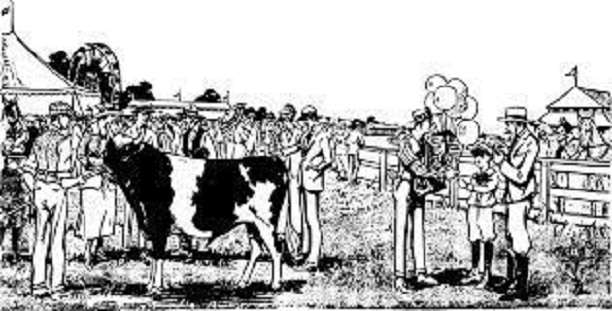
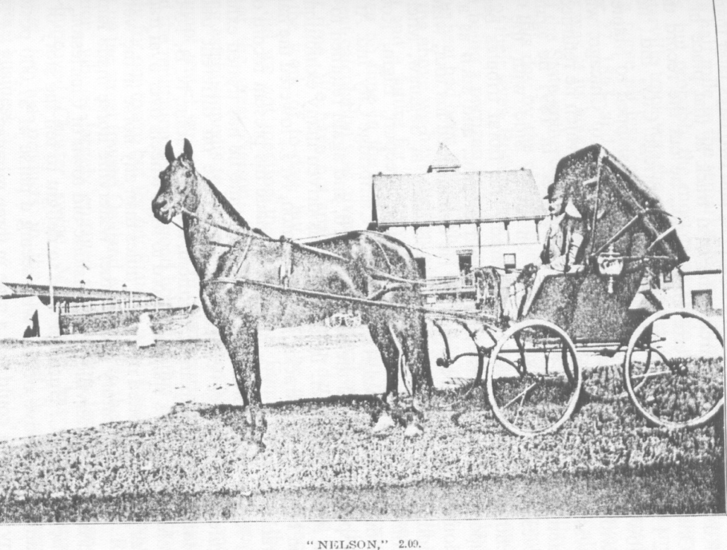
“Nelson” and his breeder Charles Horace Nelson, in a photo that appeared in The Centennial History of Waterville, 1802-1902, by Rev. Edwin Carey Whittemore. The chapter on agriculture was written by E. P. Mayo.

by Mary Grow

This article is for people who enjoy an occasional glimpse into someone else’s life – nothing scandalous or earth-shaking, just odds and ends about the ordinary lives of people in another time. The main source is Henry D. Kingsbury’s Kennebec County history.

The Illustrated History of Kennebec County Maine 1625-1892 was first published in 1892, after what editor Kingsbury described as “two years of labor.” Simeon L. Deyo is listed as co-editor and there are 18 “Resident Contributors.”

In the introduction, Kingsbury thanks “twenty writers whose names these chapters bear,” “more than twenty hundred” people who contributed through correspondence or interviews or both and “the good people of Kennebec who have so kindly and faithfully cooperated with us.”

The initial edition, by H. W. Blake & Company, 94 Reade Street, New York, was limited to 1,600 copies. The last page is number 1273, and that number does not count the introduction, illustrations or instances in which pages have the same number followed by a or b. The result is a volume that measures 11 inches high, eight inches deep and almost four inches wide – a worthy companion to the family Bible that would have been conspicuous in many Kennebec Valley homes in 1892.

Although there is no evidence of other editions until recently, there are references on line to two-volume versions. In 2018 a 956-page paperback was published.

Kingsbury divided the work into two sections. Each of the first 15 chapters covers a specific topic, like land titles, military history, courts and the law and the medical profession. The rest of the book describes individual towns, giving most a single chapter, Waterville two chapters and Augusta three chapters.

Kingsbury and his contributors were not infallible. Later historians have corrected some of his information, probably because they have more resources and more time than he had. Nonetheless, the Kennebec County history is a valuable starting point. Many on-line displays quote the same comment: “This work has been selected by scholars as being culturally important, and is part of the knowledge base of civilization as we know it.”

Each chapter on a city or town ends with what Kingsbury labeled “Personal Paragraphs.” These profile an individual, or occasionally a family, who lived in the municipality in the 18th century. The number of profiles per chapter varies, depending partly on the size of the municipality.

The vast majority of those Kingsbury chose were men – your writer has not reviewed towns outside the central Kennebec Valley, but within the area has found only two women who deserved mention. Some were prominent citizens; at the end of the chapters on Augusta, publisher Edward Charles Allen (1849 – 1891) was described as “the wealthiest man of Augusta…[who] paid the largest personal tax.” (See the Nov. 12, 2020, issue of The Town Line for information on Allen’s publishing empire and its impact on Augusta’s growth in the 1870s and 1880s.)

James G. Blaine (1830-1893; United States Representative and Senator, Secretary of State, unsuccessful presidential candidate in 1884, called the Plumed Knight by his friends and the Continental Liar from the State of Maine by his opponents) got eight and a half pages of fine print, contributed in April 1892 by “his townsman and former business partner, Hon. John L. Stevens, United States Minister Resident, Honolulu, Hawaii.” (Blaine was profiled in the Aug. 20, 2020, issue of The Town Line.)

The majority of people to whom Kingsbury gave a few sentences or a few paragraphs were less exalted. Many were farmers, blacksmiths, small businessmen and the like. As a city, Augusta offered a choice of educated professional people, some of whose stories he told.

* * * * * *

Sidney native Henry Pishon, born in 1833, attended Vassalboro and Waterville academies and served as an acting ensign in the Navy for two years of the Civil War. In the 1860s and 1870s he served two short stints as chief clerk in the Maine secretary of state’s office.

When the Augusta post office and courthouse were built on Water Street between 1886 and 1889, Kingsbury wrote, Pishon was the “clerk of construction.” A United States treasury disbursement list for July 1889 found on line lists four local men involved in the project: Thomas Lambard clerk, Pishon foreman, Herbert G. Foster disbursing agent and Melvin S. Holway superintendent of construction.

If “p.d.” in treasury records means per diem, Lambard earned $6 a day, Pishon and Foster earned $4 and Holway was paid some (illegible) fraction, perhaps one-half “of 1 p. ct.” of an unknown amount.

Sereno Sewall Webster (1805 – 1893) was the descendant of four Nathan Websters and two John Websters. The first John Webster was born in Salem, Massachusetts, in 1605. The second, Sereno’s father, was born in 1777 or 1778 and died in 1828.

(Kingsbury’s source called the 1605 John Webster a “free-man,” leading your writer to wonder if he was a former Black slave. Not necessarily; in colonial Massachusetts, a free man was anyone who had full civil rights. Some colonies, not all, required membership in the established church; land ownership was not necessary.)

Sereno was born in Gardiner, according to an on-line genealogy on the Find a Grave website. John Webster moved his family to Vassalboro in 1806, according to Kingsbury. Sereno held a “clerkship” in Washington, D. C., for nine years; in 1845, he married Mary A. Hayes (1821 – 1893) from Dover, New Hampshire. Kingsbury said the couple had three children; the on-line genealogy lists four, born between 1846 and 1857, Helen, Emeline, Sereno and Otis.

Sereno Clifford Webster, Sereno number three, was born in 1850 and died in 1919, according to the genealogy. He married Alice Etta Tracy; they named their first son Sereno Sewall Webster (1889 – 1980). Most members of the family are buried in Augusta’s Wall Cemetery, at 422 Riverside Drive.

The on-line search for Sereno Webster turned up yet another man with the same name: an obituary for Sereno Sewall Webster, Bowdoin Class of 1943, who died April 12, 2006, in Brunswick. The obituary says he was born in Augusta Aug. 9, 1920, graduated from Cony High School and after World War II service had a career as an engineer and surveyor. His wife, Eula Willetta (“Billy”) German, died in 1999; he was survived by a daughter Anne and a son Clifford Sewall Webster, Bowdoin Class of 1972.

A sad story: J. Albert Bolton, of Augusta, was born in 1820 and was still alive in 1892. He and his wife Priscilla (Merrill) had only two children. Their daughter “died in infancy” and their son, William A. Bolton, a Cony High School and Boston Commercial College graduate and “a young man of great promise,” died at 21.

J. Albert was the grandson of Savage Bolton, first settler on Augusta’s Bolton Hill. Charles Nash, in his Augusta history, quoted from Martha Ballard’s diary for Oct. 21, 1789: “Savage Bolton and his wife were taken with a warrant for breaking the Sabath.”

* * * * * *

Moving up-river to Sidney, Kingsbury profiled many farmers. Some were descendants of first settlers still occupying family homesteads, others more recent incomers. Quite a few had second occupations. Examples follow.

Frank Abbott, who was born in 1853, was the great-grandson of Joseph Abbott (1743-1833), who in 1804 came from Massachusetts and bought 1,000 acres on the Pond Road. Kingsbury did not specify whether Frank still farmed the original family land.

James H. Bean (1833 -??) combined farming with wagon-making and blacksmithing. He was probably an ancestor of the James H. Bean for whom Sidney’s elementary school, opened Sept. 6, 1957, on Middle Road, is named.

(Sidney historian Alice Hammond wrote that the Bean for whom the school is named was honored for his many contributions to education in Sidney “and is still remembered [in 1992] with love and respect.”)

Civil War veteran Thomas S. Benson moved from Augusta to Sidney in 1876 and was a farmer and deputy sheriff.

Albert Black was the grandson of a former Palermo, Maine, resident who moved to New York State in 1820. Black came back to Maine in 1863, at the age of 23. His agricultural specialty was apples, Kingsbury wrote – he grew them and bought other farmers’ and for 16 years had been making cider vinegar, 10,000 gallons in 1891.

James D. Bragg, a third-generation Sidney farmer born in 1821, and Charles H. Burgess, born in 1861, served as postmasters in two different Sidney post offices beginning in the late 1880s. Hammond wrote that Bragg served for only one month, in 1887. Burgess, whose farm Hammond located on Middle Road, was also a harness maker, Kingsbury said.

Atwood F. Jones, who moved from Mercer to Sidney in 1849 at the age of 27, was a teacher as well as a farmer until 1872, when he became “a dealer in nursery stock.”

Charles H. Lovejoy, the fourth generation of his family in Sidney, “has been messenger in the state senate since 1878.” He had also been a Sidney selectman for 12 years. (Charles’ great-grandfather, Abial Lovejoy [1731-1810], came to Sidney in 1778; see the Feb. 3, 2022, issue of The Town Line for more information on this prominent citizen.)

Stilman S. Reynolds, born in 1818, farmer and mechanic, “has worked on the river twenty years and carried the mail eight years from Sidney to Riverside” (presumably by ferry across the Kennebec).

Oliver C. Robbins (1817-1891) was a butcher and lumberman as well as a farmer. Kingsbury wrote that his widow, Mary (Weeks), and younger son Edwin were continuing the farm after Oliver’s death.

De Merrit L. Sawtelle was the third generation of his family on the same farm, previously owned by his father, Asa, and grandfather, Nathan. His specialty was “breeding and training horses.”

In addition to long family histories in Sidney and multiple occupations, many Sidney farmers had two other things in common. They were Civil War veterans; and, not surprisingly, they tended to marry neighbors and relatives, creating a town full of interrelated families.

For the most part the families were not large. Kingsbury often lists four or five children, but seldom more – with two exceptions your writer thought worthy of note.

Flint Barton (1749-1833; moved to Sidney from Massachusetts in 1773) and his wife Lydia (Crosby) Barton had 12 sons. The 10th, whom they named Anson, was born in 1799; he married Rhoda Sisson and they had 13 more Bartons.

Another man who started a large clan was Thomas Bowman, the second of that name, who moved from Massachusetts to Sidney. Kingsbury did not give dates nor mention Thomas’s wife’s name, but he said Thomas had eight sons, including a third-generation Thomas, and two daughters.

Kingsbury gave brief biographies of five male descendants, all farmers in Sidney. Grandson Isaac had farmed the land formerly his grandfather’s, where “the family burying lot is,” until he died on May 16, 1890, leaving his widow, Phebe (Richards), and oldest son, Isaac N., running the farm.

Correction to August 4 article

Benton historian Barbara Warren wrote to point out an error in the Hinds genealogy in the Aug. 4 piece on natural resources, the section on Augustine Crosby (1838-1898), who invented a gold dredge and married Asher Hinds’ daughter, Susan Ann Hinds (1837-1905).

This writer incorrectly identified Susan Hinds’ father as Asher Crosby Hinds, known as “the Parliamentarian.” Her father was actually Asher Hinds (1792- 1860), whom Warren calls “the builder” (he sponsored the building of the Benton Falls Meeting House in 1828 and in 1830 built the Benton Falls house in which Warren now lives). Warren describes him as “a prosperous farmer and merchant,” War of 1812 veteran and delegate to the Massachusetts General Court.

Susan Ann (Hinds) Crosby was Augustine Crosby’s third cousin and Parliamentarian Asher Crosby Hinds’ aunt. Her brother, another Asher Crosby Hinds, was born in 1840 and died in 1863 in the Civil War. The Parliamentarian’s father was Susan’s brother, Albert Dwelley Hinds (1835-1873).

The confusion is understandable, Warren wrote. For four generations, the Hinds family included an Asher; and Hinds and Crosbys often intermarried.

Update on the Aug. 4 update on the Kennebec Arsenal in Augusta

Kennebec Journal reporter Keith Edwards wrote in the paper’s Aug. 7 edition that Augusta City Councilors voted at their Aug. 4 meeting to declare the historic Arsenal property dangerous. They gave the private owner another 90 days to “address concerns,” and authorized the city codes officer to extend the time to 150 days.

Main sources

Hammond, Alice, History of Sidney Maine 1792-1992 (1992).
Kingsbury, Henry D., ed., Illustrated History of Kennebec County Maine 1625-1892 (1892).

Websites, miscellaneous

Up and down the Kennebec Valley: Natural resources – Part 3

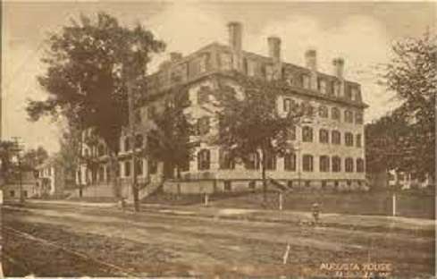
Augusta House

by Mary Grow

Three brick and granite buildings in Augusta

Attentive readers will have noted that the previous discussions of brickyards and brick-making have omitted the two cities in the central Kennebec Valley, Augusta and Waterville. Your writer deliberately saved them for last, because they have so many buildings of brick and granite as to deserve extra space.

In James North’s detailed history of Augusta, the first mention of a brickyard is in a list of businesses active in August 1792 in what was then Hallowell. There were no brickyards in the northern part of town, which after February 1797 became a separate town named Augusta.

In the southern area called the Hook, which remained Hallowell, Samuel and Phillip Norcross owned buildings, two quarter-acre house lots and “brickyard, lime kiln and earthen ware kiln.” Their total property was valued at 50 pounds, one of the town’s smaller businesses.

Samuel Norcross (Oct. 18, 1729 – Dec. 1, 1800) was the oldest of five sons of Philip and Sarah (Jackson) Norcross); his brother Phillip (1732 -?) was next oldest.

An on-line genealogy says Samuel was born in Newton, Massachusetts, where in 1752 he married Mary Wiswall. The first seven of their “at least 14” children, starting with Samuel II and Philip, were born in Massachusetts.

The family evidently came to Maine in 1762 or 1763, because the genealogy lists the seven youngest children as Mary, born in 1763 in Hallowell; Hannah, born in 1764 in Lincoln; Nathaniel, born in June 1764 in Gardiner; Sarah, born in 1766 (no place of birth listed, but in 1786 she married in Pittston); Thankful, born in 1767, in Gardiner; Susannah, born May 10, 1769, in Gardiner; and Elizabeth, born in Lincoln in 1769.

(Hannah and Elizabeth do not fit, biologically or geographically. Perhaps Hannah and Elizabeth are listed in this family in error; or perhaps Samuel kept a second family?)

The same on-line genealogy has no information about Phillip except that he remained in Newton for “about 18 years.” Another on-line source is an 1803 court record of the Kennebec Proprietors (the inheritors of British land grants who continued to claim land rights for generations) filing an action of ejectment against Phillip Norcross and others of Hallowell, in Kennebec County Supreme Judicial Court in September 1803. The Phillip Norcross born in 1732 would have been 71 by then.

North wrote that the Norcross’ house, brickyard and kilns were “at the north end of Water street” in Hallowell, “just south of the present railroad crossing.” The family also ran a nearby ferry across the Kennebec “for many years.”

There must have been other brick-making businesses in the northern part of Hallowell, because North recorded that at the first town meeting in Augusta, on March 13, 1797, voters chose among their town officials two “Inspectors of Lime and Brick,” Henry Sewall and Daniel Foster.

About 1804, North wrote, Lombardy poplars were planted on both sides of State Street from Bridge Street “to the brickyard at the southerly end of Grove street.” (Your writer found one map that identifies Grove Street as the roadway between the rotary at the west end of Kennebec Memorial Bridge and the south end of Water Street; other maps call this stretch Water Street.)

Augusta’s first brick schoolhouse went up in the spring of 1804, according to North (and to Captain Charles E. Nash, who “borrowed” North’s information for his chapters on Augusta in Kingsbury’s Kennebec County history), on the northwest side of the intersection of State and Bridge streets. It was also Augusta’s first grammar school (offering classes more advanced than primary schools); the building burned down March 16, 1807.

Readers with unusually good memories will remember that most of the commercial buildings on Water Street, in Augusta, are on the National Register of Historic Places (see the February 2021 issues of The Town Line). Some are listed individually; some are part of the Water Street Historic District. Almost all are brick; and they are not the buildings described in the following paragraphs, but their successors, built after the great fire of Sept. 17, 1865.

Merchants whom North identified as “Robinson & Crosby” built the first brick stores in 1806, two together in a block on the north corner of Market Square on the river side. In 1811, Joshua Gage, Bartholomew Nason and Benjamin Whitwell built a second block of three stores nearby.

North added that all five stores were closed temporarily in 1813, as a result of the economic slump caused by the dispute between Britain and the United States that led first to a United States embargo on trade and then to the War of 1812.

These brick store buildings had what North called “old-fashioned brick fronts,” featuring “heavy wooden door and window shutters,” hinged and locked with diagonal iron bars. By 1833, the new fashion was “granite posts and lintels.”

Seven new brick stores were added on Water Street in 1835, five at the north end and two farther south. None survived the 1865 fire.

Brick was also used, along with stone, in the Augusta jail that was built after an inmate burned down the wooden one on March 16, 1808. North wrote that prisoners were held in a very insecure temporary jail while a two-story building was built “of large blocks of rough hammered stone fastened together with iron dowels.”

This building, finished in December 1808, “was connected, by a brick ell, with a two story square brick jail house” at the intersection of State and Winthrop streets. The brick building was standing when North finished his history in 1870, but had been supplanted as a jail by a larger stone building, completed in 1859.

In 1812, owners of the newly-chartered Kennebec Bank had a brick building put up on Court Street. This building served as a bank for four years, then as a house; North wrote that it was torn down when the county courthouse was enlarged in 1851.

In 1813, Kennebec County officials, concerned about keeping paper records in the wooden county courthouse, had a brick building with “four fire proof vaults” built nearby. With brick floors, brick partitions and iron doors on the vaults, it was assumed safe; but, North wrote, when it was replaced years later, county officials were surprised to find wooden floors under the vaults, so that “the building could not have burned without consuming the contents of the vaults.”

The Augusta House on State Street, a leading hotel for many years, was built of brick and opened Jan. 31, 1831. Among its guests, according to Nash, were General Winfield Scott, who stayed about three weeks in the spring of 1839 during the Aroostook War (see The Town Line, March 17, 2022); and President Ulysses S. Grant, who visited with his family on Aug. 3, 1865, and was entertained at a state dinner at the hotel.

The Augusta House was enlarged substantially during the Civil War. On-line postcards from 1912 and 1938 show a six-story building on an above-ground granite foundation. The main door in the center of the front veranda is protected by a two-story portico supported by columns. Another on-line source says the hotel was closed and torn down in 1973.

On June 7, 1833, the Citizens’ Bank opened in its new brick building at the intersection of Oak and Water streets, in the middle of downtown. This was a three-story building, North said; the bank had the back rooms on the second floor, jeweler Benjamin Swan and dry-goods merchant G. G. Wilder shared the street floor, and the Kennebec Journal newspaper, founded in 1825, had its office on the top floor.

Another brick schoolhouse was erected in the summer of 1835 to house Augusta’s first high school. Located at the intersection of State and Bridge streets, not far from the site of the earlier brick grammar school, the building cost $7,000. North (and Nash) wrote that it was two stories high, 65-by-50-feet, with four Doric columns supporting the front pediment.

Owned by a group of corporators, the school briefly did well; but after the first head teacher moved on, it began to fail and after 1848 the building served as a public high school for the surrounding school district.

Residents must have approved of two-story brick schoolhouses, because North and Nash recorded several more built in Augusta school districts in the 1840s and 1850s, and Nash added a “large four-room” one, Cushnoc Heights Grammar School, built in 1890 at the intersection of Franklin and Oxford streets, partway up Sand Hill at the north end of the city.

The Winthrop Street Universalist Church, started with a June 19, 1867, cornerstone laying and dedicated March 5, 1868, was “built of brick laid in colored mortar,” North wrote. The building was 80-by-61-feet, with 33-foot-high walls; on the southwest corner was a 55-foot tower enclosing a 1, 500-pound bell and topped by a 135-foot (from the ground) spire.

Other brick buildings in Augusta that have not been described in earlier articles in this series and that are on the National Register of Historic Places include:

  • The Lot Morrill House on the north side of Winthrop Street at the Prospect Street intersection, built about 1830;
  • The Governor Samuel Cony House, also known as the William Payson Viles House, on the east side of Stone Street (Route 9 on the east side of the Kennebec), built in 1846;
  • The former Augusta City Hall, at 1 Cony Street, on the east bank of the Kennebec, and the north side of Bridge Street, built in 1895-96; and
  • The Governor John F. Hill Mansion, on State Street at the Green Street intersection, built in 1901.

The old city hall is now an assisted living facility. The Hill mansion is an events center welcoming area residents to rent its facilities. The Morrill and Cony houses appear to be privately owned.

* * * * * *

As previous articles (see 2021 indexes to The Town Line) have shown, another major building material was granite, used in Augusta especially for religious and public buildings, and for a minority of the commercial buildings in the Water Street Historic District.

Two major granite building complexes on the east side of the Kennebec River were the Kennebec Arsenal, built between 1828 and 1838 (see box), and the original building at what was in 1838 the Augusta Insane Hospital, plus the wing added in 1848.

Granite buildings on the west side of the Kennebec included:

  • the Kennebec County Court House, on State Street (1829);
  • the State House, on State Street (1832);
  • the Kennebec jail (1859);
  • South Parish Congregational Church, on Church Street (1865);
  • St. Mark’s Episcopal Church, on Summer Street (1886);
  • Lithgow Library, on Winthrop Street (completed in 1896); and
  • St Mary’s Catholic Church, on Western Avenue (1926).

Because of space limitations, discussion of the development of the granite industry in the Kennebec River valley will be postponed to next week.

Update on Augusta’s Kennebec Arsenal

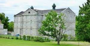
Kennebec Arsenal

The Kennebec Arsenal in Augusta is a collection of eight granite buildings built between 1828 and 1838 and designated a National Historic Landmark District in 2000 (see the Jan. 21, 2021, and Feb. 10, 2022, issues of The Town Line). It is now privately owned.

A June 24 Kennebec Journal article by Keith Edwards said the owner has failed to maintain the buildings. City council members discussed declaring the Arsenal a dangerous site, but decided at their June 23 meeting to postpone action until July 28.

Edwards explained that if the property were declared dangerous, councilors could set a deadline for action, at minimum presentation of a repair plan. Failure to meet the deadline would let the city have the work done and bill the owner, or have the buildings demolished. If the owner didn’t pay the bill, the city could lien the property; if the lien were not paid, the buildings would eventually become the city’s.

The current owner bought the property 15 years ago, Edwards wrote, accepting an obligation to maintain its historic value. A local group has been formed named Concerned Citizens for Augusta Historical Preservation of the Kennebec Arsenal.

Main sources

Kingsbury, Henry D., ed., Illustrated History of Kennebec County Maine 1625-1892 (1892).
North, James W., The History of Augusta (1870).

Websites, miscellaneous.

Up and down the Kennebec Valley: Native Americans – Part 4

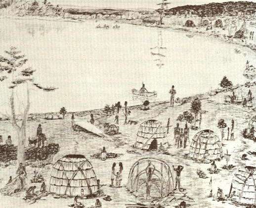
Early drawing – An Indian Campsite At The “Rips” On Cobbossee Stream, Maine, Circa 1750.

by Mary Grow

East side of and away from the Kennebec

Last week’s article talked about Native American sites along the Kennebec River between Fairfield and Sidney on the west bank, but the east bank between Ticonic (Winslow) and Cushnoc (Augusta) was skipped for lack of space. This week’s article will remedy the omission by talking about Vassalboro and about sites inland on the east side of the river (as was done for the west side last week).

Vassalboro either was popular with the Kennebec tribe or has been more thoroughly explored than other areas (or both), because various histories mention several areas connected with Native Americans, including at least one Native American burial ground on the Kennebec.

Alma Pierce Robbins, in her Vassalboro history, quoted a historian of the Catholic Church in Maine who claimed Mount Tom was an “Indian Cemetery.” Mount Tom is now in the Annie Sturgis Sanctuary a little north of Riverside, on the section of old Route 201 between the present highway and the river named Cushnoc Road.

Charles E. Nash, in the chapter on Native Americans in Kingsbury’s Kennebec County history, reported a large burial ground north of the mouth of Seven Mile Stream (or Brook), which runs from the southwest corner of Webber Pond to join the Kennebec at Riverside.

Kingsbury himself, in his chapter on Vassalboro, suggested that Robbins’ source and Nash were talking about the same site. Kingsbury wrote that the burial ground was the south side of Mount Tom, “sloping to the brook, on the Sturgis farm.” Artifacts and bones were still “plentiful” there in 1892, he said.

Nash wrote that the Native American name for Seven Mile Brook was Magorgoomagoosuck. James North, in his history of Augusta, spelled it Magorgomagarick.

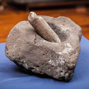
The pestle was used against the mortar for crushing and grinding and were commonly used for meal preparations such as reducing grain and corn into wheat and meal. Mortar and pestles would have also been used in the preparing of medicine as well as the manufacturing of paint.

An undated on-line copy of a University of Michigan document titled Antiquities of the New England Indians includes descriptions and photographs of a variety of artifacts, including knives, axes and mortars and pestles. The writer explained that mortars and pestles, either wooden or stone, were essential for crushing dried corn kernels.

One pestle that the writer particularly admired came from Vassalboro, and when the description was written it was owned by Kennebec Historical Society. It is now in the Maine State Museum, according to KHS archivist Emily Schroeder.

The pestle is described as 28.5 inches long, made of green slate, topped with a small human head. The illustration shows an almost round head, with oval eyes, a nose indicated by two straight lines with a connecting line at the bottom and a pursed mouth. The writer said the lower half of the pestle was found near Seven Mile Brook; the upper half was found a few miles away four years later, and “The two pieces fitted perfectly together.”

The pestle was broken intentionally, the writer asserted. He wondered whether the destruction of what could be seen as an idol was related to the nearby seventeenth-century Catholic mission.

There are also references to a Native American site farther north along the river, on the section of old Route 201 called Dunham Road.

Robbins wrote that many artifacts had been found on the shores of Webber Pond – so many, she said, that cottages built around 1900 used them as trim around fireplaces.

The major Native American site in Vassalboro located and partly investigated to date was at the outlet of China Lake in East Vassalboro, partly on property on the east side of the foot of the lake and the east bank of Outlet Stream owned for generations by the Cates family. The Vassalboro Historical Society museum in the former East Vassalboro schoolhouse has a room dedicated to information about and artifacts from the site.

According to the exhibit, the area was occupied at least sporadically from 10,000 years ago until Europeans displaced the Native Americans. Different types of tools, weapons and houses are displayed or illustrated and explained. Alewives were harvested at the China Lake outlet 5,000 years ago.

Correspondence on exhibit shows that the Maine Historic Preservation Commission listed the Cates farm site as a protected archaeological site on the Maine Register of Historic Places in the fall of 1989, as requested by George Cates.

The part of China Lake that is in the Town of China was also frequented by Native Americans. The town’s comprehensive plan says the Maine Historic Preservation Commission has found prehistoric sites on two islands in the lake, Indian Island in the east basin and Bradley Island in the west basin (plus one at the north end of Three Mile Pond, and an accompanying map shows a fourth site on Dutton Road). Commission staff think it “highly likely” that there are other sites in town, especially along waterways.

According to the China bicentennial history, the lake was part of one of the Native Americans’ routes inland from the coast in the fall. After final seafood feasts, people would paddle up the Sheepscot to a place about two and a half miles south of China Lake, portage to the south end of the lake and paddle northwest to the outlet in Vassalboro. From there Outlet Stream carried them to the Sebasticook and then to the Kennebec at Ticonic.

The Kennebecs left behind on the west shore of the southern part of the lake’s east basin a heart shape carved into a boulder. World-famous Quaker Rufus Jones, of China, told a story about this carving several times, including as a chapter in Maine Indians in History and Legends.

Jones began by warning readers that his version of The Romance of the Indian Heart is part history and part imagination. He refused to say which was which.

The legend features a Kennebec brave named Keriberba, son of Chief Bomazeen (or Bomaseen, mentioned in the June 9 article in this series), from Norridgewock, and his wife Nemaha, from Pemaquid, whom he met at one of the annual seafood feasts at Damariscotta.

Coming home from the coast, Keriberba, Nemaha and their companions stopped to roast and eat the last clams on the west shore of China Lake’s east basin by “a large sentinel granite rock” from the glacial age. They continued to Norridgewock, where Father Sebastian Rale married them beneath a picture of the Sacred Heart that hung above the altar.

Nemaha immediately organized a group named “The Sisters of the Sacred Heart,” Jones wrote. The women took lessons from Father Rale and hosted an annual feast.

When the British soldiers made their final and successful attack on Norridgewock in August 1724, Keriberba and a few other young men “escaped across the river.” Nemaha grabbed the picture of the Sacred Heart from the church and with others of her sisterhood ran to a secret hiding place in the woods.

The next morning the two groups reunited. After burying Bomazeen, Father Rale and others, they gathered up what the British had left of their belongings and went back to settle at the feasting spot on China Lake.

Jones described the 300-year-old pines that sheltered their wigwams, and the shrine they built for the Sacred Heart picture that became “the center of their religion.” The importance of the picture was reinforced when, one evening, Keriberba called across the lake, “Le sacré Coeur,” (“the sacred heart” in Father Rale’s native French). His words echoed back to him across the water.

Jones wrote that he too had experienced the echo, from the place on the shore that repeats whole sentences. But to the Kennebecs, it seemed to be the voice of the Great Spirit. From then on, Keriberba called every evening and they were comforted by the reply.

Jones described years of living in peace, traveling to Norridgewock to grow corn (because they could not clear enough land by the lake), hunting deer, moose and an occasional bear, importing clams that fed muskrats (both edible), netting and smoking alewives. As children were born and grew up, the group became larger.

One night, a storm destroyed the Sacred Heart shrine and blew the picture into the lake, where it turned to pulp. The next day, Keriberba began carving a recreation of the sacred heart into the granite rock.

When his picture was finished, the group feasted and danced until late at night. Before they went to bed, Keriberba stood beside his carving and shouted, “Le sacré coeur” – and the words came back just as they should.

There is a little more to Jones’ story; it will be continued next week.

* * * * * *

Your writer has found only bits and pieces of information about Native Americans in the areas now included in the towns of Albion, Clinton and Palermo, and nothing from Windsor.

The 2004 report on the archaeological survey around Unity Wetlands and along the Sheepscot River, reprinted on line and mentioned last week, cited a person named Willoughby who, in a 1986 publication, described one pre-European relic from Albion. The reference is to “an isolated Indian artifact recovered by a farmer in the town of Albion – a ‘mask-like sculpture’ of sandstone with pecked and incised eyes, mouth, and other facial lines. It is unclear if the portable rock sculpture was found within the Unity Wetlands study area or simply nearby.”

A photo of what is almost certainly the same sculpture, described as “found while digging potatoes in Albion, Maine” appears in the on-line Antiquities of the New England Indians. The writer described the head as sandstone, about 10 inches long by two inches thick at the thickest point.

The writer continued, “Its natural smooth surface was used for the face, and the rougher fractured surface of the back was smoothed by pecking.” The face tapers to a chin; ears round out on either side; two small round dark eyes each has a circular outline; a smaller dark circle represents the nose; and parallel horizontal lines make a slightly off-center mouth.

The writer described traces of red pigment on the front and yellow pigment on the back. He surmised the effigy came from a grave.

Clinton’s 2006 comprehensive plan says the Maine Historic Preservation Commission had found four prehistoric sites within the town boundaries, one on the Kennebec River, one on the Sebasticook River and two on Carrabassett Stream. Commission staff suggested waterside archaeological surveys. The 2021 plan gives no new information.

Palermo historian Millard Howard doubted there were permanent Native settlements within the boundaries of present-day Palermo, either before or after 1763, because, he wrote, most settlements were on rivers like the Kennebec or the lower Sheepscot.

Kerry Hardy’s map of Native American trails converging on Cushnoc shows one from the coast near Rockland that crosses the east branch of the Sheepscot River a little north of Sheepscot Pond, about where Route 3 now runs east-west a bit south of the middle of town.

Linwood Lowden began his history of the Town of Windsor with the first European settlers. Because the Sheepscot River running out of Long Pond is in southeastern Windsor, including the junction of Travel Brook, it seems likely that parts of the town would have been at least a Native American travel route, if not home to settlements.

Main sources

Grow, Mary M. China, Maine Bicentennial History including 1984 revisions (1984).
Hardy, Kerry, Notes on a Lost Flute: A Field Guide to the Wabanaki (2009).
Howard, Millard, An Introduction to the Early History of Palermo, Maine (second edition, December 2015).
Kingsbury, Henry D., ed., Illustrated History of Kennebec County Maine 1625-1892 (1892).
Maine Writers Research Club, Maine Indians in History and Legends (1952).
Robbins, Alma Pierce, History of Vassalborough Maine 1771 1971 n.d. (1971).

Websites, miscellaneous.

Up and down the Kennebec Valley: Native Americans – Part 3

A sketch of the Kennebec tribe settling along the Kennebec River. (Internet photo)

by Mary Grow

Three local settlements

The Kennebec tribe’s village at Cushnoc (a word that means head of tide, most historians agree) was on high ground on the east bank of the Kennebec River in what is now Augusta, about 20 miles south Ticonic village (described last week).

Leon Cranmer, in his Cushnoc, pointed out that the high land provided views of river traffic both upstream and down and offered some protection against attack. Canoes could land in a cove at the foot of the bank (now, he wrote, a park and boat landing).

Charles E. Nash, in his chapters on Augusta in Henry Kingsbury’s Kennebec County history, wrote that Cushnoc village had wigwams, cultivated cornfields and open space for young men to practice “wrestling, running and dancing.”

Kerry Hardy, in a nicely-illustrated 2009 book titled Notes on a Lost Flute: A Field Guide to the Wabanaki, argued that Cushnoc was the west end of an important Native American trail that ran from the present town of Stockton Springs near the mouth of the Penobscot River (almost due east of Cushnoc) to the head of tide on the Kennebec River.

Looking at old maps, Hardy traced that east-west trail and found others that converged on Cushnoc, coming from present-day Rockland (on the coast to the southeast), Canton Point (on the Androscoggin River to the northwest) and Farmington Falls (on the Sandy River to the north).

Unfortunately, Hardy did not explain why Cushnoc was the center of a Native American communications network. Instead, he summarized the importance of the British trading post established there (as at Ticonic; and, as at Ticonic, the site of the trading post was later chosen for a fort).

Cranmer offered the theory that Cushnoc was a convenient mid-way place for Native Americans traveling between Canada and the coast to branch off to other parts of Maine.

During archaeological excavations around the trading post site between 1974 and 1987, Cranmer wrote, more than 17,500 artifacts were found, mostly signs of European rather than Native American habitation.

He specifically mentioned a few stone flakes left over as Kennebecs made their edged tools; a stone projectile point that appears from its photograph to be in excellent condition and could be anywhere from 2,200 to 6,000 years old; and a bit of pottery, the remains of what Cranmer called an Iroquoian-like jug or bowl.

If there was a Native American burial ground associated with Cushnoc, this writer has been unable to find a reference to it. J. W. Hanson, in an 1852 history of the area found on line, claimed that “the quiet graves of their [Kennebec tribal members’] fathers clustered around the mouth of each tributary to their beloved river,” but he offered no specific location.

The first British trader at Cushnoc was Edward Winslow from the Plymouth Colony in 1625, Nash wrote (or in 1628, according to Old Fort Western Director Linda Novak’s bicentennial lecture). He and successors traded European goods for Native American products, primarily beaver skins.

By the 1650s, trade and profits were diminishing, Nash said. In 1661 the Plymouth group sold the trading post to four other Europeans, who gave up and closed the operation about 1665.

Novak blamed the decline in trade at Cushnoc on rival traders Thomas Clark and Thomas Lake, who opened competing posts both upriver at Ticonic and downriver near current Pittston. James W. North, in his history of Augusta, blamed “growing Indian troubles” for the decline and said war was the final blow (the first war counted by historians, writing primarily from the Anglo-American point of view, started in 1675).

North listed other problems in the 1650s, including a decrease in fur-bearing animals, the Kennebecs’ recognition that the furs were more valuable than the goods offered in exchange and “the increasing number and avaricious disposition of the traders.”

Cranmer added two more problems that could have contributed to a smaller supply of furs: British settlements expanding into woodlands, and attacks on Maine Native Americans by Iroquois tribes from the northwest (current upstate New York and thereabouts).

In 1655, the governor of the Plymouth Colony appointed Captain Constant Southworth as magistrate at Cushnoc, responsible for administering civil law throughout the colony’s holdings. He had two main jobs, Nash wrote: to prevent other traders from trespassing and “to check the sale of demoralizing liquors to the Indians.”

Nash commented that Joseph Beane or Bane, an Englishman held captive by the Native Americans, reported that remains of the Cushnoc trading post were still visible “among the new-grown trees and shrubbery” in 1692. Novak, however, says the post was burned in 1676, during the first of the serial wars. Either account suggests the Kennebecs had no interest in using the building.

North wrote that the 1725-1744 interregnum in the Kennebec Valley wars was a genuine peace, during which the Kennebecs interacted peacefully with the British traders, who he suggested treated them fairly and even generously, and with early settlers. In 1732, Massachusetts Governor Jonathan Belcher and “a large retinue” toured the coastal settlements. The governor met with an unspecified group of Native Americans at Falmouth, and told them that he planned to establish three missionary stations in the province, one to be at Cushnoc, “where a town and church were about to be built.”

North offered no evidence of such a town, or of any pacifying influence from missionaries, before the final defeat of the French at Québec in 1759. Instead, continued Native American resistance delayed the growth of European settlements around Cushnoc for another generation.

* * * * * *

Besides the settlements at Ticonic/Winslow and Cushnoc/Augusta, Kennebec tribal members lived elsewhere along the Kennebec River, its tributaries and other nearby water bodies. Some of the town histories on which this writer relies describe evidences of pre-European occupation from Fairfield and Benton through Waterville/Winslow and Vassalboro/Sidney to Augusta.

The current Town of Benton has frontage on the Kennebec River, and the Sebasticook River runs (almost) north-south through (almost) the middle of town. The Sebasticook, like the Kennebec, was a major travel route for Native Americans.

Benton historian Barbara Warren says because of the rapids in the Kennebec above Ticonic (until Waterville manufacturers’ dams calmed them, beginning in 1792), upriver travel was via the Sebasticook to Benton Falls, about five miles upstream from the Kennebec, and a portage back to the Kennebec at Fairfield. The Sebasticook was also a connector between the Kennebec and Penobscot valleys, according to another source.

Kingsbury wrote that “the relics found many years ago at the foot of the hill overlooking Benton Falls are now the only traces of the original possessors of the soil.” The “hill” – high land – is the east bank of the river where Garland Road runs through Benton Falls Village. Warren remembers as a child walking along the river and finding artifacts like shards, grinding tools and “a stone weight for a fishing net.”

Warren says a state-listed archaeological site on the west side of the Sebasticook near the dam includes a burial ground. State preservation officials are protecting the exact location of the site. Your writer surmises there was a Kennebec village, at least seasonally for fishing and perhaps year-round for farming and hunting, on the east bank with the burial ground across the river, as at Ticonic.

A 1992 University of Maine at Farmington study of the banks of the lower Sebasticook, between the dams at Benton Falls and Fort Halifax, found 30 archaeological sites along that part of the river, dating from the Archaic period (in Maine, between 10,000 and 3,000 years ago, according to Wikipedia) and the early contact period in the 1600s.

A 2004 archaeological survey related to the Unity Wetlands covered the banks of the Sebasticook in Unity and a small part of Benton and found 16 riverside Native American sites. Ten of the sites were either near rapids or near a junction with a tributary stream.

In the 2004 study, the site at Benton Falls was described as having been used during the Archaic and Ceramic periods. Wikipedia says in Maine, the Ceramic period was between 3,000 and 500 years ago, or from about 1000 B.C. to about 1500 A.D.

Both the Farmington study and a Biodiversity Research Institute publication by C. R. DeSorbo and J. Brockway, found on line, mention pre-European fisheries for migrating river herring. Warren says there is evidence suggesting Native Americans built a two-tier stone fish trap where Outlet Stream from China Lake runs into the Sebasticook in Winslow, within a mile of the Kennebec.

In neither Benton nor Fairfield are there well-known evidences of pre-European settlement along the Kennebec. The Fairfield bicentennial history says Native Americans made arrowheads in an area called the sand hills in Larone, in northern Fairfield. Evidence cited included arrowheads, broken and unbroken, and chips from making the arrowheads (although collectors had picked up most of the chips).

The type of rock used to make the arrowheads was not found locally, the writers said. They surmised the Native Americans brought the rock from Moosehead.

In Alice Hammond’s 1992 history of the Town of Sidney, she quoted Dr. Arthur Speiss, of the Maine Historic Preservation Commission, saying there had been Native Americans in Sidney since “at least 5,000 years ago.” By 1992, Hammond wrote, the Historic Preservation Commission had found 11 pre-European sites along the Kennebec River and eight along Messalonskee Lake’s eastern shore.

The Town of Sidney’s 2003 comprehensive plan gives the number of pre-historic sites as 23. Maps show four areas along the Kennebec and three more on Messalonskee Lake. The plan explains that the exact locations are not publicized to protect the areas.

Hammond wrote that there was no valid way to estimate how many Native Americans lived in Sidney, nor are there individuals’ names or information on when the last groups left. She surmised they could have been gone by the 1740s.

Sidney does, however, have its legend, retold in Hammond’s history and in other sources, including Maine Indians in History and Legend.

According to that version, Messalonskee Lake is named from the Native American word “Muskalog,” or “Giant Pike,” a big, voracious fish that lived in the lake. The name further recognizes that 14 other water bodies empty into the lake, “which like the Giant Pike was never satisfied.”

A heroic brave named Black Hawk and a sneaky brave named Red Wolf both loved a lovely, lively maiden named White Fawn. White Fawn chose Black Hawk.

The evening they were formally engaged, White Fawn and Black Hawk stole away from the celebration for some private moments on a clifftop overlooking Messalonskee Lake. Red Wolf followed them, killed Black Hawk, whose body fell into the lake, and tried to kidnap White Fawn.

Screaming, she jumped from the cliff into the water. The rest of the tribe rushed to the scene. Red Wolf cried out “Messalonskee! Messalonskee!” As the avengers closed in on him, there was an earthquake and an avalanche swept him, too, into the ever-hungry lake.

Series of lectures available online

A series of 10 lectures on early Maine history presented at Old Fort Western in 2021 is now available for viewing on line. Topics include Native Americans, Fort Western and Fort Halifax and trading posts on the Kennebec River. Speakers include Dr. Arthur Speiss and Leon Cranmer, mentioned in this article. The series can be found by searching for Old Fort Western or Maine bicentennial lectures.

Main sources

Cranmer, Leon E., Cushnoc: The History and Archaeology of Plymouth Colony Traders on the Kennebec (1990).
DeSorbo, C. R. and J. Brockway, The Lower Sebasticook River: A landowner’s guide for supporting one of Maine’s most unique and important ecosystems. (2018).
Fairfield Historical Society, Fairfield, Maine 1788-1988 (1988).
Hammond, Alice, History of Sidney Maine 1792-1992 (1992).
Hardy, Kerry, Notes on a Lost Flute: A Field Guide to the Wabanaki (2009).
Kingsbury, Henry D., ed., Illustrated History of Kennebec County Maine 1625-1892 (1892).
Maine Writers Research Club, Maine Indians in History and Legends (1952).
North, James W., The History of Augusta (1870)
Warren, Barbara, email exchange.

Websites, miscellaneous.