LIFE ON THE PLAINS: School days in the ‘50s and ‘60s

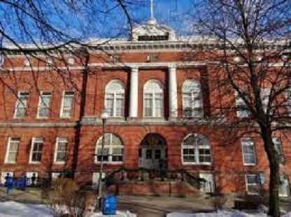
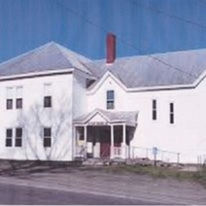
St. Francis de Sales elementary school, left, and the nun’s convent on right. There were some classrooms in the convent. (photo courtesy of Hallee family album)

by Roland D. Hallee

Let’s now proceed with what life was like on The Plains in the 1950s and ‘60s.

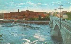
The Lockwood-Dutchess Textile Mill (the cotton mill as it was known), which was housed in three large, brick buildings at the foot of Main St., was in full operation. Many of the people in the area worked at the mill, and walked to work every day. Also, Hollingsworth & Whitney Paper Mill (H&W as it was known), was also in its hey-day, and many fathers worked there. They would walk to work, crossing the Two-Cent Bridge on foot, because not many had cars. My father and grandfather were two of the few in the neighborhood with wheels. My grandfather owned a pink and charcoal Packard Hornet, and my dad a blue and white, two-tone Buick.

Many of the mothers were stay-at-home moms that saw the children off to school every day. Nearly all of the kids in my neighborhood attended St. Francis de Sales parochial school, which was located on the corner of Elm and Winter streets. Every parish had a parochial and public school. There were three parishes in Waterville, Notre Dame, St. Francis and Sacred Heart. In the south end there was Notre Dame School, on Water St., and the public South Grammar School, on Gold St., in addition to St. Francis.

Back then, there were no buses unless you lived more than a mile from school. So most of us would gather in the morning and walk together. The same was true after school, which let out at 3 p.m. (Can you imagine that?)

The school was taught by nuns of the Ursuline order, and they were rather strict, especially on the boys. I have my theory as to why, but I will keep that to myself.

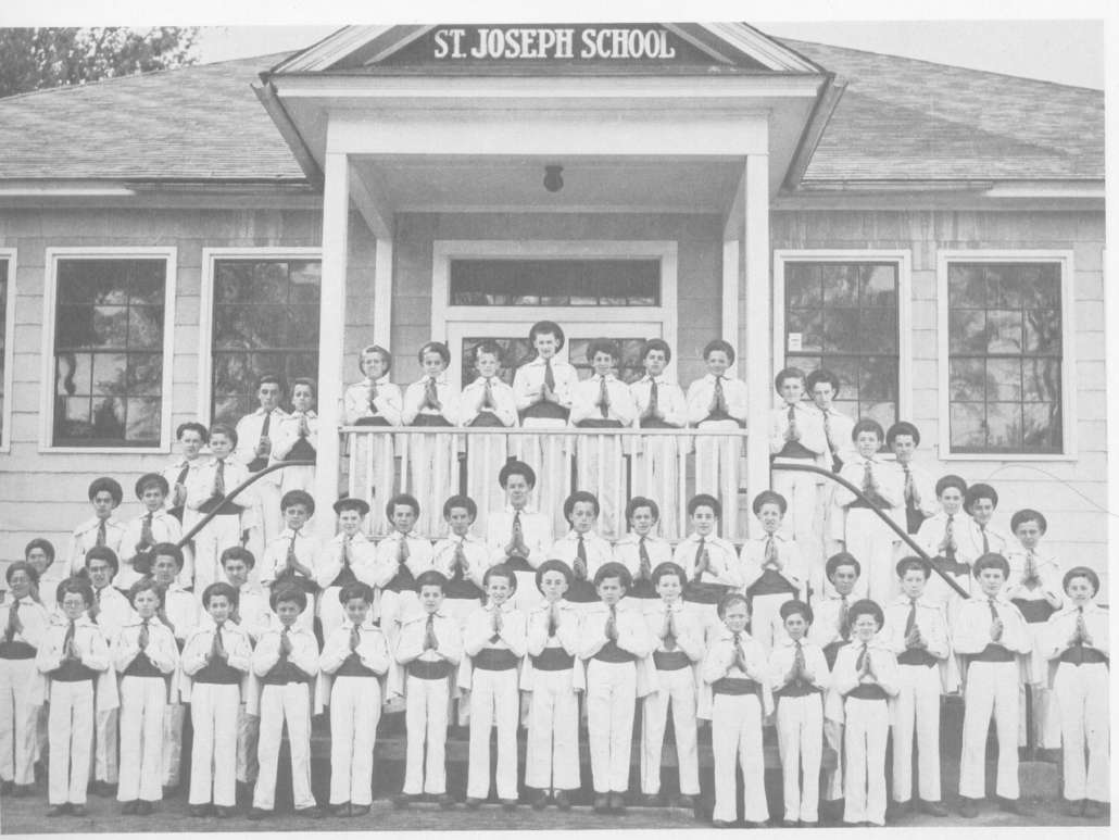
The girls would go to the school through the eighth grade, while the boys were sent to another school after the fifth grade. That would be St. Joseph’s School, where Notre Dame Church is now, as has been mentioned in past articles.

Of course, back then, I guess only in parochial schools, it was not called kindergarten, but the “baby grade”. You had to be five years old by October 15 to begin to attend. I turned five years old on October 22, so I had to wait a whole year to begin school. My parents pleaded with the nuns, saying I was ready for school, but they would have no part of “violating” the rule. It was set in stone.

Being almost six years old when I started school, I was a little older, and somewhat further ahead than the others. I just didn’t know it.

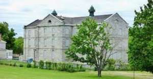
The “Brothers” School, near St. Francis elementary, where boys would go from sixth to eighth grades, until it was razed in late ‘50s. (photo courtesy of Hallee family album)

Actually, before the boys were confined to only the fifth grade, and shipped off to St. Joseph’s, there was another school across the parking lot from the parochial school, that was taught by the “brothers”. However, by the time I reached sixth grade, that school was shuttered, and eventually torn down. I don’t recall the name of the school, I guess because I was too young.

Since we all walked to and from school, some of the older boys – fifth graders – were assigned to be “patrol boys”. That is we wore white sashes, with a badge attached, designating us as crossing guards. We could not stop traffic, but we would escort the students across the street from the school. I was assigned the blue badge, meanning the captain of the corps. It didn’t really mean much.

Getting back to the neighborhood, we were a close knit group, and I can’t really tell you how many of us there were. We were a lot. Most families consisted of three to four, or more children, all blue collar families, where discipline was in order. Not that some of us didn’t get into some kind of trouble now and then. Nothing serious, mind you.

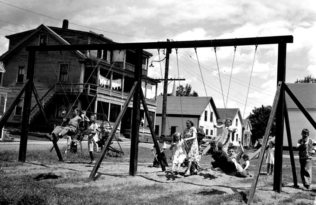
Next time, we’ll take a look at what we did back then for entertainment, minus television, and electronic devices. We made our own fun.

Up and down the Kennebec Valley: Natural resources – Part 1

Brick making operation in Brewer.

by Mary Grow

As the preceding articles have at least partly shown, pre-European inhabitants of the Kennebec Valley lived off the land, using natural resources to provide food, shelter, clothing, transport, decoration and other necessities and frivolities.

The first Europeans, arriving in small (by our standards) ships, had no choice but to imitate the Native Americans. They got food by hunting and fishing, built wooden shelters and grew crops suited to local conditions. However, they quickly branched out in two directions, monetizing many natural resources and adding imported and manufactured items.

Monetizing applied to wild animals, notably the sale of beaver and other furs to European traders; to fish, especially migratory species, a trade being revived in the 21st century; to forests, as land was cleared not only for houses and farms but for a lumber industry that covered much of Maine and continues today; and even to the ice that formed in the Kennebec River every winter and was exported globally (see the article on lumber driving and ice harvesting on the Kennebec in the May 14, 2020, issue of The Town Line).

The Kennebec Valley offered other natural resources that Europeans developed. Linwood Lowden, in his history of Windsor, mentions one of the most common: rocks.

After a would-be farmer in the Kennebec Valley cut down trees, hauled away the wood and dug out the stumps, he was usually left with a field full of rocks. Nuisances, yes, but, Lowden points out, useful: big ones were “drilled, split and removed to be used as foundation stones.” Smaller ones lined cellars and wells or made stone walls as field or property boundaries.

Some, Lowden wrote, were immoveable: the farmer and his friends would dig a hole and bury such problem stones. Smaller ones that continued to surface as the fields were plowed went to the “stone dump,” the otherwise unused area in some corner on every farm.

* * * * * *

The invaluable USM Digital Commons on line includes Mining in Maine: Past, Present, and Future, published in 1990 by Carolyn A. Lepage and others. This source considers granite, limestone, slate, feldspar and iron among Maine’s commercially important minerals.

In 1836, the Maine legislature hired a Bostonian named Charles Jackson to survey the state’s mineral resources. Lepage wrote that he inspected mostly coastal areas and “major river and overland routes.” From this sample, he concluded Maine minerals were worth developing.

By 1836, Lepage wrote, Maine was already an international granite exporter. Hallowell was one of five granite centers (plus Biddeford, Blue Hill, Penobscot Bay and Washington County).

The rest of the 19th century featured continued exploitation of resources, especially along the coast, and a brief period of excitement about gold, silver and other metals after the Civil War (with no indication that the Kennebec Valley was involved). Granite remained important; in 1901, Lepage wrote, the value of granite produced in Maine exceeded that from any other state. Maine’s granite industry slowly declined in the 20th century, especially during and after the Great Depression of 1929-1939.

A Maine Geological Survey website emphasizes slate, used especially for roofing tiles, as another important mineral. This site mentions the “Central Maine Slate Belt” that runs from the Waterville area more than 70 miles northeast to Brownville Junction.

* * * * * *

Another natural resource common enough to be mentioned in many town histories is clay.

Clay, Wikipedia says, is a fine-grained soil that contains clay minerals. Clay minerals, according to the same source, are “hydrous aluminium phyllosilicate minerals, composed of aluminium and silicon ions bonded into tiny, thin plates by interconnecting oxygen and hydroxide ions.”

These minerals are plastic – they stick together and are flexible – when they’re wet, but become rigid when they dry. The material can thus be made into many things, from bricks for walls to dishes for the people inside the walls to eat from.

Wikipedia provides more scientific information, including noting that clay is commonly found where water bodies, like glacial lakes, let the soil settle to the bottom. Since much of Maine was once under a glacier, the prevalence of clay is to be expected.

An on-line source says Maine clay is not particularly suitable for ceramics, but is excellent for brick-making. Residents exploited clay deposits for building materials, for houses and for larger structures like mills and public buildings.

The all-brick Besse Building, in Albion.

In Albion, Ruby Crosby Wiggin’s history described a brickyard on the shore of Fifteen-Mile Stream, across from the Crosby sawmill (built in 1810 and operated into the 1880s). When George Crosby built the Crosby mansion in 1886 (see the June 11, 2020, issue of The Town Line for more on the stream and the Crosbys), he used bricks from the brickyard.

Wiggin listed specific uses: three chimneys, “a large brick oven and water heater in the kitchen,” “a large tank in the cellar which was used for the liming of eggs” and brick paving for the section of the cellar floor used to store potatoes. (Storing fresh eggs in a mixture of water and lime in a cool place was one of several ways to keep them edible before refrigeration.)

The front wall of the wooden ell added to the mansion in 1832 had a brick facing, Wiggin wrote. After part of it collapsed into the driveway some 50 years later, the remaining bricks were replaced with clapboards.

Wiggin mentioned another brickyard at Puddle Dock, in southern Albion, and yet another “along the clay flat beside Alder brook.” From the later, allegedly, came bricks used to build a brick schoolhouse.

This building was the town’s District 4 schoolhouse, shown on the 1856 Kennebec County map on the north side of what is now Route 202, opposite the north end of Quaker Hill Road. Wiggin quoted Henry Taylor’s memory of his father’s description of the building as “a brick schoolhouse with a wooden clock on the outside denoting the time, quarter to nine.”

No one seemed to know what significance, if any, that particular time held. A new District 4 schoolhouse off Quaker Hill Road was built around 1858, Wiggin wrote. She did not say whether any others of Albion’s 20 or so school buildings were brick, nor did she list owners of any of the brickyards.

The 1913 brick Besse building was originally Albion’s high school and now houses its town office (it is briefly mentioned in the Sept. 30, 2021, issue of The Town Line).

In China, various sources say there were at least three brickyards, along the north end of the east basin of China Lake; there might have been seven in the town, according to the bicentennial history.

The history describes how clay was turned into bricks. It was “shoveled into a circular pond; water was added; and the mixture was stirred with a long sweep propelled by a horse walking around the pond.” The resulting goop was put into a “hand-operated moulding machine” that could make six bricks simultaneously. The bricks were sun-dried and then kiln-baked.

Captain Nathaniel Spratt started his brickyard on the stream then called Wiggin Brook, which runs into the west side of China Lake’s east basin a short distance south of China Village, in the 1820s or early 1830s, according to Henry Kingsbury’s Kennebec County history. He ran it for 25 years; the bicentennial history says that in October 1834 he advertised in the China Village newspaper, the Orb, that he had 230,000 bricks for sale. Later owners were Samuel Benson and Zalmuna Washburn. The brickyard went out of business in 1865.

(The bicentennial history explains that two early Wiggin Brooks were named for the Wiggin [or Wiggins] family of early settlers, which included two Nathaniels, father and son, one of whom fathered 25 children. The west-side Wiggin Brook, later Broad’s Brook, flows under Neck Road; Kingsbury associates “Hollis Broad’s widow” with the Spratt brickyard. The other Wiggin Brook, now commonly Meadow Brook [or Hunter Brook or Starkey Brook] is larger and flows into the east side of the muldoon [swamp] at the head of the lake.)

There are numerous handsome brick houses along Neck Road, including one just north of the former Wiggin/Broad’s Brook.

On the east side of the head of the lake, the bicentennial history says Abraham Talbot, a former slave, operated a brickyard. The town comprehensive plan dates it tentatively to the 1790s (see the June 23, 2022, issue of The Town Line for more information on the Talbot family).

Neither Kingsbury nor the bicentennial history gives a name or location for a third brickyard.

One significant brick building in China Village was the double store on the west side of the south end of Main Street, facing east down Causeway Street toward the end of the lake. Built around 1825 by two residents, Alfred Marshall (the northern two-thirds) and Benjamin Libby (the southern third), it housed various stores and intermittently the local Masonic chapter, with the two sections changing ownership separately.

The Masons briefly owned the whole building in 1866, but they promptly sold the north section. In 1919 they reacquired that part; the entire building was the China Village Masonic Hall until 2006, when the organization finished building a new hall on the east side of Main Street and had the old building demolished.

The Fairfield Historical Society’s 1988 bicentennial history says nothing about brickyards, but it and other sources describe many significant buildings made of brick.

One of the earliest was William and Abigail (Chase) Kendall’s house, built in the 1790s at the intersection of Lawrence Avenue and Newhall Street, a block west of the downtown area that was for years called Kendall’s Mills. The history says the building later housed Bunker’s Seminary, founded about 1857 (see the Oct. 21, 2021, issue of “The Town Line); it served “as a Masonic Lodge and as a boarding house” before it was demolished in the 1890s.

An on-line history says that “The United Boxboard and Paper Company, a three story brick mill complex, was established in 1882 at the northern tip of Mill Island.” (Mill Island is the largest and westernmost of the islands in the Kennebec between Fairfield and Benton.)

This mill provided pulp for paper-making at “the company’s other paper mill at Benton Falls and the Hollingsworth and Whitney Company (later Scott Paper) in Winslow.” The northern end of the island is now the town-owned Mill Island Park, designed by Waterville dentist Steve Kierstead, with walking trails built by the town public works crew and remains of the mill foundations visible here and there.

On Aug. 21, 1883, the bicentennial history says, some of wooden commercial buildings on Main Street burned down. The writers surmise that the fire probably “stimulated the building of the first of the brick blocks” on the street.

The most elaborate downtown brick building is the former Gerald Hotel, opened on June 4, 1900. Designed by Lewiston architect William R. Miller (1866-1929) for Fairfield business magnate Amos Gerald (1841-1913), it is described as “a striking Renaissance Revival structure, with a sophistication of design and decoration not normally found in rural Maine.” The building served as a hotel until 1937, according to the history, and was considered “the most elegant, if not the largest” in New England.

After 1937 the building was for many years home to Northern Mattress and Furniture Company. It has been listed on the National Register of Historic Places since 2013.

The original Lawrence High School, on High Street, opened in September 1907, is yet another significant brick building in Fairfield (see the Oct. 7, 2021, issue of The Town Line). It is now Fairfield Primary School.

Main sources

Fairfield Historical Society, Fairfield, Maine 1788-1988 (1988.)
Grow, Mary M., China Maine Bicentennial History including 1984 revisions (1984).
Kingsbury, Henry D., ed., Illustrated History of Kennebec County Maine 1625-1892 (1892).
Lepage, Carolyn A., Michael E. Foley and Woodrow B. Thompson, Mining in Maine: Past, Present, and Future (1990) found on line.
Wiggin, Ruby Crosby, Albion on the Narrow Gauge (1964).

Up and down the Kennebec Valley: Native Americans – Conclusion

The Kennebec tribe, also known as Norridgewock and Kennebis, was an early Abenaki band who lived in the Kennebec Valley of Maine. Their name comes from the Kennebec River, which was named after the bay it emptied into — kinipek meaning “bay” in the Abenaki language.

by Mary Grow

No historian your writer has found says how many Native Americans lived in the Kennebec River Valley before the Europeans arrived. The Maine Historic Preservation Commission has a document on its website estimating 25,000. Another on-line estimate for Maine and Maritime Canada (New Brunswick, Nova Scotia and Prince Edward Island) says 32,000.

Diseases brought by Europeans in the 1600s reduced the number by at least 70 percent and perhaps by as much as 90 percent. If 25,000 is accurate, a 90 percent reduction would have left only about 2,500 Native Americans in all of Maine.

A later figure comes from Old Fort Western Director Linda Novak’s bicentennial lecture. She said that by 1726, about 40 members of the Kennebec tribe were among an estimated “289 warriors remaining along the Kennebec.”

Beginning early in the 1600s, Europeans extended their clearings and buildings along the river from the coast to, eventually, Moosehead Lake. Because the settlers were moving into land already occupied by Native Americans, and because in general they had no respect for the earlier inhabitants, their advance was intermittently resisted by force. During the series of wars between 1675 and 1763, frontier settlements were repeatedly attacked and wiped out. In intervals of peace, the settlements would be reclaimed and new ones started, always farther up-river.

The story of this European conquest is told by European historians, writing from Samuel de Champlain in the 1600s to the present day. Their histories abound with stories of “savages” behaving savagely, torturing and killing men, women, children and domestic animals indiscriminately.

Nonetheless, most of the historians this writer has read expressed some sympathy for Native Americans. Many, while deploring attacks on European settlers, implied or said that the Europeans started it. The Native Americans were initially friendly, but European arrogance, indifference to indigenous values and occasional acts of violence turned them against the newcomers.

One example widely cited is a story from 1675. British sailors encountered a woman and child in a canoe on the Saco River and deliberately tipped over the canoe, to see whether it was true that Native American children were natural swimmers. The boy drowned; the father, a chief named Squando, not unsurprisingly retaliated against the British.

(In February of this year, the Stephen and Tabitha King Foundation gave the Biddeford Culture and Heritage Center [BCHC] a $40,000 grant to help put up a statue of Squando. Peter Scontras, chairman of the BCHC’s Indigenous Peoples Awareness Initiative, said in an email that the statue “acknowledges the correct relationship between Indigenous people and English colonists.”

Total cost is estimated at $150,000. The BCHC is seeking additional funding and an appropriate site in the Biddeford-Saco area. Scontras described preliminary design plans, which he hopes will be final later this summer.

The Portland Press Herald’s and other local newspapers’ February 2022 stories about the statue were picked up by U.S. News and World Report and by The Navajo Times, published in Window Rock, Arizona.)

William D. Williamson, completing his history of Maine in 1832, talked a lot about relations with Native Americans in the first 13 chapters, covering the years from 1691 to 1763.

By 1703, he wrote, the Native Americans realized that the newcomers were overpowering them. “Every hope of enjoying their native land, freed of white men, was full of despondency.”

But his sympathy was definitely mixed. A few lines later, he wrote of the Native Americans, “They made no advancements in mental culture, moral sense, honest industry, or manly enterprize.” Blaming French influence, he referred to depravity, breach of treaties and “a keener appetite…for ardent spirits, for rapine, and for blood.”

Summarizing the situation around 1750, Williamson wrote about the “best and bravest of [British] men” who had died in the wars that had “nearly exterminated” the “savage tribes.” He described the settlers as resolute patriots who, after peace was (temporarily) agreed, “cheerfully returned to their habitations,” beginning a period of piety, harmony and union.

The French, continuing their rivalry with Britain, quickly stirred up more trouble for Maine settlers, and Williamson’s next chapters talked about “barbarians” and their “depredations,” including taking settlers prisoner and killing them.

While lamenting Europeans’ sufferings, Williamson added that 1756 was not a happy year for the Native Americans, either. Describing Maine tribes generally, presumably including the Kennebecs, he referred to their “state of despondency. The French neglected them, and they were wasted by the war, and more by the smallpox, which was destructive among them, as it was in the American camp.”

As British settlement expanded after the 1759 defeat of the French, Williamson implied that the Massachusetts government developed a sense of responsibility for the Native Americans, without considering whether it was welcomed. A new governor, Francis Bernard, was installed in 1760, and Williamson wrote that one of his ideas was to make Fort Halifax one of two “truck houses” to monopolize trade (the other was at Fort Pownal in what is now Stockton Springs, at the mouth of the Penobscot).

Each trading center would have 25 or 30 soldiers, “two chaplains and armorers.” The centers would supply everything the tribes needed, and Bernard expected “favor, presents, and honorable traffic” would win their permanent friendship.

The result Williamson described does not sound friendly. Before the year ended, he wrote, Governor Bernard proposed changing “the laws concerning the Indians” to prevent them from contracting such large debts that they could repay them only by selling themselves or their children; and further, when a Native American violated British rules, to replace fines, “which they can seldom pay” with “corporeal punishment.”

In 1919 Louis Clinton Hatch published a history of Maine that included a chapter on Native Americans, mostly spent delineating the different tribal groups. He gave wars with settlers relatively little attention, preferring to emphasize wars with the Iroquois tribes to the west.

“There is a sentimental tendency to bewail the hard fate of the Indian and to blame the English for exterminating his race,” Hatch wrote. But, he continued, the Abenakis were relocated, not exterminated; and had it not been for the French influence, they would have remained friends with the British, for protection against other tribes and for European goods.

Hatch went on to describe the Maine Native Americans’ way of life, emphasizing how much hard work it required. “The ‘lazy Indian’ is a figment of the white man’s prejudice,” he wrote.

More than 50 years later, Vassalboro local historian Alma Pierce Robbins expressed sympathy for the Kennebecs. In her 1971 bicentennial history, Robbins cited numerous earlier sources on local Native Americans as she summarized the roles of the British and French in stirring animosity in Maine.

One of her sources described the Kennebecs as “sincere and faithful devotees of the Catholic Church.”

Another of her chosen quotations, from Thomas Hutchinson’s 1764 History of Massachusetts, is from a 1688 letter from “Randolph” to William Penn: “These barbarous people, the Indians, were never civilly treated by the late Government, who made it their business to encroach upon their lands, and by degrees to drive them out of it all.”

(The quotation is also found on line on page 574 of Massachusetts clergyman Cotton Mather’s 1702 Magnalia Christi Americana [The Glorious Works of Christ in America], attributed to “our late secretary Randolph.” Edward Randolph held the title of secretary in the Massachusetts colonial administration in the 1680s; Wikipedia says he died in April 1703, but perhaps Mather’s “late” meant only that he was no longer secretary.)

Robbins stated her own view: “There is no doubt that Vassalborough was homeland for Indian tribes from earliest times and they struggled to hold it until they were nearly destroyed. Who can blame them; they knew it for the beautiful land it is.”

Early chapters in the history of Maine edited by Richard W. Judd and others and published in 1995 include Native Americans’ perspectives. Harald E. L. Prins wrote about Europeans dividing tribes against each other and introducing devastating diseases. By the 1670s, he said, tribes in the northeast, including Maine, were tired of British clearing forests, providing liquor and especially allowing their free-roaming cattle to destroy Native American agricultural fields.

David L. Ghere gave a more detailed indictment of British actions, as when he accused British interpreters of deliberately mis-explaining Dummer’s Treaty, signed in July 1727 with Maine and Canadian Wabanaki leaders.

One example: “Wabanaki submission to English rule, for instance, was translated simply as a salute to the Massachusetts governor. Since the governor responded by saluting the Wabanaki leaders, the Indians assumed this indicated equal status and not subjugation.”

After 1727, Ghere wrote, Kennebec Valley Native Americans lost their leading role in wars against the Europeans, as they consolidated farther up the river. In the fighting between 1744 and 1763, Wabanakis from Canada attacked settlers along the Kennebec. Some Kennebecs joined them; other tribal members warned the British of pending attacks.

The building of Forts Halifax and Western in 1754 created “an untenable situation” for the Kennebecs, Ghere wrote, “which resulted in a gradual disintegration of the tribe.” Families deserted the valley to join other bands in Canada or elsewhere in Maine.

After the 1760s, the Kennebecs as a group almost entirely disappear from European historical records. One exception is in Kingsbury’s history, which mentions a French priest named Juniper Berthune who held Catholic services “among the Indians” after the Revolutionary War at a “mass house” on the Sebasticook.

Individual Native Americans associated with the Kennebec Valley get occasional notice, like Natanis, probably a Norridgewock, and Sabatis, perhaps a Passamaquoddy, who were among local guides for General Benedict Arnold’s 1775 expedition to attack Québec.

* * * * * *

Last week’s article ended with the explanation of the heart shape carved into a boulder on the shore of China Lake. In Rufus Jones’ The Romance of the Indian Heart, the carving was attributed to a Kennebec chief named Keriberba, who settled his small band on the west shore of the lake’s east basin after the British destroyed the French mission and Indian settlement at Norridgewock in 1724.

Jones wrote that after the group’s sacred symbol was restored, they lived in peace for a few more years. The British fort at Ticonic, built in 1754, cut off their annual trips back to Norridgewock to raise corn in the cleared fields, but they could still hunt and fish.

Then one day “when Keriberba was now an old chief of seventy-five years,” they saw settlers felling trees on the east shore, in an area where they habitually fished in a brook that ran – and still runs – into the lake. Not long afterward, another family started clearing just north of their village, “and they saw a cow where they had usually looked for deer or for bear.”

According to the China bicentennial history, these settlers were members of the Clark family, from Nantucket via Gardiner, Maine. In Gardiner the Clarks met surveyor John “Black” Jones, who had surveyed around China Lake in 1773; they came to claim lots in the spring and summer of 1774.

The Kennebecs met with the settlers and, despite no common language, enjoyed their popcorn and molasses candy, Jones wrote. But they doubted coexistence was possible.

On Keriberba’s advice, they joined other Abenakis who had migrated to Passamaquoddy Bay.

Jones concluded his story by writing that Quakers from China and Vassalboro used to visit the Passamaquoddies; “one wonders whether any of them then remembered that they too had sprung from the shore of the same lake as their visitors.”

Jones never claimed his story was all true, calling it part history and part imagination; and the China bicentennial history says the explanation of the carved heart in the granite boulder falls into the imagination category. But if the right part is true, this small band from China Lake may have been the last organized group of Kennebecs to leave the central Kennebec Valley.

Main sources

Grow, Mary M., China Maine Bicentennial History including 1984 revisions (1984).
Hatch, Louis Clinton, ed., Maine: A History 1919 ((facsimile, 1974).
Judd, Richard W., Churchill, Edwin A. and Eastman, Joel W., edd., Maine The Pine Tree State from Prehistory to the Present (1995).
Kingsbury, Henry D., ed., Illustrated History of Kennebec County Maine 1625-1892 (1892).
Maine Writers Research Club, Maine Indians in History and Legends (1952).
Robbins, Alma Pierce, History of Vassalborough Maine 1771 1971 n.d. (1971).
Williamson, William D., The History of the State of Maine from its First Discovery, A.D. 1602, to the Separation, A.D. 1820, Inclusive (1832).

LIFE ON THE PLAINS: A tour of The Plains – part 2

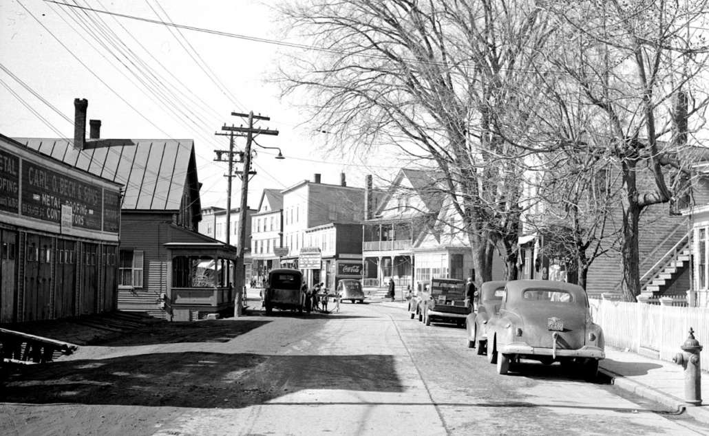
Water St., circa 1940s, looking north. The Esso sign is where Bilodeau’s Garage was located. (photo courtesy of colby.edu/mapping-waterville/)

by Roland D. Hallee

(Read part 1 here.)

This week we will continue our tour of The Plains. Last week we left off at Gold Street. From this point on it gets pretty simple.

One of the first buildings you will come across on the east side of Water St. is the original home of Jean Baptiste Mathieu, presumably the first permanent FrenchCanadian settler in Waterville and his wife, Sarah Dostie, who came here from Beauceville, Québec, in 1827, and settled in their Water Street home in 1831. The rest of the street on that side is made up of single family homes and many duplex and apartment buildings.

However, on the west side, from Gold St., there was Bilodeau’s Service Station where you could buy your gas, and have your car repaired (That building is now part of KVCAP’s campus).

Next , setting a little ways back, was the Notre Dame Church, on the second floor of the building, and Notre Dame Parochial School on the ground floor and basement.

Next came the South End Café. That establishment was famous for their fried clams. My dad would sometimes come home from working the 3 – 11 shift at Hollingsworth & Whitney Paper mill, in Winslow, later Scott Paper Co., with some clams. We could only watch, if we were still awake at that hour.

Next door to the café was Gabe’s Barber Shop. Back when I was in the sixth and seventh grades, I attended St. Joseph’s School for Boys on Summer St., between Kimball and Preston streets (where the Notre Dame Church now stands). It was either every week, or every other week, on Wednesday, my father would give me 25-cents, and I would walk to Gabe’s Barber Shop during lunch, for a haircut. A couple of times, when I felt I didn’t need a haircut, I would skip the trip and pocket the quarter. My dad, somehow, would always know.

Another thing about Gabe Giroux, who was a large, rotund man, was that he was the only Republican, that I can remember, who was ever elected to the Waterville Board of Aldermen, from Ward 7. That was before Waterville went to a council form of government.

A little further down was Dick’s Market, now closed, but still stands, with the sign in front, but is actually the location of Stripes-A-Lot.

From there, on the corner of Halde St., was a house that was rumored to have an active still in the basement during Prohibition. That was proved to be true when the home was demolished and a “secret” room was discovered in the basement.

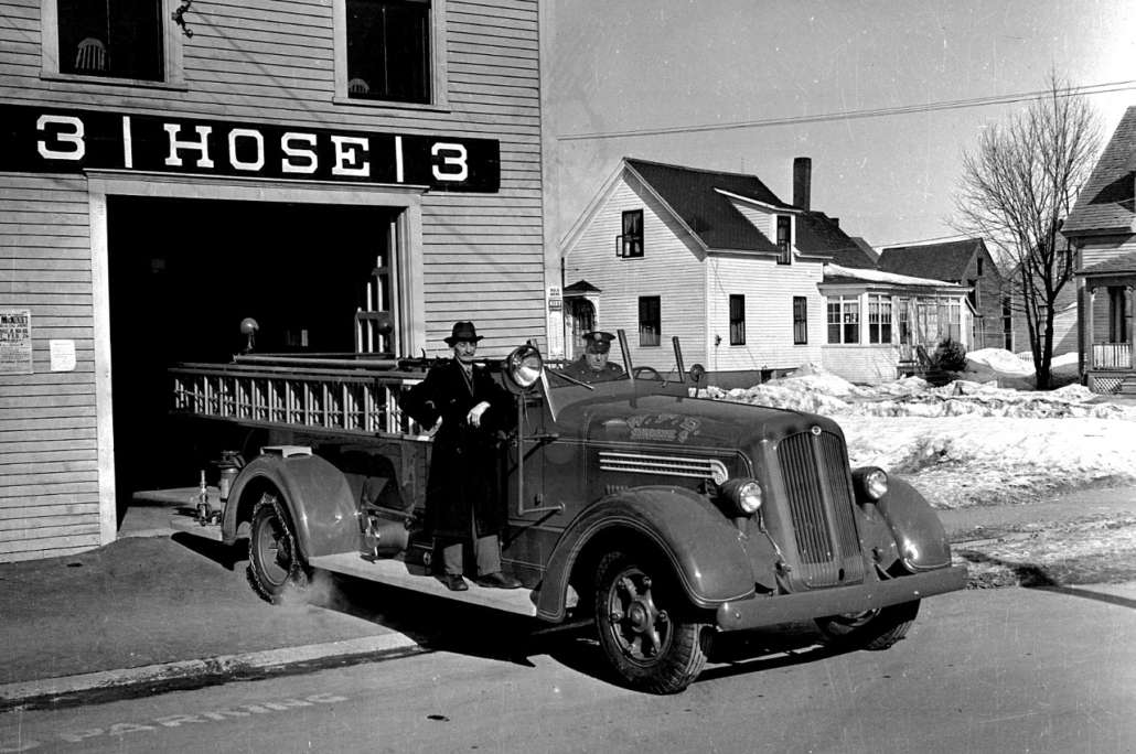
Next to the house, was a Waterville Fire Department substation. Across the street was the Second Baptist Church, which is still there today. More homes lined the street until the corner of Grove St. At the corner of the south side of Grove St., was LaVerdiere’s Market, a little larger store than the small markets.

Museum In The Street plaque of the South End Arena.

Now we’re going to return to Gold St., and the old Notre Dame Church, which is now KVCAP. Looking west, and across King St., was the South End Arena, an Olympic-size outside ice skating and hockey rink, where many of Waterville High School’s star hockey players honed their skills. We were affectionally – or not – known as the South End Rink Rats. Many varsity games were also played there before the construction of the Alfond Arena on the Colby College campus.

Many days and nights were spent at that arena. During the winter, it wasn’t unusual for me to come home from school, drop the books, grab the hockey equipment, and head out to the rink. The two years I attended St. Joseph’s School, it was common for me to bring my hockey equipment to school, and go directly to the rink after school, and not return home until after dark.

During my high school years, many evenings were spent, after hockey, to participate in public skating with the girls, after which we scraped the ice surface by hand, and “flooded” the rink after it closed at 10 p.m.

The founder, and caretaker of the rink, which was on his property, was Waterville Police Captain Arthur Gagne. To those of us who took advantage of the facility, it wasn’t South End Arena, it was “Art’s.” Gagne took care of the rink, mostly from his own money, with the assistance of a small stipend from the city. He also was the chaperone, and he had a zero tolerance policy for any unacceptable behavior. We all loved “Art”.

We have now seen an overview of what it looked like on Water Street in the 1950s and 1960s. Now, I must confess: we are talking about 60-plus years ago. The mind doesn’t quite remember everything, so I’m sure I have omitted some places. My apologies to those I missed.

Up and down the Kennebec Valley: Native Americans – Part 4

Early drawing – An Indian Campsite At The “Rips” On Cobbossee Stream, Maine, Circa 1750.

by Mary Grow

East side of and away from the Kennebec

Last week’s article talked about Native American sites along the Kennebec River between Fairfield and Sidney on the west bank, but the east bank between Ticonic (Winslow) and Cushnoc (Augusta) was skipped for lack of space. This week’s article will remedy the omission by talking about Vassalboro and about sites inland on the east side of the river (as was done for the west side last week).

Vassalboro either was popular with the Kennebec tribe or has been more thoroughly explored than other areas (or both), because various histories mention several areas connected with Native Americans, including at least one Native American burial ground on the Kennebec.

Alma Pierce Robbins, in her Vassalboro history, quoted a historian of the Catholic Church in Maine who claimed Mount Tom was an “Indian Cemetery.” Mount Tom is now in the Annie Sturgis Sanctuary a little north of Riverside, on the section of old Route 201 between the present highway and the river named Cushnoc Road.

Charles E. Nash, in the chapter on Native Americans in Kingsbury’s Kennebec County history, reported a large burial ground north of the mouth of Seven Mile Stream (or Brook), which runs from the southwest corner of Webber Pond to join the Kennebec at Riverside.

Kingsbury himself, in his chapter on Vassalboro, suggested that Robbins’ source and Nash were talking about the same site. Kingsbury wrote that the burial ground was the south side of Mount Tom, “sloping to the brook, on the Sturgis farm.” Artifacts and bones were still “plentiful” there in 1892, he said.

Nash wrote that the Native American name for Seven Mile Brook was Magorgoomagoosuck. James North, in his history of Augusta, spelled it Magorgomagarick.

The pestle was used against the mortar for crushing and grinding and were commonly used for meal preparations such as reducing grain and corn into wheat and meal. Mortar and pestles would have also been used in the preparing of medicine as well as the manufacturing of paint.

An undated on-line copy of a University of Michigan document titled Antiquities of the New England Indians includes descriptions and photographs of a variety of artifacts, including knives, axes and mortars and pestles. The writer explained that mortars and pestles, either wooden or stone, were essential for crushing dried corn kernels.

One pestle that the writer particularly admired came from Vassalboro, and when the description was written it was owned by Kennebec Historical Society. It is now in the Maine State Museum, according to KHS archivist Emily Schroeder.

The pestle is described as 28.5 inches long, made of green slate, topped with a small human head. The illustration shows an almost round head, with oval eyes, a nose indicated by two straight lines with a connecting line at the bottom and a pursed mouth. The writer said the lower half of the pestle was found near Seven Mile Brook; the upper half was found a few miles away four years later, and “The two pieces fitted perfectly together.”

The pestle was broken intentionally, the writer asserted. He wondered whether the destruction of what could be seen as an idol was related to the nearby seventeenth-century Catholic mission.

There are also references to a Native American site farther north along the river, on the section of old Route 201 called Dunham Road.

Robbins wrote that many artifacts had been found on the shores of Webber Pond – so many, she said, that cottages built around 1900 used them as trim around fireplaces.

The major Native American site in Vassalboro located and partly investigated to date was at the outlet of China Lake in East Vassalboro, partly on property on the east side of the foot of the lake and the east bank of Outlet Stream owned for generations by the Cates family. The Vassalboro Historical Society museum in the former East Vassalboro schoolhouse has a room dedicated to information about and artifacts from the site.

According to the exhibit, the area was occupied at least sporadically from 10,000 years ago until Europeans displaced the Native Americans. Different types of tools, weapons and houses are displayed or illustrated and explained. Alewives were harvested at the China Lake outlet 5,000 years ago.

Correspondence on exhibit shows that the Maine Historic Preservation Commission listed the Cates farm site as a protected archaeological site on the Maine Register of Historic Places in the fall of 1989, as requested by George Cates.

The part of China Lake that is in the Town of China was also frequented by Native Americans. The town’s comprehensive plan says the Maine Historic Preservation Commission has found prehistoric sites on two islands in the lake, Indian Island in the east basin and Bradley Island in the west basin (plus one at the north end of Three Mile Pond, and an accompanying map shows a fourth site on Dutton Road). Commission staff think it “highly likely” that there are other sites in town, especially along waterways.

According to the China bicentennial history, the lake was part of one of the Native Americans’ routes inland from the coast in the fall. After final seafood feasts, people would paddle up the Sheepscot to a place about two and a half miles south of China Lake, portage to the south end of the lake and paddle northwest to the outlet in Vassalboro. From there Outlet Stream carried them to the Sebasticook and then to the Kennebec at Ticonic.

The Kennebecs left behind on the west shore of the southern part of the lake’s east basin a heart shape carved into a boulder. World-famous Quaker Rufus Jones, of China, told a story about this carving several times, including as a chapter in Maine Indians in History and Legends.

Jones began by warning readers that his version of The Romance of the Indian Heart is part history and part imagination. He refused to say which was which.

The legend features a Kennebec brave named Keriberba, son of Chief Bomazeen (or Bomaseen, mentioned in the June 9 article in this series), from Norridgewock, and his wife Nemaha, from Pemaquid, whom he met at one of the annual seafood feasts at Damariscotta.

Coming home from the coast, Keriberba, Nemaha and their companions stopped to roast and eat the last clams on the west shore of China Lake’s east basin by “a large sentinel granite rock” from the glacial age. They continued to Norridgewock, where Father Sebastian Rale married them beneath a picture of the Sacred Heart that hung above the altar.

Nemaha immediately organized a group named “The Sisters of the Sacred Heart,” Jones wrote. The women took lessons from Father Rale and hosted an annual feast.

When the British soldiers made their final and successful attack on Norridgewock in August 1724, Keriberba and a few other young men “escaped across the river.” Nemaha grabbed the picture of the Sacred Heart from the church and with others of her sisterhood ran to a secret hiding place in the woods.

The next morning the two groups reunited. After burying Bomazeen, Father Rale and others, they gathered up what the British had left of their belongings and went back to settle at the feasting spot on China Lake.

Jones described the 300-year-old pines that sheltered their wigwams, and the shrine they built for the Sacred Heart picture that became “the center of their religion.” The importance of the picture was reinforced when, one evening, Keriberba called across the lake, “Le sacré Coeur,” (“the sacred heart” in Father Rale’s native French). His words echoed back to him across the water.

Jones wrote that he too had experienced the echo, from the place on the shore that repeats whole sentences. But to the Kennebecs, it seemed to be the voice of the Great Spirit. From then on, Keriberba called every evening and they were comforted by the reply.

Jones described years of living in peace, traveling to Norridgewock to grow corn (because they could not clear enough land by the lake), hunting deer, moose and an occasional bear, importing clams that fed muskrats (both edible), netting and smoking alewives. As children were born and grew up, the group became larger.

One night, a storm destroyed the Sacred Heart shrine and blew the picture into the lake, where it turned to pulp. The next day, Keriberba began carving a recreation of the sacred heart into the granite rock.

When his picture was finished, the group feasted and danced until late at night. Before they went to bed, Keriberba stood beside his carving and shouted, “Le sacré coeur” – and the words came back just as they should.

There is a little more to Jones’ story; it will be continued next week.

* * * * * *

Your writer has found only bits and pieces of information about Native Americans in the areas now included in the towns of Albion, Clinton and Palermo, and nothing from Windsor.

The 2004 report on the archaeological survey around Unity Wetlands and along the Sheepscot River, reprinted on line and mentioned last week, cited a person named Willoughby who, in a 1986 publication, described one pre-European relic from Albion. The reference is to “an isolated Indian artifact recovered by a farmer in the town of Albion – a ‘mask-like sculpture’ of sandstone with pecked and incised eyes, mouth, and other facial lines. It is unclear if the portable rock sculpture was found within the Unity Wetlands study area or simply nearby.”

A photo of what is almost certainly the same sculpture, described as “found while digging potatoes in Albion, Maine” appears in the on-line Antiquities of the New England Indians. The writer described the head as sandstone, about 10 inches long by two inches thick at the thickest point.

The writer continued, “Its natural smooth surface was used for the face, and the rougher fractured surface of the back was smoothed by pecking.” The face tapers to a chin; ears round out on either side; two small round dark eyes each has a circular outline; a smaller dark circle represents the nose; and parallel horizontal lines make a slightly off-center mouth.

The writer described traces of red pigment on the front and yellow pigment on the back. He surmised the effigy came from a grave.

Clinton’s 2006 comprehensive plan says the Maine Historic Preservation Commission had found four prehistoric sites within the town boundaries, one on the Kennebec River, one on the Sebasticook River and two on Carrabassett Stream. Commission staff suggested waterside archaeological surveys. The 2021 plan gives no new information.

Palermo historian Millard Howard doubted there were permanent Native settlements within the boundaries of present-day Palermo, either before or after 1763, because, he wrote, most settlements were on rivers like the Kennebec or the lower Sheepscot.

Kerry Hardy’s map of Native American trails converging on Cushnoc shows one from the coast near Rockland that crosses the east branch of the Sheepscot River a little north of Sheepscot Pond, about where Route 3 now runs east-west a bit south of the middle of town.

Linwood Lowden began his history of the Town of Windsor with the first European settlers. Because the Sheepscot River running out of Long Pond is in southeastern Windsor, including the junction of Travel Brook, it seems likely that parts of the town would have been at least a Native American travel route, if not home to settlements.

Main sources

Grow, Mary M. China, Maine Bicentennial History including 1984 revisions (1984).
Hardy, Kerry, Notes on a Lost Flute: A Field Guide to the Wabanaki (2009).
Howard, Millard, An Introduction to the Early History of Palermo, Maine (second edition, December 2015).
Kingsbury, Henry D., ed., Illustrated History of Kennebec County Maine 1625-1892 (1892).
Maine Writers Research Club, Maine Indians in History and Legends (1952).
Robbins, Alma Pierce, History of Vassalborough Maine 1771 1971 n.d. (1971).

Websites, miscellaneous.

LIFE ON THE PLAINS: A tour of ‘The Plains’ – Part 1

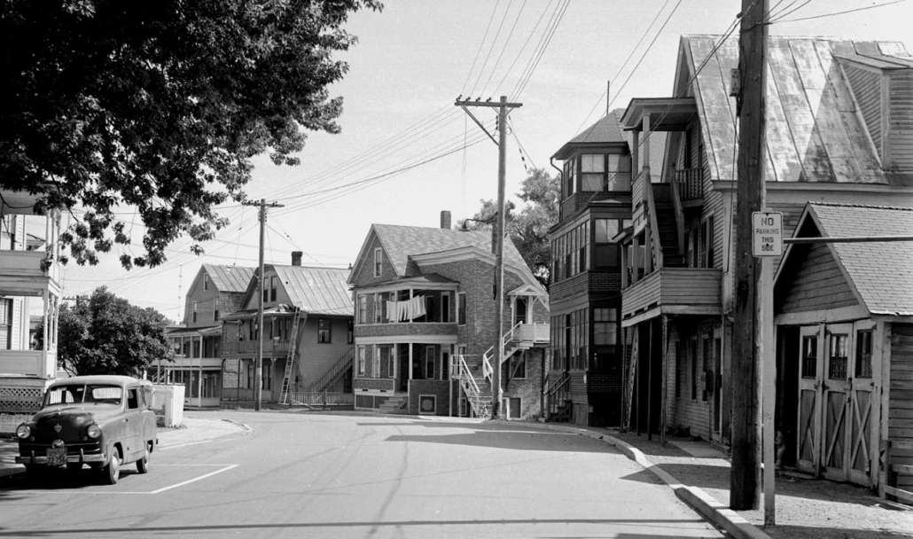
The Plains, circa 1930, with one of the three- story apartment houses that lined the west bank of the Kennebec River, on the left. (photo courtesy of Roland D. Hallee)

by Roland D. Hallee

Before we go into the era of growing up on The Plains, in Waterville, maybe we should take a tour of the area in our “way back machine”. This will take a little time, so plan on a couple of weeks.

Let’s start at the northern end of the south end, if that makes sense?

If we start along the river, there is the massive complex of the Lockwood-Dutchess Textile Mill, commonly called the cotton mill. It consisted of three large buildings, one on top of the hill was three stories, and the larger one at the bottom of the hill, five stories. In between, stood a smaller one story building, all three constructed of brick. The mill went “nonprofit” in the early 1950s. My grandfather worked there until his retirement in 1952. My grandmother also worked there for a short period before she married my grandfather, a story for later.

Across the street, was a building that contained the Pine View Furniture Store, and the famous “round house” behind it.

Proceeding on the west side of the street, next was a parking lot with a large barn. From what I recollect, the barn was used for storage, although I never did see the inside. The barn was eventually razed to make way for the new “Kentucky Fried Chicken” store.

Next, was an up-and-down duplex, and four unit tenement building, both owned by the Busque family. Alongside that was another apartment building, with many garages that spanned from Water St. to Green St.

Rodrigue’s Market was next in line, where you could buy everything from cigarettes to meat. The market had upstairs apartments. Ma Roy’s Tavern stood next door. (One thing I remember well is that her son was named Roy Roy.) I can still remember going there with my dad, enjoying an orange soda while he indulged in a “beverage”.

A three story apartment building was next, although it sat back aways from the street, followed by Pete’s Market, another mom and pop-style store. Why it was called Pete’s I don’t know. The owner’s name was not Pete. It was Bob Coté.

Some more houses were next, with another small market before a three story multi-unit tenement, before ascending on the world-reknowned, Chez Parée, a very popular watering hole on the weekends with live music. On the corner, where there is a parking lot now, was Leighteau’s Market.

Cross Sherwin Street, and there stood Dot’s Market. Can you believe, back then, within a 150 – 200 yard span there were five markets? Not to mention a sixth on top of Sherwin Hill, named Veilleux’s Market. Ah, but we’re not done yet.

Next to Dot’s Market was Red Star Laundry, now a parking lot near Scotty’s, which was earlier known as Dot’s. Scotty’s Pizza began its run across the street from Dot’s in the 1960s, in a building that was so small, it could not accommodate more than two customers at once. Otherwise, you had -to go outside. Across Redington St., was the Redington Street School, now the Forrest J. Pare VFW.

Then came a string of houses and apartment buildings, especially on the east side of Water St., where there was a string of three-story apartment buildings, all the way to Gold St. These apartment buildings stood on stilts that hovered over the Kennebec River. All of those tenement buildings are now gone from the river bank, razed back in the ‘60s. Out of site, some of the foundations are still there today. There, at the end of the row of apartment buildings, was Picher’s Furniture Store, directly across from Gold St.

On the east side of the street, almost diagnolly across from Scotty’s, stood the home of Edgar and Yvonne Poulin, Edgar being a well-known radio celebrity in Waterville (WTVL), whose Sunday radio program was called La Melodie Francais, and maternal grandparents to The Town Line’s business manager, Claire Breton. Edgar would play French music from Canada, to which my grandfather would dance while sitting in his chair.

Let’s go back across the street, to the west side. Not far from the Redington St. School, was, you guessed it, another market. I don’t recall the name of that one. Then, a few more houses before we hit the part where the Maine State Theater stood, and Daviau’s Drug Store on the corner of Gray St. It was the forerunner of LaVerdiere’s Drug Stores, and pretty much carried everything you will find in a CVS or Walgreen’s today.

Then, there were more houses and apartments to the corner of Gold St. Most of these dwellings are now gone.

So, we’ve traveled a ways this week along the northern stretch of The Plains. The Gold Street area is about the halfway point.

This part of Waterville, one of the oldest settled areas, was mostly occupied by the Franco-American community. People who immigrated from Canada to work in the mills, in search of a better life. As you can tell so far, and will learn more next week, this section of Waterville was pretty much self-sufficient. In those days, there was no need to venture “downtown”, unless you were going to a clothing store. Pretty much all you needed was right there on The Plains.

And, besides, not many had cars back then.

Next week: From Bilodeau’s Garage, to LaVerdiere’s Market.

Up and down the Kennebec Valley: Native Americans – Part 3

A sketch of the Kennebec tribe settling along the Kennebec River. (Internet photo)

by Mary Grow

Three local settlements

The Kennebec tribe’s village at Cushnoc (a word that means head of tide, most historians agree) was on high ground on the east bank of the Kennebec River in what is now Augusta, about 20 miles south Ticonic village (described last week).

Leon Cranmer, in his Cushnoc, pointed out that the high land provided views of river traffic both upstream and down and offered some protection against attack. Canoes could land in a cove at the foot of the bank (now, he wrote, a park and boat landing).

Charles E. Nash, in his chapters on Augusta in Henry Kingsbury’s Kennebec County history, wrote that Cushnoc village had wigwams, cultivated cornfields and open space for young men to practice “wrestling, running and dancing.”

Kerry Hardy, in a nicely-illustrated 2009 book titled Notes on a Lost Flute: A Field Guide to the Wabanaki, argued that Cushnoc was the west end of an important Native American trail that ran from the present town of Stockton Springs near the mouth of the Penobscot River (almost due east of Cushnoc) to the head of tide on the Kennebec River.

Looking at old maps, Hardy traced that east-west trail and found others that converged on Cushnoc, coming from present-day Rockland (on the coast to the southeast), Canton Point (on the Androscoggin River to the northwest) and Farmington Falls (on the Sandy River to the north).

Unfortunately, Hardy did not explain why Cushnoc was the center of a Native American communications network. Instead, he summarized the importance of the British trading post established there (as at Ticonic; and, as at Ticonic, the site of the trading post was later chosen for a fort).

Cranmer offered the theory that Cushnoc was a convenient mid-way place for Native Americans traveling between Canada and the coast to branch off to other parts of Maine.

During archaeological excavations around the trading post site between 1974 and 1987, Cranmer wrote, more than 17,500 artifacts were found, mostly signs of European rather than Native American habitation.

He specifically mentioned a few stone flakes left over as Kennebecs made their edged tools; a stone projectile point that appears from its photograph to be in excellent condition and could be anywhere from 2,200 to 6,000 years old; and a bit of pottery, the remains of what Cranmer called an Iroquoian-like jug or bowl.

If there was a Native American burial ground associated with Cushnoc, this writer has been unable to find a reference to it. J. W. Hanson, in an 1852 history of the area found on line, claimed that “the quiet graves of their [Kennebec tribal members’] fathers clustered around the mouth of each tributary to their beloved river,” but he offered no specific location.

The first British trader at Cushnoc was Edward Winslow from the Plymouth Colony in 1625, Nash wrote (or in 1628, according to Old Fort Western Director Linda Novak’s bicentennial lecture). He and successors traded European goods for Native American products, primarily beaver skins.

By the 1650s, trade and profits were diminishing, Nash said. In 1661 the Plymouth group sold the trading post to four other Europeans, who gave up and closed the operation about 1665.

Novak blamed the decline in trade at Cushnoc on rival traders Thomas Clark and Thomas Lake, who opened competing posts both upriver at Ticonic and downriver near current Pittston. James W. North, in his history of Augusta, blamed “growing Indian troubles” for the decline and said war was the final blow (the first war counted by historians, writing primarily from the Anglo-American point of view, started in 1675).

North listed other problems in the 1650s, including a decrease in fur-bearing animals, the Kennebecs’ recognition that the furs were more valuable than the goods offered in exchange and “the increasing number and avaricious disposition of the traders.”

Cranmer added two more problems that could have contributed to a smaller supply of furs: British settlements expanding into woodlands, and attacks on Maine Native Americans by Iroquois tribes from the northwest (current upstate New York and thereabouts).

In 1655, the governor of the Plymouth Colony appointed Captain Constant Southworth as magistrate at Cushnoc, responsible for administering civil law throughout the colony’s holdings. He had two main jobs, Nash wrote: to prevent other traders from trespassing and “to check the sale of demoralizing liquors to the Indians.”

Nash commented that Joseph Beane or Bane, an Englishman held captive by the Native Americans, reported that remains of the Cushnoc trading post were still visible “among the new-grown trees and shrubbery” in 1692. Novak, however, says the post was burned in 1676, during the first of the serial wars. Either account suggests the Kennebecs had no interest in using the building.

North wrote that the 1725-1744 interregnum in the Kennebec Valley wars was a genuine peace, during which the Kennebecs interacted peacefully with the British traders, who he suggested treated them fairly and even generously, and with early settlers. In 1732, Massachusetts Governor Jonathan Belcher and “a large retinue” toured the coastal settlements. The governor met with an unspecified group of Native Americans at Falmouth, and told them that he planned to establish three missionary stations in the province, one to be at Cushnoc, “where a town and church were about to be built.”

North offered no evidence of such a town, or of any pacifying influence from missionaries, before the final defeat of the French at Québec in 1759. Instead, continued Native American resistance delayed the growth of European settlements around Cushnoc for another generation.

* * * * * *

Besides the settlements at Ticonic/Winslow and Cushnoc/Augusta, Kennebec tribal members lived elsewhere along the Kennebec River, its tributaries and other nearby water bodies. Some of the town histories on which this writer relies describe evidences of pre-European occupation from Fairfield and Benton through Waterville/Winslow and Vassalboro/Sidney to Augusta.

The current Town of Benton has frontage on the Kennebec River, and the Sebasticook River runs (almost) north-south through (almost) the middle of town. The Sebasticook, like the Kennebec, was a major travel route for Native Americans.

Benton historian Barbara Warren says because of the rapids in the Kennebec above Ticonic (until Waterville manufacturers’ dams calmed them, beginning in 1792), upriver travel was via the Sebasticook to Benton Falls, about five miles upstream from the Kennebec, and a portage back to the Kennebec at Fairfield. The Sebasticook was also a connector between the Kennebec and Penobscot valleys, according to another source.

Kingsbury wrote that “the relics found many years ago at the foot of the hill overlooking Benton Falls are now the only traces of the original possessors of the soil.” The “hill” – high land – is the east bank of the river where Garland Road runs through Benton Falls Village. Warren remembers as a child walking along the river and finding artifacts like shards, grinding tools and “a stone weight for a fishing net.”

Warren says a state-listed archaeological site on the west side of the Sebasticook near the dam includes a burial ground. State preservation officials are protecting the exact location of the site. Your writer surmises there was a Kennebec village, at least seasonally for fishing and perhaps year-round for farming and hunting, on the east bank with the burial ground across the river, as at Ticonic.

A 1992 University of Maine at Farmington study of the banks of the lower Sebasticook, between the dams at Benton Falls and Fort Halifax, found 30 archaeological sites along that part of the river, dating from the Archaic period (in Maine, between 10,000 and 3,000 years ago, according to Wikipedia) and the early contact period in the 1600s.

A 2004 archaeological survey related to the Unity Wetlands covered the banks of the Sebasticook in Unity and a small part of Benton and found 16 riverside Native American sites. Ten of the sites were either near rapids or near a junction with a tributary stream.

In the 2004 study, the site at Benton Falls was described as having been used during the Archaic and Ceramic periods. Wikipedia says in Maine, the Ceramic period was between 3,000 and 500 years ago, or from about 1000 B.C. to about 1500 A.D.

Both the Farmington study and a Biodiversity Research Institute publication by C. R. DeSorbo and J. Brockway, found on line, mention pre-European fisheries for migrating river herring. Warren says there is evidence suggesting Native Americans built a two-tier stone fish trap where Outlet Stream from China Lake runs into the Sebasticook in Winslow, within a mile of the Kennebec.

In neither Benton nor Fairfield are there well-known evidences of pre-European settlement along the Kennebec. The Fairfield bicentennial history says Native Americans made arrowheads in an area called the sand hills in Larone, in northern Fairfield. Evidence cited included arrowheads, broken and unbroken, and chips from making the arrowheads (although collectors had picked up most of the chips).

The type of rock used to make the arrowheads was not found locally, the writers said. They surmised the Native Americans brought the rock from Moosehead.

In Alice Hammond’s 1992 history of the Town of Sidney, she quoted Dr. Arthur Speiss, of the Maine Historic Preservation Commission, saying there had been Native Americans in Sidney since “at least 5,000 years ago.” By 1992, Hammond wrote, the Historic Preservation Commission had found 11 pre-European sites along the Kennebec River and eight along Messalonskee Lake’s eastern shore.

The Town of Sidney’s 2003 comprehensive plan gives the number of pre-historic sites as 23. Maps show four areas along the Kennebec and three more on Messalonskee Lake. The plan explains that the exact locations are not publicized to protect the areas.

Hammond wrote that there was no valid way to estimate how many Native Americans lived in Sidney, nor are there individuals’ names or information on when the last groups left. She surmised they could have been gone by the 1740s.

Sidney does, however, have its legend, retold in Hammond’s history and in other sources, including Maine Indians in History and Legend.

According to that version, Messalonskee Lake is named from the Native American word “Muskalog,” or “Giant Pike,” a big, voracious fish that lived in the lake. The name further recognizes that 14 other water bodies empty into the lake, “which like the Giant Pike was never satisfied.”

A heroic brave named Black Hawk and a sneaky brave named Red Wolf both loved a lovely, lively maiden named White Fawn. White Fawn chose Black Hawk.

The evening they were formally engaged, White Fawn and Black Hawk stole away from the celebration for some private moments on a clifftop overlooking Messalonskee Lake. Red Wolf followed them, killed Black Hawk, whose body fell into the lake, and tried to kidnap White Fawn.

Screaming, she jumped from the cliff into the water. The rest of the tribe rushed to the scene. Red Wolf cried out “Messalonskee! Messalonskee!” As the avengers closed in on him, there was an earthquake and an avalanche swept him, too, into the ever-hungry lake.

Series of lectures available online

A series of 10 lectures on early Maine history presented at Old Fort Western in 2021 is now available for viewing on line. Topics include Native Americans, Fort Western and Fort Halifax and trading posts on the Kennebec River. Speakers include Dr. Arthur Speiss and Leon Cranmer, mentioned in this article. The series can be found by searching for Old Fort Western or Maine bicentennial lectures.

Main sources

Cranmer, Leon E., Cushnoc: The History and Archaeology of Plymouth Colony Traders on the Kennebec (1990).
DeSorbo, C. R. and J. Brockway, The Lower Sebasticook River: A landowner’s guide for supporting one of Maine’s most unique and important ecosystems. (2018).
Fairfield Historical Society, Fairfield, Maine 1788-1988 (1988).
Hammond, Alice, History of Sidney Maine 1792-1992 (1992).
Hardy, Kerry, Notes on a Lost Flute: A Field Guide to the Wabanaki (2009).
Kingsbury, Henry D., ed., Illustrated History of Kennebec County Maine 1625-1892 (1892).
Maine Writers Research Club, Maine Indians in History and Legends (1952).
North, James W., The History of Augusta (1870)
Warren, Barbara, email exchange.

Websites, miscellaneous.

Up and down the Kennebec Valley: Native Americans – Part 2

The British execution of Father Sebastian Rale

by Mary Grow

(Read part 1 of this series here.)

Earlier articles in this series have identified the Kennebec River Valley as a throughway connecting the coast and the St. Lawrence River, used by, among others, Benedict Arnold going north to attack Québec in 1775 and Canadians coming south to find jobs in Maine in the 19th century. According to Charles E. Nash’s chapter on the Abenakis in Kingsbury’s Kennebec County history, the route was well-traveled long before the Europeans arrived.

Nash wrote that for the Kennebec tribe of the Kennebec Valley, “The river was their highway and its banks their home.” He described a nomadic life varying seasonally with food resources.

In the winter, he wrote, families moved to the head of the river at Moosehead Lake, where they hunted moose, deer and caribou and caught trout through the ice. When the game animals left their winter yards, the Native Americans loaded their canoes and headed downriver.

They would stop along the way, Nash wrote, especially at waterfalls and at river junctions where migrating salmon and river herring assembled. Usually, their journeys ended at Merrymeeting Bay, where they and other groups spent the summer feasting on fish and shellfish.

Nash described canoes skimming down descending rapids and being carried around those too swift to run. He did not mention the autumn upstream journey, which must have been more difficult.

Along the way, the same camping places were used over and over, to the point where permanent traces were left. Nash described evidence of tool-making and of campfires still visible when the Kennebec County history was published in 1892.

“Flint and stone chippings, with arrow-heads and other articles in all stages of manufacture” were common. The slate used for the tools came from Mount Kineo, near Moosehead Lake, he said.

Nash also wrote, “Many spots where wigwam fires once glowed are yet marked by burned and crumbling stones and by fragments of the earthen vessels in which the feasts were cooked.”

Such “relic places” are spread from Moosehead Lake to Popham Beach, Nash wrote, “but they are almost continuous on the alluvial banks between Augusta and Waterville, which seems to have been a favorite resort or metropolis of the tribe.”

Nash wrote that there were no permanent villages along the river, but other sources list three places that seem to have been inhabited most, if not all, of the year: Norridgewock; Cushnoc, on the east bank of the river in Augusta; and Ticonic, at the junction of the Sebasticook and Kennebec rivers, in Winslow.

Norridgewock, too far north to be part of this series, was dominated by the French; the British built trading posts and later forts at Ticonic and Cushnoc.

An on-line article calls Ticonic, or Teconnet Village, the “ancestral home” of the Kennebec tribe; or, according to an 1852 history by J. W. Hanson also found on line, of the Teconnet clan of the Kennebec tribe.

Kingsbury considered this junction of two major rivers a natural place for a Native American village. “It was easy of access, renowned for fish and game – just the spot for camp and council, for traffic and recreation.”

An on-line history of Waterville says the village “was estimated to be the second largest Native American settlement in Maine at the time of the first European visitors.” (The article does not name the largest.)

Two sources agree that the burying ground associated with the village was on the west side of the Kennebec. An on-line history says it extended from contemporary Temple Street to the Lockwood/Hathaway mill complex.

Kingsbury wrote the lot that was by 1892 Lockwood Park (near the Lockwood Mill at the northern end of present-day Water Street) had been the site of sequential hotels after the 1840s, until the final building became a tenement and was demolished.

As the site was cleared, he said, workers found “many human bones” indicating the burial site. One of the skeletons was in a sitting position and surrounded by “over 300 copper beads about the size of a straw, from two to three inches long, and punctured from end to end.”

A Native American village attracted British traders. Kingsbury wrote that a 1719 survey showed a building on the southeast side of the Sebasticook-Kennebec junction labeled as a trading house built by Christopher Lawson, dated Sept. 10, 1653.

Lawson had acquired the land from the chief called Kennebis in 1649. In 1653 he “assigned” it to Clark & Lake, a trading company mentioned in various histories.

By 1675, Kingsbury wrote, “Richard Hammond, an ancient trader, and Clark & Lake each had a trading house at Ticonic.” ((In his history of Augusta, James W. North accuses Hammond of stealing the Kennebecs’ furs.)

By then, too, although the British were theoretically not allowed to furnish either guns or liquor to Native Americans, tribes had become dependent on guns for hunting. Williamson wrote that the Kennebecs were starving, because the British had driven them from their corn fields and had denied them hunting supplies.

Williamson described an early 1676 meeting at Ticonic between British representatives and tribal chiefs, who asked for powder and ammunition. The British denied the request, saying they feared the Kennebecs would hand them on to tribes farther west who were on the warpath. So, Mitchell said, the Kennebecs attacked the British settlers, beginning the first of the series of wars that lasted from 1675 until 1759.

In 1676, the Native Americans killed Hammond and Lake, Kingsbury wrote. They evidently seized the buildings, rather than burning them, because various sources refer to Europeans being sent as captives to a Native American “fort” at Ticonic in the 1780s and 1690s. This fort was burned in 1692, one source says, by the Kennebecs.

This first war ended with a peace treaty that Harry Edward Mitchell, author of a 1904 Winslow Register found on line, called temporary, because “The two races were naturally repellant.” War did indeed resume, with occasional intervals of peace. Europeans, their livestock and their pets were killed, their homes and farms were destroyed or abandoned; but they always came back.

One pause in the fighting followed a major meeting of Native Americans and British at Casco (Portland) in 1702. Mitchell listed three Kennebec chiefs named Bomaseen, Captain Sam and Moxus among those present.

Bomaseen or Bomazeen appears in multiple histories, identified as a Norridgewock chief, shot by the British in 1724. Captain Samuel, whose real name is given on line as Wedaranaquin, was a Kennebec or Norridgewock leader, born before 1680 and maybe died in 1722; he is described as “an orator” at the 1702 Casco conference. Moxus was, or might have been, Bomaseen’s son, born before 1660 and died about 1721, according to other on-line sources; one says he was a Penobscot leader and by 1701 leader of the Norridgewock group.

A European peace in 1713 meant an interval of peace in the Kennebec Valley and the rest of Maine, during which more settlers moved in, basing their land claims on “deeds” given them by natives who had not yet learned concepts of individual ownership.

A 1717 British attack on Norridgewock, by then home to Father Sebastien Rale, who was highly esteemed by the Kennebecs, brought open warfare again, Mitchell wrote.

In August 1724, the British succeeded in killing Rale, and on their way to Norridgewock, Bomaseen. Rale’s death ended the Kennebecs’ participation in wars against British settlers, Mitchell said. He described subsequent “minor conflicts” in the Kennebec Valley as “of little importance,” though people continued to die for another three decades.

In the spring of 1754, the Massachusetts General Court ordered a new fort on the point between the Sebasticook and the Kennebec at Ticonic to deter the French and protect the British settlers. Major General John Winslow and soldiers, Governor William Shirley and other authorities met with local chiefs late in June and told them the plan.

Williamson wrote in his history of Maine that the chiefs were opposed, until the Massachusetts delegation showed them documents by which their forebears had ceded the land. They then signed a treaty and celebrated with a dance before all, except three young men, went back to their villages.

Two days later a group of Penobscots met with the Massachusetts delegation to sign the treaty. Two of their young men also stayed behind, and, Williamson wrote, “the five were sent to Boston to be educated.” He said nothing more about them.

The British soldiers then built Fort Halifax. It was finished Sept. 3, 1754, and the Governor, who had been visiting Falmouth and surrounding towns, came upriver for an inspection. Mitchell said that the governor “very highly complimented General Winslow and his men.”

The inspection must have been hurried, however, because Williamson wrote that Shirley continued upriver from Ticonic as far as Norridgewock and was back in Boston Sept. 9.

The Massachusetts General Court promptly authorized funds to supply the fort and buy gifts for the Kennebecs, Williamson said. The gifts were recalled, because on Nov. 6, 1754, the Fort Halifax garrison sent Governor Shirley the news that Native Americans had attacked a party of soldiers outside the fort, killing one and taking four prisoners.

Williamson did not suggest what reason the Natives Americans might have had. From the British point of view, his words were “outrage” and “base and cruel treachery.” He added that efforts to ransom the prisoners were counterproductive, because they encouraged more kidnapping to collect more ransoms.

The Nov. 6 attack marked the beginning of the French and Indian War, the last of the long series. Tribal warriors attacked throughout the Kennebec Valley. Williamson mentioned one man (probably a soldier, though he did not specify) shot at Ticonic in 1755 and another “taken” on his way north to Fort Halifax.

The Kennebecs saw Fort Halifax as “an object of great affront and hatred,” Williamson wrote. In 1756, they shot and killed two soldiers “catching fish at the falls.”

Mitchell agreed, recording that “No man was safe if he ventured beyond the limits of the fortifications. Several were mortally wounded by the Indians.” The last attack, he wrote, was on May 18, 1757.

Captain Lithgow, in charge of Fort Halifax, had noticed rafts floating down the Kennebec, deduced that warriors had crossed and were making their way downstream by land and sent ten soldiers downriver to warn settlers. As the men came back, they were ambushed near Riverside. They resisted so effectively that the Kennebecs fled.

The cost was two soldiers wounded, one Kennebec killed and one wounded, Mitchell said. And, he concluded, the “skirmish” at Riverside was “the final shot of the redman, as a tribe, in this region.”

Settlers continued to use the name Ticonic, misplaced, for the west side of the Kennebec River after Winslow was created as a town (including present-day Waterville) in 1771. After Waterville became a separate town on June 23, 1802, Kingsbury wrote that Asa Redington, convening the first Waterville town meeting, called on voters to assemble “in the public meeting house in Ticonic village on Monday, July26, 1802.”

The name Ticonic endures today, as in Waterville’s Ticonic Street and Ticonic Bridge (scheduled for replacement by 2026).

Main sources

Davis, B. V., and Harry Edward Mitchell, The Winslow Register 1904 (1904) (found on line; also available as a paperback book).
Kingsbury, Henry D., ed., Illustrated History of Kennebec County Maine 1625-1892 (1892).
Williamson, William D., The History of the State of Maine from its First Discovery, A.D. 1602, to the Separation, A.D. 1820, Inclusive Vol. II (1832).

Websites, miscellaneous.

Next week: another major Native America village, at Cushnoc, and more incomplete evidence from elsewhere in the central Kennebec Valley.

Up and down the Kennebec Valley: Native Americans – Part 1

This model and an inscription of a typical Abenaki encampment can be viewed at Nowetah’s Indian Museum, in New Portland.

by Mary Grow

Logically, your writer should have started this series on the history of the central Kennebec Valley with the first human inhabitants, the groups once called Indians and now more commonly called Native Americans.

Your writer is a coward. She did not want to take on a topic about which there is no contemporary written evidence and limited later evidence.

However, in collecting information for the series it has become clear that reliable, unbiased and uncontradicted evidence is in short supply on most topics. Therefore, it is time to write about prehistoric – or better, pre-European-historic – Native American life in the central Kennebec Valley. Readers are hereby warned that everything written, no matter how authoritative the source sounds, might be wrong.

There are two areas to research: reports on archaeological excavations and interpretations of the findings; and written records by 16th and 17th European explorers, missionaries, traders and the like, as edited by later historians.

The archaeological record is incomplete in two ways: a vast amount of evidence of the way people live does not survive for hundreds of years; and modern archaeologists have found only small samples of what did survive. Nor have they necessarily correctly interpreted their findings.

Written records, too, have an interpretation problem. Europeans arriving on the coast and moving inland viewed a very different culture through their own cultural lens. Some wanted to denigrate the indigenous people, others to glorify them, and even those who intended to be purely descriptive could not necessarily understand what they were seeing.

This article will present an arbitrarily-chosen triple overview: linguistic issues; a brief and incomplete description of Native American life in Maine; and comments on relations between Maine’s Native Americans and European settlers. A subsequent article (or articles) will discuss what is known and surmised about pre-contact Native Americans in the central Kennebec Valley.

The linguistic issue involves tribal names and their spellings. The Native Americans lacked a written language, so Europeans transcribed the sounds they heard in a variety of ways.

Further, they applied them differently. Ernest Marriner wrote in Kennebec Yesterdays that the Native Americans did not give names to large areas of land or water, but only to specific smaller places, like a section of a river. The word “Kennebec” is indigenous; “Kennebec River” is European.

The Native Americans who were living in the Kennebec River Valley when the Europeans began arriving were a tribe whose name is commonly spelled Kennebec. Other spellings, listed in various sources, have included Caniba, Kenabe, Kennebeck, Kinibeki, Kinipekw, Quinebequi, Quinibequi and Quinibequy.

The last three are allegedly French explorer Samuel de Champlain’s spellings. Henry Kingsbury, in his Kennebec County history, wrote that Quinibequi was the French spelling of a Native American word, Kinai-bik, that meant “monster.” It referred to an underwater monster whose movements supposedly caused the dangerously turbulent water Native Americans encountered in the winding passage between Bath and Sheepscot Bay, where river water met tidewater.

Kingsbury and William Williamson, in his Maine history, each mentioned a Native American chief named Kennebis, who in 1649 “conveyed” to Europeans an area as far up the Kennebec River as Ticonic Falls.

Ticonic (or Teconnet) is another Native American name that is still in common use. Kingsbury said “Ticonic” was the name for the place where the Sebasticook River flows into the Kennebec, and also for the rapids a short distance upstream.

Another lasting name is Cushnoc (Cusenage in the 1650s, according to Kingsbury, or Cushenock in the 1690s, according to one of Williamson’s sources). Several historians agree it comes from a Native American word that means the place where the tide stops flowing upstream, as on the Kennebec at Augusta.

The Kennebecs were among several subtribes of the Eastern Abenaki (or Abenaque, Abenaqui, Abnaki, Abnakki, Abinaki, Alnôbak), also called the People of the Dawn. The Abenaki were one of several groups of Algonquian-speaking Native Americans who lived in what are now the northeastern United States and southeastern Canada.

Before Europeans arrived, the Kennebecs and related tribes lived off the land. Houses, tools and utensils, clothing and weapons were made of materials like wood; stone; grasses that could be woven; and animal hides, antlers and other useful parts.

Food came from hunting and trapping, fishing, collecting berries, nuts and other wild edibles and to a lesser extent growing crops. Multiple sources list the principal crops as corn, beans, squash and smoking tobacco. Some add potatoes, pumpkins and other vegetables.

Hunting weapons included lances and spears made of wood with sharpened stone points. Chert, a fine-grained, hard rock related to flint, was the preferred material for points.

Historians describe houses as oval or round, made of different materials depending partly on whether use was seasonal or year-round. One common type was the teepee or wigwam, constructed of branches slanting upward and tied at the top. Animal hides or mats woven from plant fibers covered the outside to keep out wind and water. Year-round houses might have floors of gravel sunk below ground level.

Warmth came from a fire pit, central or near the doorway. Smoke went out through a hole in the roof where the branches met. Mats or animal skins lined the lower part of the inside and covered the benches along the walls for warmth and comfort.

Native Americans traveled on foot on land, aided by snowshoes in the winter; there is no record of use of horses or similar animals or wheeled vehicles. Water travel was in dugouts and later in birchbark canoes.

Many people traveled; for example, seasonal camps would be set up on rivers and streams, including in the Kennebec Valley, in spring when river herring and salmon were migrating and on the coast in the summer.

The first Europeans began ascending the Kennebec in the 1620s. After about half a century of reasonably peaceful relationships, war broke out between the Native Americans and the English settlers. The wars that make up the Second Hundred Years War between Britain and France were fought mainly in Europe; they overflowed into the colonies, where they merged with local issues.

Williamson and Robert P. Tristram Coffin (in his Kennebec Cradle of Americans) each counted six separate wars, starting in the 1670s and ending in the 1760s. The British conquest of Québec in 1759, made permanent in the 1763 Treaty of Paris, eliminated France’s role in the northeastern United States.

Cranmer, in his Cushnoc, and the unnamed authors of The Wabanakis of Maine and the Maritimes added local reasons for hostility, based on major cultural differences. The latter writers said that the Native Americans lived in a world of abundance – except, sometimes, in late winter when stored food supplies ran low, they had all they needed and shared generously.

Williamson agreed, describing a community in which accumulating property was neither praised nor practiced, no one stole and trade was fair. Instead, the Native Americans valued and helped other people, whether neighbors or strangers.

(These historians, and others, did not glorify the Native Americans, however. Their vindictiveness against those who offended them and their cruelties in war were described in terms sadly reminiscent of the present day.)

When the first trading posts opened, the English needed the indigenous people. In addition to acquiring furs to sell, traders needed help getting food and shelter in this new environment; and the Native Americans extended their sharing to the invaders.

From the traders, the Native Americans accepted materials that made their lives easier, like metal instead of stone tools. As time went on, Cranmer said, they abandoned their old skills and became increasingly dependent on imports, and therefore on the importers. The result of the reversed relationship was complicated by the introduction of firearms and liquor, and led to the Native Americans beginning to resent the in-comers.

Resentment increased, Cranmer and other historians wrote, as the English imposed their ideas, especially the totally foreign idea of individual land ownership. British settlers cut down trees, built houses and fenced gardens and cattle pens, eliminating habitat for game animals and making traditional foods less available.

Their holdings cut off access to rivers, and they punished Native Americans who trespassed on land they claimed. Further, they captured Native Americans to sell as slaves, and killing a Native American was not a crime. One historian said scalping was practiced in Maine by Europeans and Native Americans alike.

A major effect of the arrival of Europeans was the spread of European diseases – measles, chicken pox, smallpox, influenza and many others – against which Native Americans had no immunity. In the 17th century, thousands died. The writers of The Wabanakis explained that with elimination of entire families and even entire villages, deaths of leaders and discrediting of shamans (curers or “medicine men”), native governmental and social structures were disrupted.

Williamson wrote (rather arrogantly) that “In the first settlement of this country, the judicious management of the natives was an art of great importance.” The British weren’t very good at it, he said.

But, Williamson wrote, the French, “by a condescension and familiarity peculiar to their character,” did better in making friends and allies. Other historians agree that the French who came south from Québec were generally respectful of Native Americans. Coffin wrote that unlike most of the British, the French intermarried with Native Americans.

Another reason for French popularity was their willingness to sell firearms to Native Americans, who found them useful for hunting. British traders were strictly forbidden to arm Native Americans, lest the arms be turned against them (though the prohibition was not always obeyed).

Additionally, French Catholic priests were welcomed, notably the succession of able men who served at Norridgewock, like the Jesuits Father Gabriel Dreuillettes (1610-1681) and Father Sebastien (or Sebastian) Rasle (or Rale, Ralle, Rasles) (1652-1724). These men came as friends, not masters, and several historians say Catholicism fitted readily into the indigenous way of life.

Consequently, when wars spread from Europe to the budding colonies along the Maine coast and tributary rivers, most Native Americans sided with the French, with disastrous results for early British settlers on the Kennebec. The removal of French influence, and the effective destruction of Native Americans in the Kennebec Valley, made the region safe for British expansion.

Cushnoc Trading Post replica planned

Illustration of Cushnoc Trading Post

An article by Chris Bouchard in the May 29 issue of the Kennebec Journal announced that leaders of Old Fort Western have started raising money to build a replica of the Cushnoc Trading Post.

Bouchard quoted museum director and curator Linda Novak as saying the replica will be built behind the fort. The original site was nearby on what is now the lawn of the First Church of Christ, Scientist, at 6 Williams Street.

The reconstructed building is to be “a post and beam structure with earthfast construction.” Novak explained that “earthfast” means no foundation; “the vertical roof-bearing posts will come in direct contact with the ground.” The floor will be either planks or dirt.

Because the trading post will be open to the public, Novak said, it must include anachronistic elements required by contemporary building codes, like fire alarms and a sprinkler system.

The fund-raising goal is $250,000, and the preferred deadline is 2026, to allow Novak and supporters to buy special Canadian lumber that needs to be dried for two years and to open the new trading post in 2028, the year Novak calls the 400th anniversary of the original.

In December 2021, former Augusta Mayor David Rollins proclaimed 2022 The Year of the Fort. His proclamation, a history of the fort and much more information can be found on line by searching for Old Fort Western.

Main sources

American Friends Service Committee, The Wabanakis of Maine and the Maritimes (1989).
Coffin, Robert P. Tristram, Kennebec Cradle of Americans (1937).
Cranmer, Leon E., Cushnoc: The History and Archaeology of Plymouth Colony Traders on the Kennebec (1990).
Hatch, Louis Clinton, ed., Maine: A History (1919; facsimile, 1974).
Kingsbury, Henry D., ed., Illustrated History of Kennebec County Maine 1625-1892 (1892).
Marriner, Ernest, Kennebec Yesterdays (1954).
Williamson, William D., The History of the State of Maine from its First Discovery, A.D. 1602, to the Separation, A.D. 1820, Inclusive Vol. I and Vol. II (1832).

Websites, miscellaneous.

Read part 2 of this series here.

Up and down the Kennebec Valley: Immigrants

Waterville City Hall, upper left.

by Mary Grow

Middle Easterners, Waterville, & Irish, Augusta

The French-Canadians and the Irish were not the only groups coming to the central Kennebec Valley from other countries. Stephen Plocher wrote in his Waterville history (found on line) that in the 1860s, people he called “Syrian-Lebanese” from Syria (Lebanon and Syria were French mandates until 1943, when they became two separate countries) began arriving.

Their main settlement, shared with French-Canadian immigrants, was in the area called Head of Falls, on the west bank of the Kennebec between the railroad track and the river, east of City Hall. Former Maine Senator George Mitchell, whose mother was Lebanese by birth and father Lebanese by adoption, grew up in Head of Falls.

He wrote in his book The Negotiator (see Box 2) that the area was only about two acres, bounded by the railroad, the river and the Wyandotte Worsted Textile Mill where many residents worked. The land was crowded with apartment buildings and small houses, and the buildings were crowded with people.

Mitchell wrote that one group of houses was on the bank of the Kennebec. Another group was above them at the top of a short steep hill. In winter, the gravel path between them became a sledding run for Head of Falls children (where Mitchell suffered a broken leg in an accident the winter he was five years old).

Head of Falls was first home to French-Canadians. Plocher said the earliest Middle Eastern immigrants worked as “peddlers,” but they soon found jobs with the railroad and, as manufacturing expanded, in Waterville’s numerous, mostly water-powered, mills.

The Syrians were Maronite Catholics, and joined the Franco-American church. Mitchell explained that the Maronites are named to honor a fifth-century hermit priest in what is now Lebanon; they have been part of the Roman Catholic Church since the 16th century.

Reuben Wesley Dunn’s chapter on manufacturing in Whittemore’s Waterville history listed some of the employment opportunities in the last half of the 19th century.

The Waterville Iron Manufacturing Company started in the 1840s on Silver Street. After an August 1895 fire, the company, by then Waterville Iron Works, reopened farther north, on the Kennebec north of Temple Street.

The first cotton mill, according to Dunn, was the Lockwood Company’s, planned and built over several years and producing its first cloth in February 1876. Its immediate success led to opening a second, larger mill early in 1882. When Whittemore and his colleagues wrote their history in 1902, the Lockwood mills had about 1,300 employees and an annal payroll of about $415,000.

The Hathaway Shirt Factory was started in 1849. By 1902, according to Dunn, it employed between 150 and 175 people to run 100 sewing machines, with an annual payroll around $60,000.

The company first named Riverview Worsted Mills, soon to become Wyandotte Worsted, was organized in 1899 and began operations in February 1900 in a mill a bit north of Temple Street. Its product, Dunn wrote, was “fine fancy worsteds for men’s wear.” In 1902 the company had 80 looms “of the latest and most approved pattern”; it was moving toward 300 employees and a $150,000 annual payroll.

Hollingsworth & Whitney Paper Mill

The large Hollingsworth and Whitney mill (later the Scott Paper mill), in Winslow, opened in 1892, also needed workers. Dunn wrote that the facility started with a groundwood mill and a paper mill, and added a sulphite mill in 1899. (Groundwood is, as the name says, ground-up wood, or wood pulp, used to make paper. Sulphite is one of several additions that can make paper whiter, stronger or otherwise more useful for specific purposes.)

By 1902, Dunn said, the mill employed 675 men and the payroll was about $360,000 a year.

Dunn included the Winslow mill in a history of Waterville because, he wrote, it “contributes in so high a degree to the prosperity of our city.” To make this contribution possible, the footbridge known as the Two Cent Bridge was built in 1901, to let Waterville residents, especially those living in Head of Falls, “commute” to work in Winslow. (See Box 1)

Lebanese immigration continued in the 20th century, Plocher wrote, as more people joined friends and relatives and found jobs. Enough more Maronite Catholics arrived to organize their own church. The first Maronite priest began conducting services in Arabic in 1924; St. Joseph’s Maronite Catholic Church at the intersection of Appleton and Front streets was built in 1951.

Waterville’s urban renewal in the early 1960s eliminated the Head of Falls settlement, which by then, Mitchell said, most people would have labeled a slum. The Wyandotte Woolen Mill moved to West River Road and the housing was demolished.

Edwards Dam, on Kennebec River

In 2016 former Colby College Dean Earl Smith wrote a novel titled Head of Falls about a teen-age Lebanese girl growing up in Head of Falls in the 1950s. In the Central Maine Morning Sentinel for Nov. 13, 2016, he told reporter and columnist Amy Calder that he wrote the novel “to pay tribute to the Lebanese people and to provide a testament to their lives.”

He continued, describing the area in the 1950s: “It has always fascinated me that in this community everyone got along well. They were Arabic and there were Jews and French and Irish — they all had their separate neighborhoods. It’s sort of nice to be a community where we don’t have these kinds of tensions at all. That’s what Waterville was like.”

Russian and Polish Jews also came to Waterville, Plocher added, leading to the organization of Beth Israel Congregation in 1902. Services were first held “in the north end fire station,” he wrote; the first synagogue opened in 1905. The current Upper Main Street building dates from 1957, according to the website.

Augusta was the other major manufacturing hub in the central Kennebec Valley. According to Augusta’s Museum in the Streets, immigrant workers were French-Canadians and Irish; Middle Easterners are not mentioned. (See the related article in the May 12 issue of The Town Line.)

The Museum in the Streets says the “hard and dangerous” work of building the first dam across the Kennebec in 1834 and 1835 was done by French-Canadian and Irish workers. James North agreed in his 1870 Augusta history. Of the Irish, he wrote that many worked on the dam; others “made themselves useful in the various improvements going on about town.”

The Museum quotes Nathaniel Hawthorne’s description of the workers’ houses, when he visited Augusta in 1837 with Bowdoin College classmate Horatio Bridge. He called them “subterranean” in appearance, with sod roofs and turf walls.

To accommodate the Irish population, Augusta’s first Catholic services were held in 1836 in the former Unitarian church building on the east side of the Kennebec. In 1845, Thomas B. Lynch wrote in Kingsbury’s history, a new Catholic church was built on State Street; it was dedicated September 8, 1846.

North cited a census taken in Augusta in 1836 (not the federal decennial census, and he did not explain it) that showed a population of 6,069, including 54 Blacks and 407 “Foreigners not naturalized.”

In 1845, North wrote, Augusta began a fast industrial expansion mostly based on the water power the dam supplied. A large cotton factory was started in 1845 and went into operation in November 1846. Six sawmills and “a large and expensive flour mill” began operations around the same time, and other factories followed.

The owners of the cotton factory built workers’ boarding houses and sold by auction 50 50-by-100-foot house lots on about 5.5 acres “on the table land above the factory.”

Another employment opportunity arose when the railroad was extended to Augusta, with the first locomotive arriving Monday, Dec. 15, 1851. North wrote that it came during a snowstorm and during a session of the Supreme Court, which had to be suspended because the “exultant and joyous” train whistle drowned out the proceedings.

Museum in the Streets says the various factories had 600 employees by 1858. The cotton mill alone employed 229 women and 61 men in 1860.

North described the by-then-City of Augusta as continuing to thrive until his book was published in 1870, despite dam washouts, fires, economic changes and a civil war. In contrast to Dunn and Plocher, he focused on the entrepreneurs, the financiers, the occasional political issues related to development and the building and rebuilding, and said nothing about the thousands of people who worked in the various mills and factories.

Ticonic Footbridge

The pedestrian bridge across the Kennebec River linking Waterville and Winslow was officially named the Ticonic Footbridge when it was built in 1901 for the Ticonic Foot Bridge Company, Wikipedia says.

The original bridge was carried away by a Dec. 15, 1901, flood. By 1903 it had been replaced.

When the bridge first opened, the fee to cross the river was one cent, collected at a tollbooth on the Waterville end. An on-line description of the bridge’s historic marker says the charge was doubled to pay for the 1903 rebuilding, and the bridge became known as the Two Cent Bridge or the Two Penny Bridge.

George Mitchell, whose family lived close to the bridge for the first few years of his life, wrote that children from Head of Falls became adept at sneaking past the toll collector for a free walk to Winslow. Early in the 1960s the Ticonic Foot Bridge Company gave the bridge to Waterville and city officials made it free for everyone.

The bridge was added to the National Register of Historic Places in 1973. The marker calls it “the longest [at 576 feet] and oldest wire suspension footbridge in America.

Selected contemporary sources

1) In the May 20, 2022, edition of the Central Maine newspapers, Amy Calder wrote about two Colby College seniors whose documentary about life in Waterville’s South End premiered at Railroad Square Cinema May 17. Her piece is titled Opening a door to Waterville’s South End.

The documentary by Charlie Jodka and Quinn Burke, available on Youtube, features interviews with people who grew up in The Plains.

George Mitchell

2) George Mitchell described The Negotiator as stories about his life, not a formal biography, and the description is accurate. Your writer recommends the book to readers interested in Maine, in government and politics or in this unusual man. (Former Senator Mitchell was profiled earlier in this series, in the July 23, 2020, issue of The Town Line.)

3) As your writer picked up a copy of Mitchell’s book at the South China Public Library, volunteer librarian Dale Kilian offered a small paperback titled War in the South Pacific A Soldier’s Journal (copyright 1995). The author was Thomas J. Maroon (1914-2002), a local man of Lebanese heritage who enlisted in the Maine National Guard in 1940 and fought in the Pacific theater for more than three years in World War II. Based on the informal diary he kept, it should appeal to students of military history; area residents will find many familiar names.

Main sources

Kingsbury, Henry D., ed., Illustrated History of Kennebec County Maine 1625-1892 (1892).
Mitchell, George J., The Negotiator (2015).
North, James W., The History of Augusta (1870).
Plocher, Stephen, Colby College Class of 2007, A Short History of Waterville, Maine Found on the web at Waterville-maine.gov.
Whittemore, Rev. Edwin Carey, Centennial History of Waterville 1802-1902 (1902).

Websites, miscellaneous.